Construction sites generate a constant stream of decisions that depend on knowing what’s actually been built, where it sits, and how it compares to design intent. Progress tracking and as-built documentation are not optional — they underpin handover, defects resolution, claims management and digital twin creation. The question is whether the capture workflow is keeping pace with the site.
For many UK construction teams, it isn’t. Progress records are inconsistent, as-built surveys are slow, and return visits to capture missed areas are a recurring cost. The Emesent GX1 addresses that directly — bringing mobile LiDAR and 360-degree imagery into a single, fast, repeatable capture workflow that construction teams can deploy throughout the build programme.
The problem with current construction capture workflows
Traditional approaches to construction progress documentation fall into two broad categories: photographic walkthroughs and static laser scanning. Both have limitations in a live construction environment.
Photography is fast but unstructured. It produces a visual record that is difficult to interrogate, impossible to measure from and hard to compare between visits. It tells you what things looked like, not where they are or how they relate to design intent.
Static laser scanning is measurable and precise, but the setup burden makes frequent capture impractical. On an active construction site — where access changes weekly, trades are working across multiple levels and the environment is constantly evolving — moving a tripod scanner through every relevant area per visit is time-consuming and expensive. As a result, static scanning is often reserved for milestone captures or handover, rather than used as an ongoing progress tool.
The gap between “good enough for weekly progress” and “accurate enough for handover” is where construction teams lose time and money.
How GX1 changes the capture workflow on site
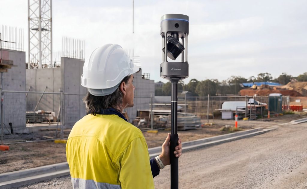
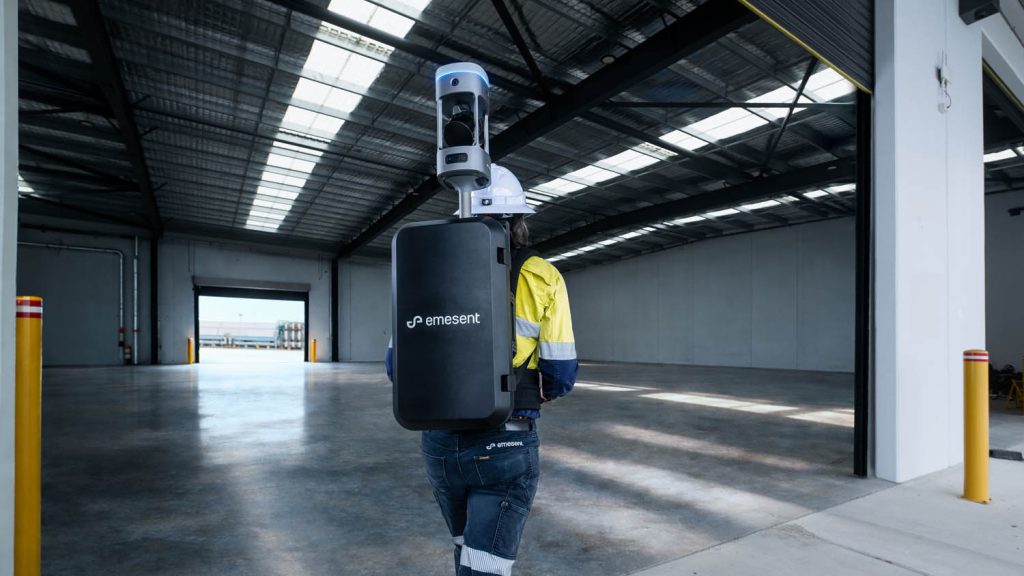
GX1 is a mobile mapping scanner. It combines RTK SLAM, high-density LiDAR and four 20 MP cameras in a backpack or pole-mount configuration that allows a single operator to walk through the site at normal pace while capturing a dense, georeferenced point cloud and 360-degree imagery simultaneously.
For construction progress and as-built applications, this means:
Repeatable capture at regular intervals. Because deployment is fast and doesn’t require static setup between positions, GX1 can realistically be used for weekly or fortnightly progress captures across a full site. Each capture produces a timestamped, georeferenced dataset that can be compared directly to previous visits and to design models.
As-built documentation embedded in the progress record. The 360-degree imagery captured alongside the point cloud means each site visit produces both the geometric record and the visual evidence needed for as-built documentation. Mechanical and electrical installation, structural elements, blockwork and cladding are all captured in the same pass.
Deviation detection against design intent. Point cloud data from GX1 can be compared against BIM models or design geometry in Aura and downstream software. Elements that have deviated from design — slabs poured at incorrect levels, walls out of position, services installed in the wrong location — are detectable before they become handover disputes or defects claims.
GPS-denied operation on multi-storey sites. The SLAM engine tracks position through environmental geometry, which means GX1 continues to operate inside reinforced concrete structures, basement levels and areas where GNSS signal is unavailable. This matters on large construction sites where GPS reception is often poor at lower levels.
Progress tracking: the commercial case
The commercial argument for regular mobile LiDAR capture on construction sites runs through several cost centres.
Disputes at handover are expensive. If an employer’s agent or client identifies discrepancies between what was built and what was contracted, the cost of rectification — or the time spent in dispute — is significant. A consistent, timestamped digital record of the build programme creates defensible evidence for contractors. It doesn’t prevent disputes, but it shortens them.
Rework is also expensive. Services installed in the wrong location, structural elements that don’t match design, or clashes identified late in the programme all result in abortive work. Regular progress capture that includes deviation detection against design gives site teams an earlier warning signal.
Subcontractor accountability is easier with a spatial record. Rather than relying on photographic evidence or site diaries, a georeferenced point cloud from each visit provides an objective record of what was complete and where at each stage of the programme.
For more on how LiDAR applies across construction and surveying workflows, see our surveying and construction sector page and our LiDAR technology capability page.
As-built surveys: where GX1 replaces or compresses the traditional workflow
As-built surveys at practical completion are often one of the most compressed and underresourced activities in the construction programme. The handover deadline is fixed, the survey needs to be done, and the time available to do it is limited.
GX1 compresses the field time required for a full as-built capture significantly. A single operator can cover a multi-storey building in a fraction of the time a static scanner requires, producing E57 point cloud outputs that integrate directly with Revit, AutoCAD and Bentley for model updating and drawing production. The embedded 360-degree imagery means the modelling team has visual context alongside the geometry, reducing the need for supplementary photography or clarification visits.
Where a post-construction digital twin is required — increasingly common on commercial, infrastructure and public sector projects — GX1 provides the reality capture baseline that the twin is built from. The quality of that input data determines the quality of the twin. For more on how aerial survey capability complements ground-based capture on construction sites, see our RTK drones page.
Deployment on a live construction site
GX1 is designed to operate in active construction environments. Backpack deployment means no tripod, no levelling, and no obstruction to ongoing work. A single operator can complete a floor-by-floor capture without requiring trades to stop or access to be cleared.
The Emesent Commander app provides real-time point cloud visualisation during capture, so the operator can see coverage building and identify any missed areas before leaving the floor — not after returning to the office. PPK (post-processed kinematic) positioning is available for sites where live RTK correction is not practical, ensuring the dataset can still be accurately georeferenced in post-processing.
Coptrz is a UK partner for Emesent GX1, supporting buyers with demonstration, workflow integration, training and after-sales care. Visit our Emesent brand page for the full product range, or speak to the team to discuss how GX1 could fit into your construction capture workflow.
Frequently asked questions
For most projects, weekly or fortnightly capture is practical with GX1. Deployment is fast, setup is minimal, and a single operator can cover a full floor plate in a fraction of the time a static scanner requires. The frequency that makes commercial sense depends on project size, programme risk and the value placed on the digital record.
Yes. Point cloud outputs from GX1 can be compared to BIM design geometry in Aura and in downstream software such as Revit, Navisworks and other BIM coordination platforms. Deviations between as-built and design intent are identifiable in the dataset.
Emesent states 5–10 mm global accuracy, 5 mm local accuracy, and 15 mm RTK/PPK accuracy. For construction progress and as-built applications, those figures are appropriate for deviation detection, model updating and handover documentation. Control points or targets should be established where tighter georeferencing is required.
Yes. The SLAM element of the GX1 tracks position through environmental geometry independently of satellite signal. The scanner functions in basements, enclosed structural bays and other GPS-denied environments typical of live construction sites.
For most commercial and infrastructure handover requirements, yes. GX1 produces E57 point cloud outputs and 360-degree imagery that integrate with Revit, AutoCAD and other BIM and drawing production platforms. For projects with very high accuracy tolerances or specific contractual requirements for static scan deliverables, a hybrid approach may be appropriate.
Coptrz provides demonstration, workflow review, training, implementation support and after-sales care for GX1 buyers in the UK. The most useful starting point is a practical demo on a live or representative site. Contact the team to arrange one.
Next steps
If construction progress tracking or as-built documentation is a current workflow pain, the right test is to bring GX1 onto a live site and measure what it produces against your current capture method. View the Emesent GX1 on Coptrz or get in touch to book a demo.
Download Our FREE RPC-L1 Guide
Understand everything you need to know about moving towards commercial drone operations with our RPC-L1 guide.
- Understand what RPC-L1 is and who it is for
- Learn how the CAA transition impacts operators and training routes
- Get a clear breakdown of requirements, costs and next steps


Related Posts
Join COPTRZ at the Flyability Elios Demo Day
COPTRZ are hitting the road again to showcase the Flyability Elios to a live audience in Eccleshall, Staffordshire on 8th February 2018. Join us as show how the Flyability Elios can be used to safely, quickly and efficiently inspect and explore confined spaces without the need for human entry. Click here to register your free place. […]

DJI NEWS: Report on DJI Data Security Released
Last week, DJI released a report from a third-party investigation into DJI data practices. DJI’s storage, collection and use of data from their drones, software and services were under the microscope. This concluded in DJI having full control of these areas. The third-party was Kivu Consulting, based in San Francisco, and they focussed on DJI’s […]

A Message From Our Managing Director – Coptrz Academy
In early March 2020, the world changed forever. All our lives have been disrupted by the coronavirus. Everyone needs to adapt to new ways of working and learning, not least in drone training. Traditional classroom courses in the current climate are not safe. Traditional online learning can be lonely, uninspiring and de-motivating. You shouldn’t feel […]















