Surveying & Construction
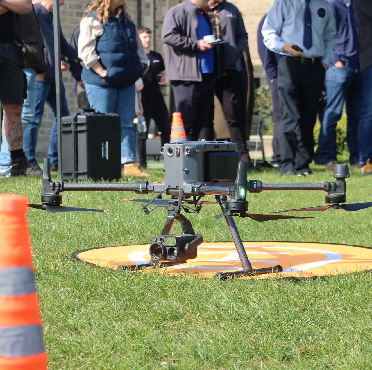
Drones in the surveying and construction industry revolutionise efficiency and safety by utilising high-resolution cameras, survey-grade modelling, advanced sensors, and volumetric measurement capabilities.
- Enhanced Efficiency
- Improved Safety
- Cost Savings
Get your FREE guide
Drones in the surveying and construction industry revolutionise efficiency and safety.

Streamlined, Safer, and More Cost-effective Operations

Enhanced Efficiency
Drones can cover larger areas in significantly less time, reducing the average survey duration from 2-3 weeks to just 1-4 days or even less. They eliminate the need for ground control points and manual measurements, reducing the necessity for extensive manpower and equipment. This facilitates quick, efficient data collection without disrupting ongoing work.
Cost Savings
Drones reduce the need for extensive manpower, allowing a smaller team to accomplish tasks that would traditionally require a larger workforce. They eliminate the need for costly equipment such as scaffolding, cranes, and other heavy machinery, which are time-consuming and expensive to use. Drones can conduct surveys and inspections without disrupting ongoing work, minimising downtime and keeping projects on schedule.

Improved Safety
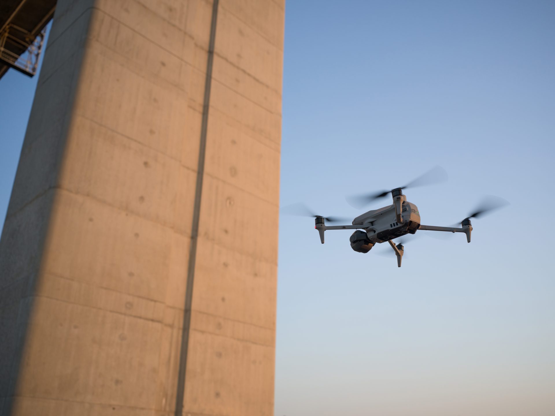
Drones collect data from a safe distance, reducing the need for workers to enter hazardous areas. This improves safety by avoiding the use of scaffolding or cherry pickers which are expensive and involve risks. Instead, a drone can fly over a site and generate a model afterwards, which can be reviewed in the office.

Data Insights
Drones provide detailed data, including photogrammetry, LiDAR, thermal, and multispectral information. One drone flight produces thousands of measurements, which can be represented in different formats (orthomosaic, point cloud, 3D mesh, DTM, DSM, contour lines, etc). This allows for comprehensive analysis and accurate measurements, enhancing decision-making and ROI.
Cutting Edge Technology

3D Modelling
Drones create detailed 3D models of construction sites and infrastructure, allowing for comprehensive analysis from a computer. Users can pan, rotate, and zoom in on models to scrutinise details and plan projects accurately.

Shareable Reports
Survey data and analyses can be exported into PDF or Word documents, facilitating easy sharing within the organisation and with clients, ensuring everyone has access to detailed, formatted information.

Streamlined Team Communication
Synchronise important information such as team positions, drone status, mission details, and more in real-time across various devices, for easy team collaboration and efficiency.
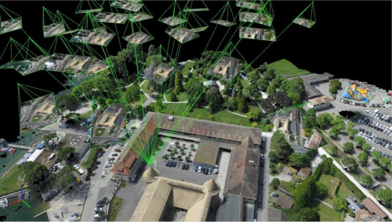
Site Surveys
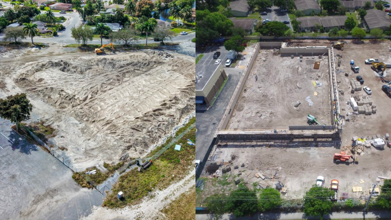
Drones provide detailed surveys of construction sites, capturing high-resolution images and topographical data. They produce orthomosaics and scaled 3D models, allowing for precise measurements and volume calculations. These measurements can be easily taken via laptop and shared across project stakeholders, clients, and other relevant parties. This facilitates planning, monitors progress, and detects potential issues early, ensuring adherence to project timelines and budgets.
Structural Surveys
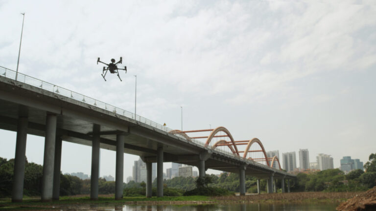
Drones equipped with high-resolution cameras, thermal sensors, and LiDAR technology survey buildings, bridges, and other infrastructure for structural integrity. These advanced tools identify defects such as cracks, heat loss, material degradation, and deformation with high precision. Thermal sensors detect heat variations, which can indicate issues like poor insulation or electrical faults. LiDAR technology provides detailed 3D mapping and accurate measurements, uncovering structural anomalies that might be invisible to the naked eye.
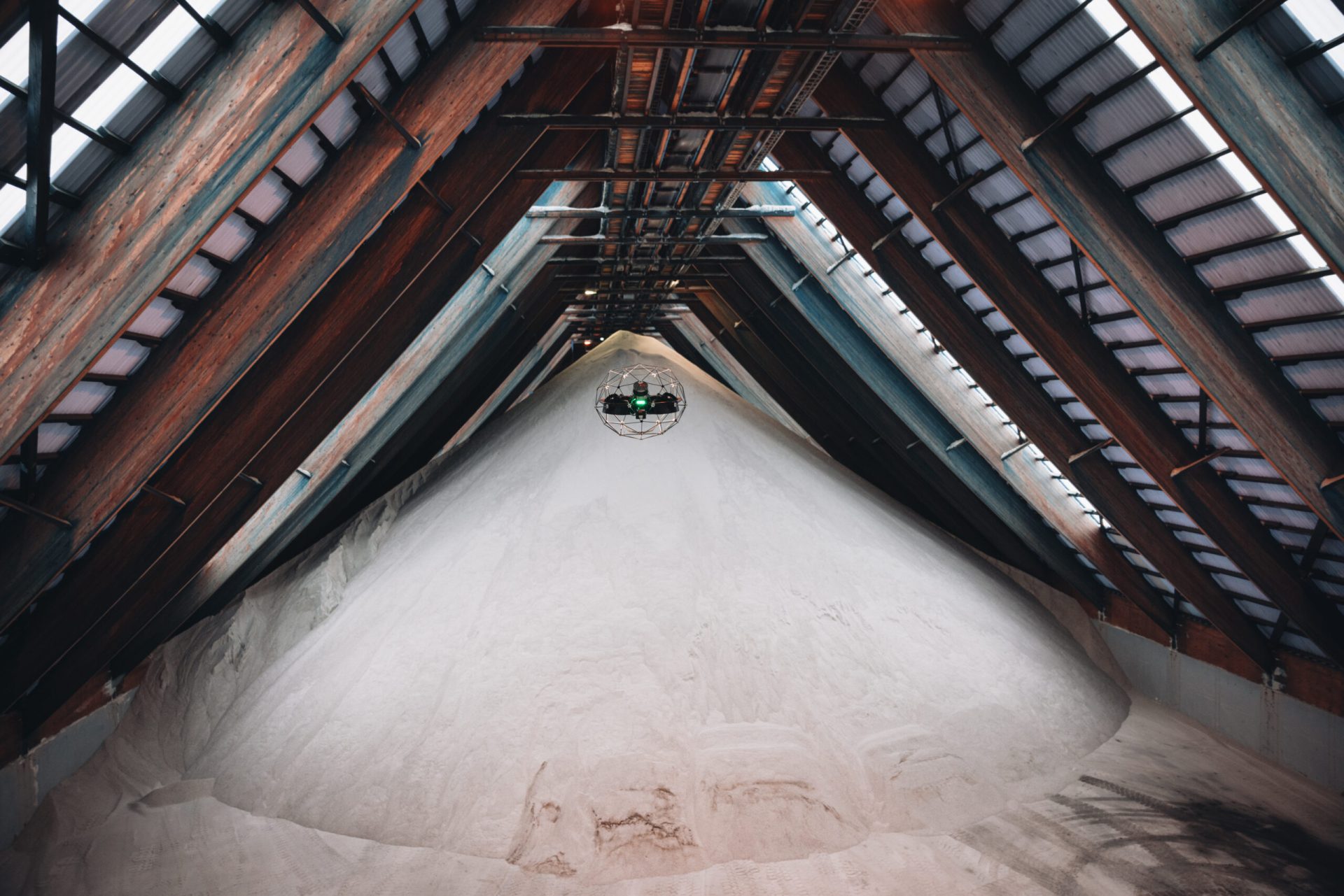
Volume and Stockpile Measurements
Drones accurately measure the volume of materials and stockpiles on construction sites, providing essential data for inventory management and project planning. Using software such as DJI Terra, users can easily obtain these measurements with just a few clicks. The drag-and-click interface allows for quick and intuitive selection of the area to be measured. Once the data is collected, the software generates precise volumetric calculations, reducing the need for time-consuming manual measurements.
Road and Highway Surveys
Drones assess the condition of roads and highways, identifying issues like potholes, cracks, and surface degradation. This data helps in planning maintenance and repair work, improving road safety and longevity.
Progress Monitoring
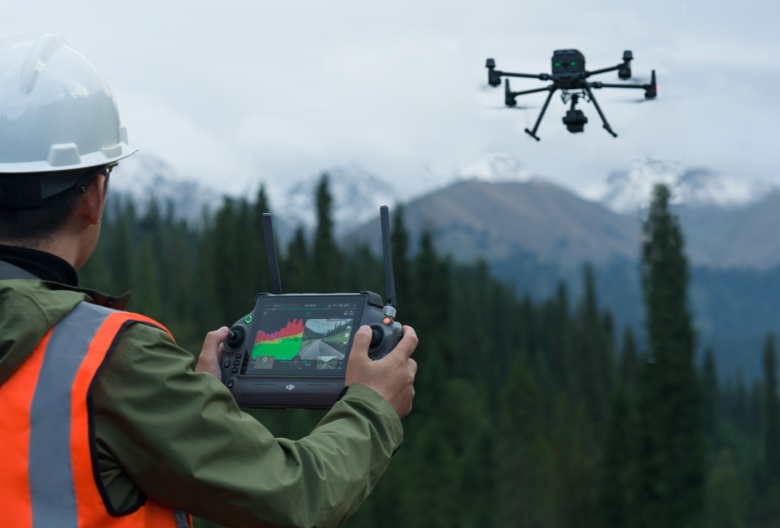
By using pre-programmed flight paths and autonomous flight capabilities, drones can consistently repeat the paths and collect precise aerial data and images from the same position. This ensures accurate tracking of construction progress over time. The ability to monitor real-time progress helps in identifying delays, assessing work quality, and making informed decisions to keep projects on track. Additionally, this data can be easily shared with stakeholders, ensuring transparency and facilitating effective communication throughout the project lifecycle.
Mapping and Land Surveys
Drones create accurate maps and land surveys, providing essential data for planning and development. Using LiDAR and photogrammetry, they generate detailed topographical maps and Digital Elevation Models (DEMs), capturing precise terrain data and surface features. This information is crucial for the design and layout of construction projects, ensuring accurate and comprehensive planning. Drones streamline the surveying process, reducing time and costs while enhancing data quality and accuracy.
FAQs
Drones can capture high-resolution images, videos, thermal data, LiDAR scans, and topographical data, providing detailed and accurate information for planning, monitoring, and inspections.
Drones perform tasks that would otherwise require workers to enter hazardous areas, reducing the risk of accidents and injuries. They eliminate the need for manual inspections at heights or in dangerous environments.
Drones reduce labour costs, minimise the need for expensive equipment like scaffolding and cranes, and shorten survey and inspection times. This leads to significant savings in operational expenses and project budgets.
Drones equipped with advanced sensors like LiDAR and high-resolution cameras provide highly accurate measurements, essential for detailed surveys, volume calculations, and structural assessments.
Yes, drones can capture real-time images and data, allowing project managers to monitor progress, identify delays, assess work quality, and make informed decisions to keep projects on schedule.
Software such as DJI Terra, Pix4D, and similar platforms are used to process drone data. These tools generate orthomosaics, 3D models, and volumetric calculations, and facilitate data analysis and reporting.
Drones create accurate site surveys and maps using photogrammetry and LiDAR, generating detailed topographical maps and Digital Elevation Models (DEMs). This data aids in the design and layout of construction projects.
Drones capture aerial images of stockpiles, and software like DJI Terra processes this data to generate precise volumetric measurements. The drag-and-click interface allows for easy area selection and calculation.
Yes, drone data and reports can be exported into formats like PDF and Word documents, making it easy to share with project stakeholders, clients, and team members for effective communication and collaboration.
Drones provide faster, more accurate, and safer data collection. They reduce the need for extensive manpower and equipment, minimise disruptions to ongoing work, and offer detailed, real-time insights that enhance project planning and execution.
Book your FREE online consultation
Experience the unique advantage of our 360° drone solutions exclusively at Coptrz. With a network of over 20 partnerships with top-tier drone technology manufacturers, we're uniquely positioned to provide a tailored solution that you won't find elsewhere.
Impartial Expertise for
Commercial Drone Integration
End-to-end Drone Solutions
Complete drone solutions, including hardware, software, pilot training, repairs and support.
Impartial Advice
Industry experts work closely with you to find the best solution for your organisation.
UK's Widest Drone Selection
We're not limited to one brand, we offer the UK's widest range of world-renowned suppliers.