Is it time you embarked on a career specialising in drone thermal imaging?
The ability to offer specialist skills as a drone pilot opens up your portfolio to a wider range of opportunities, jobs and employers. And, with drone thermal imaging technology improving year on year, the potential to broaden your skill set and add real value to a number of sectors is starting to become limitless.
But, like any career, you’ve got to work at it.
Think about it.
If almost anyone with a drone, some training and a PfCO can fly a UAV to capture aerial imagery, then it’s going to be difficult to differentiate yourself from the rest of the market. And you know what, the drone industry has just cranked the volume up to 11.
It’s got high year on year predicted growth that is going to lead to drones being part of everyday life. We’re talking a new job market, with new skills sought after from all sectors.
That’s a lot of ocean to swim in to over the next few years. But…
As drone technology becomes more sophisticated, so do their application and uses in a commercial environment. In turn, customers and drone solutions become more sophisticated. This means that drone operators need to follow suit. It’s inevitable Mr Anderson.
People hiring drone operators do so to solve a particular problem. That means they are likely to hire those with the specific skill set they need.
For a moderate investment a professional drone pilot, or an operator looking to kickstart a career in flight, can get trained in thermal, infrared and other specialist imaging.
We offer those kind of courses, and we’re doing it in partnership with the leading light in the UK, iRed.
You can check out our Aerial Thermal Imaging Course in partnership with iRed here.
What do these newly acquired skills get you?
A wide range of opportunities across a wide range of career paths.
These include in the emergency services, search and rescue, the power industry, inspecting solar panels, building HVAC (heating, ventilation and air conditioning) surveys, roof inspections, telephony and hazmat inspections.
In this post, we’ll run through:
- The basics of thermography
- What to look for in a thermal camera
- How to take accurate infrared images
- The types of careers drone pilots with thermal imaging skills can consider
- An overview of FLIR – the world’s leading company in the design and manufacturer of thermal cameras
- How you can find out more about thermal imaging, get started and access training
Thermography from the skies – the brief science bit

Thermal imaging is a method of measuring the heat emitted from an object or area in order to analyse it. This infrared thermography (IRT) is the process of detecting the infrared energy emitted from something and translating the reading into heat.
All objects above absolute zero emit infrared energy. The higher the temperature, the faster the atoms and molecules move. The faster they move, the more infrared energy is generated.
Thermal and infrared cameras can be mounted on a drone in order to fly over an area to detect heat. There are many reasons why we would want to do this, from detecting the body warmth of a missing person to identifying hotspots in power lines which can indicate a fault.
Factors to look for in thermal cameras

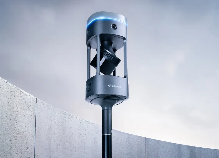
The new payload from FLIR. Designed to change the game with the DJI M200 and M300 series.
There are several components which contribute to the quality, effectiveness and cost of a thermal imaging camera. The two most important are sensor resolution and thermal sensitivity.
The detector resolution is determined by the number of pixels captured in each image. Essentially, the greater the number of pixels, the more data we can capture. If we take a resolution of 640 x 480 pixels then that equates to 153,600 data points. As anyone within a smartphone or digital camera will know, the higher the resolution the better the image quality too.
Thermal sensitivity is the amount of temperate difference the camera can detect. A fairly standard value of thermal sensitivity is 0.050°. This means that the sensor can distinguish between two areas with five-hundredths of a degree difference in temperature. IR camera sensitivities can range from 0.020°C up to 0.075°C, depending on the type of detector within the camera.
Thermal imaging cameras also come with a temperature range. This tells us what the maximum and minimum temperatures the sensor can detect. Typically this range is between -20°C and +650°C. Most types of wood begin combusting at around 350°C while minus 20 degrees Celsius is the accepted baseline temperature at which to store hazardous, flammable, or perishable substances.
Capturing the best thermal image
Most thermal imaging cameras have a variety of settings which can be adjusted. You should take a look at what your options are before opting for a particular model and consider what you’ll be measuring.
Look out for camera focus, emissivity settings, reflective temperature setting options and thermal tuning.
Of all the settings that can be adjusted, focus is by far the most important in improving thermal camera accuracy. The focus on most thermal imaging cameras can be set manually or automatically with a motorised zoom lens.
Emissivity is a measurement of how well a surface reflects heat. A ‘black body’ absorbs all light and has an emissivity of 1.0 which is a baseline reading. Here, the entire infrared component of light is reflected by the black body (‘perfect emitter’) and is used as a reference point.
For an accurate temperature measurement, the emissivity setting of the sensor should be set to match the heat ratio of the energy radiated from a material’s surface to that radiated from a perfect emitter. For non-reflective non-metallic surfaces and for painted areas, the emissivity is usually set to 0.95.
The reflective temperature setting allows you to compensate for heat readings from surrounding objects reflecting on your target object, including yourself! Thermal tuning refers to adjusting individual frames to display temperature differences.
The thing with all of these settings is that you really need to be properly trained in how to use them. And then you can become a thermographer!
Careers for drone pilots with thermal imaging skills
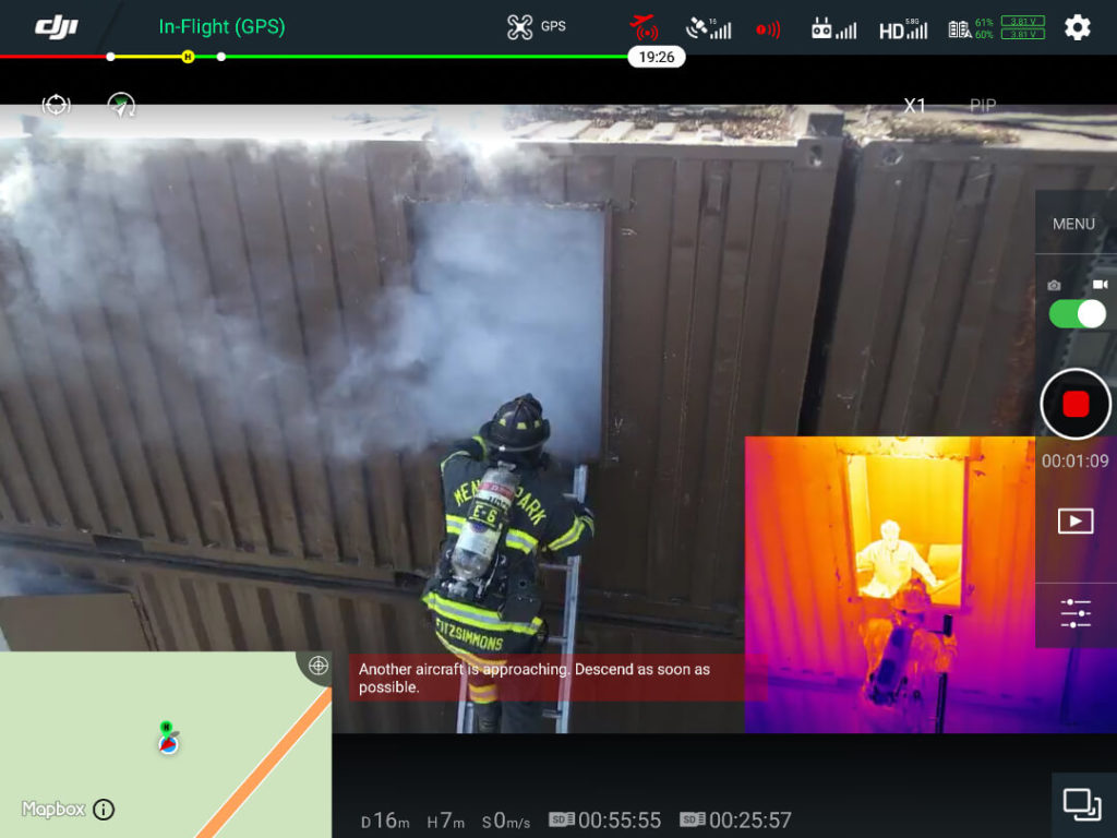
Some of the obvious career paths for flying drones to take thermal images include firefighting (identifying hotspots in burning buildings or locating potential victims), and search and rescue missions to assist looking for missing persons.
We hear this one a lot at Coptrz.
However, arriving at your nearest fire station or police department equipped with a drone and camera is unlikely to be enough to land you a job with the specialist units within each force. In fact, this is probably the last thing you want to be building your new drone thermal imaging empire around.
In most cases, Public Safety organisations are bringing their drone operations in-house. So, dust off that old copy of Backdraft and get yourself ready for a career in fire fighting if you want to go down this route with your drone thermal imaging business.
Drone power line inspections
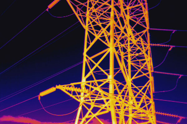
One of the many uses of aerial thermography is in preventing fires that occur as a result of failures in power lines.
By identifying weak points in the network of lines and power generation sources, drones equipped with thermal imaging systems can identify problem areas before a breakdown or a fire happens. This can prevent a potentially dangerous incident occurring in the first place.
Drone inspections are also carried out by the major utility companies to check power pylons for bird’s nests, lightning strikes, rust/corrosion and damaged fixtures.
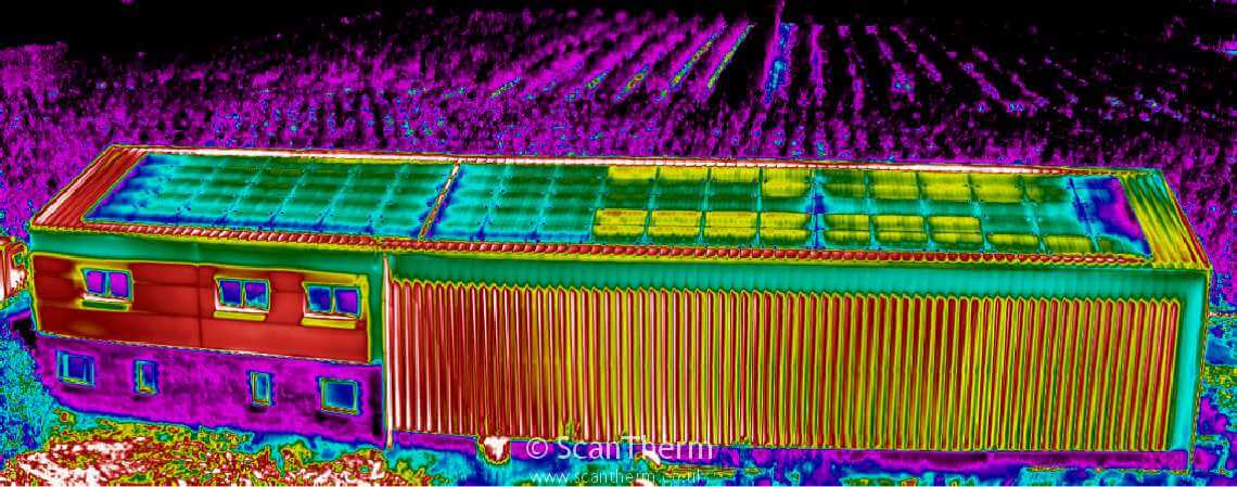
Drones for solar panel inspections
 In a similar way, UAVs are also used to inspect solar panels. If a solar panel is malfunctioning, it could mean a loss of energy being generated. Manual inspections are time-consuming and costly and because drones can cover a larger area quicker than a human with a ladder, they can be performed more efficiently.
Using aerial thermography, an entire field of solar panels can be surveyed at speed, checking for any hot spots where there might be sections causing a problem.
Solar modules constantly fail and then under-produce which lowers the energy efficiency of an entire site. When a panel is operating inefficiently, infrared cameras can detect the heat signature to read whether it is higher or lower than its neighbouring panels. This allows for replacement of the defective unit.
From a handful of panels up on residential properties to giant solar farms, a drone with a thermal camera can scan the site for defects much easier and quicker than one on the ground. And that’s particularly true of buildings with sloping roofs where a cherry picker may be required with the risk of damage to the property.
Drones for HVAC inspections

Thermography can allow pilots to perform a simple energy audit of any building, either someone’s home or a large corporate structure, in order to determine where there might be excess heat, or where heat might be escaping.
Drones present an ideal solution for property managers tasked with HVAC inspections. UAVs offer a faster, safer, and more efficient solution than satellite imagery of human inspectors in dangerous places. Drones enable inspections of HVAC sites and equipment at scale and can carry out equipment inspections with precise detail in near-real-time.
At the residential level, homes that have poor insulation, draughty windows, and old doors can be energy inefficient and expensive to maintain and heat. Drone inspection services can conduct infrared scans of the property to identify money-wasting leaks. These scans are often most effective during the seasons involving heavy usage of air conditioning or heating; infrared scans conducted properly will show where the house is losing energy.
Over 30% of carbon emissions come from buildings in the UK. The world is burning from climate change. This is a career path that is only going to grow and grow over the next few years.
Drones for mobile phone masts surveys
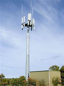
Just as with power lines, aerial thermography can also help detect problem areas in mobile phone masts. Telecoms providers are increasingly using drones to automate mobile tower inspections and to accelerate the rollout of 5G infrastructure.
Drones can capture high-resolution images and videos in a matter of minutes. The footage can be zoomed in and any faults on the tower or its antennas can be easily detected. Thermal imagery FLIR cameras can be used to detect any energy loss and potential performance issues.
Hazardous Material (HAZMAT) inspections

Emergency teams can find themselves having to face situations involving hazardous materials (Hazmats). These can involve incidents with chemical, biological, radiological, nuclear and explosive substances.
Dones offer an invaluable chance to tackle problems remotely in order to maintain safety. Thermal and video cameras and other payloads are flown to help detect hazardous materials and relay data in real-time. This enables maintenance crews to assess a hazmat issue before exposing themselves to a potentially highly dangerous zone.
FLIR Thermal Imaging Vision Cameras
 Flir is the global leader in the design and manufacture of Thermal Imaging Infrared Cameras. This is both for UAV-mounted and ground-based sensors.
The company founded in 1978 was originally formed to provide IR imaging systems to be used in performing energy audits. FLIR now offers a range of infrared cameras which can be mounted on a drone.
We are the only official UK Partner for Flir UAS.
Read our latest article to find out what thermal imaging cameras make it into our top 5 for 2020.
How do I access training to be a drone thermographer?
Infrared technology is useful in many fields expanding quickly into all manner of industries. Technology is rapidly developing with new ways to create better products and services with costs falling at the same time.
If you’re ready to embark on the next chapter of your flying career, check out the Coptrz Ultimate Thermal Drone Package for everything you need to get started in thermography, including a high-spec drone, all the kit you will need and a one-day workshop on thermography. You can opt for a Mavic 2 Enterprise Dual Drone or Parrot ANAFI Thermal Drone which both have an integrated thermal camera.
I know. That all sounds great, but how can we help you unlock all this amazing technology?
Don’t worry. We’ve got you covered with drones, cameras, software, training and all-year round support.
You can access it all through the links below.
Aerial Thermal Imaging Course
If you’re a Drone Service Provider or organisation looking to bring thermal imaging for drones into your operations then our recent partnership with Ired to deliver the UK’s industry leading Aerial Thermal Imaging course is the perfect start point for you.
Find out more about the course here.
Thermal Imaging Camera
If you’re looking to add a thermal imaging camera into your operations, then speak to one of our UAV Strategists today and they will assist you in finding the right one. No one in the UK offers the variety of Enterprise Payloads we do, so you can be certain of getting the solution that matches your requirements.
The best drones for thermal imaging cameras
If you’re interested in adding aerial thermal imaging capability into your operations then we have the largest range of drones to get you off the ground with confidence. Speak to one of our UAV strategists today and they will assist you in finding the right one.
If you want to keep up to date with all things drones, then don’t forget to sign-up to free newsletter below:
Download Our FREE RPC-L1 Guide
Understand everything you need to know about moving towards commercial drone operations with our RPC-L1 guide.
- Understand what RPC-L1 is and who it is for
- Learn how the CAA transition impacts operators and training routes
- Get a clear breakdown of requirements, costs and next steps


Related Posts
Parrot Anafi Thermal – the ultimate compact thermal inspection drone
Parrot Anafi Thermal In years gone by even considering having a thermal team as part of your everyday inspection crew might have seemed like something of a luxury item. With expensive equipment coupled with the demand for specialist training, having access to this crucial data might have been considered too much of a stretch for […]
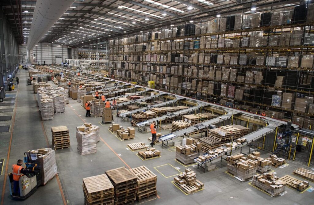
Drones for Racking & Warehouse Inspection
For business operations with large warehouse and distribution centres, it is imperative that operations are running efficiently with minimal down-time. This means that regular inspections are required to ensure that faults are found quickly. These vast locations, often filled with miles of shelving packed with goods stacked right up to the ceiling, can be tricky […]

Industry insight on using drones for inspections like the ELIOS 2
In this blog you’ll find out: How to get into the industrial inspection sector using drone technology like the Elios 2 Inspection Drone What drones you can use for industrial inspection A comparison of the ELIOS 2 and the Caged Mavic for inspections An insight into why organisations are keen to adopt technology that reduces […]