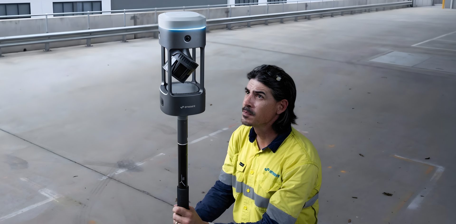
SURVEY FASTER. DELIVER WITH CONFIDENCE.
Emesent GX1
GX1
GX1 combines industry-leading SLAM, integrated RTK, LiDAR and 360° imagery into one streamlined workflow, helping survey professionals capture accurate data in a fraction of the time.
Get Your FREE GX1 Product Brochure
Get the full breakdown of the world’s most accurate RTK SLAM scanner, including features, workflow and specifications, in this free GX1 guide
5–10
mm
Global Accuracy
300
m
Maximum LiDAR Range
4 ×
20MP Cameras
448
Channel RTK
Up to
95%
Faster Surveys*
5–10mm
Global Accuracy
300m
Maximum LiDAR Range
4 ×
20MP Cameras
448
Channel RTK
Up to 95%
Faster Surveys*
Revolutionary in Mobile Mapping
Emesent GX1 gives surveyors what they’ve been asking for: mobile scanning speed with accuracy you can rely on, time and time again.
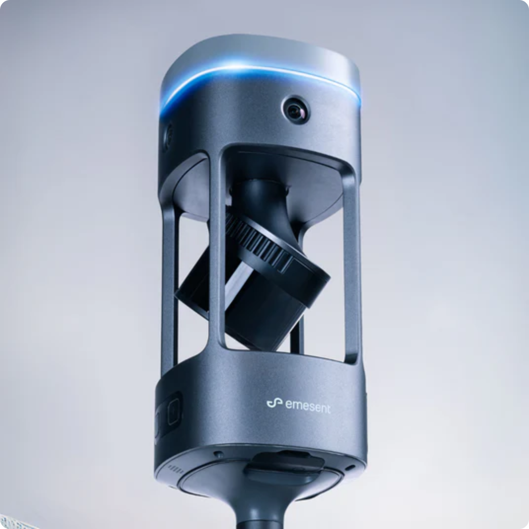
Scan Faster, Without Sacrificing Accuracy
Emesent GX1 combines mobile scanning speed with reliable 5–10mm global accuracy and integrated premium RTK georeferencing. Rapid RTK quality monitoring, accuracy reports and four 20MP cameras help surveyors capture data faster, verify accuracy on site and deliver professional-grade imagery.
GX1 can be used handheld or mounted on a backpack, survey pole or vehicle for topographic surveys, construction progress tracking, Scan-to-BIM and GPS-denied tunnels. It also includes removable cable-free batteries, flexible georeferencing in Aura, unlimited on-premise processing, 360° walkthroughs in Aura Cloud and continuous software improvements.
Built to Perform on Every Survey

Proven Accuracy
GX1 delivers reliable sub-10mm global accuracy indoors and outdoors. Enhanced Emesent SLAM reduces drift and improves repeatability, producing dependable results across confined spaces, open sites and challenging environments where other systems may struggle.

Capture More, Faster
GX1’s mobile SLAM technology significantly reduces time on site compared with traditional surveying methods. Complete complex scans in hours rather than days, increase project capacity and deliver results faster without adding to your team.

A Simplified User Experience
GX1 combines LiDAR, RTK, cameras and software in one connected workflow, from field capture to validated deliverables. It is simple enough for new users to learn quickly, while providing experienced surveyors with the performance needed for complex projects.

One Device. Any Project.
Switch between backpack, survey pole, vehicle and handheld deployment to suit the job. Integrated RTK, PPK and user-selected targets in Aura provide flexible georeferencing while reducing the risk of repeat visits and costly rework.
Survey-Grade Accuracy, Built in
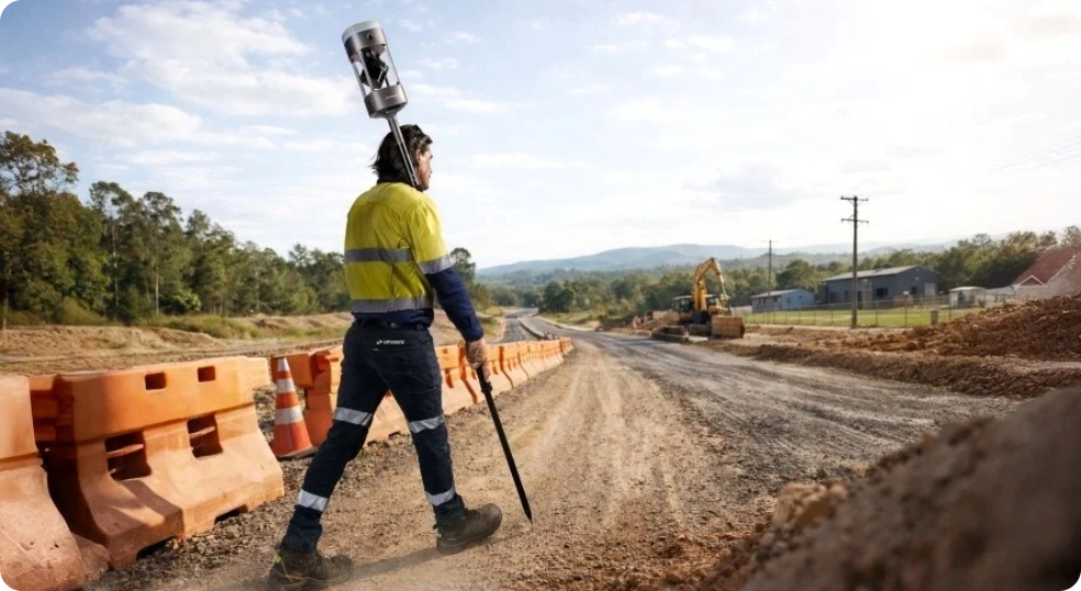
Accurate Positioning From Field To Finish
GX1’s integrated 448-channel RTK receiver delivers highly accurate georeferencing with real-time quality monitoring through the Commander app. Whether you’re using RTK in the field or PPK during post-processing, GX1 provides the confidence to capture accurate, reliable data on every survey.

Integrated RTK
Reliable Georeferencing On Every Survey
Achieve survey-grade accuracy with GX1’s integrated 448-channel RTK receiver. Real-time quality monitoring, combined with RTK and PPK support, delivers precise, reliable georeferencing whether working live on site or processing data post-survey.
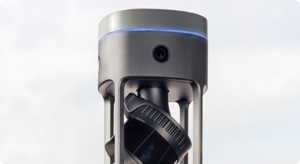
Capture Every Detail in One Pass
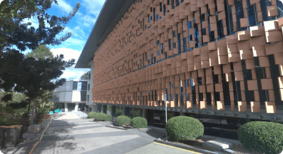
360° Visual Coverage With Every Scan
Four integrated 20MP cameras provide 360° horizontal and 284° vertical coverage, capturing rich visual context alongside every point cloud. Automated people masking and immersive panoramas help clients understand sites faster while reducing blind spots, post-processing and unnecessary return visits.
Unlimited Processing. No Hidden Costs.
Scale Your Processing Without Limits
Process unlimited datasets on-premise without per-scan licences or additional cloud processing fees. Concurrent user licensing allows multiple team members to work simultaneously, giving your business predictable software costs as projects and workloads grow.
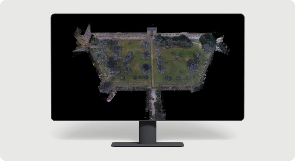
A complete Surveying Ecosystem
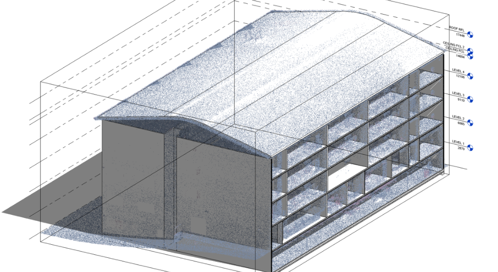
Everything You Need In One Workflow
From field capture and live scan monitoring to point cloud processing and cloud-based collaboration, GX1 integrates seamlessly with Commander, Aura and Aura Cloud. Regular software updates, expert technical support and compatibility with platforms such as Autodesk Revit help streamline every stage of your workflow.
GX1 Vs Hovermap STX
| Feature | GX1 | Hovermap STX |
|---|---|---|
| Primary Use | Ground-based surveying | Aerial, autonomous & multi-platform mapping |
| Accuracy | 5–10mm global accuracy | Sub-centimetre accuracy with GCP/RTK workflows |
| RTK | Integrated premium RTK | External RTK/PPK options |
| Cameras | 4 × 20MP integrated | Optional colourisation camera |
| Best For | Topographic surveys, Scan-to-BIM, construction | Mining, confined spaces, drone inspections |
| Mounting | Handheld, backpack, pole, vehicle | Drone, backpack, vehicle, handheld |
| Workflow | Survey-focused | Multi-platform mapping |
Adapt To Any Project
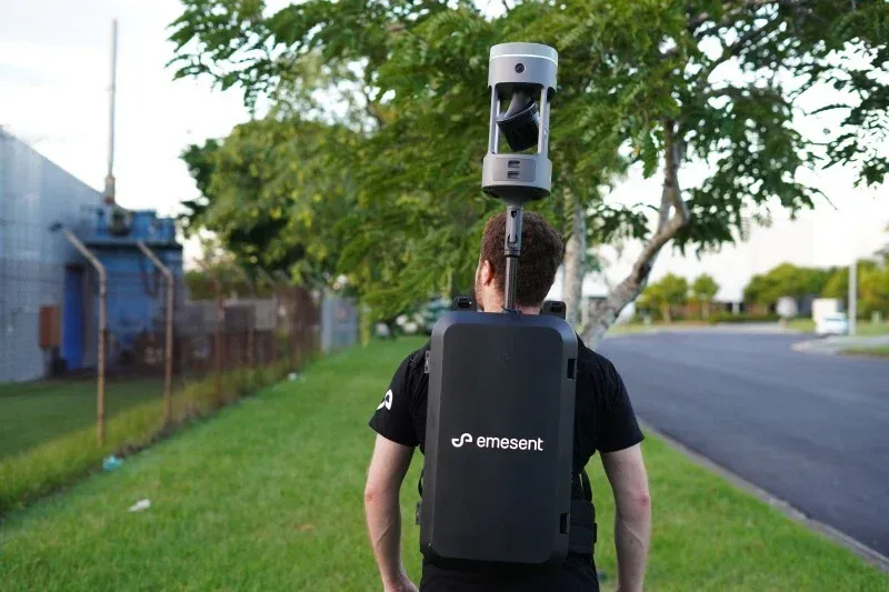
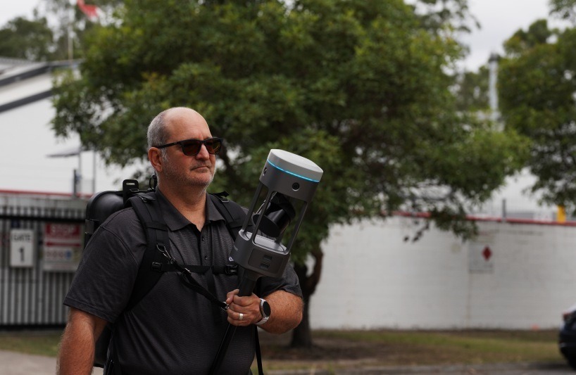
Backpack mount
Supported handheld
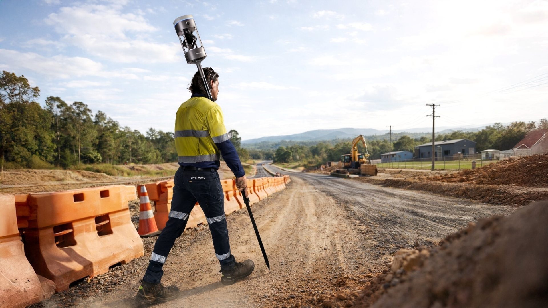
Survey pole
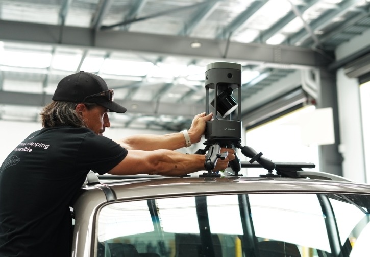
Vehicle mount
Frequently Asked Questions
The Emesent GX1 closes the gap between mobile scanning speed and static terrestrial laser scanner accuracy. Driven by an integrated 448-channel RTK/PPK GNSS receiver and Emesent’s industry-proven SLAM engine, the GX1 delivers:
- 5–10 mm repeatable global accuracy.
- 15 mm local accuracy / 3D RMSE RTK-SLAM (across a 1 km baseline with zero control points).
- Sub-centimetre drift mitigation against established survey control targets.
The GX1 dynamically fuses GNSS RTK corrections with real-time 3D LiDAR SLAM. Outdoors, the scanner anchors point clouds to global coordinates via continuous RTK (or post-processed kinematic PPK). When entering enclosed or subterranean spaces (e.g., basements, tunnels, or complex steel structures) where satellite reception drops, the system seamlessly hands over tracking to geometric feature-matching via SLAM, preserving millimeter-level trajectory continuity without data corruption or coordinate loss.
The GX1 features a modular, zero-cable architecture that deploys across four operational configurations:
- Backpack Mount: Ergonomically counterbalanced with an adjustable mast height for long-distance asset scanning, rail corridors, and civil infrastructure.
- Handheld Harness: Quick clip-in setup for rapid navigating through tight doorways, mechanical rooms, and stairwells.
- Survey Pole: Elevated capture mode for reaching above suspended ceilings, service shafts, and structural voids.
- Vehicle Mount: High-speed roof installation for roadway, highway corridor, and open-pit mine digitization.
The GX1 integrates enterprise-tier sensing hardware within an IP65-rated housing:
- LiDAR Sensor: Hesai XT32M2X delivering 640,000 points/sec (single return) and up to 1,920,000 points/sec (triple return) across 32 channels with a 300-metre operational range.
- Optical Array: Four integrated 20MP cameras providing a combined 360° × 142° field of view, generating 0.96 mm/pixel resolution at 1 metre for automated point cloud colourisation and 360° virtual walkthroughs.
No. Unlike cloud-dependent SLAM systems that charge subscription credits or per-gigabyte processing fees, the GX1 workflow operates with unlimited on-premise processing through Emesent Aura. Teams can process unlimited point clouds locally without recurring per-scan fees. For cross-team stakeholder collaboration, datasets can be uploaded to Aura Cloud for browser-based, client-accessible 360° walkthroughs without viewer licence restrictions.
Aura automates one-step point cloud colourisation and embeds full-resolution 360° panoramic bubbles directly into structured E57 export files. Datasets export natively in LAS, LAZ, PLY, and DXF, enabling immediate import into Autodesk Revit, AutoCAD, Navisworks, Leica Cyclone, Bentley MicroStation, and Trimble Connect for scan-to-BIM, clash detection, and as-built verification.
Trusted Where Failure Is Not An Option

Nick Canham
Duncan Turner
Adam Carter
Emily B.

Partners & Clients










Accreditations
Recognised for excellence. Explore the industry certifications that validate our commitment to quality, compliance, and continuous improvement.

ISO 9001 Certified
Certified quality management systems for consistent service and customer satisfaction.

ISO 14001 Certified
Internationally recognised standard for environmental management and commitment to sustainable operations.

Cyber Essentials & Cyber Essential Plus
Government-backed certification demonstrating the highest level of commitment to robust cyber security.

The Equality Register Member
Committed to promoting equality, diversity, and inclusive practices across our entire organisation.

TQUK Recognised Centre
An officially recognised centre for Training Qualifications UK, delivering high-standard regulated qualifications

Registered with Elcas
Approved by the Enhanced Learning Credits Administration Service to provide funded training for Armed Forces personnel.

UK CAA Recognised Assessment Entity: RAE15510
CAA-approved to deliver drone training and assessment for RPC-L1, GVC and A2 CofC qualifications.

FCA Registered
Authorised and regulated by the FCA for consumer finance activities.
UK SORA & BVLOS Operations: SORA-28947, SORA-29134
Helping organisations obtain Operational Authorisations for BVLOS and other complex drone operations using the UK SORA framework.

Ofqual Regulated Training
Delivering prestigious, government-regulated training programmes that guarantee educational excellence and industry recognition.
Latest From Coptrz

Transforming UK Agriculture & Forestry with Advanced Drone Solutions

Elevating Public Safety: How Drones Are Transforming Emergency Response

DJI Matrice 400


