AMP8 — the eighth asset management period for England and Wales’s water sector — represents one of the largest infrastructure investment programmes the industry has seen. Water companies are committing to significant capital expenditure on treatment works, network assets, pumping stations, reservoirs and wastewater infrastructure between 2025 and 2030. That investment creates an immediate and sustained demand for accurate, repeatable asset data.
Reality capture — the process of producing accurate 3D spatial records of physical assets using LiDAR, photogrammetry and imaging technology — sits at the centre of that demand. This post covers where reality capture applies in AMP8 water infrastructure programmes, what the data requirements look like, and how mobile mapping fits into the workflow.
Why AMP8 creates a reality capture requirement
Water infrastructure assets are often poorly documented. Treatment works, pumping stations, filter beds, sludge handling facilities and network assets have frequently been built, extended and modified over decades, with asset records that don’t reflect current conditions. Before significant capital investment can be designed, consented and delivered, accurate as-existing data is needed.
AMP8 programmes create that requirement at scale. Asset condition surveys, baseline surveys ahead of major refurbishment or replacement programmes, design coordination surveys, and digital twin baselines are all required before and during delivery. The volume of work, the access constraints typical of operational water sites, and the requirement for repeatable capture throughout delivery all make this a strong use case for mobile mapping.
There is also a regulatory context. Ofwat’s expectations around asset data quality and digital twin development are increasing. Water companies that can demonstrate accurate, current asset records — and the workflows to maintain them — are better positioned for future price reviews.
AMP8 capital programmes create a practical driver to invest in the data infrastructure alongside the physical infrastructure.
The access challenge on operational water sites
Water treatment works and network assets present specific access challenges that make conventional survey approaches difficult.
Sites are live and operational. Surveys must be completed around continuous treatment processes, with restricted access to specific areas, time-limited entry to confined spaces, and strict permit-to-work requirements. The window for data capture is often short, and the cost of a return visit — in access reinstatement, permit reissue and operational disruption — is high.
Environments are geometrically complex. Treatment works include tanks, channels, filter beds, pipe runs, gantries, buildings and underground chambers — all in close proximity, with varying levels of access and lighting. Static laser scanning is time-consuming to set up across multiple positions in these environments, and aerial survey can’t access enclosed areas or below-ground structures.
GPS signal is often unreliable. Reinforced concrete structures, enclosed buildings and below-ground chambers all attenuate satellite signal. A scanner that depends entirely on GNSS for positioning will produce poor results in these conditions.
Where mobile mapping addresses these challenges
Mobile LiDAR mapping — particularly RTK SLAM-based ground-level scanning — is well suited to water infrastructure survey for several reasons.
Fast deployment within constrained access windows. A mobile scanner can be deployed within minutes of arriving on site, with no tripod, no levelling and no static setup. For a two-hour permit window on a live treatment works, that setup time saving is commercially significant. The team captures data immediately and maximises the available window.
Continuous capture across complex geometry. Rather than moving between static positions, the surveyor walks through the site continuously — across the treatment works, through buildings, along pipe runs and into accessible confined spaces — while the scanner captures a dense point cloud and 360-degree imagery in a single pass. Complex geometry that would require many static scanner positions is captured in a single continuous dataset.
GPS-denied operation in enclosed areas. RTK SLAM scanners track position through environmental geometry rather than satellite signal, which means they continue to operate inside reinforced concrete structures, enclosed buildings and covered channels where GNSS is unavailable. For water infrastructure survey, this is a fundamental requirement rather than an optional feature.
Integrated imagery for asset condition records. The 360-degree imagery captured alongside the point cloud provides a visual record of asset condition — pipe condition, tank lining, structural fabric, mechanical and electrical equipment — without a separate photography stage. For condition surveys and asset register updates, this is a significant efficiency gain.
For more on how LiDAR technology applies across infrastructure inspection workflows, see our LiDAR technology capability pageand our post on the best LiDAR scanner for infrastructure and asset inspection.
AMP8 use cases for reality capture
Baseline as-existing surveys. Before major refurbishment or replacement programmes can be designed, accurate as-existing data is required. Mobile mapping provides a fast, comprehensive baseline for design teams, removing the uncertainty that comes from working from drawings that don’t reflect current conditions.
Asset condition surveys. Repeatable mobile capture of treatment works, pumping stations and network assets produces a timestamped condition record that feeds asset management systems, informs maintenance planning and supports Ofwat reporting requirements.
Design coordination. Point cloud data from mobile mapping integrates directly with civil, structural and mechanical design models, enabling design teams to work from accurate spatial context rather than estimated dimensions. Clash detection between new plant and existing fabric is possible before construction begins.
Construction progress and as-built records during delivery. As AMP8 capital programmes are delivered, regular progress capture and as-built documentation create a defensible record of the build. For complex treatment works refurbishments where multiple packages overlap, a spatial progress record reduces disputes and supports handover. See our post on using Emesent GX1 for construction progress tracking and as-builts for more on this workflow.
Digital twin baselines. AMP8 programmes increasingly include digital twin requirements. Mobile mapping provides the reality capture foundation that a water infrastructure digital twin is built from. The quality and accuracy of that input data determines the value of the twin as an operational tool. For more on this, see our post on LiDAR for digital twins: why data capture quality matters.
Where Emesent GX1 fits in AMP8 programmes
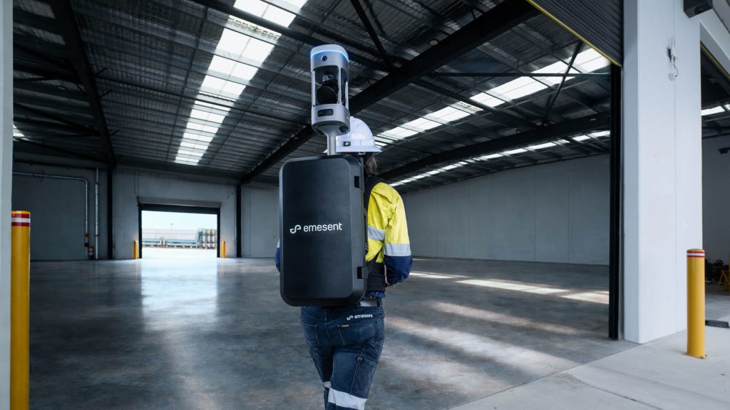
The Emesent GX1 is a ground-based mobile mapping scanner combining RTK SLAM, high-density LiDAR and 360-degree imagery. Its GPS-denied performance, multiple deployment configurations — backpack, pole, vehicle mount and supported handheld — and integrated imagery make it directly applicable to water infrastructure survey environments.
Emesent states 5–10 mm global accuracy, 5 mm local accuracy, and 15 mm RTK/PPK accuracy. For the majority of AMP8 survey applications — baseline surveys, condition records, design coordination and as-built documentation — those figures are appropriate. E57 point cloud outputs integrate with Civil 3D, Revit, BIM coordination platforms and GIS environments typically used on water infrastructure programmes.
Coptrz is a UK partner for Emesent, supporting buyers with demonstration, workflow review, training and after-sales care. Find out more on our Emesent brand page, or see how mobile mapping applies across UK infrastructure programmes on our surveying and construction sector page.
Combining aerial and ground-based survey on water sites
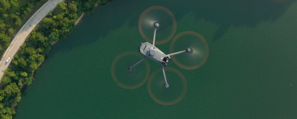
Large treatment works and network assets often require both aerial and ground-based survey. Drone-based LiDAR is well suited to large open areas of a treatment works — settlement tanks, lagoons, external structures and site-wide topography — where aerial access is practical and efficient. Ground-based mobile scanning covers what aerial can’t reach: enclosed buildings, below-ground chambers, pipe runs and indoor plant areas.
The strongest AMP8 survey programmes will combine both, with the aerial and ground-based datasets integrated into a single coordinated point cloud. For more on how aerial LiDAR capability complements ground-based mobile mapping, see our RTK drones page.
Frequently asked questions
AMP8 is the eighth asset management period for the water sector in England and Wales, covering 2025–2030. Water companies are required to deliver significant capital investment in treatment and network infrastructure during this period. Before and during delivery, accurate as-existing data, condition surveys, design coordination surveys and as-built records are all required — creating a substantial and sustained demand for reality capture services.
Yes. Mobile RTK SLAM scanners operate in GPS-denied environments — including enclosed buildings, covered channels and reinforced concrete structures — because they track position through environmental geometry rather than satellite signal. This makes them directly applicable to the enclosed and below-ground areas typical of water treatment sites.
This varies by application. Design coordination surveys and as-existing baselines typically require accuracy appropriate for civil and structural design — in the range of 5–20 mm. Condition surveys and asset register updates may require less precision. Emesent states GX1 delivers 5–10 mm global accuracy and 5 mm local accuracy, which is appropriate for most AMP8 survey applications.
Point cloud data from mobile mapping, combined with 360-degree imagery, provides the spatial and visual baseline that a digital twin is built from. This data is integrated with asset management systems, BIM models and operational data to create a dynamic model of the asset. The quality of the input capture data directly determines the accuracy and usefulness of the twin.
Yes. Coptrz provides practical demonstrations, workflow advice, training and implementation support for GX1 buyers in the UK, including teams working on water infrastructure programmes. Contact the team to discuss your AMP8 programme requirements and arrange a demo.
Next steps
If you’re working on AMP8 capital programmes and evaluating reality capture capability, the best starting point is a practical demonstration on a representative site — not a product comparison. Bring a specific asset type, an access constraint and an output requirement, and test the workflow against your programme needs.
View the Emesent GX1 on Coptrz or get in touch to book a demo.
Download Our FREE RPC-L1 Guide
Understand everything you need to know about moving towards commercial drone operations with our RPC-L1 guide.
- Understand what RPC-L1 is and who it is for
- Learn how the CAA transition impacts operators and training routes
- Get a clear breakdown of requirements, costs and next steps


Related Posts

Women in Drones
Women in Drones What can be achieved with drones is evolving on a daily basis. From performing inspections, surveys, photography, videography and saving the environment. Despite the constant technological developments, the industry itself looks a little outdated. While the Civil Aviation Authority (CAA) doesn’t keep track of the gender of those applying for permission to […]

DJI Zenmuse XT2: A Closer Look at DJI’s Latest Payload
At a recent event in Menlo Park, CA, DJI announced the launch of two exciting products aimed at the enterprise and commercial applications UAV market. The first was a new payload software development kit (SDK) which opens up the DJI Matrice 200 Series platform to third-party developers wishing to integrate their own payloads. The second […]

What is the Difference Between Pix4D, Drone Deploy, and DJI Terra?
When evaluating drone mapping software, Pix4D, DroneDeploy, and DJI Terra each offer distinct advantages tailored to specific operational needs. Here’s a strategic breakdown to guide informed decision-making: Pix4D: Precision and Versatility Pix4D stands out for its high-precision outputs and broad compatibility. It supports a wide range of drones and cameras, making it ideal for professionals […]















