
Latest from Coptrz
Stay updated with the latest insights, tips, and industry news on our blog. Discover expert advice, success stories, and innovative uses of drone technology. Our blog features a diverse range of topics to keep you informed and inspired.
All Posts

The importance of pre-flight checks
The CAA have just issued Safety Notice SN-2025/004, stressing the importance of keeping UAS firmware and software up to date. But updates alone aren’t enough they need to be paired with robust pre-flight checks to ensure safe, compliant operations and continuous airworthiness! Why does this matter? Improperly handled software and firmware updates have been linked […]

How VZU Plzen Achieved an 80% Reduction in Penstock Inspection Time with the Elios 3
In the realm of hydroelectric power, penstocks—large pipes channeling water to turbines—are critical components requiring regular inspections to ensure operational safety and efficiency. Traditional inspection methods often involve constructing custom scaffolding systems, which can be time-consuming, costly, and pose significant safety risks due to the confined spaces and heights involved. However, advancements in drone technology, […]

UK CAA Scheme of Charges 2025/26 for Drone Operators: What You Need to Know
The UK Civil Aviation Authority (CAA) has released its 2025/26 Scheme of Charges for drone operators, introducing a new fee structure that will take effect from April 1, 2025. This updated scheme brings significant changes, including higher charges for operational authorisations, the adoption of a new risk assessment methodology (UK SORA), and adjustments that affect […]
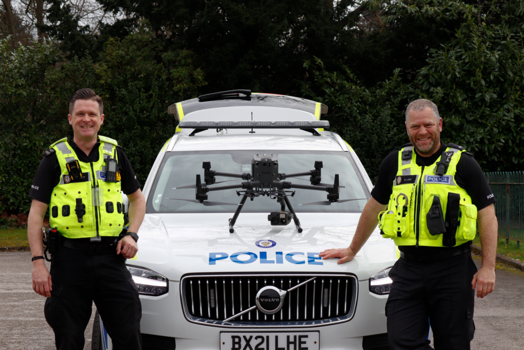
Top Drones for Police in 2024
In recent years, the integration of drones in the police force has significantly transformed policing strategies, not just within the United Kingdom, but globally. The use of drones in policing offers a unique blend of efficiency, safety, and versatility, making them indispensable tools in a vast amount of policing tasks. From aerial surveillance and crime […]

Drones in Surveying: Everything You Need to Know
The surveying industry has undergone a revolution in recent years, thanks to advancements in drone technology. Drones offer a faster, safer, and more cost-effective solution for capturing high-quality geospatial data. But with multiple technologies, platforms, and workflows available, understanding the best approach for your surveying needs can be complex. In this blog, I’ll answer key […]

Top 5 Drone Mapping Software for 2024
Drone mapping is an indispensable tool in today’s fast-paced, technologically advanced world. It has changed workflows across numerous industries, from agriculture and real estate to construction and environmental conservation. By providing a quick, efficient, and safe means to collect massive amounts of data, drone mapping allows for detailed analysis and insights that were previously impossible […]
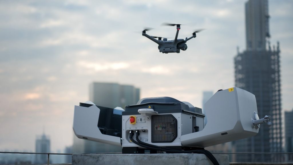
DJI Dock 2 vs. DJI Dock 3: A Comprehensive Comparison
As drone technology advances, so do the docking solutions that enable autonomous drone operations. DJI Dock 2 and DJI Dock 3 are cutting-edge solutions designed to enhance drone deployment, security, and efficiency. This article compares the two docks across key features such as regulatory compliance, data security, performance, and deployment capabilities. Regulatory Compliance & Safety […]

Revolutionising Cargo Oil Tank Inspections: How Flyability’s Elios 3 is Saving Time, Money, and Lives
In the fast-moving maritime industry, efficiency and safety are paramount. Traditional Cargo Oil Tank (COT) inspections have long been time-consuming, expensive, and hazardous. However, thanks to Flyability’s Elios 3 drone with its UT (Ultrasonic Thickness) payload, inspections are now six times faster, significantly safer, and far more cost-effective. Cyberhawk™, a leader in drone inspections and […]

The secret tool for the BEST drone fleet management
With regulations in the drone industry set to encourage more freedom and widespread use of drones, efficiency, safety, and compliance are paramount for operators and organisations. What is AirData UAV? AirData UAV is an all-encompassing application that serves as the central hub for managing drone operations across an entire organisation. It simplifies the complexities associated […]

Everything you NEED to know about the General Visual Line of Sight Certificate
A General Visual Line of Sight Certificate (GVC) is essential for remote pilots conducting VLOS (Visual Line of Sight) operations within the Specific category that cannot be done under the Open Category with other qualifications like the A2 CofC. A GVC certificate alongside a completed Operations Manual allows you to file for Operational Authorisation to […]

How a farmer cuts costs by 56% with Pix4Dfields
Targeted herbicide applications of agricultural inputs help save costs whilst protecting soil health and the environment. Global demand for food is growing bigger but the challenges around agriculture and crop production are growing too. Increased prices of agricultural inputs and the higher need for more sustainable ways of production are posing a modern farming challenge. […]

How the Elios 3 Delivers Unmatched Safety, Efficiency, and Cost Savings
In the realm of power generation, the efficiency and safety of operations are paramount. A critical component in this process is the condenser, responsible for converting steam back into water for reuse. Traditional inspection methods for condensers are often time-consuming, costly, and pose significant safety risks due to the confined and complex nature of these […]


