The DJI Mavic 3 Enterprise is a top contender for surveying work, blending precision, efficiency, and versatility into a budget-friendly package perfect for first-time and seasoned professionals alike. This drone offers various features designed to facilitate a wide range of surveying tasks, making it an invaluable tool in the arsenal of surveyors across various industries. From construction site monitoring to environmental mapping, let’s explore the capabilities and applications of the Mavic 3 Enterprise to understand why it’s one of the go-to choices for professionals seeking to leverage drone technology for surveying and 3D modelling projects.
About The Drone
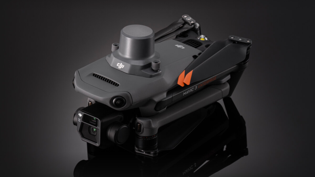
The DJI Mavic 3 Enterprise is a compact, cost-effective drone perfect for beginners and professionals in photogrammetry and 3D mapping. Its RTK module brings survey-grade data within reach, offering 1cm horizontal and 1.5cm vertical accuracy, ideal for detailed tasks like stockpile measurements and accurately scaled 3D models.

- Weight: 915g, making it lightweight and portable.
- IP Rating: None, so it’s best used in good weather conditions.
- Camera:
- Wide Camera: Features a 4/3 CMOS sensor with 20MP resolution, a large 3.3um pixel size, and a 0.7s shooting interval for efficient surveying. It uses a mechanical shutter to avoid motion blur and has a 24mm equivalent focal length.
- Tele Camera: Comes with a ½ inch CMOS sensor, 12MP resolution, 162mm equivalent focal length, and up to 56x hybrid zoom.
RTK Module
The DJI Mavic 3 Enterprise’s RTK module, coupled with creates survey-grade 2D and 3D models by ensuring microsecond-level synchronisation of the camera, flight controller, RTK module, and gimbal. This setup delivers highly accurate geo-referenced data, significantly reducing the need for Ground Control Points (GCPs) in data reconstruction, though checkpoints are recommended for quality assurance. The RTK module’s integration optimises photogrammetric results by aligning positioning data with the camera lens’s optical centre, enabling images to achieve precise positioning. Additionally, the Mavic 3 Enterprise records GNSS data in photos, allowing for compatibility with third-party PPK software for advanced data analysis.
*Note that the DJI Mavic 3 Thermal is not suitable for mapping, even with the RTK module. On the other hand, the DJI Mavic 3E’s camera is designed for surveying, featuring advanced specifications like a larger 4/3 CMOS sensor, increased pixel size, and a rapid 0.7s shooting interval.
Applications:
Site Monitoring and Progress Tracking
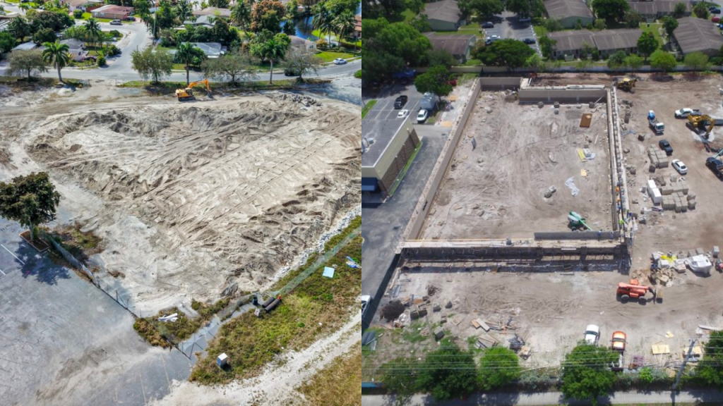
The DJI M3E can provide regular updates on construction progress, allowing project managers to monitor developments, manage resources efficiently, and stay on schedule. It has the ability to capture high-resolution images and generate accurate, detailed 3D models of the construction site. These models provide precise measurements and a comprehensive view of the site, which can be critical for planning, design adjustments, and ensuring the project adheres to its specifications. The detailed imagery and models produced by drones can be used for tracking construction materials, equipment, and assets on-site, helping to optimise inventory management and reduce the risk of theft or loss. Furthermore, the data captured can serve as a valuable record of the construction process, providing documentation that can be used for legal, regulatory, or historical purposes.
Stockpile Measurement:
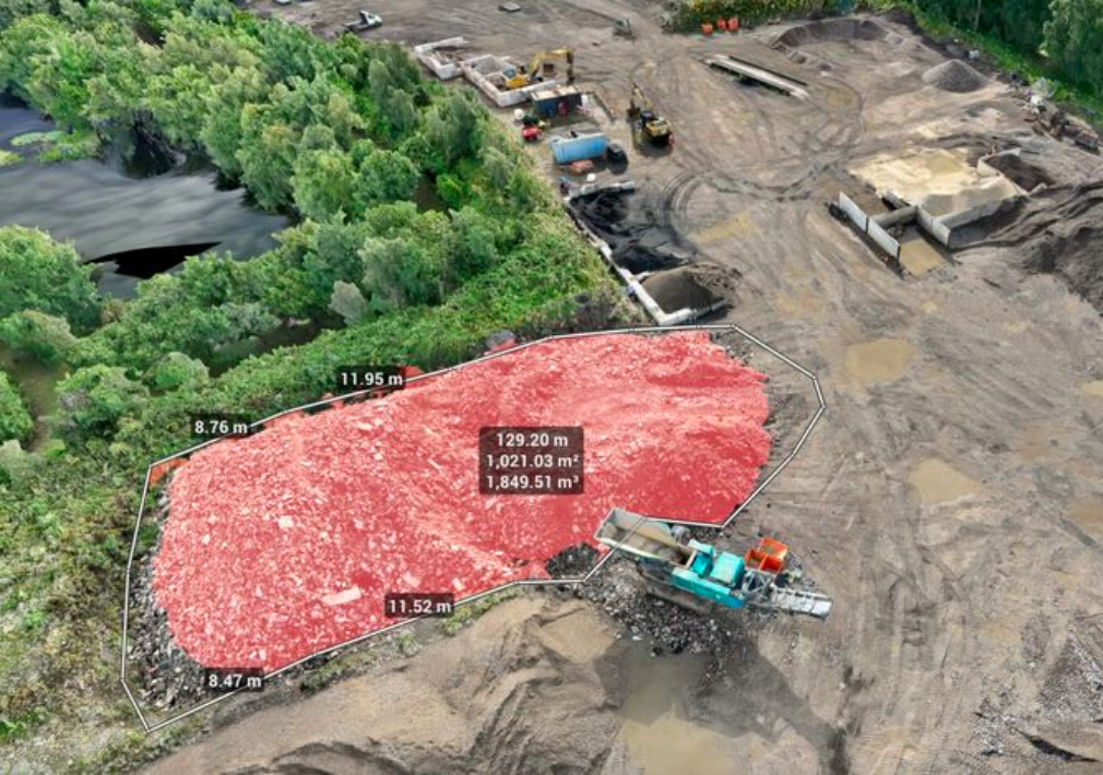
The Mavic 3E can quickly survey vast areas, capturing pinpoint accurate data that is then processed to calculate precise stockpile volumes. This method significantly reduces the time and labour required for manual measurements, minimising human error and enhancing operational efficiency. Moreover, frequently monitoring stockpiles ensures real-time inventory tracking, aids in forecasting, and supports adherence to safety and environmental regulations. By leveraging the advanced capabilities of the drone, businesses can optimise their resource management and decision-making processes, leading to improved productivity and cost savings.
Topographic Mapping:
Create detailed topographic maps for planning and design purposes, accurately capturing land contours, elevation, and features. Traditional topographic surveys face challenges such as extensive fieldwork, high costs, and delays due to inefficient data collection, often lacking contour data for visualisation. With the DJI M3E, cover large areas and generate scaled maps with centimetre-level accuracy with little to no ground control points, enhancing data collection and processing efficiency by up to 10 times.

Infrastructure Planning:
The M3E is highly beneficial for infrastructure planning as it provides detailed imagery and data crucial for the analysis and design of projects. Drones offer a comprehensive view that aids in identifying potential problems before the onset of construction. By leveraging the precise and extensive information gathered through aerial surveys, planners can make informed decisions, optimise designs, and efficiently allocate resources, ensuring a smoother and more cost-effective project development process.

Pre-Construction Site Analysis:
Using a drone like the M3E offers valuable insights into the site condition before construction begins, helping with risk assessment, planning, and ensuring the site is optimised for the project.

Communication and Collaboration:
Enhances communication among stakeholders by providing visual data that can be shared and discussed, ensuring everyone is informed and aligned on the project status.

DJI Mavic 3 Enterprise 3D Model:
The DJI Mavic 3 Enterprise’s advanced imaging capabilities and precise data collection transform how professionals approach complex surveying tasks and generate detailed 3D models. This drone is not just a tool but a game-changer in the field, enabling accurate, reliable, and time-saving practices for surveying professionals and industries reliant on spatial data and 3D representations
Download Our FREE RPC-L1 Guide
Understand everything you need to know about moving towards commercial drone operations with our RPC-L1 guide.
- Understand what RPC-L1 is and who it is for
- Learn how the CAA transition impacts operators and training routes
- Get a clear breakdown of requirements, costs and next steps


Related Posts

DJI Matrice 30 Series – The Ultimate Buyer’s Guide
Now the initial hype from the release of the DJI Matrice 30 Series is over, we’re here to answer all of your questions about the product so that you have the information you need before you buy! What is the DJI Matrice 30 Series? The Matrice 30 series are two drones (Matrice 30 and Matrice […]
Drone Privacy: Considerations When Using Your UAV
Most people who have their reservations about drones do so because they’re worried about their privacy. Rightly so! The idea that anyone can fly a drone with a camera can be scary – but we’re all in favour of responsible drone piloting. While rules on privacy vary from country to country, there are a few […]

5 Steps to Kickstart a Drone Construction Business
Construction is one of the sectors which has benefitted greatly from drone technology in recent years. Surveyors are able to get a birds-eye view of a site, feeding into construction planning, offering the opportunity to improve both accuracy and efficiency in the process. Inspections, health and safety, maintenance and marketing are other elements of construction […]















