Targeted herbicide applications of agricultural inputs help save costs whilst protecting soil health and the environment.
Global demand for food is growing bigger but the challenges around agriculture and crop production are growing too. Increased prices of agricultural inputs and the higher need for more sustainable ways of production are posing a modern farming challenge. Smart agriculture technologies can not only used to help solve this problem but also save significant costs and alleviate farmers’ demanding and quite often unpredictable challenges.
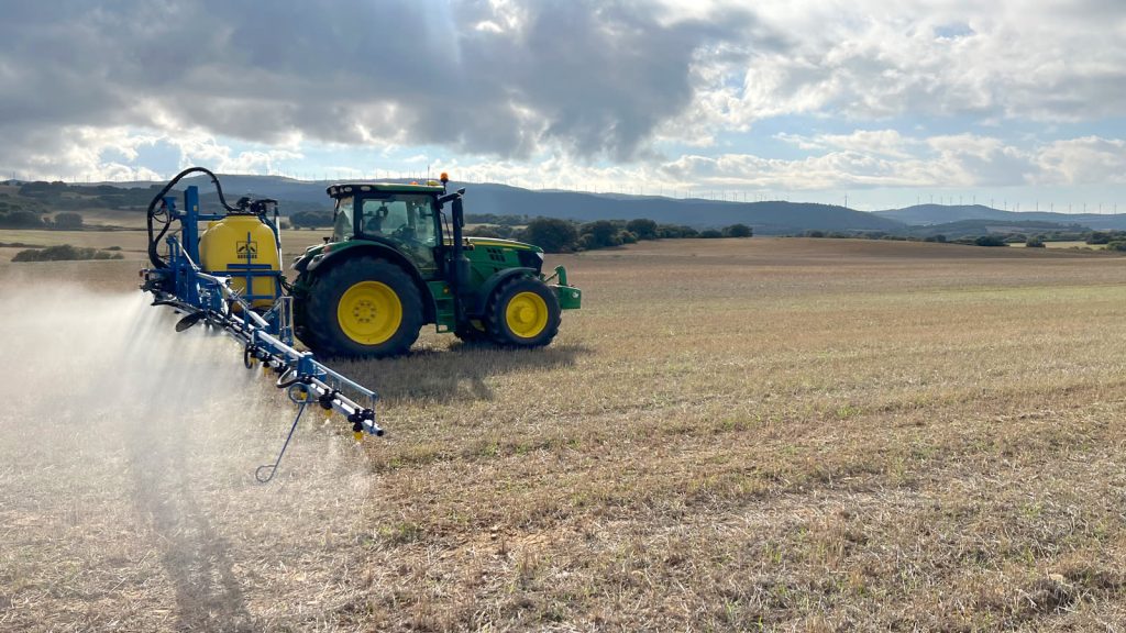
Targeted foliar herbicide spraying on a wheat field
Marcos Esteve Pamias is a farmer and mechanical engineer managing his family farm in Valdorba in Spain. Along with his farming work of growing wheat, barley and oats, Marcos also works at EOSOL where his current project involves developing a virtual fertilisation advisor. Together with his family, they started organic farming in 2012 before they switched to precision farming in 2017, with the aim to reduce their environmental footprint.
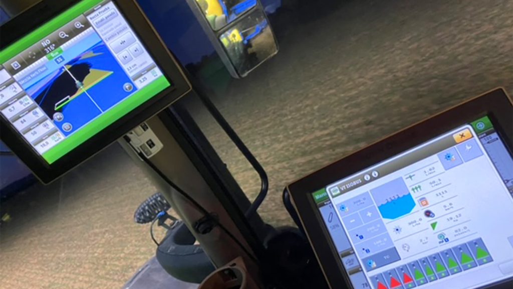
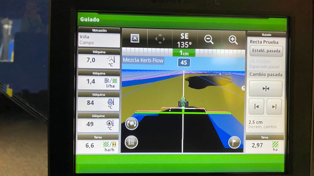
Their family farm is fully equipped with precision farming technology to carry out all applications successfully in the field. The machinery and equipment include weather stations, a drone with a multispectral camera as well as a tractor with isobus connection which allows for full control over farming operations.
Project details:
Location: Valdroba, Spain
User: Marcos Esteve Pamias
Project duration: 2 days
Areas surveyed: 8 acres
Software used: Pix4Dfields
Hardware used: DJI Mavic 3 Multispectral
Processing hardware: CPU AMD Ryzen 9 5900X, 64GB RAM, GPU 4080
Processing time: 23 minutes
Images captured: 4825
GSD: 21mm

The Magic Tool identifying areas to be treated with herbicide
Marcos began working to treat areas on his farm that were affected by weeds: more specifically brome. The factors that defined this project were the high herbicide costs and their foliar application, which makes it even more important to only target areas on the field with high concentration in weeds. To precisely locate these areas, Marcos flew a drone and processed all the images he captured in Pix4Dfields, with results ready in just 23 minutes. After the fast processing, he analysed the multispectral images.
The areas affected with brome were clearly visible from the images taken with the drone. Marcos could select some of these areas with the Magic Tool to highlight what to detect in the field. With Pix4Dfields’ Magic Tool, the remaining areas affected by weeds were detected instantly, allowing Marcos to create a prescription map for a targeted herbicide application only in the areas where weed concentration is high.

After the creation of this prescription map in PIX4Dfields, it can be integrated to the tractor’s system, in this case a John Deere tractor, for a variable rate herbicide application. Overall, the project took just two days, and with Pix4Dfields’ Magic Tool, helped the farmer save 56% of costs on herbicide that would have been applied in the case of a blanket application.
Reducing herbicide costs applied per hectare
With the growing pressure to reduce resource use whilst increasing yields, precision farming projects like these are becoming more common. The fast turnaround of collecting data, processing the imagery, and analysing the results with Pix4Dfields made it easy to react quickly to the weeds as well as saving money on spot-treatments rather than blanket spraying the field.
“What I liked most about Pix4D is both the accuracy and speed of orthomosaics generation, as well as the ability to take advantage of the data by generating new indices or tools for data analytics..“
Marcos Esteve Pamias, Farmer
The project had a great impact on reducing herbicide applied per hectare as both the product used and the cost per hectare has been halved. Additionally, using less herbicide means being more sustainable and environmentally friendly, which lines up with the aims of Marcos and his family for their farm. Marcos highlighted Pix4Dfields’ high quality and orthomosaic images resolution, speed, and the Magic Tool functionality. Accuracy and speed, and most importantly the fast generation of valuable analytics, are what made this farmer choose Pix4Dfields software for his agriculture applications.
Article Credit: Pix4D
Download Our FREE RPC-L1 Guide
Understand everything you need to know about moving towards commercial drone operations with our RPC-L1 guide.
- Understand what RPC-L1 is and who it is for
- Learn how the CAA transition impacts operators and training routes
- Get a clear breakdown of requirements, costs and next steps


Related Posts
Preparing Your PfCO Operations Manual
As a qualified NQE, COPTRZ provides specialist training to enable drone pilots to obtain their permission for commercial operations (PfCO). The process of applying for your PfCO involves three key areas; a theory assessment, flight assessment and an operations manual submission to the Civil Aviation Authority (CAA). Submitting drone flight operations manual to the CAA is […]
Pix4Dreact – Mapping On Demand
Pix4Dreact – a detailed look into this game changing real-time mapper When time is of the essence and every second counts, Pix4Dreact is fast mapping software that’s tailor-made for rapid response and emergency situations. Released in the autumn of 2019, Pix4Dreact was developed to meet the needs of first responders and emergency services. It quickly […]

Wind Turbine Inspections – Martek Marine
We’re revolutionising the way visual wind turbine inspections are carried out using specialised UAS drone technology. Gone are the days of risking staff safety or using inefficient inspection techniques that don’t deliver complete blade coverage and data We’re committed to delivering minimum blade downtime to maximise your production. It’s all been made possible by the […]