Construction is one of the sectors which has benefitted greatly from drone technology in recent years. Surveyors are able to get a birds-eye view of a site, feeding into construction planning, offering the opportunity to improve both accuracy and efficiency in the process. Inspections, health and safety, maintenance and marketing are other elements of construction which are being advanced by drone technology.
If you are a construction company which is thinking about starting your own drone construction programme, you might be a little cautious. This could be due to a lack of knowledge, or perhaps experience – but the good news is that the best drone technology providers will be able to guide you through the purchasing process.

In this blog, we offer the top five steps to getting your drone programme underway. Outlining the key considerations which can go towards making an intelligent and informed decision:
1. Choosing the right drone for your needs
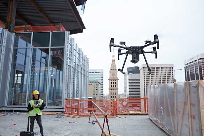
One of the critical steps to implementing a drone programme for a construction business is to ensure investment into the right drone. Among the unmanned aerial vehicles which are most suited to construction are the Matrice 200 series and Matrice 600 Pro.
The Matrice 200 series offers up to 30 minutes flight time, an FPV camera and collision avoidance technology. Its ability to provide total magnification of up to 180x is an obvious advantage for surveys and inspections. Many of the tasks required of drones for construction purposes need only a single data output. The Matrice 210 can fit the bill perfectly and includes an intelligent data capture platform.
In the same vein, the Matrice 600 Pro, offers even more loading capacity and third-party software which can also make the unit perfect for professional photography needed for construction marketing purposes.
2. Get the right training
Training should be part of your drone programme, even if you already have some drone use experience. It is important that you understand the best way to use the specific UAV you will choose to fulfil your requirements.
In the UK, those operating drones should hold a Permission for Commercial Operations (PfCO) certificate. This is issued by the Civil Aviation Authority (CAA). COPTRZ offers an OFQUAL accredited CAA Drone Training Course which will provide participants with all the skills, experience and knowledge which they need to gain a PfCO. These courses, which typically take four days, involve ground school lessons, flight tests, theory tests and reviews of operation manuals.
You should ensure that the personnel in your drone programme are equipped with the right skills to fly a UAV. Then there are more specific training courses which are important for using the various software packages. These will allow you to make the most of the data collected in drones. For example, we offer a COPTRZ Pix4D workshop which trains attendees in using the popular 3D mapping software.
3. Choosing the ideal payloads
A payload refers to the objects or weight which a drone will carry in flight, and in the case of drones used for construction purposes, quite often this can be the camera. Choosing the right kind of camera for your requirements can be crucial to getting the job done every time.
The Zenmuse Z30 is a camera which is favourable to construction tasks such as inspections. It offers TapZoom, a feature which allows visual data to be collected in a precise manner. A tap system makes gaining an enlarged view of a specific area, simple. Then there is the extremely effective stabilisation system which is so important for minimising movement for a high-powered zoom.
You might also consider the Zenmuse XT2, a powerful accompaniment for the Matrice drones mentioned above, offering a way of collecting and analysing aerial data quickly. This is an aerial thermal and visual imaging solution which can be ideal for construction site surveying and inspections.
4. Extra software needed for your drone construction business
It might be said that a drone programme is only as effective as the software which is used to use the data collected from it. Pix4D is a leading 3D mapping software which is suited to construction drone programmes. Pix4D has the ability to convert images into accurate georeferenced 2D maps and 3D models.
You can choose from a number of different licences, depending on your needs. Then there is FlightHub, which can be another important software package. It allows you to manage your drone operations centrally and remotely, streamlining collaboration between on-site pilots and offsite teams.
5. Having the right data collection solution in place
From photogrammetry to land surveying, construction companies looking at drone technology must ensure that they have the right data collection solution, addressing their specific requirements. By choosing the right drone, the right payload and the right software which you need – both for drone operations and for analysing data for insights – therefore you can ensure that your construction organisation has exactly the right tools for the job. After all, there is no use investing in a drone if you are not maximising its business potential.
Watch: What you need to start a commercial drone business
COPTRZ UAV Strategist George Burne takes you through everything you will need to get your commercial drone business off the ground.
Read more of our articles:
- How to use drones to assess construction sites
- Drones in construction: 4 key benefits
- Fixed Wing vs Multirotor drones for surveying
- Innovair: Using the M210 for land surveying and inspection
Download Our FREE RPC-L1 Guide
Understand everything you need to know about moving towards commercial drone operations with our RPC-L1 guide.
- Understand what RPC-L1 is and who it is for
- Learn how the CAA transition impacts operators and training routes
- Get a clear breakdown of requirements, costs and next steps


Related Posts

Expert insight from DJI and the CAA on the changing Drone Regulations
COPTRZ asked the Civil Aviation Authority (CAA) and drone heavyweights DJI to share their industry insight on the upcoming changing drone regulations in the UK. With some key changes coming in July, we wanted to find out what to expect and how it could impact on your everyday commercial drone operations. What you’ll find out […]

How multispectral imaging is used to facilitate data-driven decisions in agriculture and farming
In the modern era of technology, agriculture is no longer just about ploughing fields and sowing seeds. It has evolved into a high-tech industry where advanced tools are being used to optimise productivity and sustainability. One such technology that is making waves in the agricultural sector is multispectral drone imaging. But what exactly is it, […]

3 Ways Drones Could Change Wind Turbine Inspections Forever
Regardless of your industry, it’s certain that technology has changed at least one way you work. From artificial intelligence to smartphones and augmented reality, there’s no shortage of incredible new products to make our daily lives easier and more productive, yet it’s often the less glamorous innovations such as wind turbines that are having the […]















