This is the second part of a two-part series taking an in-depth look at the Matrice 200 Series. This part looks at a number of different payloads that can be used to enhance your data capturing capabilities.
The series features the DJI Matrice 200, as well as the DJI Matrice 210 and M210 RTK. Described by the manufacturer as its most ‘rugged, reliable, and versatile commercial aircraft to date’. They come equipped with an array of adaptable and technologically-advanced tools. These are designed for use by professionals in areas such as engineering, building & bridge inspection, and search & rescue.
A dual-battery power system enables flight times of up to 35 minutes, and it has a payload capacity of 2kg in order to safely carry the most advanced and sensitive camera systems in all kinds of weather conditions (more on those payload systems later).
The Matrice 200 Series has been designed with an innovative ‘two-gimble’ feature. Operators can make use of two separate aerial camera perspectives instead of just one. This enables the capture of two different kinds of camera imaging simultaneously.
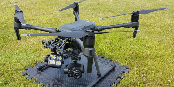
The Matrice 200 Series has been designed for use with specific payloads, each with their own specialised camera features and facilities. Here we take a closer look at the payloads designed to be used with the Matrice 200 Series drone.
DJI Zenmuse Z30
With aerial drones increasingly becoming vital tools for organisations looking to effectively gather information on surrounding areas, aerial payload cameras are becoming more and more sophisticated in terms of the technology they employ.
A great example of this is the DJI Zenmuse Z30, which was designed, according to the manufacturers, as ‘the first integrated aerial camera with an optical zoom up to 30x and digital up to 6x’. This means the user can record images in impressive clarity in either optical or digital modes.
As the makers point out, this makes the Zenmuse Z30 ideal for facilitating inspections from a safe distance, without the need for potentially difficult or dangerous close flying. The Zenmuse Z30 can, therefore, be used as a long-distance payload camera – making it ideal for inspecting the components of structures like wires and cables in a commercial engineering setting.

DJI Zenmuse X5S
The DJI Zenmuse X5S features an upgraded onboard Micro 4.3 sensor and renders images at an impressive 20.8 megapixels. It comes with 12.8 stops of dynamic range. The Zenmuse X5S has a significantly improved signal-to-noise ratio. Especially compared to the closely-related X5R model.
The Zenmuse X5S can be used with an impressive array of professional lenses. The focal lengths of these eight compatible lenses range from 9mm to 45mm. This gives the X5S user greater control and freedom over the kind of shots they take.
Still images can be taken with the Zenmuse X5S while it is functioning in video mode. This, without any interruption to the footage being recorded. The X5S can be set in Burst Mode. When utilising the Micro SD card, a series of high-resolution images can be captured at a rate of 14fps.
The Zenmuse X5S also features an advanced stabilisation feature. This makes use of a motor-rotated 3-axis gimbal. The rotation of which is powered by an independent processor.

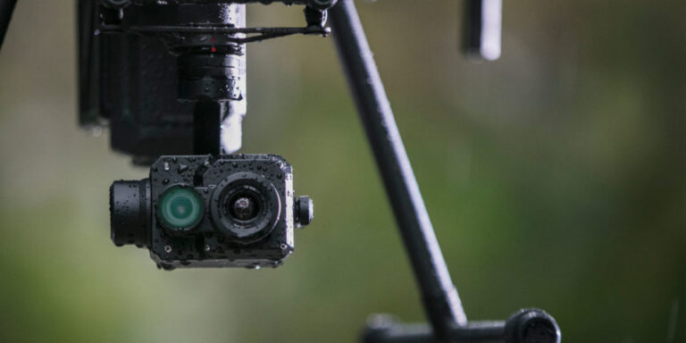
DJI Zenmuse XT & XT2
For advanced thermal-imaging systems, users of the Matrice 200 Series will require the DJI Zenmuse XT and DJI Zenmuse XT2 payloads.
Created in partnership with Flir, the XT is available in both radiometric and performance versions with a variety of resolutions. It provides high-sensitivity (50mK) thermal imaging at 640/30 fps or 336/30 fps depending on the camera model. This sensitivity provides accurate temperature measurements ideal for analytics and telemetry
The Zenmuse XT2 is the ‘next generation’ of drone thermal imaging software. It features an impressive combination of advanced imaging software and user-friendly design. A FLIR Tau 2 thermal sensor is paired with a state-of-the-art 4K imaging camera. This allows for the convenience of switching between the two viewing modes. The XT2 can quickly turn aerial data into impressively powerful insights for commercial operations.
The Zenmuse XT2 has an advanced array of features. These include temperature alarm, heat tracker, and FLIR MSX data interpreter. This is the ideal drone payload for use in life-or-death rescue work.
LiDAR USA
The LiDAR range is ideal to pair up alongside a Matrice 200 Series drone. There are three main options; the Revolution Series, the Snoopy A Series, and the Snoopy V Series.
The Revolution Series provides a great entry point in terms of cost and accuracy. When 2-4cm accuracy is within specified tolerances, these lidar units are a survey must. These sensors are ideal for a whole range of survey related tasks and are compatible with the ever-popular DJI M200 series drone.
Snoopy A-Series is a smaller, evolved version of LidarUSA’s original Snoopy system. This is a multi-vehicle configurable solution with increased accuracy. The A-Series is light-weight and easy to use. With just a click of a button on your smartphone, you can scan over the edge of a boat, the front of a motorcycle, the belly of a drone, the back of a car, the side of a train, the possibilities are endless.
The base model of the V series is the MINI VUX-1 UAV, and it is a powerful 3D mapping solution for businesses across multiple disciplines. It remains operational all the way up to 45 metres in the air, has a field of view of 360 degrees and weighs only 3.1kgs. For increased absolute accuracy and range then the VUX is the only option. With the long-range version boasting a range of 550m the VUX collects data which is incomparable to its competitors.

Speak to the commercial drone experts
If you’re in the process of starting your commercial drone operations, speak to COPTRZ and our friendly team can point you in the right direction when it comes to training, hardware and software. Contact us or call 0330 111 7177.
Read more of our blogs:
- DJI Zenmuse XT2: A Closer Look at DJI’s Latest Payload
- Key Features of the Matrice 200 Series
- Enterprise Solutions: DJI Matrice 200 Series Comparison
- DJI Matrice 200 Series: Part 1 – Commercial Applications
Download Our FREE RPC-L1 Guide
Understand everything you need to know about moving towards commercial drone operations with our RPC-L1 guide.
- Understand what RPC-L1 is and who it is for
- Learn how the CAA transition impacts operators and training routes
- Get a clear breakdown of requirements, costs and next steps


Related Posts
Innovair: Using the DJI Matrice 210 for land surveying and inspection
COPTRZ recently had the opportunity to speak to Andrew Johnston, Director of Inspection at Innovair. Andrew has over 10 years of experience in the oil and gas industry and is a qualified UAV pilot. He specialises in advanced and remote inspection technology and programme & software development. Drones are becoming an increasingly popular tool used […]
Parrot Anafi USA: Everything You Need To Know
Parrot Anafi USA – Everything You Need To Know Parrot ‘s Asif Gillani introduces us to Parrot’s newest drone – The Anafi USA. You can view the product showcase page Parrot Anafi Usa. What was the design process behind the Anafi USA, How did it come to be? As you know, the Anafi Thermal we […]

Managing Mast Inspection with Drones: An AT&T Case Study
Commercial organisations across the globe are waking up to the power of drone technology for surveying, including the major benefits offered for mast inspections – as shown by AT&T in the United States. Before we take a look at the case study, let’s delve into just a few of the many reasons that businesses around […]















