Sport Old
Drones provide innovative ways to capture footage, analyse performance, and enhance the spectator experience. Their ability to offer unique perspectives and detailed analytics makes them invaluable tools for athletes, coaches, and broadcasters.
- Enhanced Performance Analysis
- Improved Spectator Experience
- Innovative Training Methods
Get your FREE guide
Drones provide innovative ways to capture footage, analyse performance, and enhance the spectator experience.






Training Programs With Aerial Perspectives

Enhanced Performance Analysis
Drones capture high-resolution video and real-time data from unique angles, allowing coaches and analysts to scrutinise every aspect of an athlete’s performance. This detailed footage helps to identify strengths, weaknesses, and areas for improvement, leading to better training outcomes and enhanced athletic performance.

Improved Spectator Experience
Drones provide dynamic and comprehensive coverage of sports events. They can capture overhead views, follow the action closely, and offer perspectives that were previously unattainable with traditional cameras. This results in a more engaging and immersive experience for spectators, whether they are watching live or on broadcast.

Innovative Training Methods
Drones are used in innovative training programs to simulate game scenarios, monitor practice sessions, and provide real-time feedback. Athletes can review footage to correct their techniques, adjust strategies, and improve overall performance

Data Insights
In certain sports, drones can provide additional perspectives to assist referees and umpires in making more accurate and fair decisions. This can be particularly useful in situations where the on-field officials may not have a clear view of the action.
Related Guides

DJI Dock 2 vs Dock 1 Comparison – Datasheet
DJI Zenmuse L2 vs L1 Comparison – Datasheet
Related Case Studies

Archaeological Research Services
Archaeological Research Services Ltd (ARS Ltd) leverages advanced drone technology to uncover hidden historical features with remarkable speed and accuracy.
Blackthorn Arable
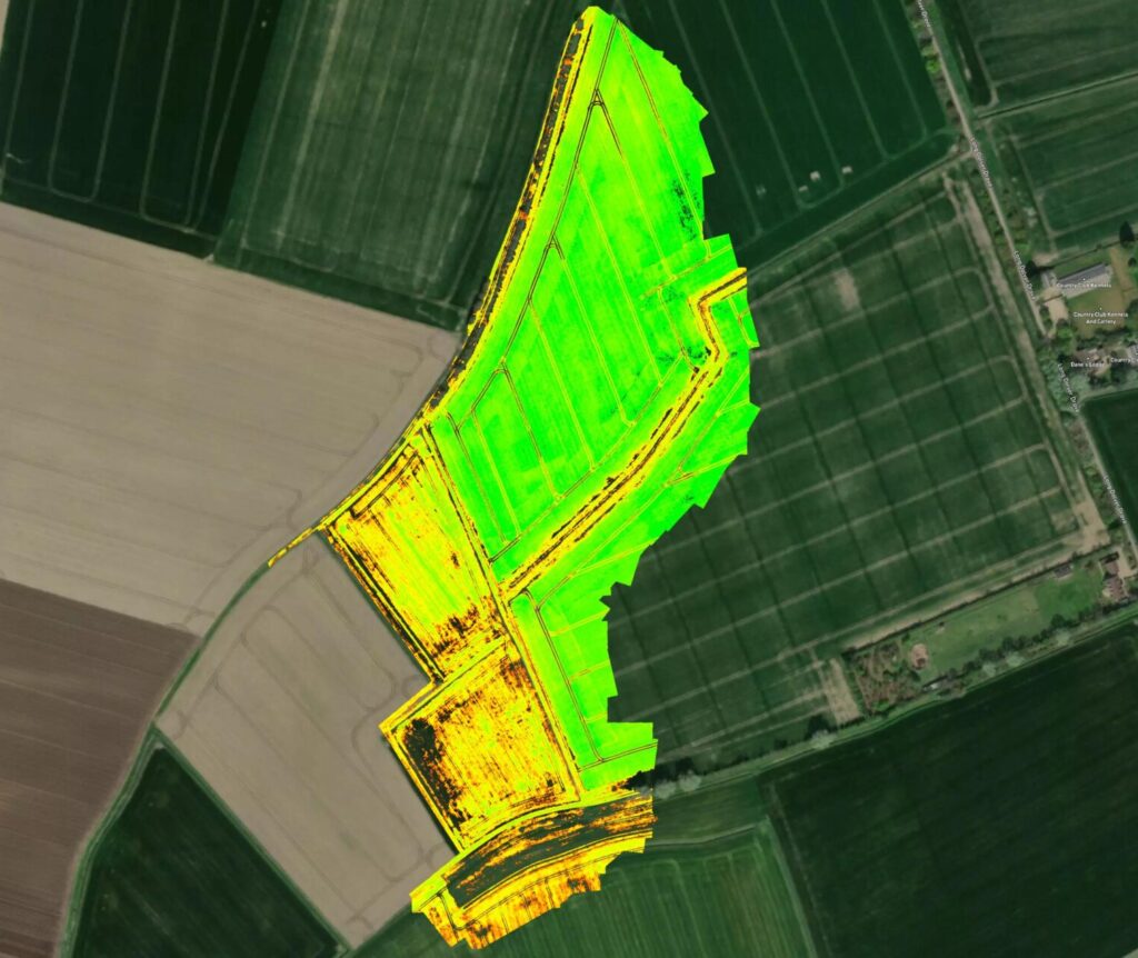
Blackthorn Arable Ltd collaborates with Coptrz to enhance farming methods through drone technology. Using the DJI Mavic 3 Multispectral and Pix4D, they aim to make better farming decisions and optimise crop management, pioneering innovations in sustainable agriculture.

Bolton College
Bolton College, part of the University of Bolton, is leading educational innovation, particularly in engineering and technology.
FAQs
Drones can capture high-resolution images, videos, thermal data, LiDAR scans, and topographical data, providing detailed and accurate information for planning, monitoring, and inspections.
Drones perform tasks that would otherwise require workers to enter hazardous areas, reducing the risk of accidents and injuries. They eliminate the need for manual inspections at heights or in dangerous environments.
Drones reduce labour costs, minimise the need for expensive equipment like scaffolding and cranes, and shorten survey and inspection times. This leads to significant savings in operational expenses and project budgets.
Drones equipped with advanced sensors like LiDAR and high-resolution cameras provide highly accurate measurements, essential for detailed surveys, volume calculations, and structural assessments.
Yes, drones can capture real-time images and data, allowing project managers to monitor progress, identify delays, assess work quality, and make informed decisions to keep projects on schedule.
Software such as DJI Terra, Pix4D, and similar platforms are used to process drone data. These tools generate orthomosaics, 3D models, and volumetric calculations, and facilitate data analysis and reporting.
Drones create accurate site surveys and maps using photogrammetry and LiDAR, generating detailed topographical maps and Digital Elevation Models (DEMs). This data aids in the design and layout of construction projects.
Drones capture aerial images of stockpiles, and software like DJI Terra processes this data to generate precise volumetric measurements. The drag-and-click interface allows for easy area selection and calculation.
Yes, drone data and reports can be exported into formats like PDF and Word documents, making it easy to share with project stakeholders, clients, and team members for effective communication and collaboration.
Drones provide faster, more accurate, and safer data collection. They reduce the need for extensive manpower and equipment, minimise disruptions to ongoing work, and offer detailed, real-time insights that enhance project planning and execution.
Book your FREE online consultation
Experience the unique advantage of our 360° drone solutions exclusively at Coptrz. With a network of over 20 partnerships with top-tier drone technology manufacturers, we're uniquely positioned to provide a tailored solution that you won't find elsewhere.
Impartial Expertise for
Commercial Drone Integration
End-to-end Drone Solutions
Complete drone solutions, including hardware, software, pilot training, repairs and support.
Impartial Advice
Industry experts work closely with you to find the best solution for your organisation.
UK's Widest Drone Selection
We're not limited to one brand, we offer the UK's widest range of world-renowned suppliers.

Accreditations
Recognised for excellence. Explore the industry certifications that validate our commitment to quality, compliance, and continuous improvement.

ISO 9001 Certified
Certified quality management systems for consistent service and customer satisfaction.

ISO 14001 Certified
Internationally recognised standard for environmental management and commitment to sustainable operations.

Cyber Essentials & Cyber Essential Plus
Government-backed certification demonstrating the highest level of commitment to robust cyber security.

The Equality Register Member
Committed to promoting equality, diversity, and inclusive practices across our entire organisation.

TQUK Recognised Centre
An officially recognised centre for Training Qualifications UK, delivering high-standard regulated qualifications

Registered with Elcas
Approved by the Enhanced Learning Credits Administration Service to provide funded training for Armed Forces personnel.

UK CAA Recognised Assessment Entity: RAE15510
CAA-approved to deliver drone training and assessment for RPC-L1, GVC and A2 CofC qualifications.

FCA Registered
Authorised and regulated by the FCA for consumer finance activities.
UK SORA & BVLOS Operations: SORA-28947, SORA-29134
Helping organisations obtain Operational Authorisations for BVLOS and other complex drone operations using the UK SORA framework.

Ofqual Regulated Training
Delivering prestigious, government-regulated training programmes that guarantee educational excellence and industry recognition.
Latest From Coptrz

Mobile Mapping for Rail and Highways: Capturing More During Access Windows


DJI Matrice 400


