In rail and highways survey, access is the constraint. Possessions are short, expensive to arrange, and non-negotiable in their end time. Highway lane closures carry traffic management costs that mount by the hour. The window for data capture is fixed — and when it closes, it closes regardless of how much of the site has been covered.
The survey workflow that maximises what can be captured in a given access window has a direct commercial value in these environments. Mobile mapping is that workflow for a wide range of rail and highways applications.
The access window problem in rail and highways survey
Rail possessions are one of the most constrained working environments in infrastructure survey. A possession window — typically a few hours overnight or at weekends — gives survey teams access to live track, structures and corridor assets under controlled conditions. When the possession ends, the line reopens. Everything the team didn’t capture has to wait for the next possession, which may be weeks or months away.
The cost of a missed possession isn’t just the survey fee. It’s the cost of re-arranging access, the programme delay while waiting for the next window, and in some cases, consequential delay costs to the wider project. A survey team that can capture more in a single possession — or complete the scope in fewer possessions — delivers a measurable commercial benefit to the client.
Highways lane closures have a similar dynamic. Traffic management is expensive and operationally disruptive. Survey work that requires multiple closures to complete what should be achievable in one is a direct cost to the programme. The capability to capture a highway asset — a bridge, a junction, a retaining wall or a road corridor — comprehensively in a single closure is commercially valuable.
Where conventional survey methods create limitations
Static laser scanning in rail and highway environments has real strengths — accuracy, point density, established deliverable formats — but the setup burden creates a tension with constrained access windows.
Moving between scanner positions, levelling, targeting and registering scans takes time that could be spent capturing data. On a possession of four hours, a significant proportion of that time is consumed by setup and movement between stations rather than active capture. The result is that coverage is limited not by the scanner’s capability but by the logistics of deploying it under time pressure.
Vehicle-mounted mobile scanning is one established response to this problem, and it works well for road corridors where continuous vehicle access is available. For rail, structures, tunnels and the more complex geometry of stations and depots, vehicle-based capture has its own limitations — coverage gaps, access restrictions and the inability to capture pedestrian-speed detail in confined areas.
How mobile mapping changes the capture equation
Ground-based mobile mapping — using a backpack, pole or vehicle-mounted scanner with RTK SLAM positioning — changes the capture equation in access-constrained environments in several ways.
Deployment is immediate. There is no levelling, no target placement and no static setup before capture can begin. The team arrives on site and starts capturing. On a short possession window, this can add fifteen to thirty minutes of productive capture time per visit compared to static scanning setup.
Movement is continuous. Rather than capturing at fixed positions and moving between them, the scanner captures data continuously as the team moves along the corridor, through the structure, or across the site. Coverage is accumulated at walking pace — or vehicle speed for road corridor applications — rather than incrementally between setup positions.
Coverage gaps are visible in real time. The point cloud builds in real time during capture, visible through monitoring software. If an area has been missed, the team can see it and return before the possession ends — not after it has closed. This is significant in environments where missing something means waiting weeks for the next access window.
GPS-denied environments are navigable. Rail tunnels, underbridges, station undercrofts and highway structures with enclosed decks are all environments where GNSS signal is weak or absent. RTK SLAM scanners track position through environmental geometry rather than satellite signal, which means they continue to operate in these areas without losing positioning confidence. For rail survey in particular, this covers a significant proportion of the assets that matter most.
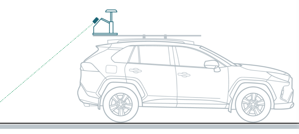
Multiple deployment configurations adapt to different environments. A backpack configuration suits pedestrian-speed corridor survey and structure inspection. A pole mount suits confined access and specific measurement requirements. A vehicle mount suits road corridor capture at speed. The same scanner adapts to different environments within a single possession or closure, without requiring different equipment for each.
Rail applications
Track corridor survey. Continuous mobile capture along a track corridor produces a dense point cloud of the permanent way, drainage, fencing, lineside structures and overhead line equipment. Combined with RTK/PPK positioning, the dataset is georeferenced to the network coordinate system and usable for design, maintenance planning and asset record updates.
Tunnel survey. Tunnels are GPS-denied environments where static scanning is time-consuming and aerial survey is impossible. Mobile RTK SLAM scanning in a backpack or rail vehicle configuration captures tunnel geometry, lining condition and clearance profile continuously, maximising capture in a constrained possession window.
Station and structure survey. Platforms, footbridges, station buildings and adjacent structures can be captured efficiently during an engineering possession. The 360-degree imagery captured alongside the LiDAR provides condition evidence alongside geometry, supporting both structural assessment and asset record requirements.
Depot and yard mapping. Rail depots and maintenance facilities are complex, multi-level environments with constrained access and changing track arrangements. Mobile scanning captures the full extent of the facility in a single deployment, with point cloud outputs usable for design, refurbishment planning and digital twin baselines.
Highways applications
Bridge and structure inspection. Highway bridges, retaining walls, tunnels and culverts can be captured efficiently during a lane closure. Mobile scanning of the structure interior, soffit and abutments — combined with drone-based LiDAR of the deck and superstructure where accessible — produces a comprehensive dataset in a single closure. For more on how drone and ground-based LiDAR combine for infrastructure inspection, see our post on drone LiDAR vs terrestrial LiDAR: why UK teams need both.
Road corridor survey. Vehicle-mounted mobile scanning of road corridors — capturing carriageway geometry, drainage, signs, street furniture and verge conditions — produces a continuous georeferenced dataset at road speed. Combined with RTK positioning, the outputs meet the requirements for highways asset inventory, maintenance planning and design development.
Junction and interchange survey. Complex junctions and interchange structures require comprehensive capture from multiple angles. Mobile scanning adapts to the geometry of the environment, capturing pedestrian routes, bridge structures, underpasses and approach carriageways in a single deployment.
For more on how LiDAR applies across infrastructure inspection and asset management workflows, see our LiDAR technology capability page and our post on the best LiDAR scanner for infrastructure and asset inspection.
Where Emesent GX1 fits in rail and highways survey
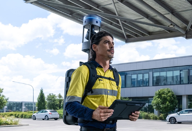
The Emesent GX1 is a ground-based mobile mapping scanner combining RTK SLAM, high-density LiDAR with a 300 m range, and four 20 MP cameras capturing 360-degree imagery. It is deployable in backpack, pole, vehicle and supported handheld configurations, with an IP65 environmental rating for field use.
Its GPS-denied performance makes it directly applicable to rail tunnels, enclosed highway structures and other environments where satellite positioning is unavailable. Emesent states 5–10 mm global accuracy, 5 mm local accuracy and 15 mm RTK/PPK accuracy — appropriate for the corridor survey, structure inspection and asset record applications typical of rail and highways programmes.
E57 point cloud outputs integrate with Civil 3D, Revit, GIS and asset management platforms used across the rail and highways supply chain. Coptrz is a UK partner for Emesent, supporting buyers with demonstration, workflow review, training and after-sales care. Find out more on our Emesent brand page and our surveying and construction sector page.
Making the possession count: a practical approach
For survey teams working in rail and highways, the practical test of mobile mapping is straightforward: take a possession or closure where coverage was previously limited by setup time, run a mobile scanning workflow for the same scope, and compare what was captured. The output — more corridor, more structure, more asset detail — is the commercial case.
For firms currently referring rail or highways survey work because their static scanning workflow can’t deliver enough in a possession window, mobile mapping removes that constraint. For those already working in these environments, it increases the coverage achievable per possession, which either reduces the number of possessions required or expands the scope that can be delivered in each one.
For more on how to build the financial case for mobile mapping investment, see our post on how to build an ROI case for mobile mapping equipment.
Frequently asked questions
Mobile mapping is deployed during possessions — when the line is closed to traffic and controlled access is granted. It does not operate on live track. Within a possession, backpack, pole and rail-vehicle configurations all allow efficient capture of track, structures and corridor assets.
Yes. RTK SLAM scanners track position through environmental geometry rather than satellite signal, which means they operate in GPS-denied environments including tunnels, underbridges and enclosed structures. Vehicle-mounted deployment allows tunnel capture at speed where rail vehicle access is available; backpack deployment allows pedestrian-speed capture with more detail in complex areas.
The primary outputs are a georeferenced point cloud — available in E57, LAS and other standard formats — and 360-degree imagery captured in the same pass. These integrate with Civil 3D, Revit, GIS and asset management platforms used across rail and highways programmes. RTK/PPK positioning ties the dataset to the relevant coordinate reference system.
Vehicle-mounted laser scanning is well established for road corridor survey at speed and produces high-quality results for carriageway and roadside assets. Ground-based mobile scanning complements it for areas where vehicle speed is too high for the required detail, where access is restricted to pedestrians, or where structures and enclosed environments need to be captured in the same deployment. The two approaches are complementary rather than competing.
Yes. Coptrz provides practical demonstrations, workflow advice, training and after-sales support for GX1 buyers in the UK, including teams working in rail and highways environments. Contact the team to discuss your programme and arrange a demonstration.
Next steps
If access windows are limiting what your survey team can capture on rail or highways projects, the right test is to run a mobile scanning workflow on a possession or closure where coverage has previously been the constraint. Measure what changes.
View the Emesent GX1 on Coptrz or get in touch to book a demo.
Download Our FREE RPC-L1 Guide
Understand everything you need to know about moving towards commercial drone operations with our RPC-L1 guide.
- Understand what RPC-L1 is and who it is for
- Learn how the CAA transition impacts operators and training routes
- Get a clear breakdown of requirements, costs and next steps


Related Posts
Transform Your Operations with the Parrot ANAFI Ai: Innovation That Delivers Results
The Parrot ANAFI Ai is setting new standards in the drone industry, offering advanced features tailored to meet the evolving needs of professionals across various industries. Designed to address real-world challenges, it provides unmatched performance for inspections, mapping, and data collection, empowering businesses to operate smarter and more efficiently. Why the ANAFI Ai Stands Out […]
DJI Launches DJI Pro Website for Professional Cinematographers and Filmmakers
DJI, the world’s leader in creative camera technology, today launched the new DJI Pro website https://pro.dji.com. Since the introduction of the Z15 three-axis aerial gimbal in 2014, DJI has been committed to providing reliable and easy-to-use tools for creative visionaries. The DJI Pro website continues that commitment, providing a comprehensive user experience for cinematographers and filmmakers […]
The Future of Gas Detection using Drones
Why UAVs equipped with specialist cameras are forging ahead with effective gas detection With gas emissions coming under ever closer environmental scrutiny, as well as the more immediate safety issues that can result from gas leaks across a variety of fields, it’s no surprise to see the drone industry step up with solutions designed to […]















