When lives are on the line, situational awareness is the ultimate currency. For decades, emergency services relied heavily on ground teams and expensive manned aviation to gather critical intelligence. Today, Unmanned Aerial Vehicles (UAVs) have fundamentally shifted the operational paradigm.
Public safety drones act as an immediate force multiplier. By deploying rapidly and providing real-time, high-definition aerial intelligence, UAVs enable incident commanders to make faster, safer, and more effective data-driven decisions. Whether tracking a suspect, assessing a three-alarm structural fire, or conducting a grid search over rugged terrain, drones have transitioned from experimental tech to an operational necessity.
Here is a deep dive into how drone technology is reshaping the primary pillars of public safety, and why integrating the right hardware and software ecosystem is critical to mission success.
Law Enforcement: The Tactical Eye in the Sky
For police forces and border security agencies, the primary advantage of a UAV is covert, rapid deployment. Traditional helicopters take time to scramble and can cost thousands of pounds per hour to operate. Drones, conversely, can be airborne in under a minute directly from the trunk of a patrol vehicle.
- Overwatch and Crowd Control: High-zoom optical payloads (such as those found on the DJI Matrice series) allow command centres to monitor large gatherings, protests, or high-risk raids from a safe standoff distance without escalating tension on the ground.
- Suspect Tracking & Apprehension: Equipped with thermal imaging, drones can easily track human heat signatures through dense foliage or darkness, guiding K9 units and ground officers precisely to the target while minimising ambush risks.
- Accident Reconstruction: Using photogrammetry software like Pix4D, traffic collision investigation teams can map an entire accident scene in 3D in a fraction of the time it takes using traditional surveying tools, allowing roads to reopen hours faster.

Fire and Rescue: Navigating the Heat
Firefighting is inherently chaotic. The ability to see through dense smoke and understand the structural integrity of a burning building changes how fire crews tackle an active blaze.
- Thermal Hotspot Identification: Payloads integrating high-resolution radiometric thermal cameras—such as the DJI Zenmuse H30T—allow operators to see straight through heavy smoke. Incident commanders can pinpoint the exact origin of the fire, identify hidden hotspots within roofing structures, and direct aerial water drops or ground-based hoses with pinpoint accuracy.
- HazMat and Chemical Spills: In hazardous material incidents, sending a human to assess the danger zone risks severe exposure. Drones can be flown into the hot zone to read chemical placards on overturned vehicles, assess spill trajectories, and even deploy gas-sniffing payloads to determine toxicity levels in the air.
- Structural Integrity Assessment: Drones like the Flyability Elios 3, protected by an advanced collision-tolerant cage, can be flown inside unstable, burning, or collapsed structures to search for survivors without putting rescue teams at risk of structural collapse.
Search and Rescue (SAR): Saving Time, Saving Lives
In a missing person scenario, the survival rate drops exponentially with every passing hour. Drones equipped with advanced sensors have revolutionised search and rescue operations, particularly in harsh environments.
- Vast Area Coverage: A drone can cover a 10-square-kilometre search grid in a fraction of the time it would take a ground team on foot. By utilizing automated flight paths and advanced mapping software, SAR teams can systematically rule out terrain.
- Night Operations: The combination of thermal imaging and laser rangefinders allows drones to operate 24/7. A drone can easily spot the heat signature of a missing hiker against the cold background of a forest floor, coordinate GPS coordinates, and guide rescue teams directly to the location.
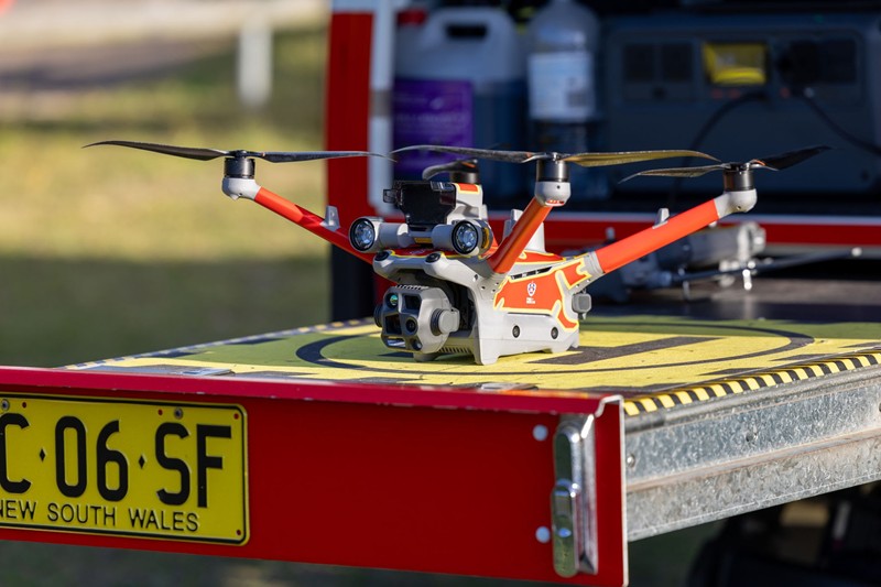
Building a 360-Degree Drone Ecosystem
Hardware alone doesn’t solve public safety challenges; the magic happens when hardware, payloads, and software are integrated into a cohesive workflow.
- Airframes: From the highly portable DJI Mavic 3 Thermal for rapid deployment, to the heavy-lift DJI Matrice 350 RTK capable of carrying multi-sensor payloads, to the highly secure, data-encrypted Parrot ANAFI USA designed for government operations.
- Payloads: Drop mechanisms for delivering life jackets or medical supplies, high-lumen spotlights for night operations, and advanced LiDAR/Thermal sensors (like the Zenmuse L2 and H30 series).
- Software: Fleet management platforms like DJI FlightHub 2 or AirData Enterprise allow off-site command centres to view live drone feeds in real time, manage pilot flight logs, and coordinate multi-drone operations across a city.
Why Partner with Coptrz?
Scaling a drone program for a public safety agency requires more than just buying a fleet of UAVs; it demands rigorous training, regulatory compliance, and ongoing technical support.
As a leading UK provider of commercial drone solutions, Coptrz provides a complete 360-degree service. From selecting the right bespoke payload to providing advanced CAA-approved pilot training tailored specifically for emergency services, Coptrz ensures your teams are deployment-ready from day one.
Ready to modernise your agency’s response capabilities? Explore the complete ecosystem of Public Safety Drone Solutions at Coptrz and equip your frontline with the aerial intelligence they need to save lives.
Download Our FREE RPC-L1 Guide
Understand everything you need to know about moving towards commercial drone operations with our RPC-L1 guide.
- Understand what RPC-L1 is and who it is for
- Learn how the CAA transition impacts operators and training routes
- Get a clear breakdown of requirements, costs and next steps


Related Posts

OFQUAL 5: Chief Pilot Training course
Take your drone training to the next level with OFQUAL 5 Chief Pilot Training As we’ve discussed in the past, if you want to operate drones on a commercial basis in the UK you need a Permission for Commercial Operations (PfCO) – typically delivered via a three or four-day course from a National Qualified Entity […]

Why Universities, Research Institutes and Government Agencies Are Turning to Drones
Across the UK’s universities, research institutes, government agencies, and specialist research organisations, the same operational shift keeps showing up: fieldwork that used to take days is being compressed into hours, datasets that used to vary by surveyor and conditions are becoming repeatable and defensible, and drone capability is increasingly becoming a standard part of research, […]

Why DJI’s Latest Drones Are Raising the Bar for Reliability and Efficiency
When you’re deploying drones for critical operations — whether that’s public safety, infrastructure inspection, or utility work — every second and every feature counts. That’s why DJI’s latest aircraft, the Matrice 4TD, is turning heads and setting a new benchmark in efficiency, reliability, and intelligent performance. We recently took a deep dive into how it […]














