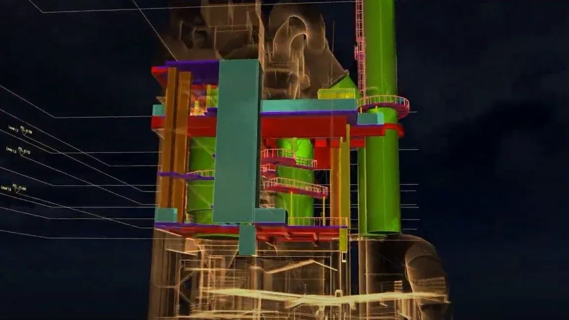
In the world of infrastructure and industrial inspection, Building Information Modelling (BIM) has become a standard. But capturing the data to feed these models—especially in hazardous or hard-to-reach areas—remains a challenge.
That’s where Flyability’s Elios 3 steps in.
With its collision-tolerant design and industry-leading LiDAR payload, the Elios 3 is enabling faster, safer, and more efficient data capture for Scan to BIM workflows, especially in environments where traditional tools fall short.
Traditional Methods vs Elios 3
Conventional tools like Terrestrial Laser Scanners (TLS) or Total Stations require safe, stable access and line-of-sight for multiple setups. In confined or cluttered areas, this is often impractical or even impossible—leading to patchy data and extended downtime.
In contrast, the Elios 3’s drone-mounted Surveying Payload brings:
✅ Centimetre-level accuracy (0.1% drift)
✅ Live 3D mapping and high-res 4K visual data
✅ Rapid capture—up to 10x faster than terrestrial scanning
✅ Full coverage, even in GPS-denied or obstructed environments
✅ Remote operation that keeps people out of hazardous areas
What Level of Detail (LOD) Can It Achieve?
Thanks to the powerful Ouster OS0-128 LiDAR sensor and FARO Connect SLAM algorithm, the Elios 3 comfortably achieves:
🔹 LOD 200 – Ideal for schematic design, layout simulations, and early-stage architectural planning
🔹 LOD 300 (with the right environment and operator) – Capturing specific shapes, spatial relationships, and dimensions
It’s not a replacement for TLS in ultra-precision applications—but it’s revolutionising how and where BIM-ready data can be collected.
The Scan to BIM Workflow (Simplified)
The workflow using Elios 3 is refreshingly straightforward:
- Fly through the target area capturing LiDAR and video data
- Process the flight logs in Flyability’s Inspector and FARO Connect
- Export clean point clouds into .LAS or .E57 format
- Model in BIM tools like Autodesk Revit for use in planning, construction, or documentation
No scaffolding. No rope access. No line-of-sight limitations.
Real-World Applications
The Elios 3 is already being used to power BIM models for:
🔸 Industrial plants and warehouses 🔸 Bridges and roof structures 🔸 Vertical shafts, tunnels, and pipes 🔸 Emergency response sites and confined infrastructure
If it’s hard to reach, Elios 3 can likely map it—safely and effectively.
Final Thoughts
With over 70% of construction companies now using BIM in some capacity, tools that simplify and accelerate data capture are vital.
The Elios 3 isn’t just another inspection drone. It’s an enabler for accurate, up-to-date BIM models in places previously off-limits to surveyors.
If you’re involved in infrastructure design, plant maintenance, or asset management and you rely on reliable BIM data—this is one piece of tech worth looking into.
Want to see how Elios 3 fits into your BIM workflow? Reach out to the team at Coptrz .
Download Our FREE RPC-L1 Guide
Understand everything you need to know about moving towards commercial drone operations with our RPC-L1 guide.
- Understand what RPC-L1 is and who it is for
- Learn how the CAA transition impacts operators and training routes
- Get a clear breakdown of requirements, costs and next steps


Related Posts

Upgrade your DJI Matrice 300: TB65 Battery Compatibility
Upgrade your M300 with this In the dynamic world of drones, the DJI M300 RTK has consistently proven itself as a reliable choice for both enthusiasts and professionals. However, there’s an exciting development that will further enhance its performance. This comes in the form of the TB65 Intelligent Flight Battery, a new addition to the […]

Drone Business Success – Case Study – Adam Watkin AeroMedia Wales Limited
Drone Business Success – Case Study – Adam Watkin AeroMedia Wales Limited Ever wondered what it’s like to take a PFCO course? Then we are on hand to help you out. The PFCO ‘licence’ is a key tool for commercial enterprises who want to take their drone business to the next level. We spoke to […]

The Rise Of The Health Care Drone: Drones For Good
The Rise Of The Health Care Drone: Drones For Good The coronavirus pandemic has meant all sectors have had to adapt quickly. As a result, innovation has moved quickly, with drones use and technology coming to the forefront in many industries and areas. In this article we look at how 2020 could see the rise […]















