Industry News
Stay up to date with the latest developments, product launches and trends shaping the global drone and UAV industry.
Industry News

The Role of Drones in Education: Enhancing Surveying, Construction, and Beyond
Drones, or Unmanned Aerial Vehicles (UAVs), have revolutionised various industries, including education. In the UK, institutions are increasingly integrating drones into their curriculum, particularly in surveying, construction, and other technical fields. Their ability to provide real-time data, improve safety, and enhance learning experiences makes them invaluable tools for students and professionals alike. Drones in Surveying […]
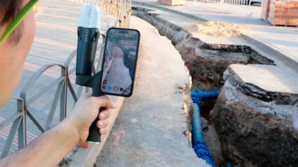
Revolutionising Utility Mapping: The Power of Gaussian Splatting
In the realm of utility management, accurately documenting underground infrastructures has always been a complex challenge. Traditional methods often fall short, leading to data gaps and incomplete visualizations. Enter Pix4D Gaussian splatting—a groundbreaking technique that’s redefining how we capture and visualise subterranean utilities. The Limitations of Conventional Methods Historically, surveying underground utilities involved hiring land […]
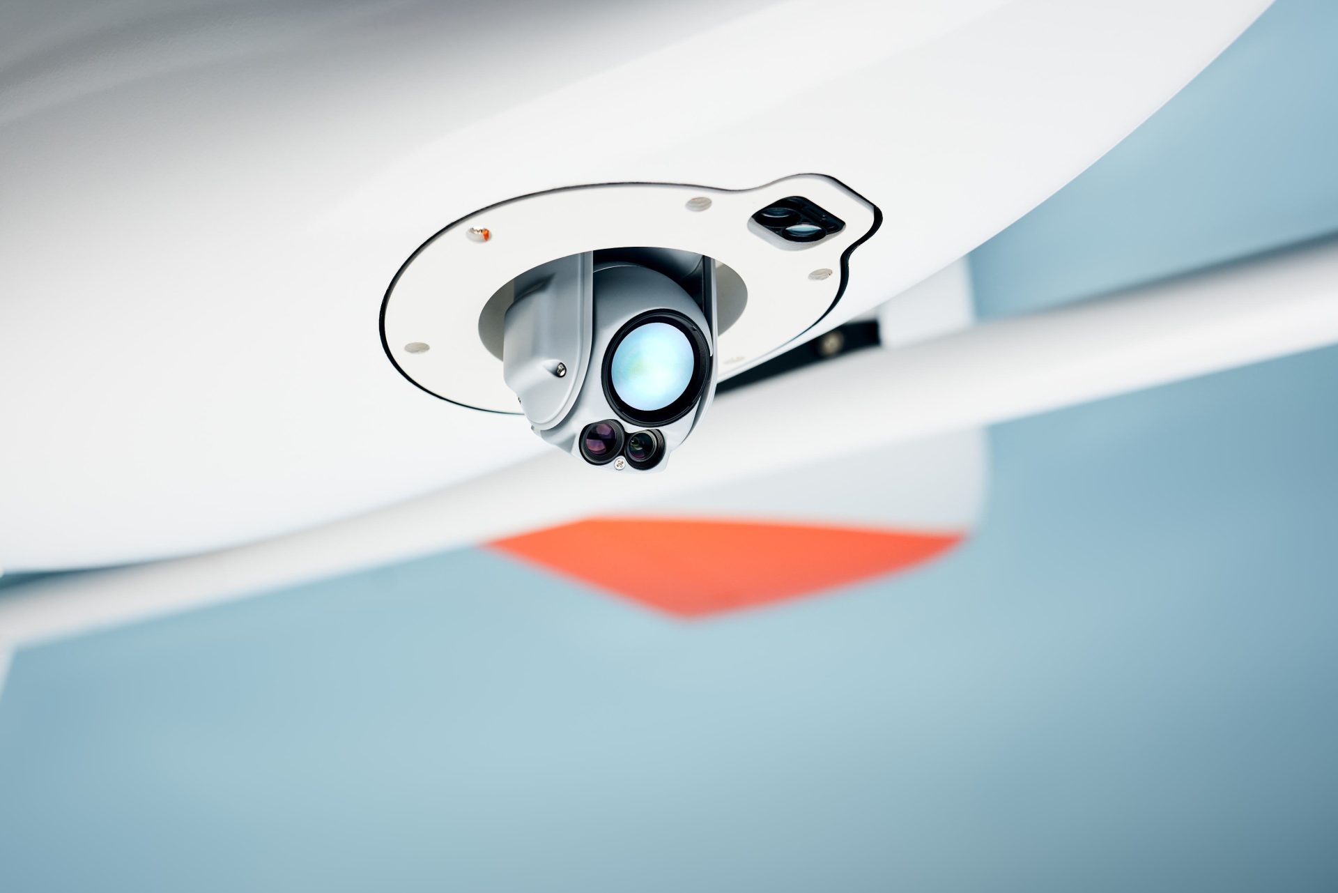
Why Emesent’s Hovermap ST-X is Redefining SLAM LiDAR Mapping Accuracy in 2025
The LiDAR mapping space is no stranger to innovation, but every now and then, a technology sets a new benchmark that redefines expectations. Emesent’s latest Hovermap Accuracy Report delivers exactly that. Based on independent testing at GeoWeek 2024 and head-to-head comparisons with both SLAM and TLS systems, the Hovermap ST-X emerges not just as a […]

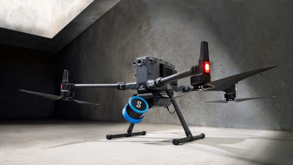
DJI Matrice 4 Series vs. DJI Mavic 3 Enterprise Series: A Comprehensive Comparison
With the introduction of DJI’s latest enterprise drone the Matrice 4 series, you may now be faced with a decision on which suits you best, the Matrice 4 Series or the Mavic 3 Enterprise Series. Both are designed to meet the diverse needs of professionals across various industries, but they differ significantly in capabilities, design, and applications. This […]

Enhancing Telescope Accuracy with UAV Photogrammetry: The Power of Phase One P3
The University of Tasmania’s School of Natural Sciences set out to improve the precision of their 26-meter radio telescope at the Mount Pleasant Radio Telescope Observatory. This telescope plays a critical role in Positioning, Navigation, and Timing (PNT) research, capturing signals from distant galaxies to study Earth’s shape, rotation, plate tectonics, and timekeeping. These measurements […]

Enhancing Snow and Ice Research with Drone-Based Ground Penetrating Radar
In the realm of snow and ice research, traditional methods like digging snow pits for stability assessments are labor-intensive and pose safety risks. Recognising these challenges, GEORESEARCH, in collaboration with LO.LA Peak Solutions GmbH and funded by the FFG, embarked on the STRATIFY project to explore innovative approaches to snowpack analysis. The Challenge Assessing snowpack […]

PDRA01 Application Process Cut from 6 weeks to 24 hours!
We’re excited to share news of a major update in the application process for Specific Category Operational Authorisations. The Civil Aviation Authority (CAA) has introduced a simplified, more efficient application procedure through a new online platform, designed to significantly speed up and streamline the process for applicants. This innovation begins with the launch of the […]
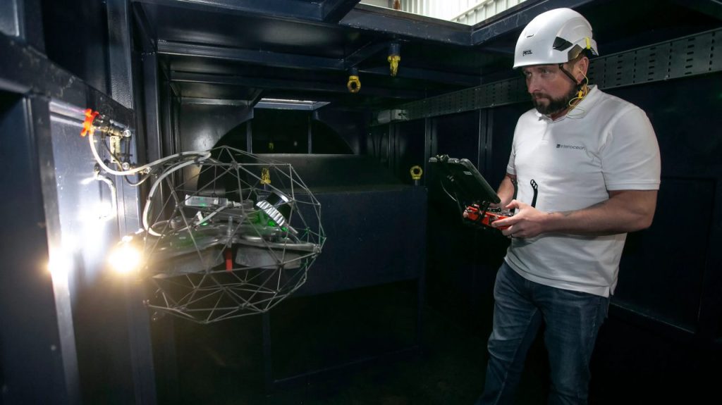
Class Certification for Maritime Drone Inspections with the Elios 3
How Interocean is leading the way with Class-Certified Drone inspections At Coptrz, we’re proud to be the exclusive UK provider of the Flyability Elios series—revolutionary drones that are redefining how industrial inspections are carried out. One of our valued customers, Interocean Marine Services, has been at the forefront of this transformation, leveraging drone technology to […]

Photogrammetry vs. LiDAR in Surveying & Construction: Which is Right for You?
Surveying and construction professionals have more advanced tools at their disposal than ever before, with drones revolutionising data collection across the industry. Two of the most powerful methods used today are photogrammetry and LiDAR, each offering unique advantages depending on the application. But how do you decide which one is best for your projects? Let’s […]
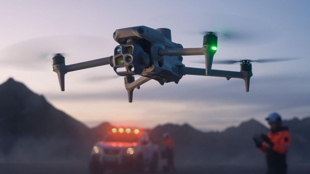
Public Safety Drones – Matrice 30 or Matrice 4 ?
In the realm of public safety operations, deploying drones equipped with advanced capabilities can significantly enhance situational awareness and response effectiveness. DJI‘s Matrice 30 Series and Matrice 4 Series are two prominent offerings tailored for such demanding applications. This article provides a comparative analysis of these two drone series, focusing on their specifications and suitability […]
Drones in Inspection
In the realm of asset integrity and inspection, the advent of drone technology has revolutionised traditional methodologies, offering unprecedented efficiency, safety, and cost-effectiveness. Industries such as oil and gas, maritime, power generation, and infrastructure are increasingly integrating drones into their inspection protocols to enhance operational performance. The Transformative Impact of Drones on Inspections Drones, equipped […]

Drones: A Game-Changer in Rainforest Restoration
A groundbreaking initiative in the South West of England is demonstrating how drones can transform the way we restore natural habitats. In an ambitious project led by the The Woodland Trust, drones have been deployed to scatter 75,000 tree seeds across previously inaccessible terrain—marking a major step forward in reforestation efforts. Why Drones? Traditional tree […]