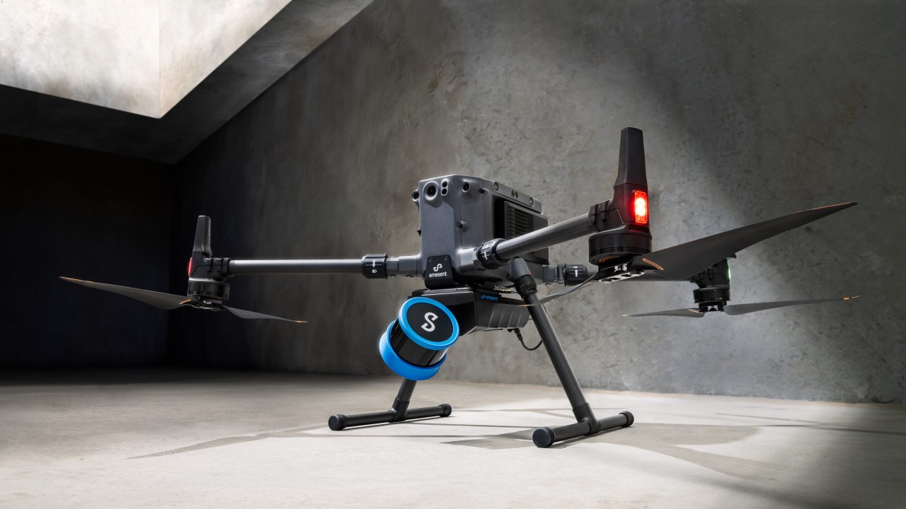
The LiDAR mapping space is no stranger to innovation, but every now and then, a technology sets a new benchmark that redefines expectations. Emesent’s latest Hovermap Accuracy Report delivers exactly that. Based on independent testing at GeoWeek 2024 and head-to-head comparisons with both SLAM and TLS systems, the Hovermap ST-X emerges not just as a tool; but a class-leading solution.
Here’s why Hovermap is being recognised as the gold standard for accuracy, precision, and repeatability in SLAM-based LiDAR mapping.
A Decade of Innovation, A Heritage of Excellence
Hovermap’s SLAM engine—Wildcat—originated from Australia’s national science agency, CSIRO, the same institution behind Wi-Fi. Emesent’s founders were part of the original team that developed Zeb1 (the world’s first commercial SLAM LiDAR) and Wildcat represents the next-generation evolution of that legacy. In fact, during the DARPA Sub-T Challenge, Wildcat achieved a “zero percent deviation” result—beating out global robotics teams and proving its real-world robustness.
Tested Head-to-Head at GeoWeek 2024
Organised by the US Institute of Building Documentation (USIBD), the GeoWeek scanner evaluation provided a level playing field for leading LiDAR technologies. Vendors were tasked with scanning a complex, GPS-denied environment inside the Denver Convention Centre and producing deliverables suitable for a typical LOD 200 project.
Hovermap was tested under three real-world conditions:
- A fast jog scan (open-loop, no loop closure)
- A standard walking scan with loop closure
- A long scan with extended loop closure paths
Each scan was processed both with and without Emesent’s automated GCP workflow—a powerful feature in the Aura software suite that improves global accuracy and automates geo-referencing.
Real-World Results That Speak Volumes
Let’s get to the numbers. With GCPs applied, all three Hovermap scan types achieved:
- Global accuracy under 11mm
- Pairwise measurement errors under 5mm
- Repeatable accuracy, even at jogging speeds with no loop closure
The fast scan, remarkably, performed the best with an average global error of just 6.1mm and a pairwise error of 4.2mm. This is particularly impressive when you consider that this scan was done at speed, in an open loop, over a 300m course.
By contrast, other top scanners—both SLAM and TLS—produced global errors ranging from 21mm to 59mm.
What Sets Hovermap Apart?
Hovermap isn’t just a scanner—it’s an ecosystem engineered for precision. Here’s what makes the difference:
✅ Rotating LiDAR Puck: Ensures uniform, spherical coverage—essential for consistent feature detection across all orientations.
✅ Long-Range Sensors: 300m range (ST-X) means better loop closure and reduced SLAM drift in large or feature-poor environments.
✅ Advanced SLAM Matching: Wildcat’s continuous-time odometry and global optimisation phases handle large-scale loop closures with ease.
✅ Automated GCP Workflow: Automatically detects reflective targets without needing to stop scanning—saving time and reducing user error.
✅ ISO9001 Manufacturing & Rigorous Calibration: Every Hovermap unit is hand-assembled and tested in Australia for consistent output quality.
Outperforming TLS—Without the Trade-offs
Traditionally, Terrestrial Laser Scanners (TLS) have been the go-to for high-accuracy capture. But Hovermap is changing that equation.
In this test:
- Hovermap outperformed Z&F 5015 and Faro Focus TLS systems on both global accuracy and distance precision.
- Even with complex cross-sections, Hovermap maintained tight vertical and horizontal alignment with the ground-truth Riegl scan.
This isn’t just about speed—although Hovermap did complete its fastest scan in 5 minutes, versus 126 minutes for TLS. It’s about repeatable, survey-grade results that are practical to capture and process.
Final Thoughts: A Leap Forward in SLAM Mapping
SLAM-based LiDAR systems are no longer a compromise on accuracy. With Hovermap ST-X and Aura, Emesent has demonstrated that it’s possible to achieve sub-centimetre precision, even under aggressive or non-traditional scanning conditions.
Whether you’re scanning underground tunnels, industrial facilities, or sprawling construction sites, Hovermap’s accuracy, adaptability, and ease-of-use are hard to match.
Coptrz is proud to be the only UK supplier of this incredible technology, and, we offer obligation free proof of concepts
Enquire on 0330 111 7177 or [email protected]
Download Our FREE RPC-L1 Guide
Understand everything you need to know about moving towards commercial drone operations with our RPC-L1 guide.
- Understand what RPC-L1 is and who it is for
- Learn how the CAA transition impacts operators and training routes
- Get a clear breakdown of requirements, costs and next steps


Related Posts
Innovair: Using the DJI Matrice 210 for land surveying and inspection
COPTRZ recently had the opportunity to speak to Andrew Johnston, Director of Inspection at Innovair. Andrew has over 10 years of experience in the oil and gas industry and is a qualified UAV pilot. He specialises in advanced and remote inspection technology and programme & software development. Drones are becoming an increasingly popular tool used […]

The DJI Enterprise Drone Buyer’s Guide
Whether you’re a CEO or a manager, this guide is the perfect starting point to explore the benefits of DJI’s Enterprise range of drones. By leveraging drone technology, you can enhance precision, increase efficiency, and make informed decisions that drive your business forward. Dive into our expert insights, practical applications, and in-depth analysis to discover […]

Drone LiDAR vs Terrestrial LiDAR: Why UK Teams Need Both
Drone LiDAR and terrestrial LiDAR are frequently positioned as competing technologies. They are not. They cover different ground — literally and operationally — and the survey and inspection teams best placed to win work in the current UK market are those that have built capability in both rather than committed to one. This post explains […]















