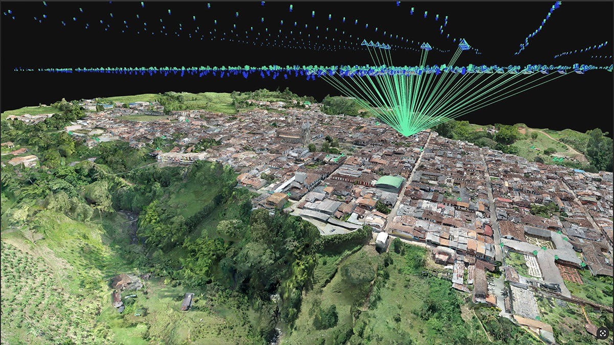
Digitising cadastral surveys is pivotal for modernising land management and urban planning. Traditional methods often involve extensive fieldwork, which can be time-consuming, costly, and challenging, especially in areas with complex terrains or limited accessibility. However, advancements in drone technology and photogrammetry software have revolutionized this process, enabling efficient and precise data collection.
A compelling example of this innovation is the project undertaken in Jardín, Antioquia, Colombia. JAB Visual, led by José Alfredo Betancourt, aimed to generate a detailed 3D model of the municipality to aid in territorial and tourism planning. The town’s traditional architecture and irregular topography posed significant challenges for cadastral updates, as many buildings had unregistered modifications, and the steep slopes made certain areas difficult to access.
To address these challenges, JAB Visual employed drone technology to capture aerial images of the area. Utilising drones like the eBee X and Phantom 4 RTK, they collected 2,254 images covering 210 hectares in just half a day. This approach significantly reduced the time and resources required compared to traditional field surveys.
The collected data was processed using PIX4Dmatic, a photogrammetry software designed for large-scale mapping. This software enabled the team to process the data in six hours, generating accurate 3D models with a ground sampling distance (GSD) of 5 cm. The resulting models provided a detailed and reliable representation of the municipality, facilitating better decision-making for infrastructure planning and management.
The integration of drone technology with advanced photogrammetry software like PIX4Dmatic exemplifies the transformative potential of digital tools in cadastral surveying. By reducing the need for extensive fieldwork and providing high-precision data, these technologies enhance the efficiency and accuracy of land management processes.
For professionals and organisations looking to adopt similar solutions, Coptrz offers PIX4Dmatic among its range of products. As a trusted provider of drone solutions and software, Coptrz can support your transition to more efficient and accurate cadastral surveying methods.
Embracing these technological advancements not only streamlines operations but also contributes to more informed and effective urban planning and land management strategies.
Download Our FREE RPC-L1 Guide
Understand everything you need to know about moving towards commercial drone operations with our RPC-L1 guide.
- Understand what RPC-L1 is and who it is for
- Learn how the CAA transition impacts operators and training routes
- Get a clear breakdown of requirements, costs and next steps


Related Posts

Beyond Traditional Inspections: Emesent’s Hovermap in the Oil & Gas Sector
The oil and gas industry, with its vast infrastructure and critical operations, demands precision, efficiency, and safety in every aspect. At the heart of this intricate network lies the challenge of asset management. From pipelines and filtration systems to compressors and export infrastructure, the sheer volume and complexity of equipment can be overwhelming. Recognising this […]

DJI Mavic 2 Quadcopter Range: An Overview
The long-awaited quadcopter launch is over and it’s no surprise that DJI’ launch event ‘See the Bigger Picture’ represents the release of the DJI Mavic 2 Range. It’s been named DJI’s worst kept secret due to a number of high-profile leaks by the likes of Argos and TechCrunch. However, it’s one that’s been long-awaited following […]

The cheapest drone training is expensive if it leaves your operation exposed
The cheapest training is not cheap if it leaves your pilots uncertain and your operation exposed. Choosing an RPC-L1 training provider is a commercial decision, not just an admin task. The provider you choose affects: If your organisation depends on drone work, choose the provider carefully. Start with CAA approval The CAA maintains a directory […]















