Drone Solutions For Agriculture & Forestry
Monitor crops, spray with precision, and manage land more efficiently — with drone technology built for the demands of UK agriculture and forestry.
- Map up to 200 hectares, or 494 acres, in a single flight with the Mavic 3 Multispectral
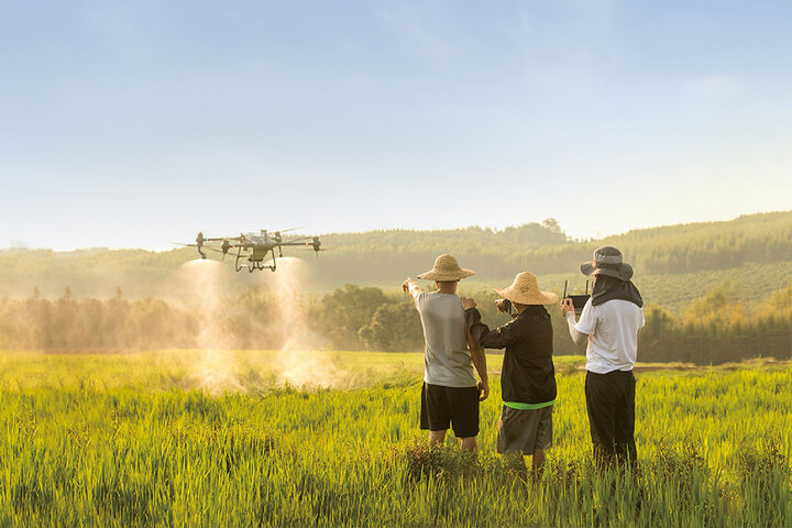
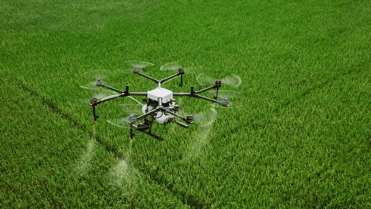
- Spray up to 21 hectares, or 50 acres, per hour with the Agras T50, using multispectral maps to target applications
- Detect disease, stress, and irrigation failure before it’s visible from the ground

Get Your FREE Guide
How UK farmers and land managers are using drones to reduce costs, improve yields, and manage land more sustainably.
★ 4.9 average rating from verified customers
• Comprehensive Drone Training for Operational Success
• Tailored Drone Solutions for Every Industry
• Experienced Technical Support Team





Increased Crop Yield. Fewer Inputs. Better Decisions.
Faster Field Coverage
Survey hundreds of acres in a single flight, replacing days of ground-level assessment with hours of aerial data.
Precision Input Reduction
Apply only where needed. Targeted spraying and variable rate application cut agrochemical use significantly.

Early Problem Detection
Multispectral imaging detects crop stress, disease, and irrigation failure before symptoms are visible, allowing earlier intervention.

Better Data For Decisions
Generate NDVI maps, yield prediction data, and inspection reports supporting farm management and subsidy compliance.

Agriculture & Forestry Workflows In Practice
Every Agriculture And Forestry Programme Is Different — But The Underlying Workflows Are Consistent.
Below is a breakdown of how agriculture and forestry drone is applied across common use cases, including what is captured, why it matters, and what teams get out of it.

What It Is
Using multispectral sensors to capture NDVI and other vegetation indices across crop areas, identifying stress, disease, and uneven growth before visible symptoms appear.
How It’s Used
Flown at key growth stages to generate maps guiding variable rate applications, identify problem areas, and track crop health over the season.
Typical Outputs
•
NDVI and vegetation index maps
•
Stress zone identification
•
Prescription maps for variable rate application
•
Season-on-season comparison data

What It Is
Deploying specialist agricultural spraying drones to apply pesticides, fungicides, herbicides, and fertilisers with precision.
How It’s Used
Used where traditional machinery cannot access — steep slopes, waterlogged fields, orchards, and vineyards — or where targeted application reduces input waste.
Typical Outputs
•
Treatment area and dosage logs
•
Application compliance documentation
•
Input reduction reporting
•
GPS-mapped treatment records
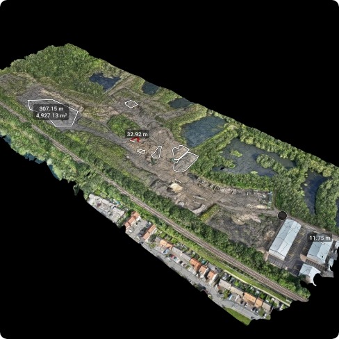
What It Is
Capturing high-resolution orthomosaics and elevation data across agricultural land for planning, subsidy compliance, and habitat management.
How It’s Used
Used by farmers, land agents, and ecologists to map field boundaries, assess drainage, and satisfy countryside stewardship requirements.
Typical Outputs
•
Orthomosaic field maps
•
Digital elevation models
•
Boundary and feature mapping
•
Habitat classification outputs

What It Is
Using drones to survey woodland areas for tree health, storm damage, and species composition — faster and safer than ground-level surveys in dense canopy.
How It’s Used
Deployed by forestry managers and ecologists to assess large woodland areas, identify disease or blowdown, and plan replanting programmes.
Typical Outputs
•
Canopy health assessments
•
Storm damage extent mapping
•
Species and density surveys
•
LiDAR under-canopy ground models
Featured Equipment For Agriculture & Forestry
Selecting the right platform for agriculture depends on the task. Spraying, mapping, and health monitoring each require different hardware.

DJI Agras T50
The UK’s leading precision agricultural spraying drone.

50L tank for extended operations
Active phased array radar for obstacle avoidance
Supports spraying, spreading, and surveying
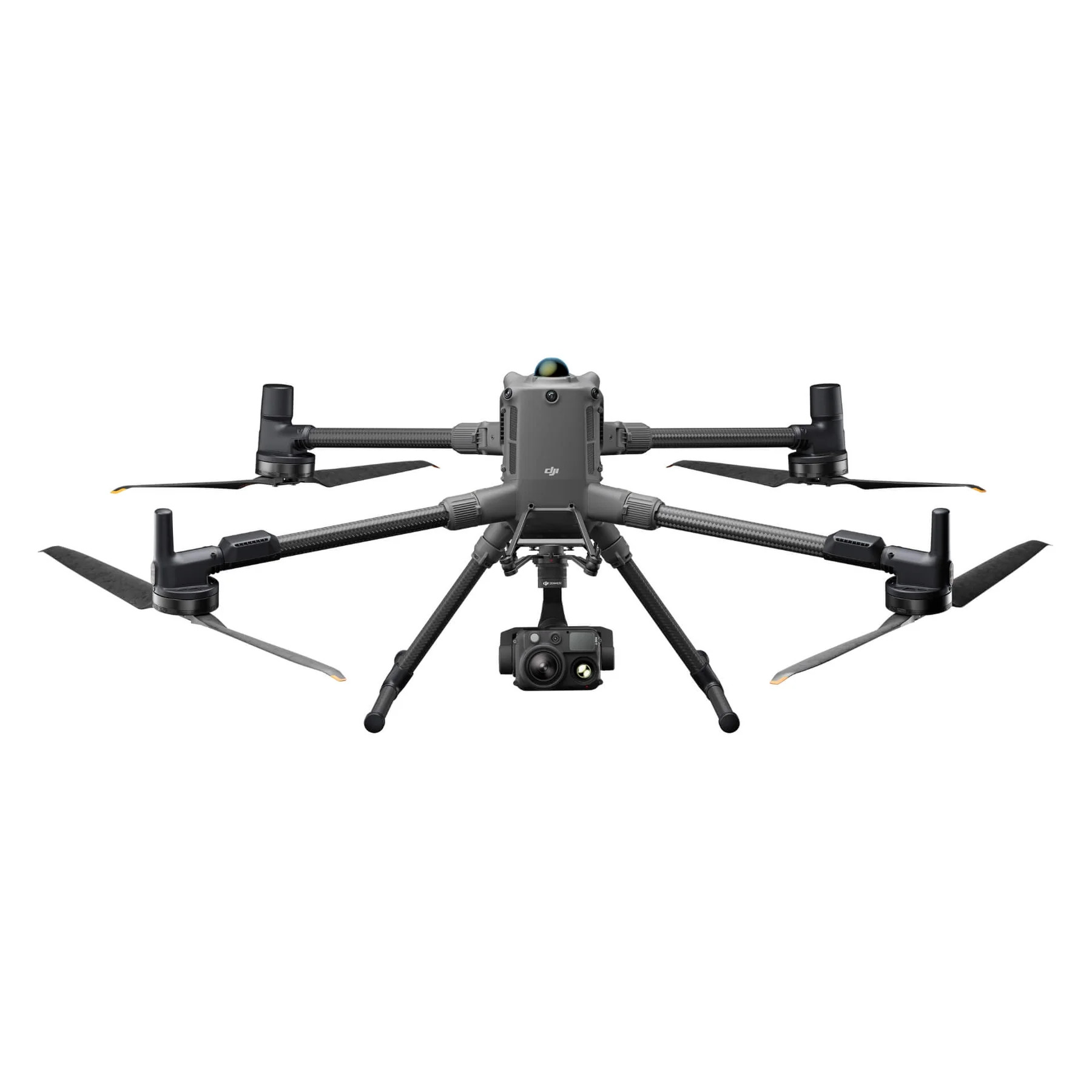
DJI Matrice 400
High-accuracy enterprise mapping platform for large-scale land surveys.
RTK precision for survey-grade outputs
Compatible with Zenmuse L3 for LiDAR workflows
Long flight times for large area coverage
Supports EagleNXT Multispec sensor payload
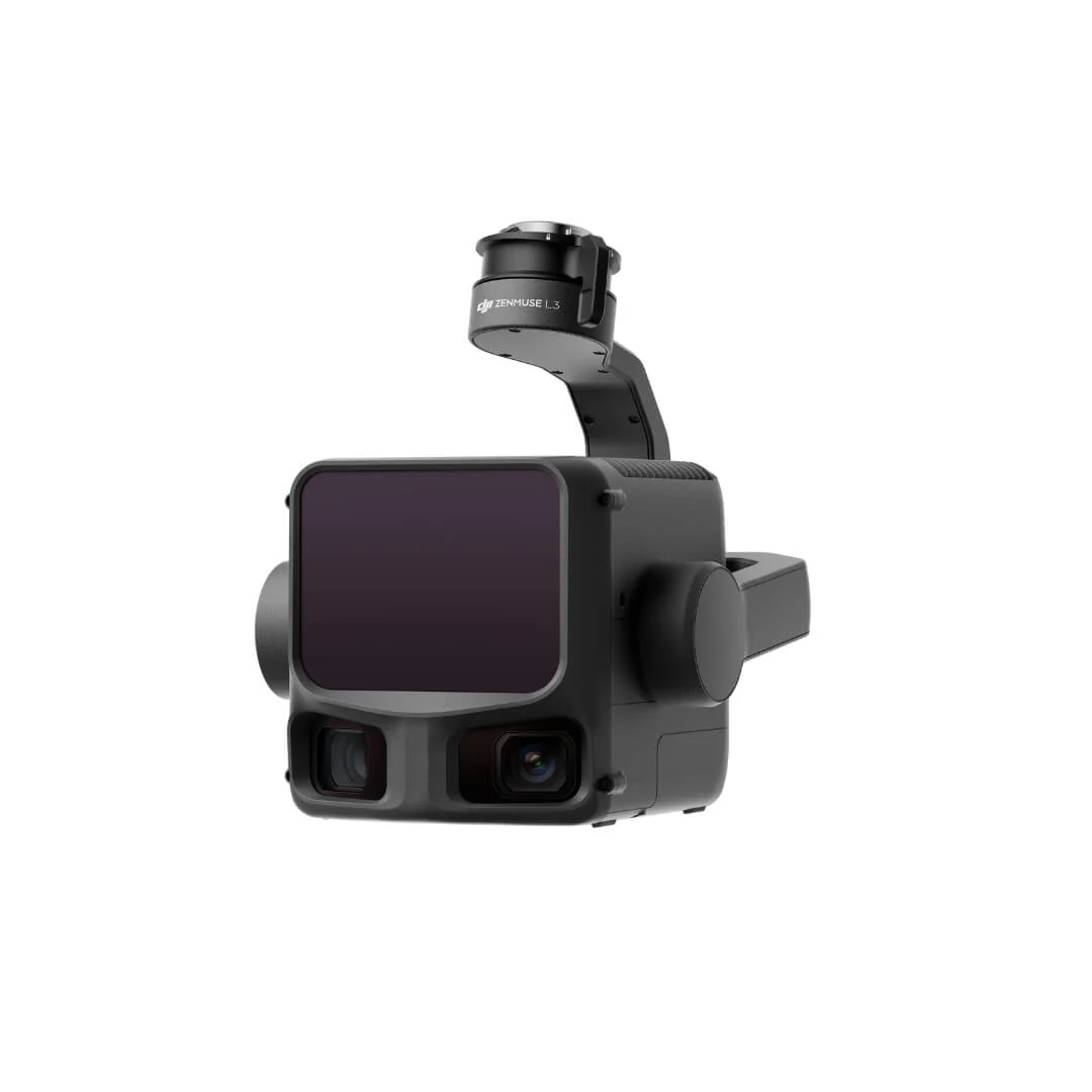
DJI Zenmuse L3
Long-range LiDAR payload built for large-scale, high-precision aerial surveying.
Hybrid LiDAR system with extended detection range for large area coverage
High-accuracy point cloud data for survey-grade mapping outputs
Seamless integration with DJI Terra for streamlined post-processing
Other Agriculture & Forestry Drone Setups
The EagleNXT Multispec sensor is compatible with the DJI Matrice 400 and provides advanced multispectral capture capabilities for research-grade crop health monitoring, precision agriculture workflows, and environmental monitoring. Speak to the Coptrz team for configuration advice.
- View Product: AgEagle MicaSense RedEdge-P Dual

AgEagle MicaSense RedEdge-P Dual
- View Product: AgEagle MicaSense RedEdge-P
AgEagle MicaSense RedEdge-P
- View Product: AgEagle MicaSense Altum-PT
AgEagle MicaSense Altum-PT
- View Product: DJI Mavic 3 Multispectral
DJI Mavic 3 Multispectral


From Field To Actionable Output: The Four-Step Workflow
Every agriculture and forestry deployment follows the same structured workflow — from mission planning through to final client outputs. Here is what that looks like in practice.
1. Plan
Map field boundaries, define flight parameters, check airspace status, confirm weather suitability.

Field boundary upload
Flight plan auto-generation
Weather check (wind <8m/s)
Airspace confirmation
2. Capture
Fly automated mission collecting multispectral, RGB, or LiDAR data at defined parameters.
Multispectral bands captured
RGB orthomosaic data
RTK positioning active
Consistent altitude maintained
3. Process
Imagery processed to generate health maps and prescription files.
NDVI and stress maps
Elevation and drainage models
Variable-rate prescription outputs
QA and validation review
4. Deliver
Prescriptions applied via Agras sprayer or shared with agronomist.
Variable-rate spray mission upload
Agronomist report delivery
BIM/CAD files
Archive for cross-compliance
Year-on-year comparison dataset
Multispectral Or RGB?
Here Is How To Decide
RGB captures what the eye can see. Multispectral captures what it can’t — and that’s where most agronomic insight comes from.

Multispectral
Multispectral imaging reveals crop stress, disease, and irrigation problems weeks before they’re visible to the naked eye — giving you the data to act early and apply inputs only where they’re needed.
Use when
Detects stress 2+ weeks before visible symptoms appear
Generates NDVI, vegetation indices, and prescription maps
Supports variable rate application and input reduction
Best for agronomic decisions and input optimisation

RGB / Visual
Standard RGB capture delivers high-resolution imagery for mapping, planning, and compliance — a lower-cost entry point for land management tasks that don’t need spectral analysis.
Use when
High-resolution orthomosaics for planning and compliance
Produces orthomosaics, elevation models, and boundary maps
Ideal for field boundary, drainage, and damage assessment work
Best for land management and compliance photography
The commercial implication: choosing RGB when multispectral is required means missing crop stress until it’s already visible — by which point yield loss has often already occurred and the intervention window has closed. It also means blanket-rate input application instead of targeted treatment, driving up agrochemical costs unnecessarily. The right sensor choice at the start protects yield, reduces input spend, and keeps decisions data-led rather than reactive.
Deliverables Your Teams Can Use Immediately
Drone surveying produces a range of formats. Below is a plain-English breakdown of what each deliverable is, and which teams use it — so procurement, technical leads, and project managers all understand what they are commissioning.
Ensure Your Team Is Operationally Ready
Agricultural drone operations have specific regulatory requirements — particularly for crop spraying, which requires additional permissions beyond standard qualifications.
Recommended training for agriculture & forestry teams
RPC-L1 Part A In-Person Training Course
RPC-L1 Part A Online Drone Training Course
GVC to RPC-L1 Conversion Course
Introduction To UK SORA
Keep Your Operations Running Without Downtime
Downtime on active projects leads directly to delays and additional cost. Reliable servicing and support ensure your equipment stays operational when you need it most.
DJI Certified repairs and servicing
Priority repair pathways to minimise disruption
Ongoing maintenance and lifecycle support
UK-based technical support from experienced teams
Decision Resources For Agriculture & Forestry Teams
These resources help you validate decisions, reduce internal friction, and build a strong business case for drone deployment.
Guides to Support Your Decision

Multispectral Imagery Explained: From Basics to Application
Proven Results In Real-World Projects

Agriculture & Forestry
Blackthorn Arable
Blackthorn Arable Ltd
Blackthorn Arable Ltd collaborates with Coptrz to enhance farming methods through drone technology.
Trusted Where Failure Is Not An Option

Nick Canham
Duncan Turner
Adam Carter
Emily B.

Partners & Clients
Why Coptrz For Agriculture & Forestry?
Confidence In Every Step Of Your Programme
Coptrz has spent over a decade supporting commercial drone operations across the UK, helping businesses streamline workflows, improve accuracy, and reduce risk. That experience informs how we recommend, deploy, and support drone systems for the agriculture and forestry sectors.
Our Key Benefits
Trusted by over 12,000 operators
4.9★ average rating at scale
UK-based technical and operational experts
Established UK fulfilment and support infrastructure
Coptrz Academy ensuring operator competence and continuity
End-to-end Drone Solutions
Proven results across critical national infrastructure projects
Over a decade of commercial drone operations experience
Frequently Asked Questions
Yes, with the correct permissions. Drone spraying requires an RPC-L1, a SORA-based Operational Authorisation from the CAA, and compliance with HSE requirements for pesticide application. Coptrz can advise on the full pathway.
The DJI Agras T50 can spray up to 40 acres per hour under optimal conditions.
NDVI (Normalised Difference Vegetation Index) is a measure of plant health derived from multispectral imagery. Mapping NDVI across a field identifies stress zones requiring targeted input or agronomic intervention.
The DJI Mavic 3 Multispectral is a four-band unit. Research-grade platforms like the M400 with EagleNXT sensors can provide additional bands for more detailed spectral analysis. Contact Coptrz to discuss the right configuration for your programme.
Yes. Commercial agricultural drone operations require an RPC-L1 and, for spraying, a SORA and Operational Authorisation. Coptrz Academy delivers the full pathway.
Book Your FREE Online Consultation
Experience the unique advantage of our 360° drone solutions exclusively at Coptrz. With a network of over 20 partnerships with top-tier drone technology manufacturers, we’re uniquely positioned to provide a tailored solution that you won’t find elsewhere.
Accreditations
Recognised for excellence. Explore the industry certifications that validate our commitment to quality, compliance, and continuous improvement.

ISO 9001 Certified
Certified quality management systems for consistent service and customer satisfaction.

ISO 14001 Certified
Internationally recognised standard for environmental management and commitment to sustainable operations.

Cyber Essentials & Cyber Essential Plus
Government-backed certification demonstrating the highest level of commitment to robust cyber security.

The Equality Register Member
Committed to promoting equality, diversity, and inclusive practices across our entire organisation.

TQUK Recognised Centre
An officially recognised centre for Training Qualifications UK, delivering high-standard regulated qualifications

Registered with Elcas
Approved by the Enhanced Learning Credits Administration Service to provide funded training for Armed Forces personnel.

UK CAA Recognised Assessment Entity: RAE15510
CAA-approved to deliver drone training and assessment for RPC-L1, GVC and A2 CofC qualifications.

FCA Registered
Authorised and regulated by the FCA for consumer finance activities.
UK SORA & BVLOS Operations: SORA-28947, SORA-29134
Helping organisations obtain Operational Authorisations for BVLOS and other complex drone operations using the UK SORA framework.

Ofqual Regulated Training
Delivering prestigious, government-regulated training programmes that guarantee educational excellence and industry recognition.
Latest From Coptrz

Mobile Mapping for Rail and Highways: Capturing More During Access Windows


DJI Matrice 400


