ENTERPRISE FLAGSHIP DRONE PLATFORM

A long-endurance enterprise drone platform engineered for complex inspections, emergency response, surveying and demanding automated operations.
59
MINS
Max Flight Time
UP TO
7
PAYLOADS
Simultaneously Supported
IP55
Ingress Protection
25
M/S
Flight Speed
-20C
to
50C
Operating Temperature
59
MINS
Max Flight Time
UP TO
7
PAYLOADS
Simultaneously Supported
IP55
Ingress Protection
25
M/S
Flight Speed
-20C
to
50C
Operating Temperature
One Platform. More Operational Possibilities
The DJI Matrice 400 is an enterprise drone platform designed for organisations that need greater endurance, payload flexibility and operational confidence.
From detailed infrastructure inspection and large-scale mapping to emergency response and complex public-safety missions, it provides the flight performance, sensing technology and intelligent tools required to complete demanding work more efficiently.
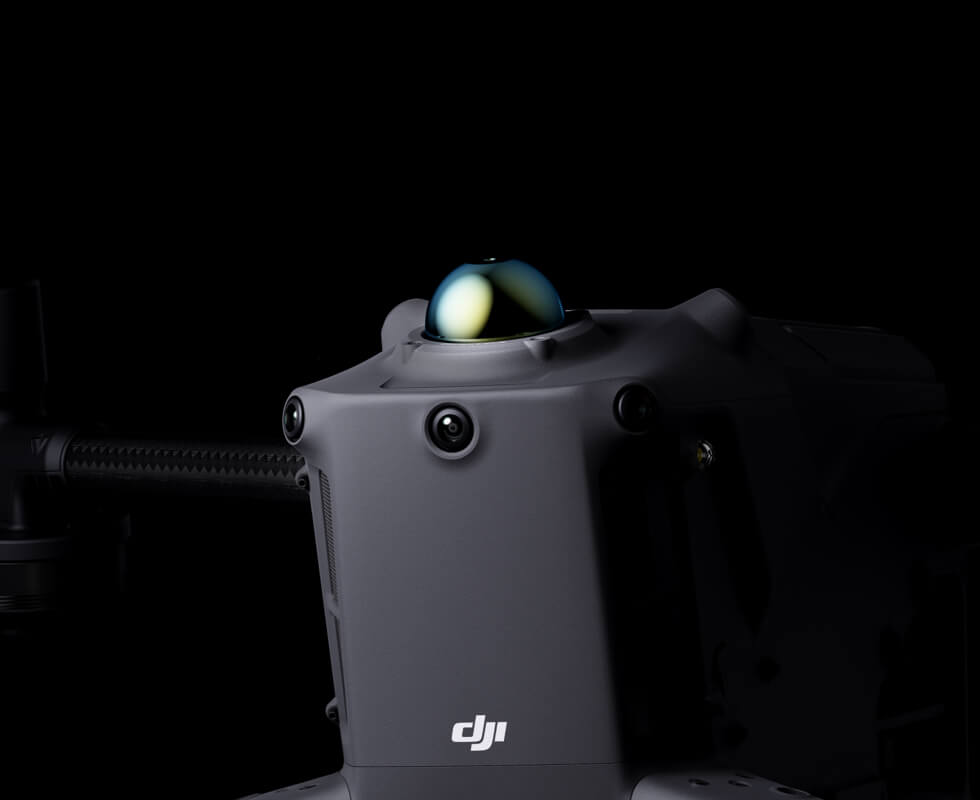
It combines rotating LiDAR, mmWave radar, advanced visual sensing and intelligent flight features with support for a wide range of professional payloads.
Advanced Capabilities for Real-World Operations
Greater Confidence in Every Flight
Smarter, More Efficient Operations
Longer Flights. Faster Operations.
Designed for Automated Operations

Expand Your Operational Capabilities

Built to
Carry More
Endurance for Demanding Operations

Extended
Flight Time

6KG Payload
Capacity

Safe & Reliable
Flight

Enhanced
Intelligence

Easier Automated
Operations
Flexible Payload Configuration
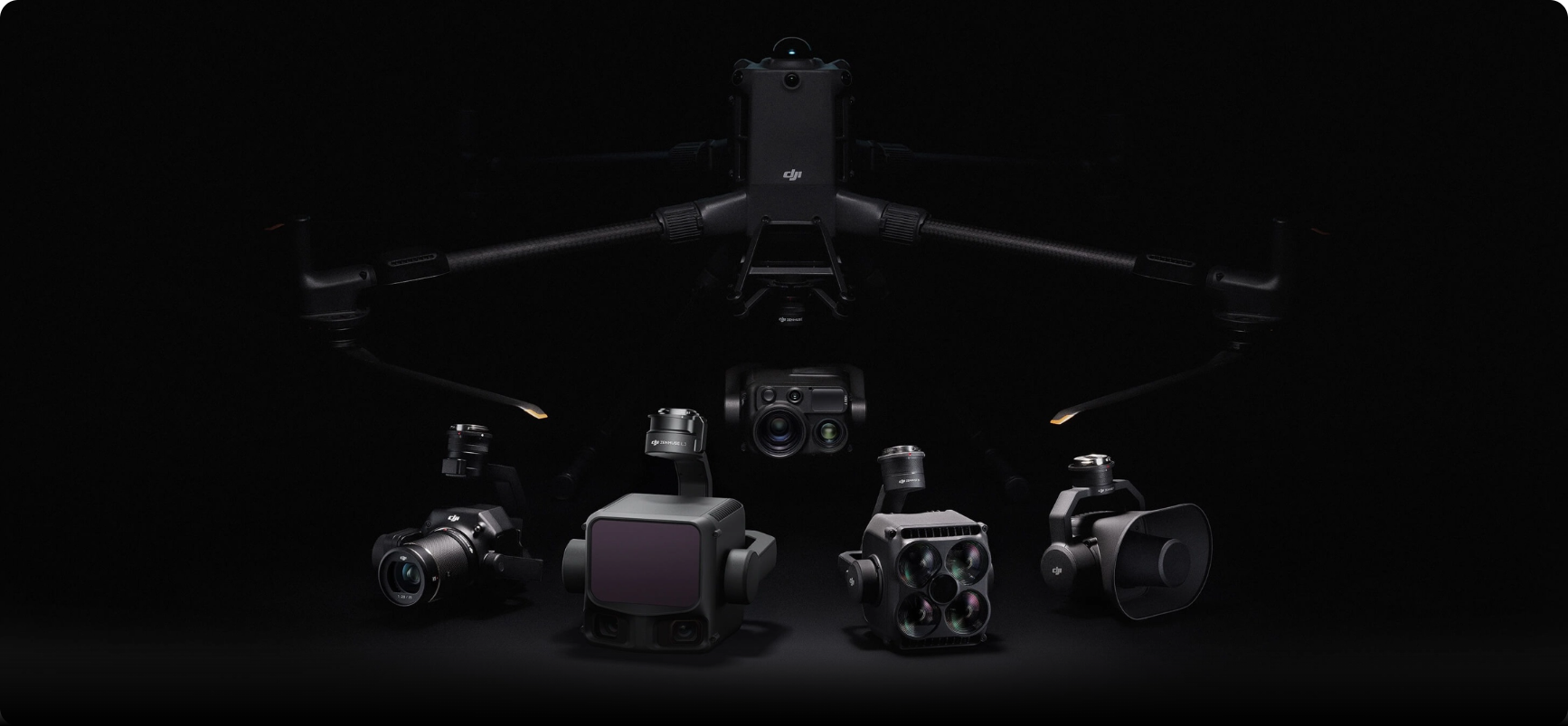
With a maximum payload capacity of 6kg, the Matrice 400 can be configured for a wide range of operations. It supports single or dual downward gimbals, alongside a third underside gimbal connector for added flexibility.
Four external E-Port V2 ports also allow up to seven payloads to be mounted at once, helping teams adapt the aircraft around each mission.

Zenmuse H30 Series
The Zenmuse H30 Series combines five advanced sensors in one payload: a wide-angle camera, zoom camera, infrared thermal camera, laser rangefinder and NIR auxiliary light. Powered by intelligent imaging algorithms, it delivers clearer, more accurate visuals across both daytime and low-light operations.
Zenmuse L3 Series
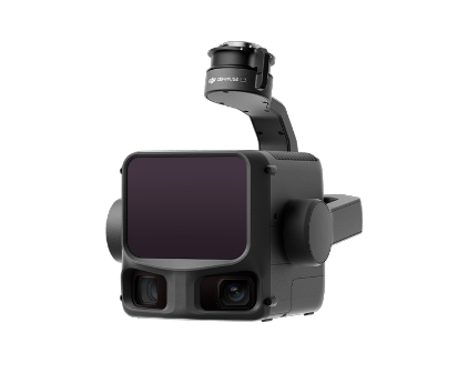
The Zenmuse L3 combines long-range 1535nm LiDAR, dual 100MP RGB mapping cameras and a high-precision positioning system in one advanced payload. Mounted to the Matrice 400 using the dedicated single gimbal connector, it enables faster and more efficient geospatial data capture.

Zenmuse P1 Series
The Zenmuse P1 combines a full-frame sensor with interchangeable fixed-focus lenses on a 3-axis stabilised gimbal. Built for high-accuracy photogrammetry missions, it enables faster data capture without compromising precision.
Zenmuse S1
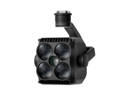
The Zenmuse S1 is DJI’s first spotlight built for multi-payload drone platforms. Using LEP technology, it delivers powerful long-range illumination with multiple lighting modes, making it well suited to public safety, emergency response, inspections and other nighttime operations.

Zenmuse V1
The Zenmuse V1 is DJI’s first loudspeaker designed for multi-payload drone platforms. It delivers powerful, long-range audio and supports multiple broadcast modes, making it ideal for public safety, emergency response and other mission-critical operations.
Intelligent Detection
And Tracking
Smarter Ways to
Navigate Every Mission
Takeoff and Landing on Ships
Designed for offshore operations such as maritime patrol and wind turbine inspection, the Matrice 400 supports takeoff from stationary vessels and landing on moving vessels. By recognising landing point patterns on the deck, it can land with greater accuracy and control in demanding marine environments.
Real-Time Terrain Follow
The Matrice 400 supports Real-Time Terrain Follow in any horizontal direction, helping the aircraft maintain a consistent height from the ground during both manual flights and automated routes.
For large-scale search and rescue missions, this helps keep ground subjects at a consistent size on the controller screen, reducing the need for repeated zoom adjustments. In mapping workflows, it also helps maintain a consistent ground sampling distance for more accurate data capture.
Advanced Route Intelligence
The Matrice 400 supports slope and geometric route planning through DJI Pilot 2 and DJI FlightHub 2. This allows teams to create precise flight paths for building facades, slopes, inclined surfaces and individual structures, helping capture high-accuracy survey and mapping data more efficiently.
Software Built for the Full Mission Workflow
DJI Matrice 400 vs Matrice 350 RTK
Already using the DJI Matrice 350 RTK or comparing enterprise drone platforms? Here is how the DJI Matrice 400 builds on DJI’s proven Matrice series for heavier payloads, longer missions and more advanced operational workflows.
| Feature | DJI Matrice 400 | DJI Matrice 350 RTK |
|---|---|---|
| Positioning | New flagship enterprise platform | Proven enterprise workhorse |
| Weight | Up to 59 minutes | Up to 55 minutes |
| Sensor Size | Up to 6kg | Up to 2.7kg |
| Resolution | IP55 | IP55 |
| Aperture | O4 Enterprise Enhanced Video Transmission | O3 Enterprise Transmission |
| Max Video | Integrated LiDAR and mmWave radar-based sensing | Six-directional sensing and positioning |
| Dynamic Range | Heavy payloads, complex inspections, emergency response, advanced multi-sensor workflows | Mapping, inspection, public safety and general enterprise operations |
| Obstacle Sensing | More payload flexibility, improved sensing and newer workflow capability | Reliable existing platform with broad payload support |
Frequently Asked Questions
Answers to common questions about payloads, flight time, software,
compatibility and choosing the right enterprise drone platform.
Yes. The DJI Matrice 400 is designed for demanding enterprise operations, including surveying, mapping, inspection and emergency reponse. When paired with payloads such as the Zenmuse L2, Zenmuse P1 and DJI Terra, it can support accurate data capture, point cloud processing and 2D or 3D reconstruction workflows.
Yes. The DJI Matrice 400 is designed for demanding enterprise operations, including surveying, mapping, inspection and emergency reponse. When paired with payloads such as the Zenmuse L2, Zenmuse P1 and DJI Terra, it can support accurate data capture, point cloud processing and 2D or 3D reconstruction workflows.
Yes. The DJI Matrice 400 is designed for demanding enterprise operations, including surveying, mapping, inspection and emergency reponse. When paired with payloads such as the Zenmuse L2, Zenmuse P1 and DJI Terra, it can support accurate data capture, point cloud processing and 2D or 3D reconstruction workflows.
Yes. The DJI Matrice 400 is designed for demanding enterprise operations, including surveying, mapping, inspection and emergency reponse. When paired with payloads such as the Zenmuse L2, Zenmuse P1 and DJI Terra, it can support accurate data capture, point cloud processing and 2D or 3D reconstruction workflows.
Yes. The DJI Matrice 400 is designed for demanding enterprise operations, including surveying, mapping, inspection and emergency reponse. When paired with payloads such as the Zenmuse L2, Zenmuse P1 and DJI Terra, it can support accurate data capture, point cloud processing and 2D or 3D reconstruction workflows.
Trusted Where Failure Is Not An Option

Nick Canham
Duncan Turner
Adam Carter
Emily B.

Partners & Clients