Surveying & Construction
Learn how drones support surveying, mapping, progress tracking and site inspection across construction, engineering and infrastructure projects.
Surveying & Construction

The Matrice 600: Top Payloads for DJI’s Innovative Drone
The Matrice 600 by DJI is one of the most innovative drone platforms available on the market today. From high-end features such as its A3 flight controller to maintenance perks like its intelligent battery management system, there’s plenty to like about this drone. Designed both for large-scale, systematic commercial usage as well as simple in-air […]
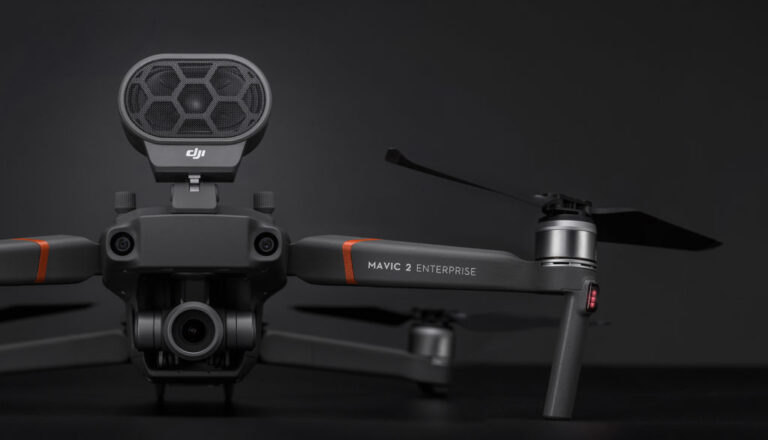
An In-Depth Look at the Mavic 2 Enterprise
When the original Mavic drone was launched back in 2016, it was marketed as a high-end consumer drone. But the platform’s ease of use, extensive payload options and affordability meant it found popularity in a number of industries including construction, surveying and search and rescue. So when DJI launched the updated Mavic 2 Zoom and […]

Ready for Business: How the Mavic 2 Enterprise expands upon the original Mavic 2 Series
DJI has certainly been busy of late, with the long-anticipated announcement of the Mavic 2 pairing followed recently by the Phantom 4 RTK and now the Mavic 2 Enterprise. The latter two are interesting because they mark a clear shift by DJI towards creating more specific solutions for the professional market. Sure, the company has […]
Smart Inventory Management: Using Drones for Stockpile Volume Measurements
Accurately measuring stockpiles of bulk and loose materials is a labour-intensive task for any production facility. Here we discuss how using drones for stockpile volume measurements can help to improve operational efficiencies in an industrial environment. Stock control is one of the most important tasks for any logistics coordinator. Knowing how much inventory you have […]

Agricultural Drones: How they are being used
Visit any modern farm these days and you’re just as likely to find drones or unmanned aerial vehicles going about their business as you are a tractor and trailer. Like many other industries, drones have transformed the way agricultural businesses operate over the past 3-5 years. Drone technology has introduced precision agriculture to farms that […]

LiDAR or Photogrammetry with Drones?
If you are involved in any type of land surveying using drone technology, there seems to be a good chance that you know about LiDAR drones and photogrammetry. But do you know what the differences, as well as what the similarities are, between these two technologies? In this blog, we cut through the confusion which often […]

Why Choose COPTRZ to Enable Your Drone Surveying Strategy?
Drones have the ability to transform a number of industries, but there is no better example of the benefits drones provide than the mapping and surveying industry. Today’s drones provide a cost-effective and time-efficient method for collecting accurate geomatics data. Whether this data is used to create topographic surveys or to carry out monitoring studies, […]
Top 5 Commercial Drone Use Cases
Drones have come a long way in the past five years or so. Once seen as a toy for the wealthy, today UAVs have the power to reinvent old businesses and create new ones. Whether it’s providing news coverage, helping the emergency services or inspecting sewage systems, drones are doing some pretty amazing things today. […]
Drone Photogrammetry: How drone photos turn into 3D surveys
Using drones to create 3D surveys of your land is an incredibly powerful tool to have. By simply flying your drone above the land, you are all of a sudden left with a highly in-depth 3D model of the terrain, allowing you to make incredibly accurate commercial decisions. Well, if you’re wondering how all of […]

5 Reasons to Join the Pix4D Workshop
Pix4D is the leading UAV photogrammetry software. It has been specifically designed for users who want to make 3D maps and point clouds from data captured from their drone. It’s one of the most popular software packages on the market, however, making full use of the platform is hard without a helping hand. That’s why […]

5 Steps to Kickstart a Drone Construction Business
Construction is one of the sectors which has benefitted greatly from drone technology in recent years. Surveyors are able to get a birds-eye view of a site, feeding into construction planning, offering the opportunity to improve both accuracy and efficiency in the process. Inspections, health and safety, maintenance and marketing are other elements of construction […]
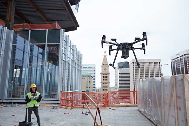
How to use drones to assess construction sites
Drones are providing valuable work across many diverse industries today, with the aircraft found everywhere from the mine to the warehouse and even the battlefield. But one place where drones have proved to have the biggest impact is on the construction site. Drones have become as common on the construction site as the dump truck […]


