Latest News
Latest News
Revolutionising Utility Mapping: The Power of Gaussian Splatting
In the realm of utility management, accurately documenting underground infrastructures has always been a complex challenge. Traditional methods often fall short, leading to data gaps and incomplete visualizations. Enter Pix4D Gaussian splatting—a groundbreaking technique that’s redefining how we capture and visualise subterranean utilities. The Limitations of Conventional Methods Historically, surveying underground utilities involved hiring land […]
Why Emesent’s Hovermap ST-X is Redefining SLAM LiDAR Mapping Accuracy in 2025
The LiDAR mapping space is no stranger to innovation, but every now and then, a technology sets a new benchmark that redefines expectations. Emesent’s latest Hovermap Accuracy Report delivers exactly that. Based on independent testing at GeoWeek 2024 and head-to-head comparisons with both SLAM and TLS systems, the Hovermap ST-X emerges not just as a […]

DJI Matrice 4 Series vs. DJI Mavic 3 Enterprise Series: A Comprehensive Comparison
With the introduction of DJI’s latest enterprise drone the Matrice 4 series, you may now be faced with a decision on which suits you best, the Matrice 4 Series or the Mavic 3 Enterprise Series. Both are designed to meet the diverse needs of professionals across various industries, but they differ significantly in capabilities, design, and applications. This […]

DJI Mini 3 Pro Drone Gets a Fresh Firmware Update 2024
DJI has just dropped a brand-new firmware update for their incredibly versatile Mini 3 Pro drone. If you’re a proud owner of this drone, it’s time to get excited! What’s New? The Mini 3 Pro aircraft firmware has been updated to version 01.00.0900. Alongside this, there are new firmware versions for the remote controllers: RC-N1 […]

How High Can A Drone Fly? Maximum Heights & Limits Uncovered
As drone users, we often wonder how we can get the most out of our purchase. Drones come in all shapes and sizes, with each drone being unique. That is why working out how high a drone can fly can be tough work. The answer to this question is variable, depending on the drone’s capabilities. […]

Learning to Fly Drones? Keep Safe with Altitude Angel
With the price of recreational drones becoming more affordable and an increase in drone operators undertaking commercial work, we often receive questions from new drone operators asking how they can make sure they fly safely. We also have an increasing number of queries from recreational users who undertake ‘small’ jobs which, unbeknown to them, place […]

Enhancing Telescope Accuracy with UAV Photogrammetry: The Power of Phase One P3
The University of Tasmania’s School of Natural Sciences set out to improve the precision of their 26-meter radio telescope at the Mount Pleasant Radio Telescope Observatory. This telescope plays a critical role in Positioning, Navigation, and Timing (PNT) research, capturing signals from distant galaxies to study Earth’s shape, rotation, plate tectonics, and timekeeping. These measurements […]

Enhancing Snow and Ice Research with Drone-Based Ground Penetrating Radar
In the realm of snow and ice research, traditional methods like digging snow pits for stability assessments are labor-intensive and pose safety risks. Recognising these challenges, GEORESEARCH, in collaboration with LO.LA Peak Solutions GmbH and funded by the FFG, embarked on the STRATIFY project to explore innovative approaches to snowpack analysis. The Challenge Assessing snowpack […]

Commercial drone experts, Coptrz, partner with Ajuno
Commercial drone experts, Coptrz, has partnered with Ajuno, the innovative consultancy that enables the adoption of novel technologies. The partnership will focus on accelerating the adoption of new drone capability and further revolutionising organisations through drones. Ajuno iteratively integrate solutions through a structured approach pioneered by NASA. Coptrz, established in 2016, create full end-to-end commercial […]

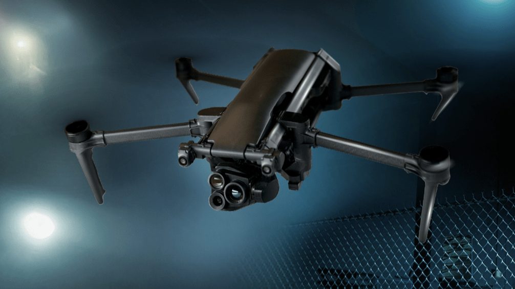
Top 5 Drones for Security in 2024
Drones or unmanned aerial vehicles (UAVs) are aircraft either controlled by pilots from the ground or autonomously following a pre-planned flight path. Unlike fixed CCTV security systems, drones provide dynamic surveillance capabilities, outpacing ground patrol land coverage by up to 86%. Security drones can carry multiple sensors, such as thermal, night vision, and zoom, to highlight […]

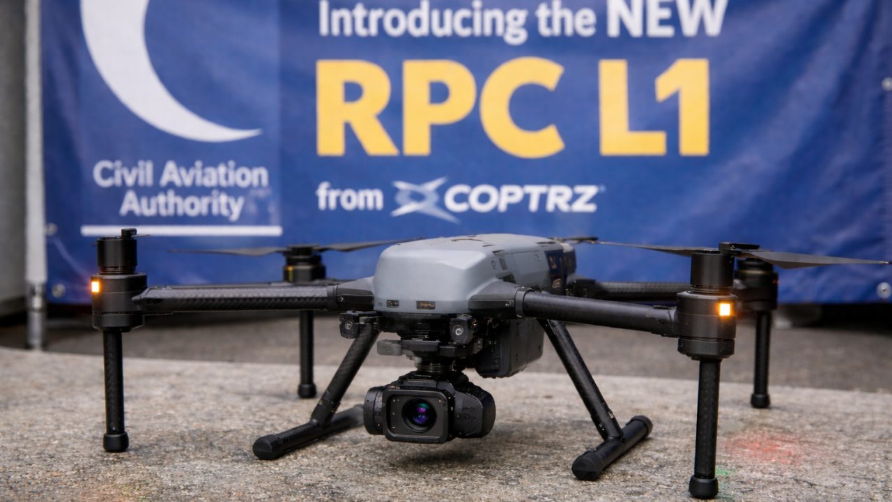
PDRA01 Application Process Cut from 6 weeks to 24 hours!
We’re excited to share news of a major update in the application process for Specific Category Operational Authorisations. The Civil Aviation Authority (CAA) has introduced a simplified, more efficient application procedure through a new online platform, designed to significantly speed up and streamline the process for applicants. This innovation begins with the launch of the […]
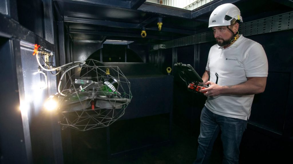
Class Certification for Maritime Drone Inspections with the Elios 3
How Interocean is leading the way with Class-Certified Drone inspections At Coptrz, we’re proud to be the exclusive UK provider of the Flyability Elios series—revolutionary drones that are redefining how industrial inspections are carried out. One of our valued customers, Interocean Marine Services, has been at the forefront of this transformation, leveraging drone technology to […]