SLAM and photogrammetry are both widely used to produce 3D spatial data, and both have a legitimate place in modern survey workflows. They are not interchangeable. They work through different underlying methods, perform differently across different environments, and produce outputs with different characteristics. Choosing between them — or knowing when to combine them — is a practical question that matters for UK survey teams building out their reality capture capability.
This post explains how each method works, where each performs best, and how to think about them as complementary tools rather than competing alternatives.
How SLAM works
SLAM — simultaneous localisation and mapping — is a positioning and mapping technique used in mobile LiDAR scanners. The scanner uses its LiDAR sensor to continuously measure the geometry of its surroundings, tracking its own position within that geometry as it moves. It builds a map and locates itself within that map at the same time, in real time.
The result is a dense, georeferenced point cloud generated by a scanner that moves through the environment rather than being set up at fixed positions. RTK and PPK positioning — using satellite correction data — tie the SLAM trajectory to a project coordinate system, improving georeferencing accuracy for the final dataset.
SLAM-based scanners capture geometry as their primary data type. Imagery is typically captured alongside the LiDAR data — the Emesent GX1, for example, carries four 20 MP cameras capturing 360-degree imagery in the same pass — but the geometric point cloud is the core output. For more on how SLAM technology works in practice, see our post on what is RTK SLAM and why it matters for UK surveyors.
How photogrammetry works
Photogrammetry derives 3D geometry from overlapping photographs. Software identifies common points across multiple images captured from different positions, calculates the geometry of those points through triangulation, and produces a dense point cloud or mesh from the image set.
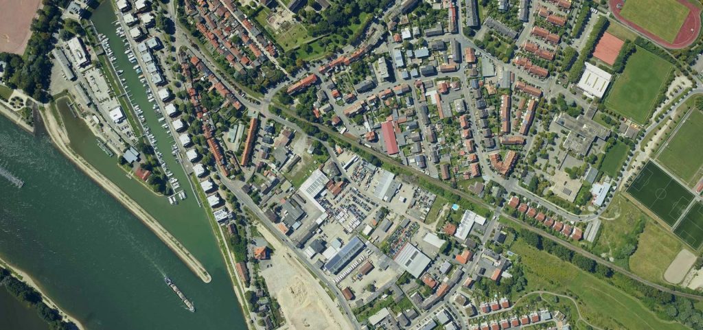
Photogrammetry can be ground-based — using a camera or smartphone to photograph a scene from multiple angles — but in surveying it is most commonly associated with drone-based aerial photogrammetry, where an aircraft captures overlapping nadir and oblique imagery across a site. The outputs — point clouds, orthophotos, digital surface models and textured meshes — are produced through photogrammetric processing software such as Agisoft Metashape, Pix4D or similar.
Photogrammetry’s primary data is imagery. The 3D geometry is derived from it. This means the visual quality of photogrammetric outputs is typically very high — textured meshes and orthophotos are visually rich — but geometric accuracy in areas with poor photographic contrast, texture or overlap can be lower than LiDAR.
Key differences between SLAM and photogrammetry
How geometry is captured. LiDAR measures distance directly using laser pulses. Photogrammetry infers geometry from image overlap. LiDAR is less dependent on surface texture and lighting conditions; photogrammetry struggles with featureless surfaces, reflective materials, dark or poorly lit environments, and areas without adequate image overlap.
GPS-denied performance. SLAM-based LiDAR can operate in environments without GNSS signal — tunnels, building interiors, confined spaces — because it tracks position through geometry. Photogrammetry depends on either GNSS-tagged images or ground control points; it cannot navigate GPS-denied environments in the same way.
Point cloud density and quality. LiDAR produces very dense, consistently accurate point clouds across a wide range of surfaces and conditions. Photogrammetric point clouds can be dense and high-quality in good conditions, but accuracy degrades in areas with poor texture, shadow or insufficient overlap.
Visual output quality. Photogrammetry produces visually rich textured meshes and orthophotos. LiDAR point clouds are geometrically precise but visually sparse unless colourised from co-captured imagery. For deliverables where visual presentation matters — client-facing reports, planning submissions, public engagement — photogrammetric outputs are often more accessible.
Processing time and complexity. Photogrammetric processing is computationally intensive and can take hours or days for large datasets. SLAM point cloud processing through platforms like Emesent’s Aura is typically faster and produces a usable dataset sooner after capture.
Where SLAM is the stronger choice
- Indoor environments, building interiors, tunnels and confined spaces where aerial access is impossible and GPS is unavailable
- Sites with surfaces that are difficult to photograph: dark areas, reflective materials, featureless walls, low-texture environments
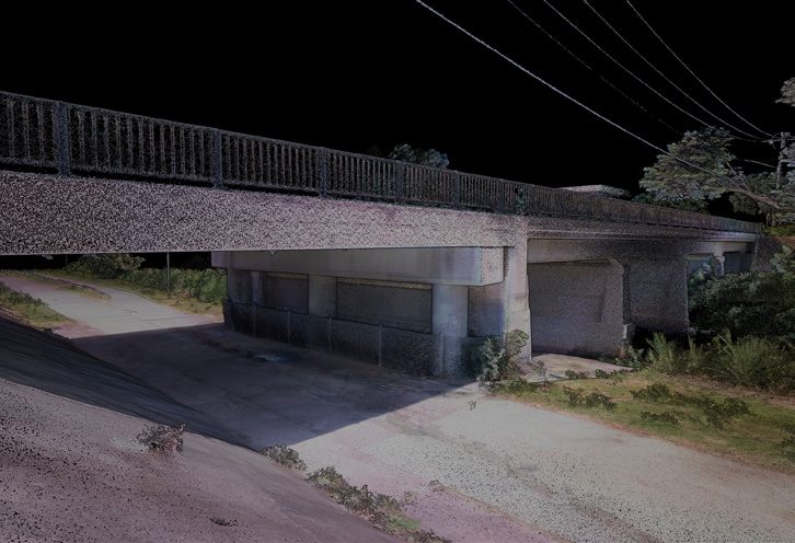
- Infrastructure inspection where geometric accuracy across complex 3D geometry is the priority
- Scan-to-BIM and measured building workflows where point cloud accuracy and processing speed both matter
- Construction progress tracking where repeatable, timestamped geometric capture is required at regular intervals
- GPS-denied environments where photogrammetry cannot reliably georeference outputs without external control
Where photogrammetry is the stronger choice
- Large open-area topographic surveys where drone-based aerial photogrammetry is faster and more cost-effective than ground-based mobile scanning
- Deliverables requiring visually rich orthophotos, textured meshes or 3D models for client presentation, planning or public engagement
- Sites with good surface texture, consistent lighting and adequate overlap — where photogrammetric accuracy is sufficient for the deliverable
- Lower-budget projects where the photogrammetric workflow can be completed with existing drone hardware and a software subscription
- Vegetation and landscape surveys where visual context and canopy structure matter alongside terrain geometry
When to use both
For many survey projects, the strongest workflow combines SLAM and photogrammetry rather than choosing one. Drone-based photogrammetry for the above-ground, open-area capture — fast, cost-effective, visually rich — and SLAM-based mobile LiDAR for interiors, underground sections, enclosed structures and GPS-denied areas that aerial can’t reach.
This is increasingly the standard approach for large infrastructure projects, mixed-use developments and asset inspection programmes that span both accessible outdoor areas and complex indoor or below-ground environments. For more on how aerial and ground-based LiDAR combine in UK survey workflows, see our RTK drones page and our LiDAR technology capability page.

What this means for UK survey teams
The practical implication is that SLAM and photogrammetry are tools in a toolkit, not substitutes for each other. Survey firms that can deploy both — and know when each is the right choice — are better placed to respond to the full range of project requirements than those committed to a single method.
For teams evaluating whether to add SLAM-based mobile mapping to their existing photogrammetric capability, the Emesent GX1 is a ground-based mobile scanner that complements rather than replaces aerial photogrammetry. It covers the environments and deliverable types where photogrammetry is weakest, and integrates with the same downstream CAD, BIM and GIS workflows. Coptrz is a UK partner for Emesent, supporting teams with demonstration, workflow advice, training and implementation. Find out more on our Emesent brand page or our surveying and construction sector page.
Frequently asked questions
In most conditions, LiDAR-based SLAM produces more consistently accurate geometric data than photogrammetry, particularly on surfaces with low texture, in poor lighting, or in areas with insufficient image overlap. Photogrammetry can achieve high accuracy in good conditions. The right comparison is always against the specific deliverable requirement rather than in absolute terms.
Ground-based photogrammetry — using a camera or smartphone — can work indoors, but it requires good lighting, sufficient surface texture and careful image overlap management. It does not navigate GPS-denied environments in the same way as SLAM, and the processing burden can be significant. For most indoor survey applications, SLAM-based mobile LiDAR is the more practical choice.
For most Scan-to-BIM workflows, SLAM-based mobile LiDAR is the stronger choice. It produces dense, accurate point clouds across a wide range of building environments, integrates well with Revit and CAD workflows, and captures 360-degree imagery alongside the geometric data. Photogrammetry can produce Scan-to-BIM inputs but is more dependent on site conditions and typically slower to process for complex building geometry.
Not for all applications. Drone LiDAR penetrates vegetation canopy better than photogrammetry, performs better in low-light or high-contrast conditions, and produces a direct geometric measurement rather than an inferred one. For topographic surveys in open areas with good surface texture, photogrammetry is often sufficient and more cost-effective. For corridor surveys, vegetation mapping, and environments where surface conditions are variable, drone LiDAR is typically the stronger choice.
Start with the environment and the deliverable. If the capture area is outdoors and accessible by air, photogrammetry is often the most efficient starting point. If it includes indoor areas, GPS-denied environments, or surfaces that are difficult to photograph, SLAM-based mobile LiDAR is required. For complex projects spanning both, a hybrid workflow is likely the right answer.
Next steps
If you’re evaluating SLAM-based mobile mapping to complement your existing survey capability, Coptrz can provide a practical demonstration and workflow assessment.
View the Emesent GX1 on Coptrz or register for a GX1 webinar to see the workflow in action.
Download Our FREE RPC-L1 Guide
Understand everything you need to know about moving towards commercial drone operations with our RPC-L1 guide.
- Understand what RPC-L1 is and who it is for
- Learn how the CAA transition impacts operators and training routes
- Get a clear breakdown of requirements, costs and next steps


Related Posts

Revolutionising Cargo Oil Tank Inspections: How Flyability’s Elios 3 is Saving Time, Money, and Lives
In the fast-moving maritime industry, efficiency and safety are paramount. Traditional Cargo Oil Tank (COT) inspections have long been time-consuming, expensive, and hazardous. However, thanks to Flyability’s Elios 3 drone with its UT (Ultrasonic Thickness) payload, inspections are now six times faster, significantly safer, and far more cost-effective. Cyberhawk™, a leader in drone inspections and […]

Is this the end of Royal Mail? Introducing the DJI FlyCart 30 – the future of delivery
When you think of drones, you probably imagine those flying gadgets capturing breath-taking aerial shots or monitoring public safety. But what if we told you drones are about to redefine the way we receive our packages? Move over, Royal Mail, DPD, and Evri, the DJI FlyCart 30 is a game-changer in the world of deliveries. […]

Coptrz Defence shows out at UK’s First Battle Lab demo
Coptrz assisted Brigantes and the British Army in hosting the inaugural UAS Solutions (Unmanned Aircraft System) event at Battle Lab. Over 15 brands presented their range of products to 100 visitors. About the Event The event aimed to create a unique opportunity for the visitors to learn about the wide range of companies within the […]















