
Latest from Coptrz
Stay updated with the latest insights, tips, and industry news on our blog. Discover expert advice, success stories, and innovative uses of drone technology. Our blog features a diverse range of topics to keep you informed and inspired.
All Posts

How Drone Data is shaping the future of Asset Management: Trendspek
We are proud to announce our latest partnership with Trendspek, Trendspek connects asset owners, operators and engineers, through a simple to use online platform. Form opinions, make decisions and reach outcomes faster by collaborating on a single source of truth. TRENDSPEK Trendspek is the drone data solution developed in collaboration with oil and gas supermajors […]

Drones in Filmmaking – The best drones for the job
Drones in Filmmaking: The best drones for the job, key obstacles and using them to capture the action If you’re an aspiring or experienced filmmaker, or you’re merely interested in how drones can capture the most amazing aerial footage, you’re not alone. From high-budget film crews to amateur vloggers, many of our Coptrz Academy students […]
LiDAR in Public Safety
5 minute read The AEC sectors have been using LiDAR as a method for capturing accurate and insightful data for many years. Yet as LiDAR has more recently become accessible and even mobile, the number of suitable applications has grown massively. In this blog we’ll explore a few of the emerging applications for LiDAR systems, […]

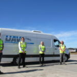
999: What’s your Emergency? Drones for Public Safety
Drones for Public Safety: Can Drones Save Lives? Ever seen the show ‘999: What’s your emergency?’? It’s a show following the lives of emergency personnel responding to 999 calls. It’s interesting to see how each service works from behind the scenes. However, what they don’t show is how the use of Unmanned Aerial Vehicles (UAVs) […]

Drones in Renewable Energy: The Future is here
Drones in renewable energy and how crazy the world seems without them Or, if you’ve never thought about Drones in Renewable Energy then this wouldn’t seem crazy at all. But… Sometimes working in a particular industry gives you a blinkered view and you need to step back and forget everything you know and look at […]

Hovermap: Accuracy Evaluation
Georeferencing Hovermap Point Clouds using ‘Best-Fit’ Sphere Registration in Cloudcompare. Dr. Jeremy J. Sofonia, CEnvP – Solution Manager, Emesent If you’re not aware, we recently added the incredible Hovermap system by Emesent to our product line up. Hovermap is packed full of smart features to help you get the best data in challenging areas. Designed […]

5 Tips for Adding Value to Your Drone Services
The commercial drone industry is rapidly increasing, and we are already seeing a major uplift in drone use across a number of industries, such as media, agriculture, surveying and construction. It’s a great time to start a commercial drone business, however, like all lucrative industries, the threat of competition will increase year-on-year. Only those businesses […]
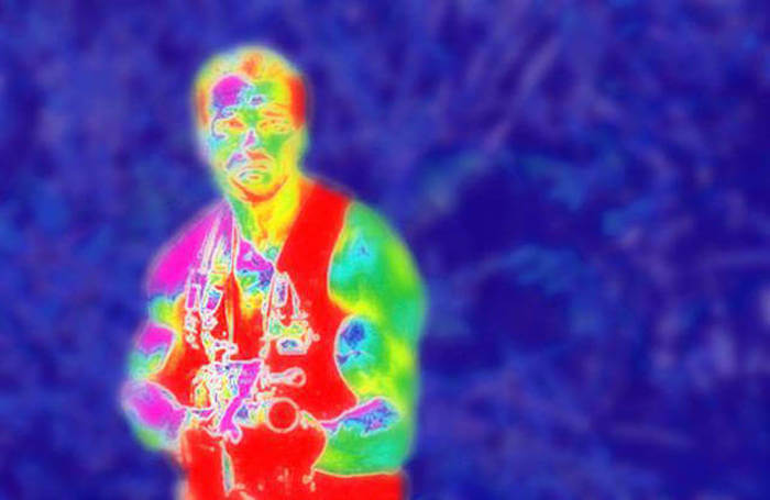
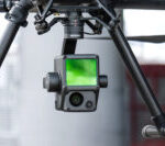
Top Thermal Camera’s for Inspection and Public Safety
Seeing the unseen through Thermal Camera’s can transform your aerial inspections If you’re like us, your first taste of thermal cameras would’ve come from the film Predator. Back then, the tech was mind blowing, and it added an extra dimension to being hunted by an Extra Terrestrial being from another planet. Hell, it nearly took […]

How Drones Are Used in Education
Drones In Education: How does it work? From interactive whiteboards to the laptops and Chromebooks children use for schoolwork, technology is always present in the classroom. However, it’s used as a tool rather than a learning opportunity. Children may be digital natives, but that’s only in terms of using technology, not creating it or working […]
How can I start surveying with drones? Understanding UK commercial drone laws
10 minute read How can I start surveying with drones in the UK? Understanding the ever-changing drone legislation in the UK is enough to give anyone a headache, especially if you’re looking to do it commercially and need to ensure your following the rules. We’ve written this blog to cut through the mysticism and give […]
Nuclear Decommissioning Authority turns to Drones for Help
How is Sellafield, Europe’s largest nuclear site, using drones? Sellafield is a large multi-function nuclear site close to Seascale on the coast of Cumbria. Activities at the site include nuclear fuel reprocessing, nuclear waste storage and nuclear decommissioning, and it is a former nuclear power generating site. The licensed site covers an area of 265 […]
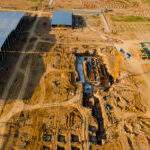
A Guide to Drone Data: Outcomes and Results in Surveying
10 minute read PWC suggest that by 2030, the UK could see as many at 76,000 commercial drones in our skies, generating a net cost savings of over £16bn across multiple industries. The exponential growth in drone technology positions them as an essential tool for many organisations looking to develop their workflows and reduce costs. […]


