In the realm of geospatial research, precision is paramount. The University of Tasmania’s recent project exemplifies how integrating advanced UAV photogrammetry can significantly enhance the accuracy of radio telescope measurements.
The Challenge
The Mount Pleasant Radio Telescope Observatory in Hobart houses a 26-meter radio telescope crucial for Positioning, Navigation, and Timing (PNT) research. Over time, gravitational forces and other environmental factors can cause minute deformations in the telescope’s structure, potentially impacting data accuracy. Traditional surveying methods lacked the precision required to detect these subtle changes.
The Innovative Approach
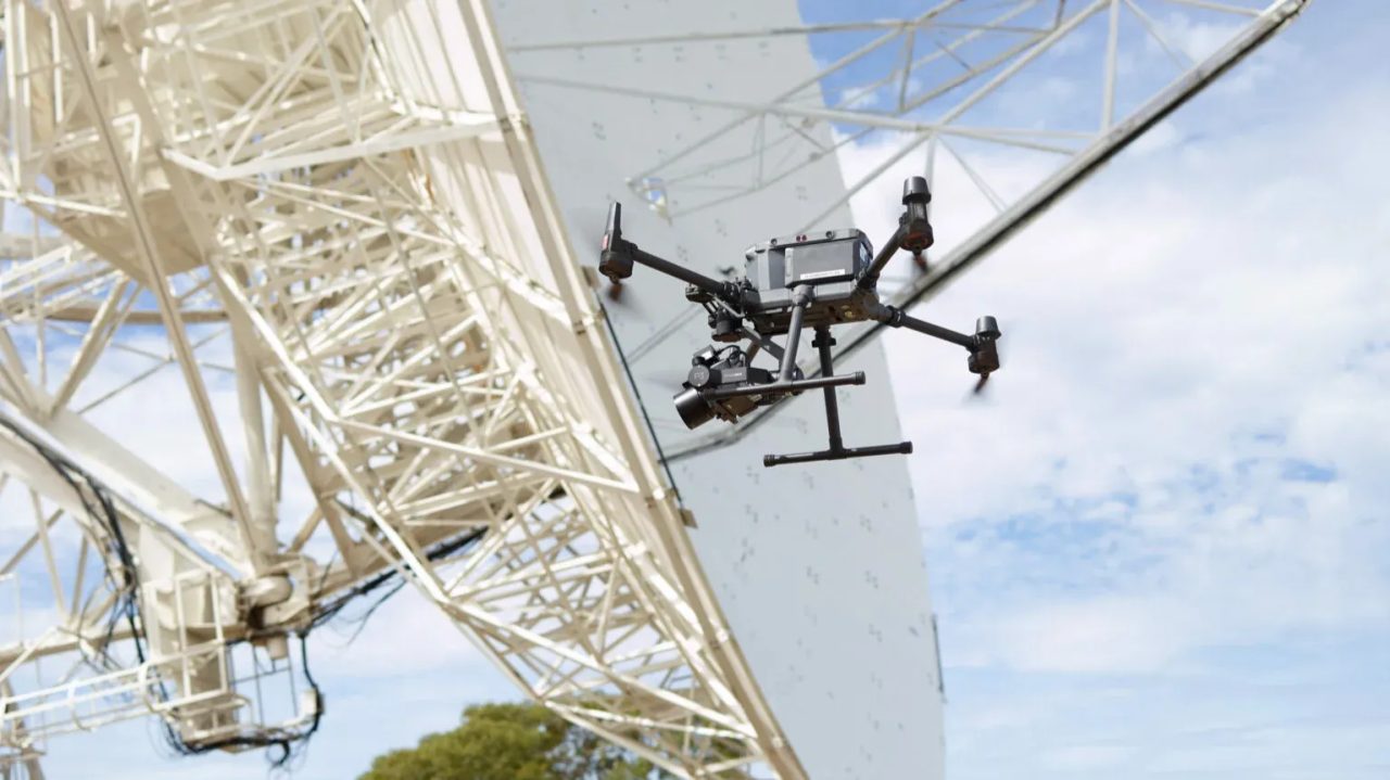
To address this, the university collaborated with photogrammetry experts from Germany to employ a UAV-based solution. A DJI M350 drone equipped with a Phase One P3 camera was deployed to capture high-resolution images of the telescope’s surface. The team affixed 1,000 target points onto the dish to serve as reference markers. Through approximately 200 flights, each capturing over 300 images, they achieved a measurement precision of better than 0.1 mm.
Outcomes and Implications
This high level of accuracy enabled the creation of a detailed deformation model of the telescope, allowing for precise calibration of its measurements. Such advancements not only enhance the reliability of geospatial data but also set a new standard for structural analysis in similar large-scale instruments.
The success of this project underscores the transformative potential of integrating UAV photogrammetry into scientific research, paving the way for more accurate and efficient data collection methods in the future.
Download Our FREE RPC-L1 Guide
Understand everything you need to know about moving towards commercial drone operations with our RPC-L1 guide.
- Understand what RPC-L1 is and who it is for
- Learn how the CAA transition impacts operators and training routes
- Get a clear breakdown of requirements, costs and next steps


Related Posts

Using Drones for Good, Part 3: Elios
In part 3 of our series, using drones for good, we are going to look at how the innovative Elios drone from Flyability is helping to keep beer production lines flowing at Pilsner, support law enforcement in France, prevent a major environmental disaster in Barcelona and explore new cave systems in Sicily. The Flyability Elios […]

Thames Water using the Flyability Elios for Inspections
COPTRZ recently had the opportunity to speak to Jon Lorimer, Risk Management Specialist at Thames Water. Thames Water is the largest water and wastewater services companies in the UK. They supply around 2,600 million litres of tap water to 9 million customers across London and the Thames Valley. Alongside this, they treat and remove more […]
EDF Energy using Drones to increase business efficiency
How EDF Energy are using drones to cut down-time and increase business efficiency EDF Energy are the UK’s largest generator of low-carbon electricity. Using wind, nuclear and solar power they supply low-carbon energy to meet the UK’s electricity demands generating over a fifth of the UK’s electricity generated by their eight nuclear power stations. Their […]