Traditional terrestrial laser scanning earned its place in surveying for good reasons. It is accurate, well-understood by clients, and supported by established workflows that survey teams have built practices around over many years. The question is not whether it works – it does – but whether it is always the right tool for every job.
The Emesent GX1 sits in a different part of the workflow. It is a ground-based mobile mapping scanner combining RTK SLAM, high-density LiDAR and 360-degree imagery, designed for teams that need fast, flexible capture without sacrificing the georeferencing confidence that survey-grade deliverables demand. This post compares both approaches across the areas that matter most for UK survey teams: speed, accuracy, workflow and project fit.
Where traditional laser scanning is strongest
Tripod-based terrestrial laser scanners remain the standard for tasks where static precision, controlled setup and defensible accuracy are the priority. They deliver high point density at close range, operate within well-understood quality assurance frameworks, and produce outputs that clients and checking surveyors are familiar with.
For monitoring, precise deformation analysis, structural surveys and control-critical tasks where every millimetre counts, static TLS is often still the right answer. The workflows are mature, the training is established, and the outputs are well understood across the supply chain.
That is not in question. What is worth examining is where those same workflows become a constraint.
Where traditional laser scanning has limitations
The limitation of static scanning is field productivity. Moving between stations, setting up, levelling, checking coverage, and then registering multiple scans in post-processing takes time. On large sites, complex buildings, road corridors or assets with constrained access, that time compounds.
Return visits are one consequence. If a scan is missed, occluded or doesn’t register cleanly, going back is expensive – in travel, labour and project delay. Multiple station setups across a large site can also mean a full day’s fieldwork producing data for an area that a mobile scanner could cover in a fraction of the time.
For survey firms under pressure to increase throughput without adding headcount, that gap between field time and output volume becomes a margin problem. For more on how LiDAR workflows are evolving across UK survey and infrastructure sectors, see our LiDAR technology capability page.
How Emesent GX1 approaches the same problem differently
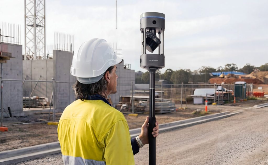
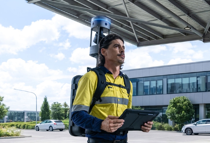
GX1 is designed for continuous mobile capture. Rather than setting up in fixed positions, the survey team moves through the environment – on foot with a backpack mount, using a pole, in a vehicle, or in a supported handheld configuration – while the scanner captures LiDAR and 360-degree imagery in real time.
The SLAM (simultaneous localisation and mapping) engine tracks position through environmental geometry, which means the scanner builds its own map as it moves. RTK and PPK positioning tie that map to a project coordinate system, producing georeferenced outputs without the need for manual registration between stations.
The practical result is faster coverage of large or complex environments, fewer return visits because missing areas are caught in real time, and a single pass that produces both point cloud and visual data. Coptrz is a UK partner for Emesent GX1 – you can find out more about the full product range on our Emesent brand page.
Accuracy: what the numbers mean in practice
Emesent states that GX1 delivers 5-10 mm global accuracy, 5 mm local accuracy, and 15 mm RTK/PPK accuracy. Those figures position it well above early-generation mobile SLAM scanners, which gave the technology a reputation for speed at the expense of accuracy that the current generation has largely addressed.
That said, accuracy figures need context. They are achieved under controlled conditions, with appropriate control points, site conditions and QA processes in place. They do not remove the need for survey judgement, proper control framework, or output validation against project requirements.
What they do mean is that GX1 is now credible for a wide range of projects where survey teams previously assumed mobile scanning could not meet the required accuracy. For the comparison to be meaningful, the right question is not “which scanner is more accurate in absolute terms” but “does GX1 meet the accuracy requirement for this specific project and deliverable?” For most construction, Scan-to-BIM, infrastructure inspection and progress-tracking workflows, the answer is yes.
Workflow comparison: static vs mobile
The two approaches produce different field experiences and different downstream workflows.
Traditional TLS workflow: Set up at Station 1. Level, target, scan. Move to Station 2. Repeat. Overlap between stations must be managed carefully. Post-processing involves registration – stitching scans together using targets or cloud-to-cloud methods. Quality assurance is largely a post-processing exercise, which means problems may not surface until the team is back in the office.
GX1 mobile workflow: Deploy in backpack, pole or vehicle configuration. Move continuously through the capture area while monitoring the point cloud build in real time via Emesent Commander. RTK positioning corrects georeferencing during capture. Return to base with a single, continuous dataset. Process in Aura. Export to E57 or integrate directly with CAD and BIM workflows.
The mobile workflow catches missed areas on site, not in post-processing. It also captures 360-degree imagery alongside the LiDAR, which means the visual context needed for measured building surveys, as-builts and handover documentation is embedded in the same pass. For Scan-to-BIM workflows in particular, this significantly reduces the number of site visits required before modelling can begin. See our surveying and construction sector page for more on how these workflows apply across UK survey projects.
Which projects suit each approach?
Traditional TLS is typically the right choice for:
- Structural monitoring and deformation analysis where millimetre-level precision is required and tracked over time
- Legal boundary and control-critical surveys where outputs must be verified against a known benchmark
- Selective high-accuracy measurement points within a larger workflow
- Projects where the client or checking surveyor requires static scan deliverables specifically
GX1 mobile mapping is typically the right choice for:
- Large or complex sites where static scanner setup time creates a productivity bottleneck
- Scan-to-BIM and measured building surveys where speed and visual context both matter
- Construction progress tracking and as-built documentation requiring repeatable, timestamped capture
- Road corridors, bridges and linear infrastructure where continuous capture reduces closure time
- GPS-denied environments – tunnels, basements, confined spaces – where drone-based LiDAR can’t operate
- Industrial facilities and treatment works with constrained access windows
Hybrid workflows: Many teams will find the strongest approach combines both. Use GX1 for the bulk of site capture – fast, continuous, imagery-rich – and deploy static TLS selectively for control points or areas requiring the highest precision. The two tools are complementary rather than competing, and knowing when to use each is where the commercial value lies. For drone-based aerial LiDAR that completes the picture for large open areas, see our RTK drones capability page.
The commercial argument
If GX1 can reduce field time, avoid return visits, and allow a survey crew to deliver more projects per month, the business case becomes straightforward. The purchase price is not the right starting point – the ROI calculation runs through crew productivity, subcontract displacement, return-visit cost reduction and the commercial value of faster deliverable turnaround.
For survey firms considering GX1 alongside their existing static scanner, the practical test is to identify one live project where field time or return visits are a current pain point, run a controlled capture with GX1 against agreed success criteria, and measure the result. That is a more reliable basis for a buying decision than a spec sheet comparison.
Coptrz supports UK buyers through that process – from initial demonstration and workflow review through to training, implementation and after-sales support. Speak to the team to arrange a practical GX1 demo against your current scanning workflow.
Frequently asked questions
For many workflows, yes. GX1 is capable of replacing static scanning for construction progress, Scan-to-BIM, corridor surveys, infrastructure inspection and as-built documentation. For very high-control tasks such as structural monitoring or legal boundary surveys, static TLS may still be required for selected measurements. The sensible approach is to test GX1 against your specific project requirements rather than making a blanket decision either way.
Emesent states 5–10 mm global accuracy, 5 mm local accuracy, and 15 mm RTK/PPK accuracy. For the majority of survey, construction and infrastructure deliverables, those figures are appropriate. The accuracy needs to be validated against your specific control framework and output requirements – which is exactly what a controlled demo is designed to establish.
GX1 captures a georeferenced point cloud alongside 360-degree imagery. Point clouds are available in E57 and other standard formats. These integrate with CAD, Revit, BIM and GIS platforms, and with Emesent’s Aura processing software and Aura Cloud.
This depends heavily on the site and project type. For large or complex environments, mobile capture is typically significantly faster than equivalent static scanner coverage – fewer setup positions, no levelling, and no manual registration in post-processing. The field time saving compounds on larger sites and multi-visit projects.
Yes. Coptrz offers practical demonstrations, workflow reviews, training, implementation support and after-sales care for GX1 buyers in the UK. The most useful starting point is a demo against a live use case rather than a generic product walkthrough. Contact the team to discuss your project and arrange a demo.
Next steps
The right way to evaluate GX1 against your current scanning workflow is not to compare spec sheets – it’s to bring a real project, an output requirement and a current workflow pain, and test it. View the Emesent GX1 on Coptrz or get in touch to book a demo.
Download Our FREE RPC-L1 Guide
Understand everything you need to know about moving towards commercial drone operations with our RPC-L1 guide.
- Understand what RPC-L1 is and who it is for
- Learn how the CAA transition impacts operators and training routes
- Get a clear breakdown of requirements, costs and next steps


Related Posts

Capturing Clarity Without Compromise
In the realm of renewable energy, ensuring the integrity of wind turbine blades is paramount. Traditional inspection methods often necessitate halting turbine operations, leading to significant downtime and associated costs. Enter Drone Solution’s innovative approach: utilising UAV-mounted high-resolution cameras to inspect turbine blades while they remain in motion. The Challenge Conventional inspections require turbines to […]
RPC Progression Plan and How to Build from RPC-L1 to RPC-L2
Why Smart Operators Are Building an RPC Progression Plan Now Most UK drone operators still think about training reactively. They buy the certificate they need for the job in front of them, then revisit the question when a bigger opportunity arrives. Under the CAA’s RPC framework, that is not the strongest way to plan. The […]

Drones in Surveying: Everything You Need to Know
The surveying industry has undergone a revolution in recent years, thanks to advancements in drone technology. Drones offer a faster, safer, and more cost-effective solution for capturing high-quality geospatial data. But with multiple technologies, platforms, and workflows available, understanding the best approach for your surveying needs can be complex. In this blog, I’ll answer key […]















