
Latest from Coptrz
Stay updated with the latest insights, tips, and industry news on our blog. Discover expert advice, success stories, and innovative uses of drone technology. Our blog features a diverse range of topics to keep you informed and inspired.
All Posts
Propeller AeroPoints – Do they work in the real world?
With the increase in drones being used as a key surveying tool, many questions are being asked about the accuracy of their GPS positioning from the sky. 3D mapping can be easily achieved with the use of a basic GPS enabled drone and processing software. However, for times when pinpoint accuracy is required, it is […]
A Closer Look at The DJI Zenmuse Z30
The COPTRZ team recently put the DJI Zenmuse Z30 through its paces at our DJI M210 Demo Day and we were mightily impressed with how it performed. Despite the number of payloads that the team demonstrated during the day, the Zenmuse Z30 was undoubtedly the crowd favourite due to its unrivalled zoom capabilities. It’s clear to see […]
Enterprise Solutions: DJI Matrice 200 Series Comparison
There has been a tremendous response from commercial drone users ever since COPTRZ unveiled the first DJI Matrice 200 in the UK back in May 2017. The industry has been crying out for a rugged, industrial grade aircraft and DJI have responded brilliantly with the release of the M200 Series. There are three aircraft in the series; […]

Why Choose COPTRZ For Your CAA PfCO Training
As an approved NQE, COPTRZ provides a complete 4 day CAA PfCO Training Course that enables drone pilots to obtain their permission for commercial operations. Training for all ability levels Our students range from photographers/videographers all the way through to police forces and large corporations looking to use drones as part of their operations. Why choose COPTRZ […]
Pix4Dmapper Version 3.3 Released
Pix4D’s rayCloud is an iconic interface that connects original images to the 3D reconstruction. Add and edit your ground control and manual tie points to improve your project accuracy without searching for each point in an endless list of images. Simply select the point’s approximate location in the point cloud and refine its position in […]

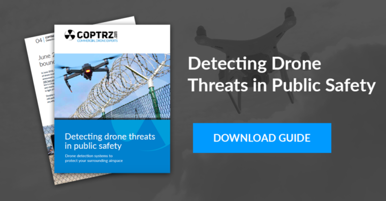
Using 3D Mapping for Accident & Emergency
The origins of photogrammetry and 3D mapping can be traced back to 1480 when Leonardo da Vinci developed the concept of perspective and projective geometry. Techniques have come a long way since then, with both the technology and software becoming more accessible and affordable. Our Emergency Services have been some of the earliest adopters of […]
UK Drone Laws: Safety Tests & Drone Registration Required
The UK government has today announced plans to introduce new drone laws, including mandatory registration of drones and a requirement for owners of small unmanned aircraft to attend a safety awareness course. New UK Drone Laws to ‘Protect the Public’ Reporting to the BBC on the new legislation, Aviation Minister Lord Martin Callanan claimed that “Our […]

CAA Case Study: Peter Hinton, Operations Manager at the Royal Variety Charity
At COPTRZ, we’re always happy to catch up with our former students to find out how their COPTRZ CAA training is helping them as a commercial drone pilot. This month we had the pleasure of catching up with Peter Hinton, Operations Manager at the Royal Variety Charity, who has started using drones during the proposed redevelopment of the […]

Is UAV LiDAR the Next Big Thing for Surveying?
In the world of technological innovation, there usually comes a time where an invention crosses over from cutting-edge, into the mainstream, from being a great concept, into a greater reality. UAV LiDAR is one such technology. What could be better than mobile LiDAR? Affordable airborne LiDAR, of course! The world of surveying covers such a […]
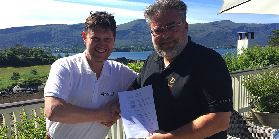
COPTRZ announce strategic partnership with GRIFF Aviation
COPTRZ, the commercial drone experts, have agreed a strategic partnership with Norwegian manufacturer GRIFF Aviation to become the sole distributor of their fleet of heavy-lift commercial drones in the UK and Republic of Ireland. Unlike any other drone on the market, the ‘GRIFF’ can lift up to 150kg and has been specifically designed for heavy […]
DJI XT Pro iOS App Released
COPTRZ are pleased to announce that DJI has released the new DJI XT Pro App, designed to empower Zenmuse XT users by giving them a more simple, streamlined method of capturing thermal imaging data. The use of thermal imaging with drones is rapidly increasing, with Fire Services, Search and Rescue and Police Forces beginning to […]
Top 5 Dream Destinations for Flying a Drone
The notion of flying a drone conjures up images of the open air, beautiful scenery and undiscovered visual treasures. It’s no wonder the drone revolution has captured the imagination of millions of people across the globe. From budding photographers to roofers and estate agents, our customers span a variety of industries and interests, all with […]


