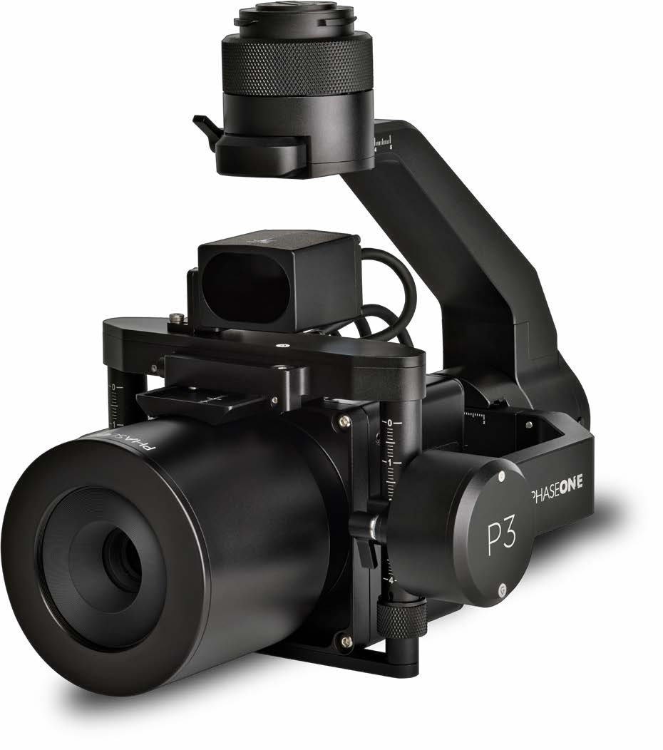
Phase One P3 iXM-GS 120
120MP/100MP Medium-Format Sensor
Interchangeable Lenses
Smart Focusing and Triggering
Unmatched Inspection Productivity
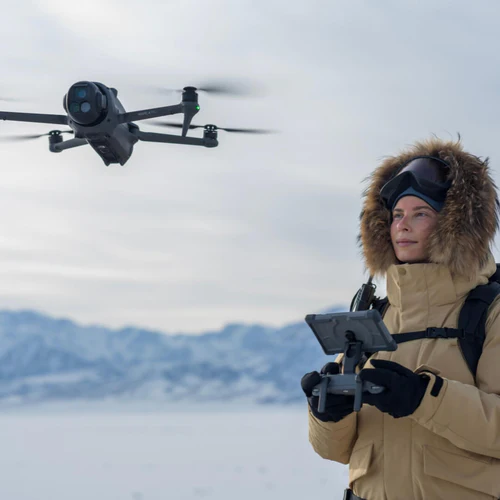
The PhaseOne P3 is designed to maximise the productivity of the most demanding inspection projects. Ready for flight with DJI M300/350 and ready for integration with MAVLink drones, the P3 enhances your inspection productivity through its ease of installation, superior data output, and uncompromised image details.

Medium-Format Sensor
The PhaseOne P3 features a medium-format sensor that captures high-resolution images, with a sensor 1.7 times larger than typical sensors, ensuring the finest details are captured in every shot.

Superior Zoom Capability
The P3 offers a versatile selection of lenses, including 35mm, 80mm, and 150mm*, allowing users to capture the broadest coverage or the finest detail from any distance.
*150mm lens not supported for DJI M300/M350

Smart Focusing and Triggering
Built-in laser range finder and smart focusing ensure consistent focus in complex and high-contrast situations. Smart triggering captures fast-moving objects efficiently.


Flexible Configuration
The P3 allows switching between vertical and horizontal configurations to reduce background noise and collect data faster, providing flexible solutions for various inspection needs.

High-Resolution Thermal Imaging
The gimbal provides pitch and yaw control for better image stability, ensuring sharp and clear images in all conditions.

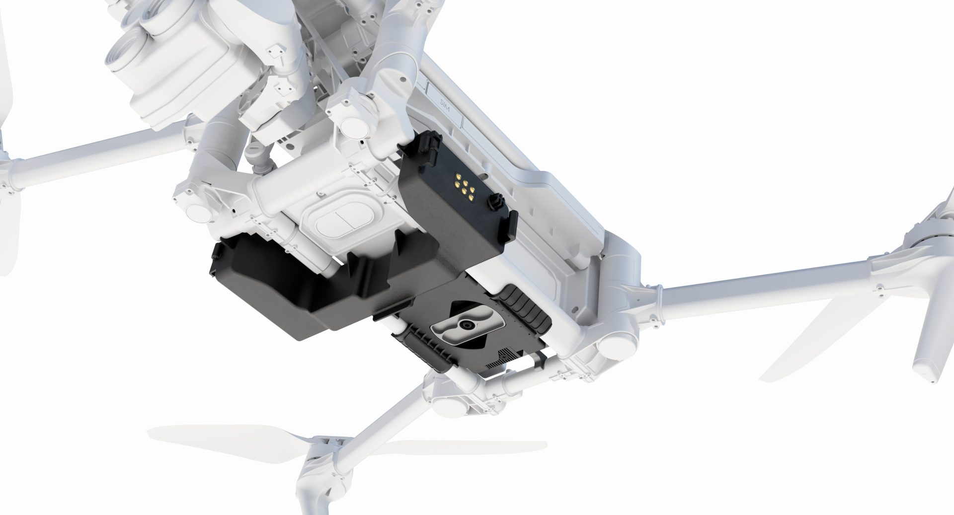
End-to-End Integration
The P3 Payload integrates seamlessly with DJI M300/350, MAVLink, and Auterion UAV systems, offering full compatibility and ease of use with existing workflows and software.

Wide Range of Lenses
With 35mm, 80mm, and 150mm lenses, the P3 meets various GSD requirements without compromising safety, offering the best sensor performance for any project.

Environmental Durability
The P3 is built to operate efficiently in diverse environments, with an IP53 rating ensuring reliability in various conditions, making it suitable for demanding inspection projects.
The finest details from the furthest distance
The Phase One P3 is a high-performance camera system engineered for demanding inspection projects where precision, safety, and efficiency are critical. It offers seamless integration with DJI M300/350 and MAVLink drones, ensuring quick installation and superior data capture. Equipped with a medium-format Phase One iXM camera featuring a sensor 1.7 times larger than comparable cameras, the P3 delivers unmatched image detail and an expansive dynamic range, supported by a versatile selection of lenses from 35mm to 150mm. This makes the P3 an ideal tool for professionals seeking to maximize productivity and achieve uncompromised results in their inspection workflows.
Best-in-class sensor performance
Make the most of every flight by capturing more in every shot with the largest image sensor.
Flexible configuration for every need
Get more value out of your inspection by switching between vertical and horizontal configurations to collect data faster and reduce background noise.
More details from a distance
Get detailed data from the safest distance while covering a large area choosing from variety of our lenses
Smart capture for robust results
Make every shot count capturing easily complex assets and moving objects with smart focusing and triggering.
Make no compromises
on image quality
Customize your drone to meet your project requirements
By offering a variety of lens options you can customize your drone according to your priorities; whereas you want to achieve the broadest coverage or the finest detail.
Boost your productivity with flexible configuration
Depending on the type of asset to inspect, you can switch your P3 configuration from horizontal to vertical and vice versa to reduce background noise and collect data faster.
Vertical and horizontal camera orientation.
P3 Payload can easily be integrated with the most recognized UAV systems DJI M300/350, MAVLink and Auterion.
Interface to DJI, Auterion and MAVLink UAVs or use the Phase One toolbox for seamless integration with your existing workflows.
Built-in laser range finder to ensure consistent focus in complex and high contrast situations
Automatic and continuous distance measuring triggering a capture for fast moving objects.
35, 80 and 150 mm lenses, to meet your GSD requirements from any distance without compromising on safety.
Pitch and yaw control of the gimbal providing better image stability
120 & 100 MP sensors ensure largest coverage, highest dynamic range, and smallest GSD.
Buy Phase One P3 iXM-GS 120
FAQs
The PhaseOne P3 is an advanced UAV payload designed for high-resolution inspection and mapping, featuring a 120MP or 100MP medium-format sensor and a variety of interchangeable lenses.
The P3 is compatible with DJI M300/350 and MAVLink-supported drones, offering ready-for-flight and easy integration options.
The P3 supports 35mm, 80mm, and 150mm lenses, allowing for flexibility in capturing different levels of detail from various distances.
The P3 features a built-in laser range finder for smart focusing and automatic triggering, ensuring consistent focus and capturing of fast-moving objects.
Yes, the P3 is built with an IP53 rating, ensuring reliable performance in various environmental conditions.
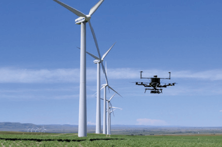
The P3 is used in surveying, construction, infrastructure inspection, utilities, oil & gas, public safety, environmental monitoring, agriculture, urban planning, forestry management, mining, asset integrity inspection, and archaeology.
The P3 offers flexible configurations (vertical and horizontal), 3-axis stabilization, and seamless integration with existing UAV systems, boosting productivity by reducing background noise and collecting data faster.
The P3 integrates with DJI Pilot App for DJI drones, and it supports Q Ground Control, Mission Planner, and MAVLink Protocol v1 and v2 for MAVLink drones.