Pix4Dfields Essentials Online Training
12,000+ Pilots Trained
CAA-Accredited
UK's Leading Training Provider
The Pix4Dmatic Essentials Online Training Course is a comprehensive program designed for professionals seeking expertise in advanced drone and terrestrial mapping. This course equips you with the skills to master Pix4Dmatic, a cutting-edge tool for creating high-quality photogrammetric deliverables. You'll learn the fundamentals of RGB image capture and flight planning, techniques for generating realistic, accurate 2D and 3D georeferenced representations, including orthomosaics and 3D models, and skills to efficiently export 2D and 3D deliverables to share with stakeholders.
Why Take The Course?

Show Your Expertise
Master the advanced techniques of photogrammetry using Pix4Dmatic, demonstrating your proficiency in creating high-quality 2D and 3D deliverables.

Competitive Advantage
Enhance your skills to provide precise and professional mapping solutions, giving you an edge in industries that require detailed geospatial data.

Build Confidence
Develop the confidence to capture, process, and share high-quality aerial and terrestrial data, understanding the full scope of Pix4Dmatic workflows.
Course Format
Duration: 8 hours of on-demand videos


Course Feature
- Subtitles in English
- Quizzes in the language of the course
- Workbook in the language of the course
- Unlimited access to course materials
- Certificate of completion
Certification Exam
- Approximately 2 hours, including 60 multiple-choice questions (no time limit)
- Requires a score of 80% to pass
- One attempt allowed
- Digital certificate upon passing

Buy Pix4Dfields Essentials Online Training
Price range: £225.00 through £315.00 Excl. VAT
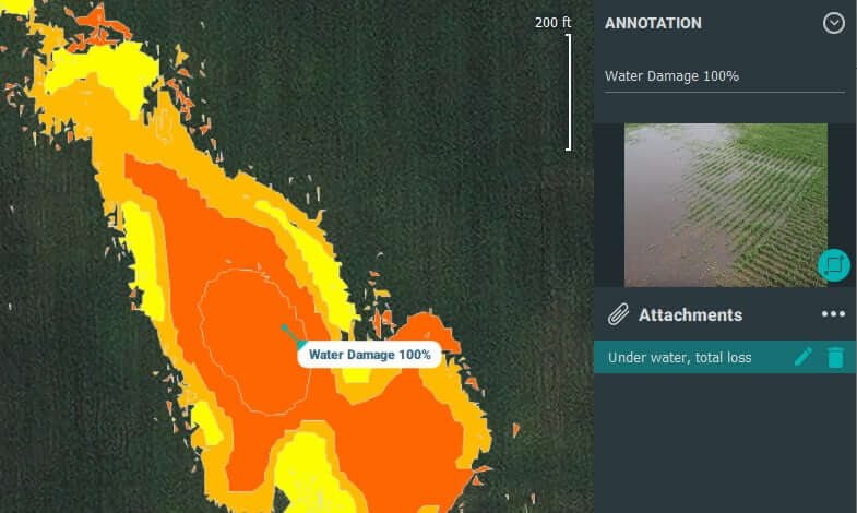
Elevate your expertise in drone mapping and photogrammetry tailored for precision agriculture. Gain proficiency in producing superior agricultural data with RGB and multispectral imagery.
- Call Us Now On 0330 111 7177
Course Content:
Introduction to Vital Pix4Dmatic Workflows
- Objectives: Create precise 2D and 3D georeferenced reality representations, such as orthomosaics and 3D models.
- Learn to acquire accurate measurements and effectively share deliverables with stakeholders.
Key Concepts
- RGB Images
- Ground Sampling Distance
- Ground Control Points
- Dense Point Cloud
- Orthomosaic
Curriculum:
Module 1 - Getting Started
- Enrolment form
- Instructions
Module 2 - Course Materials
Module 3 - Prepare Data for Hands-on Exercises
Module 4 - Introduction to the Pix4Dmatic Essentials Course
Module 5 - Basics of Photogrammetry
Module 6 - Getting Started with Pix4Dmatic
Module 7 - Processing with Pix4Dmatic
Module 8 - Vectorize with Pix4Dmatic
Module 9 - Exporting and Sharing Deliverables
Module 10 - Working with Pix4Dcatch Terrestrial Imagery in Pix4Dmatic
Module 11 - Merging Aerial and Terrestrial Projects with Pix4Dmatic
Module 12 - Adding a Scale Constraint in Pix4Dmatic
Module 13 - Course Conclusion
Next Steps:
- After Passing: Successfully completing the course and exam earns you a Pix4Dmatic Essentials certification, showcasing your expertise in drone-based mapping and data analysis.
- Further Learning: Continue your professional development with additional courses available on the Coptrz Academy eLearning platform.
Enrol in the Pix4Dmatic Essentials Online Training course to advance your skills and ensure effective use of Pix4Dmatic for precise 2D and 3D mapping, enhancing your capabilities in this specialised field.


