Top Drones for Surveying in 2022
10 minute read
Are you a surveyor looking to add drones to your operations in 2022? Are you exploring the latest and greatest hardware in the market? Well you’ve come to the right place!
2022 is set to be another exciting year for the Drone Industry as organisations are increasingly looking for faster and more cost effective solutions for their operations. If you want the latest information on drones in surveying, you can access the Surveying resource centre HERE for videos, blogs, white paper reports and more.
We’ll take you through the following in this article:
- How drones are transforming the surveying process
- The benefits of drone surveying
- How using drones for surveying reduces costs
- Applications of drone surveying
- Our top 5 drones and payloads for surveying in 2022
- Download our Drones for Surveying ebook
How are Drones transforming the surveying process?
A drone survey refers to the use of a drone, or unmanned aerial vehicle (UAV), to capture aerial data with downward-facing sensors, such as RGB or multispectral cameras, and LiDAR payloads. During a drone survey, the ground is photographed several times from different angles, and each image is tagged with coordinates.
There are numerous benefits to using drones over traditional surveying methods. Drones are up to five times faster than traditional methods, easily transported/deployed and well adapted for use on terrain that would be otherwise difficult to survey by foot. Using drones for surveying in 2022 is now the industry standard.

What are the benefits of drone surveying?
- Reduced time on site, lower survey costs
- Drone software allows easily replicable data sets
- Increased health and safety for difficult terrain
- Reduced boots on the ground, lower costs
How does using drones for surveying reduce costs?
By investing traditional mapping budgets into an autonomous drone and mapping software, you’re able to get accurate data faster, and at a much lower cost.
When a company integrates drone mapping into its job site analysis process, it can dramatically reduce the cost of aerial surveys and manned surveys.
COPTRZ Top Drones for Surveying in 2022
Best drone for large scale projects: WingtraOne GEN II
While there are other fixed-wing options on the market, what makes the WingtraOne GEN II special is it’s VTOL capabilities, which allow it to to take off and land vertically, dramatically reducing the deployment time and ensureing the payload is kept safe, even during landing.
Find out more about WingtraOne GEN II

Best entry level survey drone: DJI Phantom 4 RTK
For an entry level drone that’s designed for aerial surveying and 3d mapping, look no further than the new DJI Phantom 4 RTK. Built specifically with surveyors in mind, the Phantom 4 RTK incorporates a 1″ CMOS 20mp camera to give you sharp and detailed images.
A new RTK module is also integrated directly into the Phantom 4 RTK, providing real-time, centimetre-level positing data for improved absolute accuracy on image metadata. Satellite observation data is also stored for Post Processed Kinematics (PPK).
You can also support you Phantom 4 RTK with the D-RTK 2 Mobile Station – providing real-time differential data to the drone and forming an accurate surveying solution. The Mobile Station’s rugged design and OcuSync transmission system ensures you can gain centimeter-level accurate data with your Phantom 4 RTK in any condition.
DJI applied what they’d learnt from their consumer level drones and combined with the requirements of the survey industry, creating a powerful yet simple to use drone, capable of transforming your operations.
Find out more: Phantom 4 RTK

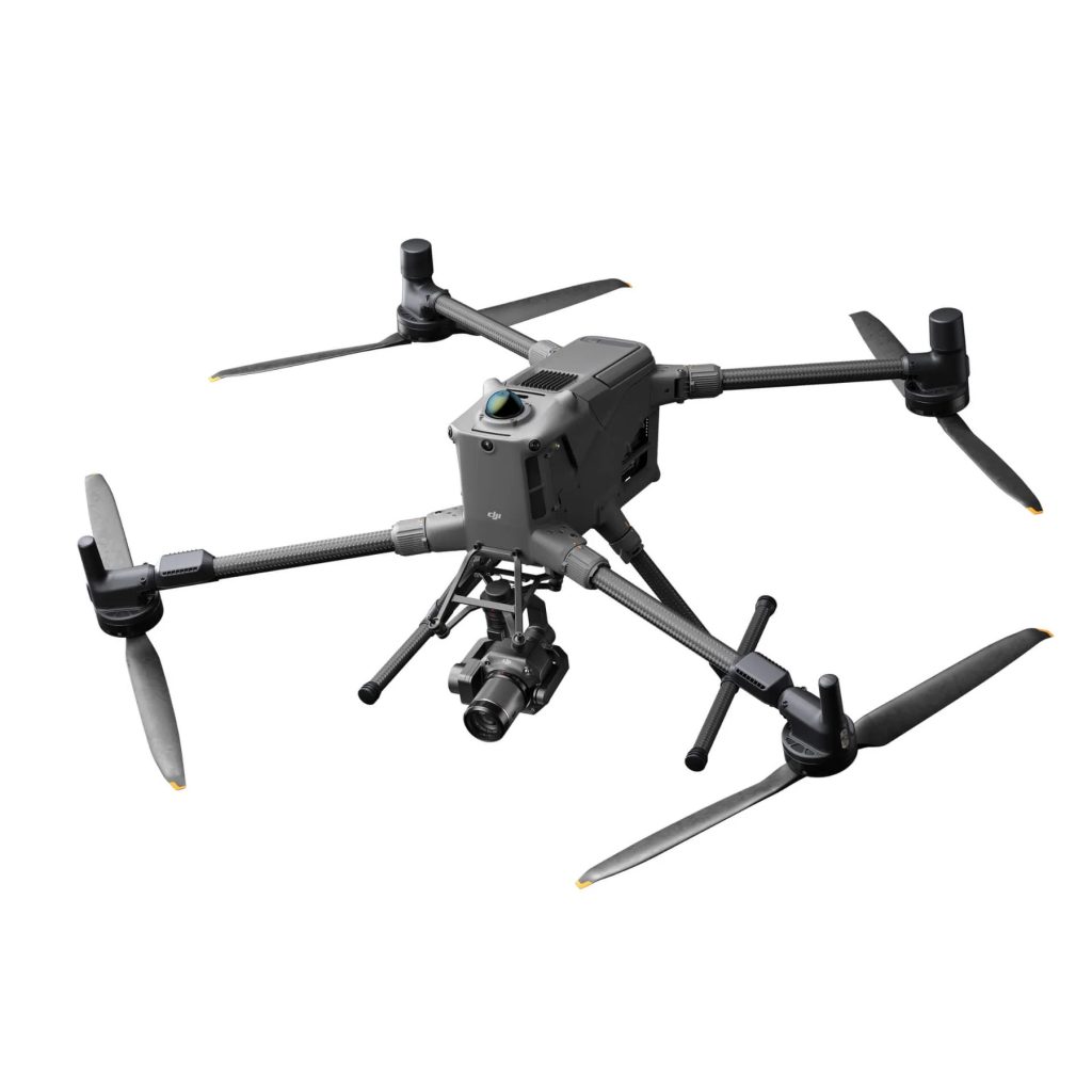
Best drone for mission versatility: DJI Matrice 300 RTK
Built for the toughest environments and capable of carrying an astounding array of payloads, the Matrice 300 RTK is our pick for 2022’s most versatile drone. Engineered to improve upon the popular features of the Matrice 200 Series, the Matrice 300 RTK gives you impressive flight times of up to 55 minutes, an IP45 rating and 15km transmission range.
What’s most impressive though is the number of compatible payloads engineered specifically for Surveying, which gives the Matrice 300 RTK some of the best versatility in the market. From LiDAR manufacturers like Emesent and LiDAR USA to Photogrammetry payloads from Phase One, the Matrice 300 RTK really is the Swiss army knife of aerial surveying.
Find out more: DJI Matrice 300 RTK

Best Photogrammetry payload: PhaseOne iXM
The Phase One iXM metric camera incorporates the first medium-format sensor with backside-illumination technology, enabling high light sensitivity and extended dynamic range – perfect for capturing high detail images for surveying.
The Phase One iXM is fast, highly responsive, robust, and weatherproof (IP53 compliant), the iXM 100MP delivers superior quality aerial imaging and flexible operation to satisfy diverse surveying applications. This piece of kit is essential if you’re wanting to carry out incredibly detailed surveys.
Best LiDAR payload: Hovermap by Emesent
If you’re looking for a LiDAR payload which does it all, look no further than Hovermap by Emesent. This payload is a smart mobile scanning unit which is capable of mapping in the most challenging and inaccessible areas.
Equally capable above ground or underground, indoors or out, Hovermap is your complete mobile LiDAR mapping solution.When mounted to a drone, Hovermap also provides collision avoidance and autonomy to map inaccessible or GPS-denied areas. It is equally capable above ground, under bridges, or up close to critical infrastructure.
Easily process Hovermap’s accurate, high-resolution point clouds into a CAD-ready dataset and build a 3D model using industry standard tools, such as PointCab, PointFuse, or Revit/AutoCAD.
Find out more: Hovermap by Emesent


For more information on our top 5 picks for payloads in 2022, there’s a helpful video below.
Want to know more about drones for surveying in 2022?
Download your free guide for 2022.

Download our FREE GVC Training Guide
Learn everything you need to know about becoming a drone pilot with our GVC training guide.
- Get a full course roadmap to understand every step of the journey
- Contains clear answers to all of the frequently asked questions
- Get a transparent and comprehensive breakdown of course costs


