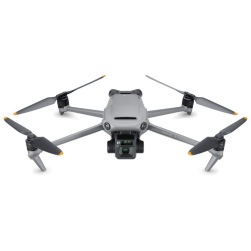
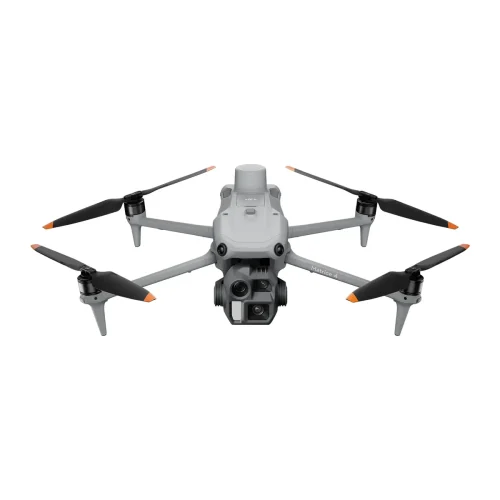
DJI Mavic 3 Enterprise
Advanced Imaging
Compact Design
Superior Performance
The DJI Mavic 3 Enterprise Packs A Punch
The DJI Mavic 3 Enterprise packs a ton of features into its compact and portable frame, with two survey-grade cameras, batteries capable of 45 minute maximum flight time and a whole host of other useful features. All while keeping the cost of this drone down, the DJI Mavic 3 Enterprise offers incredible value.

Optimised For Surveying
Featuring high quality wide and tele cameras with large pixel size, intelligent low-light mode and mechanical shutter, the DJI Mavic 3 Enterprise is built with surveying and mapping in mind.

Fly For Longer
The DJI Mavic 3 Enterprise boasts a 45 minute maximum flight time with fast charge capable batteries. Survey up to 2 square kilometres in a single flight.

Compact And Portable
Fit this incredible piece of drone technology in the palm of your hand. Easily take it on any mission and deploy at a moment’s notice.
Commercial Uses

Surveying & Construction
Asset Integrity & Inspection

Public Safety

Government Body

Energy & Renewables

Oil & Gas

Sport

Research & Education
Flight Customisation
Explore the endless possibilities of flight planning, capture, and smart features that are all packed into your Mavic 3 Enterprise.
Terrain Follow
Automatically adjust altitude when mapping areas with variations in elevation, all without needing to import external elevation data.
Smart Oblique Capture
The gimbal auto-rotates in three directions during flight, enabling two routes to gather all necessary angles for precise 3D modelling.
Live Mission Recording
The gimbal auto-rotates in three directions during flight, enabling two routes to gather all necessary angles for precise 3D modelling.
Mission Planning
Automate surveys of highways, rivers, and pipelines by drawing a line on the map to segment the area for streamlined surveying.
Survey With Speed
The Mavic 3E’s wide-angle 4/3 CMOS 20MP sensor, equipped with a mechanical shutter, eliminates motion blur and supports rapid 0.7-second interval shooting. Achieve unparalleled efficiency in mapping missions without relying on Ground Control Points.
Survey-Grade Deliverables
Create pinpoint accurate 2D and 3D models with the Mavic 3 Enterprise. Perfect for construction site progress monitoring, precise stockpile measurements, and scaled digital twins of your projects. Transform your operations with survey-grade deliverables accessible directly from your computer.
Zoom and Track
Equipped with a 12MP Zoom Camera, the Mavic 3 Enterprise supports up to 56× Max Hybrid Zoom, allowing you to capture essential details from a distance without the need for scaffolding or navigating large, hazardous sites.
Buy DJI Mavic 3 Enterprise
Compare DJI Mavic 3 Enterprise Drones


Survey-Grade
Zoom
Flight Time
IP Rating
FAQs
DJI is a Chinese company that is based in Shenzhen, which is often touted as the silicon valley of China.
DJI was founded in 2006 by Frank Wang who built one of the first prototypes of DJIs projects in his dorm room at the Hong Kong University of Science and Technology.
DJI stands for Da-Jiang Innovations, in Chinese this translates to great frontier innovations.
Drones


Related Training


Software


Accessories


Related products
-

DJI Mavic 3
Price range: £2,997.00 through £4,797.00 Excl. VATDJI Mini 4 Pro
Price range: £574.20 through £815.80 Excl. VAT
DJI Mavic 3 Pro Cine
DJI Matrice 4 Enterprise
£3,283.00 Excl. VATRelated Guides

Drones for Inspection – Guide Download

Survey Success Secrets – Guide Download

Drones for Surveying Guide – Download
Related Case Studies

Oceanites
Oceanites, a US-based NGO dedicated to penguin conservation in Antarctica for the past 30 years, has revolutionised its data collection and presentation methods using DJI Terra software.


Latest From Coptrz
 NEW
NEWDJI Matrice 400
Become a Drone Pilot
Unlock your business potential with drone technology