Surveying and construction professionals have more advanced tools at their disposal than ever before, with drones revolutionising data collection across the industry. Two of the most powerful methods used today are photogrammetry and LiDAR, each offering unique advantages depending on the application. But how do you decide which one is best for your projects? Let’s break it down.
Photogrammetry: The Power of High-Resolution Imaging
Photogrammetry is a technique that uses high-resolution images to create 3D models and maps. By capturing multiple overlapping images and using specialised software to stitch them together, photogrammetry produces highly detailed and visually rich reconstructions of the environment.
Key Benefits of Photogrammetry:
Cost-Effective – Requires only a high-resolution camera on a drone, making it more affordable than LiDAR.
High-Resolution Detail – Captures textures, colours, and intricate details of structures and landscapes.
Ideal for Aerial Mapping – Produces detailed topographic maps and digital elevation models (DEMs).
Perfect for Large-Scale Projects – Suitable for construction site progress monitoring, urban planning, and agriculture.
Featured Solution: DJI Zenmuse P1
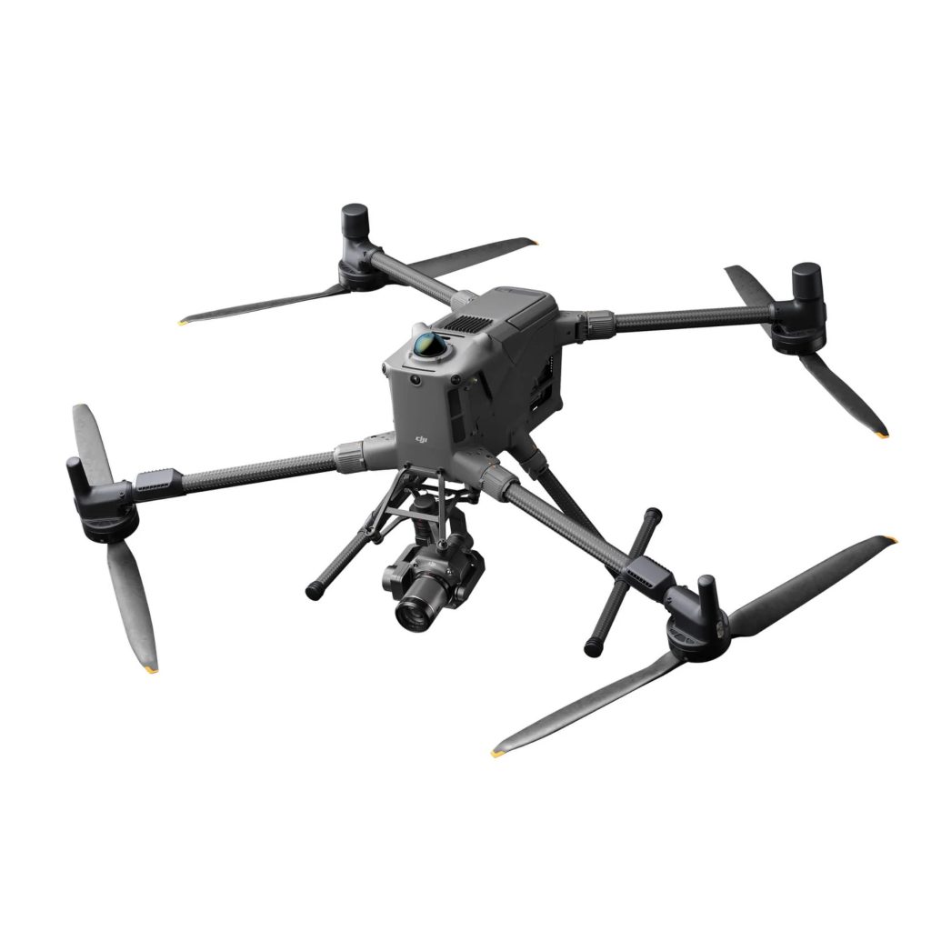
The DJI Zenmuse P1, when mounted on a drone like the DJI Matrice 350 RTK, is a game-changer for photogrammetry. With its 45MP full-frame sensor, mechanical shutter, and Smart Oblique Capture feature, it significantly enhances mapping efficiency. It’s an ideal choice for surveyors needing high-accuracy geospatial data without the added cost of LiDAR.
LiDAR: Precision Beyond the Surface
LiDAR uses laser pulses to generate highly accurate, three-dimensional models of terrain, structures, and vegetation. Unlike photogrammetry, LiDAR can penetrate vegetation and see through gaps in tree canopies, making it indispensable for dense environments.
Key Benefits of LiDAR:
Unparalleled Accuracy – Delivers highly precise elevation data, even in complex environments.
Penetrates Vegetation – Ideal for forestry, mining, and infrastructure projects where the ground surface is obscured.
Works in Low-Light Conditions – Unlike photogrammetry, LiDAR is effective even in low-light or nighttime conditions.
Faster Data Processing – Produces detailed point clouds without relying on texture or lighting conditions.
Featured Solutions: DJI Zenmuse L2 & Emesent Hovermap STX
DJI Zenmuse L2: The latest integrated LiDAR and RGB camera system for DJI enterprise drones like the Matrice 350 RTK. With improved point cloud accuracy, the L2 is a perfect tool for surveyors needing fast, precise terrain mapping.
Emesent Hovermap STX: This cutting-edge LiDAR scanner is designed for indoor, outdoor, above ground and underground environments. It’s ideal for mining, tunnel inspections, and complex infrastructure surveys, offering SLAM-based real-time 3D mapping.
Which One Should You Choose?
The choice between photogrammetry and LiDAR depends entirely on your project requirements:
Go with Photogrammetry if:
- You need high-resolution visual models.
- Cost is a major factor.
- Your site is open with minimal vegetation.
Opt for LiDAR if:
- You require precise elevation data.
- Your survey area has dense vegetation or complex structures.
- You need to work in challenging lighting conditions.
For many surveyors, the best solution may be a hybrid approach, leveraging photogrammetry for visual clarity and LiDAR for accurate terrain data.
Get the Right Drone Surveying Solution with Coptrz
Whether you need a DJI Zenmuse P1 for high-resolution photogrammetry or the DJI Zenmuse L2 for precision LiDAR, Coptrz has the expertise and technology to equip you with the perfect solution. Want to see these systems in action?
Get in touch today to book a demo and find the best fit for your surveying needs!
#Surveying #ConstructionTech #DronesForSurveying #Photogrammetry #LiDAR #DJIEnterprise #Emesent #DroneTechnology
Download our FREE GVC Training Guide
Learn everything you need to know about becoming a drone pilot with our GVC training guide.
- Get a full course roadmap to understand every step of the journey
- Contains clear answers to all of the frequently asked questions
- Get a transparent and comprehensive breakdown of course costs


