Drones For Crop Research: We Spoke To the British Beet Research Organisation
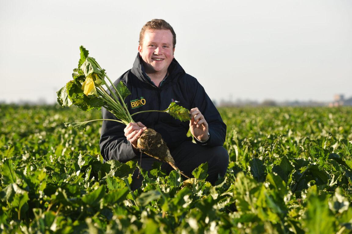
Photo of Alistair Wright from BBRO at Chapel Farm, Ringshall, for the British Sugar Beet Review 2018/19
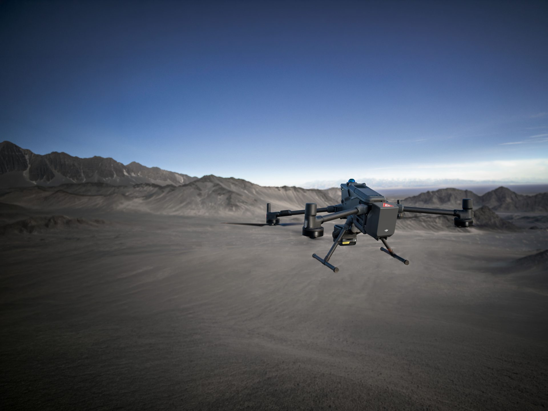
We love speaking to our Coptrz Alumni and hearing how drones are revolutionising their industry. We recently caught up with Dr Alistair Wright of The British Beet Research Organisation to hear how he’s been using a DJI Matrice 210 equipped with a Zenmuse X5S RGB camera and a MicaSense Altum Multispectral sensor to monitor crops of sugar beet in the UK.
In this article you will learn;
- What is the BBRO?
- How is the BBRO using drones for crop research?
- What are the benefits of using drones for crop research?
- What are the shortcomings of using drones for crop research?
- What’s the future of drones for crop research?
If you have a story about how drones are helping your business to progress, you can contact us Contact Us.
Tell me about your role at the British Beet Research Organisation (BBRO)?
At the University of Nottingham, I studied for my PhD in investigating interactions between a nematode worm which attacks sugar beet and brassica crops. The project was jointly funded by the University of Nottingham and the British Beet Research Organisation (BBRO). BBRO is a not-for-profit business focusing solely on sugar beet research. We are equally funded by the UK sugar beet growers and the UK beet sugar processor, British Sugar.
I’m now a Crop Scientist for BBRO, working on an InnovateUK funded project. I’m currently specialising in assessing how new varieties of sugar beet can be assessed for resistance to a range of important pest and disease problems and then advise growers on which varieties to use. When I moved into my role I wanted to look for a way to conduct regular assessments of my crop trials and that’s when I started looking at drone technology. I was familiar with some of the technology in the cameras but hadn’t used drones before. The devices I’d used in the past were quite different, they only looked at reflective wavelengths of light rather than the drones which take an actual image.
I went to a show called CropTec in 2018 when my current project was starting. At the time I was looking at the possibility of using sensors mounted on tractors to survey crops. There was a company there showcasing drones for rapid data collection and I realised how advanced the technology on drones now is. Once I got back to work I did my own research into the various sensors which may be useful and also found Coptrz as the UK based supplier for many of the sensors.
From your experience are drones being used often in the world of Crop Science and Management in the UK and overseas?
In the research sector drone technology is becoming quite common, in terms of the farming sector the process itself is still fairly advanced so it’s definitely a new area. During a recent trip to Australia for work, I went along thinking they would be lightyears ahead of the UK as their government are spending huge amounts investing in drone technology but it turns out they are having the same issues we are. At present, I don’t think there is a system out there that is overly commercialised for plot-based surveying. Currently, I’m working around that and doing it in a more labour-intensive way but it works and then the data I acquire proves to be very valuable to my research and also to the wider aims of BBRO.
How could drone technology be improved to manage crops?
The hardware works fine, no problems at all, it’s the software behind it. It’s the fact you have to go from images from Mica Sense to stitching it together on Pix4D then having to turn that into an orthomosaic to another programme to then extract the data. For farmers using things like Pix4DFields, it’s fine for them because it does it all. At BBRO because we are wanting solid data we can’t just use an image.

How have BBRO been using drone technology?
Using drones we’ve been looking at various applications. We have a big problem with viruses in our crop that cause the plants to go yellow. So we recently had a trial looking at different varieties and resistances to the viruses and the drones have been invaluable for surveying that. We took out the drone at least 16 times throughout the season to survey that particular trial all the way from establishment in May through to harvest in November.
We also have other diseases caused by fungi which strip away some of the canopy and can also severely limit yield. We have had trials looking at natural resistances in the sugar beet utilising the drone again to assess these sites. Each time we fly we have the DJI Zenmuse X5S RGB camera and MicaSense Altum Multispectral sensor attached to the aircraft so we are able to collect a large set of data simultaneously.
We’re hoping to -develop something simple to help a farmer to operate a drone and look for a disease before it becomes visible to the naked eye. We’re aiming to look for visual signals that we can’t see by eye but that we can see using a drone. Then that would tell us where we may need to apply some treatment to protect the crop.
Have you been operating the drones yourself and how have you found it?
Yes, we’re halfway through our drone training at the moment, there are four of us in total who operate the drones. We have two in our fleet, a Matrice 210 which we bought from Coptrz and a Phantom 3 which is quite old now. We tend to use the Phantom 3 to practice flying and the Matrice 210 for our projects.
The M210 is ever so easy to fly. I couldn’t believe how simple it is to operate. The set-up and the support is great, you just get it out of the box and off it goes which I was surprised by for such a large aircraft. The way it hovers, it’s so steady even in strong winds. The battery performance is also really impressive when we’ve got it fully laden with both cameras we can still get nearly 30-minutes flight time from it, allowing us to cover a huge area. The most I have managed is a 24-hectare field on just one set of batteries.
Another fantastic feature is that we can go back in time to view the data previously collected, whenever we need to interrogate it, as the computer saves it all for us. Usually, this would be a lot more labour intensive and time-consuming when using traditional visual scoring methods or hand-held tools and there’s no way to look back to check the data with those methods.

Why is it important in your sector to look at and use drone technology?
It’s a cliché but it is the future. For us, it’s all about rapid data collection and accurate data collection so if we were going out and taking similar measurements by hand it would take probably several hours each time. I did some calculations when I was looking at various different methods of data collection for a project and one option would have taken one person 7-days compared to what the drone can do in about 3-hours.
Obviously, the resolution isn’t as good when flying at 50 metres but the resolution is still incredible for what you get. It’s also the repeatability and the ease of operations which definitely helps. Being able for it to locate to an exact spot by just pressing play is so handy. It means I can give the drone to a colleague, they can take it out and watch it so the amount of training needed is quite minimal once you know what you’re doing. Creating the flight paths is so simple, you just draw the box on the screen in the field and off it goes. Therefore, during the flights, you can focus on keeping safe and making sure the drone is capturing quality images rather than monitoring flight performance and the route it is taking. This also reduces operator error. So far, the M210 has performed faultlessly!
The drone is also future-proofed for several years. The opportunity to change the payloads means we can easily upgrade the sensors attached to the aircraft if and when we need without having to buy a new drone.
How can drone technology be improved in the research sector for crop management?
As time goes on I think we’ll start to see more and more sensors being added to the aircraft, at the moment we have thermal, RGB and the Multi-spectral which is a fairly good set-up. There are some other sensors used in Crop Research which could potentially be made into a sensor to add to a drone.
We’ve looked at the possibility of adding a Lidar sensor to the drone but we realised we’d need to upgrade the aircraft to a Matrice 600 Series. We aren’t working with a crop that has particularly complex architecture so we aren’t sure Lidar would be necessary. This year we are looking at using a different RGB lens on our camera to see if we can get high-resolution images for point-cloud processing. Results so far look really promising
How are you using drone technology to educate the Farming sector?
We’ve used the drone for some promotional activity to showcase the work we’ve been doing at BBRO. We’ve flown it at some of our open day events so the growers who have funded the technology get to see it in action. A huge part of our work is knowledge exchange as there isn’t any point on conducting the research without sharing our findings.
I have two time-lapse videos which are 3D renderings of one of my trials, I played it to some of the growers at our recent grower conferences and there was a sharp intake of breath when they could actually see the difference between the time and varieties of crops.
Virtual or augmented reality may also soon be an important part of farming. Using the drone to make models of trials and allow growers to move through them at their own pace will help when it comes to variety selection and see more data than is possible on a single day at an open day or industry event.
How did you come across Coptrz?
We were looking at the right tools to use for my project to capture data during regular assessments of crops and that’s when I came across Multispectral imaging. We wanted a suitable drone to carry the Altum MicaSense and Coptrz turned out to be the best value. We actually saved a lot of money when we chose you as a supplier which is important when we are funded by our growers.
We got a great hardware and training package and I couldn’t recommend Coptrz more highly. We’ve had good support whenever we’ve had any problems and we wouldn’t hesitate to come to Coptrz again in the future.

Read about BBRO’s drone programme in their Journal on page 52: Click HERE
If you would like to speak one of our experts about incorporating drones into your business click Contact Us.
Download Our FREE RPC-L1 Guide
Understand everything you need to know about moving towards commercial drone operations with our RPC-L1 guide.
- Understand what RPC-L1 is and who it is for
- Learn how the CAA transition impacts operators and training routes
- Get a clear breakdown of requirements, costs and next steps


Related Posts
Police Using Drones: The Reality Is Here
Police using drones: sounds like science fiction, right? Wrong. Forces in Bedfordshire, Cumbria, Devon and Cornwall, Dorset, Warwickshire, and West Mercia have all trialled the use of drones like the DJI Inspire 1 and the 3DR Solo. Devon and Cornwall Police in Plymouth have a drone ready for action within 24 hours of the start […]

Capturing Clarity Without Compromise
In the realm of renewable energy, ensuring the integrity of wind turbine blades is paramount. Traditional inspection methods often necessitate halting turbine operations, leading to significant downtime and associated costs. Enter Drone Solution’s innovative approach: utilising UAV-mounted high-resolution cameras to inspect turbine blades while they remain in motion. The Challenge Conventional inspections require turbines to […]
7 Surprising Features of The DJI Mavic 3 Enterprise Series
Compact, portable, and powerful, the Mavic 3E (M3E) drone is cleverly engineered for day-to-day operations. So, whether you’re a hobbyist pilot ready to go pro or searching for an adaptable solution to reinforce your commercial fleet, the Mavic 3E is in a league of its own. The functionality of the Mavic 3E makes it […]