See through far and true.
That’s the promise behind DJI’s latest LiDAR payload — the Zenmuse L3.
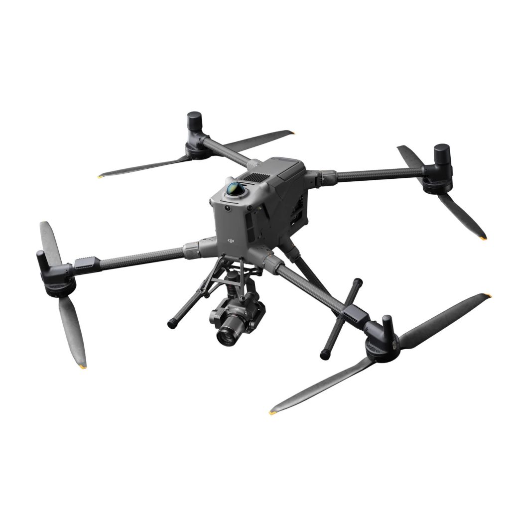
As the successor to the proven Zenmuse L2, this new generation builds on DJI’s reputation for precision mapping and effortless integration with enterprise workflows. Designed for surveying, construction, forestry, and infrastructure inspection, the L3 combines a next-generation laser sensor, dual 100 MP RGB cameras, and a re-engineered IMU.
The result is a LiDAR system that sees further, clearer, and truer than ever before — capturing more data from greater distances with improved accuracy and efficiency.
Key Upgrades at a Glance
- Extended Detection Range: Up to 950 m at 10 % reflectivity (vs 450 m on L2) — ideal for long-range terrain mapping.
- Higher Accuracy: Horizontal 3–5 cm, vertical 2–4 cm — improving on L2’s 5 cm/4 cm performance.
- Enhanced Returns: Up to 16 returns (vs 5 on L2) for exceptional canopy penetration.
- New Scanning Modes: “Star Show” non-repetitive patterns enhance accuracy under vegetation.
- Dual 100 MP RGB Cameras: Adjustable resolution (25–100 MP), 1 s intervals, mechanical shutters rated for 500,000 cycles.
- Smaller Laser Spot: ≈ 41 mm @ 120 m (20 % of L2) — denser point clouds and finer detail.
- Adaptive Point Cloud Rate: Adjust energy per point for environmental conditions.
- Improved IMU: 2.5× performance boost, auto-calibration on power-up, minimal warm-up.
- Extended Laser Rangefinder: 900 m (vs 500 m on L2).
- Optimised for M400 RTK: Single-port installation and anti-drop rails.
- Rugged Design: IP54 rating, operating –25 °C to 55 °C.
- Weight: 1.6 kg (vs 905 g on L2).
Zenmuse L3 vs L2: Specification Comparison
| Feature | Zenmuse L2 | Zenmuse L3 |
|---|---|---|
| LiDAR Detection Range | 450 m @ 50 % / 250 m @ 10 % | Up to 950 m @ 10 % reflectivity |
| Horizontal Accuracy | ± 5 cm @ 150 m | ± 3–5 cm (horizontal) / ± 2–4 cm (vertical) |
| Point Cloud Rate | 240 k–1.2 M pts/s | Adjustable (≈ 350 kHz typical) |
| Returns Per Pulse | Up to 5 | Up to 16 |
| Laser Spot Size (@ 120 m) | ≈ 205 mm | ≈ 41 mm (20 % of L2) |
| LRF Range | 500 m | 900 m |
| IMU Performance | ± 0.025° Roll/Pitch | 2.5× improvement, auto-calibration |
| RGB Camera | 4/3″ CMOS 20 MP | Dual 100 MP (1 s interval, variable GSD) |
| Scanning Modes | Linear | Linear / Star Show / Non-repetitive |
| FOV (LiDAR) | 70° × 75° | 80° × 80° |
| Protection Rating | IP54 | IP54 |
| Operating Temp. | –20 °C to 50 °C | –25 °C to 55 °C |
| Weight | 905 g | 1.6 kg |
| Compatible Platforms | M350 RTK / M300 RTK | M400 RTK only |
| Special Features | Point Cloud Generation in DJI Terra | Real-time Gaussian Splatting + Fusion Reconstruction |
Operational and Industry Benefits
Greater Efficiency and Safety
With a 950 m detection range, the L3 enables surveyors to fly higher and cover more ground per mission — improving productivity while maintaining safe altitudes over uneven or hazardous terrain.
Unmatched Detail and Penetration
Its 16 returns and 20 % smaller spot size deliver denser point clouds and superior penetration through canopy and vegetation — vital for forestry, archaeology, and environmental mapping projects.
Faster Data to Insight
Real-time Gaussian splatting and fusion reconstruction enable multiple outputs — DSM/DEM models, 2D maps, and 3D models — from a single flight capture. Operators can generate digital twins with minimal reprocessing, enhancing efficiency and data consistency.
Simplified Workflows
The new IMU eliminates lengthy calibration routines. Automatic heading, pitch, and roll adjustments make the L3 ready for operation the moment it powers on.
Superior Imaging
Dual 100 MP cameras with adjustable pixel settings and wide FOV (80 × 80°) produce exceptional RGB data for colourised LiDAR and photogrammetry workflows, capturing two datasets in a single flight.
Software Integration: DJI Terra & DJI Modify Updates
The L3 doesn’t just bring hardware innovation — it also maximises new capabilities within DJI Terra and DJI Modify to make data processing faster and smarter.
- Fusion Reconstruction: One-flight capture for multiple deliverables (2D maps, 3D models, Gaussian splatting outputs).
- DSM/DEM Generation & Contours: Produce high-density elevation models directly from L3 data.
- Cluster Reconstruction: DJI Terra now supports multi-computer processing for accelerated data handling on large projects.
- Optimised DJI Modify: Improved point-cloud rendering for large-scale datasets (32 GB RAM recommended) and block-splitting for efficient editing.
- Cross-Section Tool & Classification: New denoising, smoothing, and automatic point classification functions.
- Visible Light Reconstruction: Adds RGB reconstruction tasks using L3 imagery — free for the first year.
These software upgrades ensure that data captured by the L3 translates into faster processing, higher clarity, and more actionable results across all mapping applications.
Final Verdict
The Zenmuse L3 truly embodies DJI’s tagline — see through far and true.
With double the range, triple the returns, and breakthrough software integration, it transforms how professionals collect, process, and visualise geospatial data.By pairing advanced hardware with next-generation DJI Terra and Modify workflows, the L3 empowers surveyors, engineers and inspectors to capture, reconstruct, and deliver results with unmatched precision and speed.
For a demonstration or tailored consultation on integrating the Zenmuse L3 into your workflows, contact Coptrz today.
Download our FREE GVC Training Guide
Learn everything you need to know about becoming a drone pilot with our GVC training guide.
- Get a full course roadmap to understand every step of the journey
- Contains clear answers to all of the frequently asked questions
- Get a transparent and comprehensive breakdown of course costs


