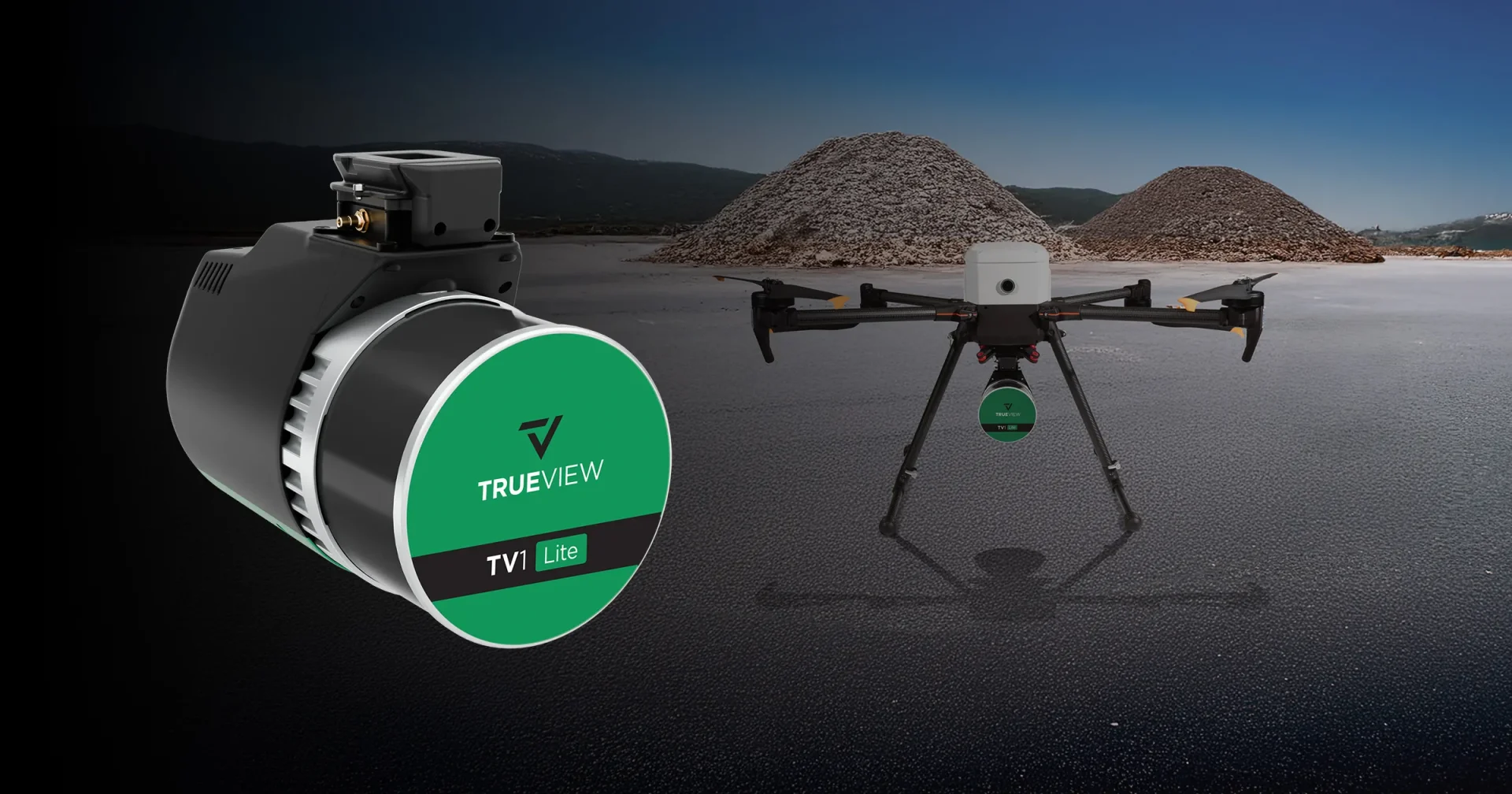
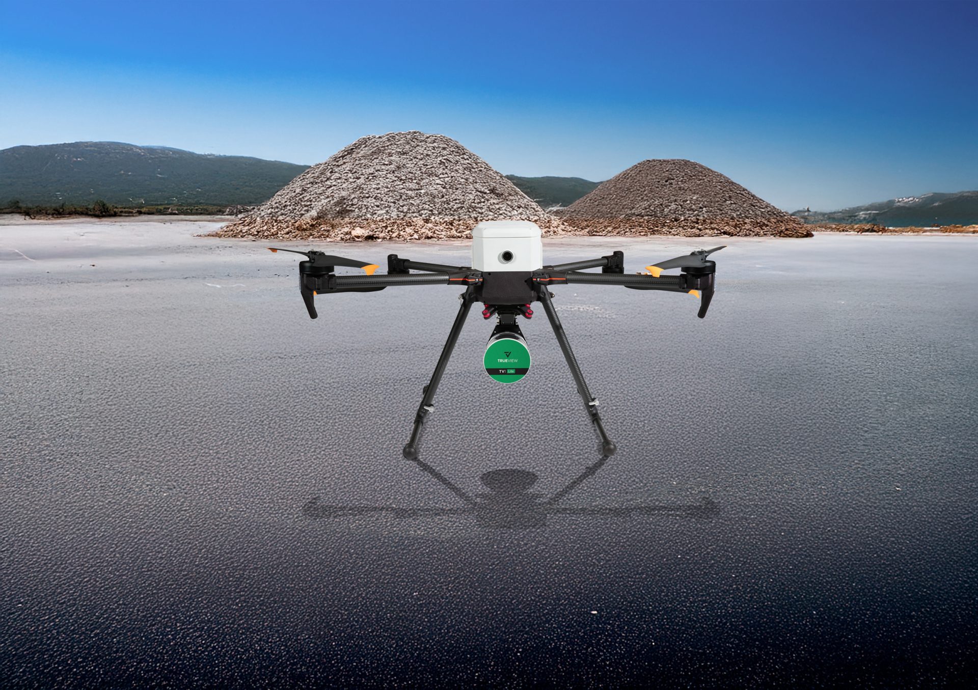
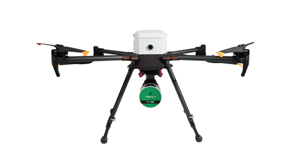
TV1 Lite
£19,025.97 excl. VAT
Global Shutter Imagery
Survey-Grade Accuracy
Ultimate Starter Solution
Professional Grade LiDAR Sensor
Our most budget-friendly LiDAR system, puts survey-grade accuracy within everyone’s reach. Get the TrueView 1 Lite equipped with a proven Hesai 32 Channel Laser Scanner, and with a FLIR 5MP Global Shutter Camera with 80º FOV. The TrueView 1 Lite is the ultimate starter solution—reliable, easy-to-use, and affordable.
32-Channel Laser Scanner
Equipped with a proven Hesai 32-channel laser scanner, the TV1 Lite delivers reliable high-density point clouds for accurate aerial mapping.
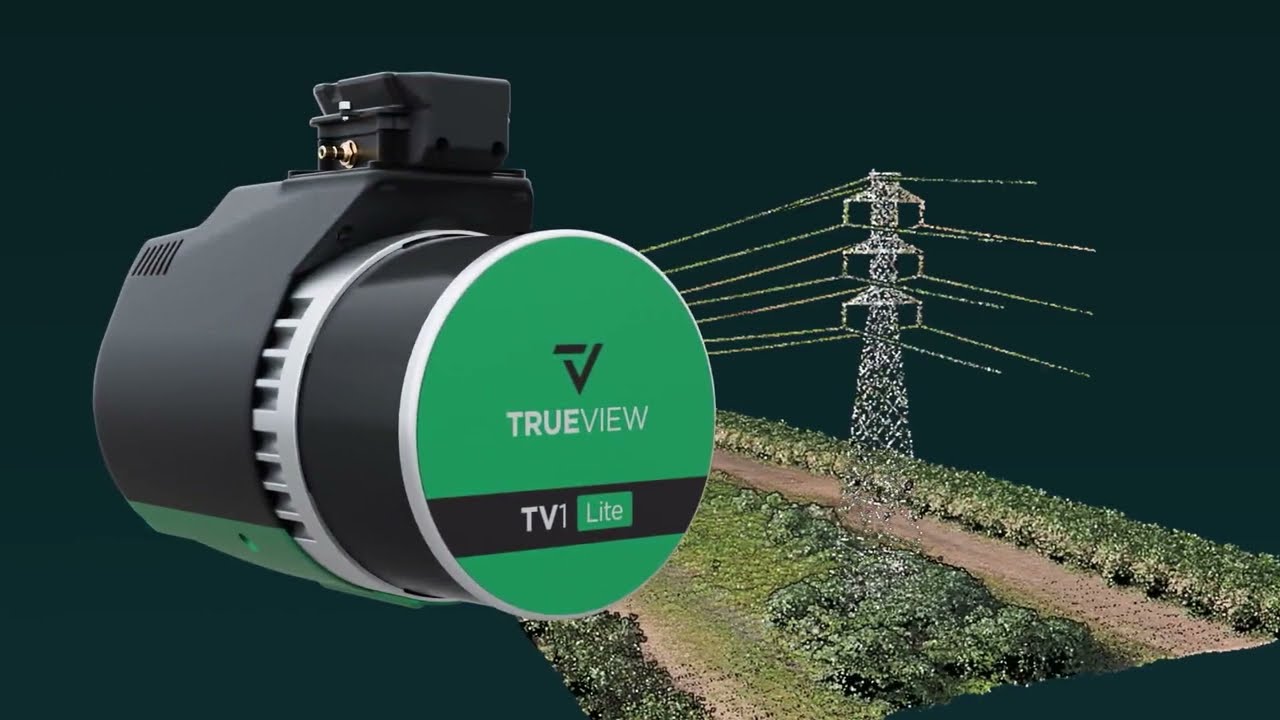
FLIR 5MP Camera
Features a high-performance FLIR Global Shutter camera with an 80º Field of View (FOV) for perfectly synchronized, colorized LiDAR data.
Budget-Friendly LiDAR
Our most accessible system that puts professional-grade accuracy within reach, making it the ultimate starter solution for surveyors and engineers.
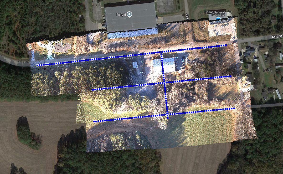
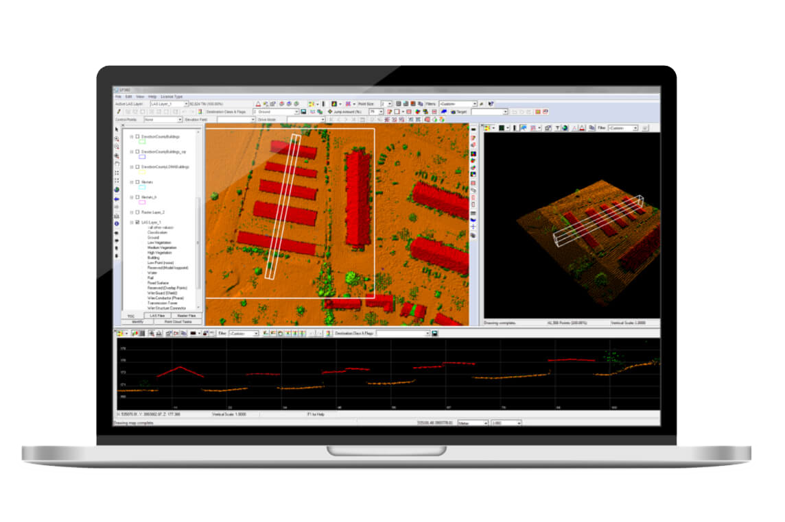
The Integrated TrueView Workflow
Just like the high-end models, the TV1 Lite is fully integrated into the GeoCue ecosystem. This ensures a seamless transition from drone flight to data processing through LP360 software. By utilizing GeoCue’s proven integration and support, users can achieve reliable, repeatable results even with our most affordable starter solution.
Reliable & Easy-to-Use Aerial Mapping
The TrueView 1 Lite is designed to be the ultimate entry point into the world of aerial LiDAR. It combines ease of use with the high-end performance GeoCue is known for, allowing you to capture survey-grade data with minimal setup. Reliable, easy-to-use, and affordable, it is the perfect tool for those looking to expand their mapping capabilities.
Featured Applications
What's included
Accessories Parts
TV1 Lite Sensor
USB Thumbdrive
Sensor Hardcase
Software/Data Management
1 Year of TV1 Lite Annual Processing
Support
1 year of hardware and software support
Drone Platforms
The TrueView 3D Imaging Sensors are designed as a lightweight payload, offering flexible integration with a wide range of drone platforms. Geocue has worked with several drone manufacturers to help provide customers with a complete drone mapping solution. If your preferred brand isn't listed, get in touch with our team to discuss custom integration options!