Nira – Web‑based 3D Model Collaboration Platform
A cloud platform that enables real-time rendering, sharing, inspection, and annotation of massive 3D models and point clouds directly in any browser or device—smartphones, tablets, desktops included
No need for powerful hardware or specialized software—any stakeholder can interact with high-fidelity 3D visuals instantly.
Book your initial consultation call now
Key Capabilities
Nira is built to handle the scale, complexity, and collaboration demands of today’s 3D workflows. From massive model rendering to real-time team interaction, here’s what sets the platform apart.
Massive Model Support
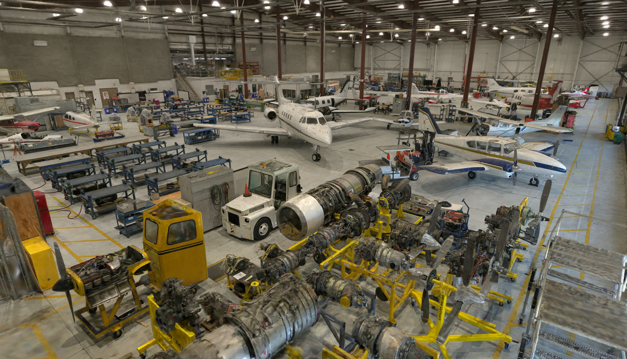
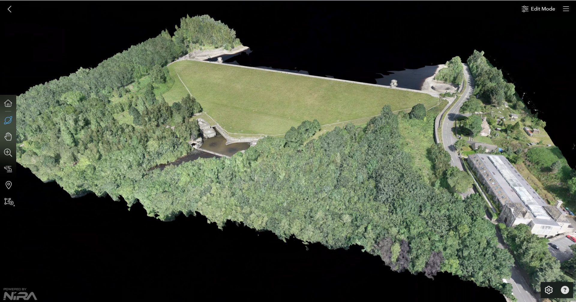
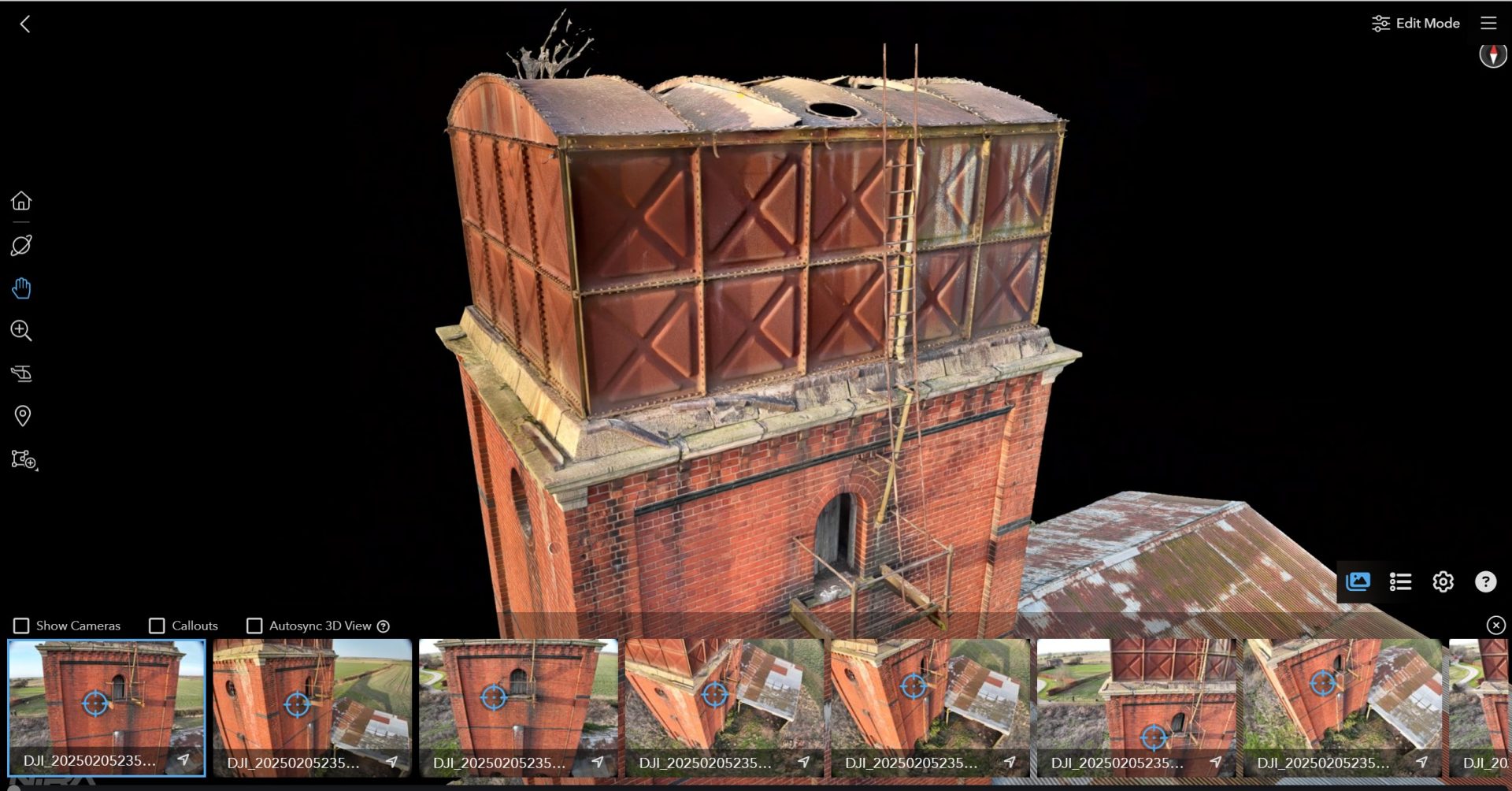
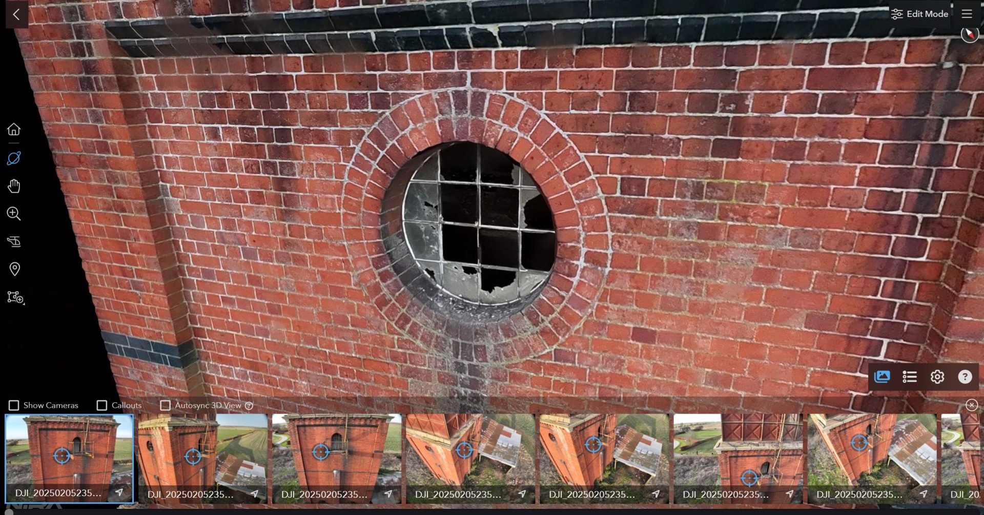
Handles billion‑polygon models, gigapixel textures, and large photo sets without performance degradation
Supports photogrammetry, laser scans, Gaussian splats—all major 3D file formats and tools (RealityCapture, Pix4D, ReCap, etc.)
Interactive Tools
Nira’s interactive toolkit empowers users to extract insights directly from 3D models—enabling precise distance, area, volume, and slope measurements, rich 2D/3D annotations with photo callouts, georeferenced overlays like ortho-mosaics, and seamless branding and embedding for tailored presentation and integration.
Collaboration & Reporting
Nira streamlines collaboration and reporting with secure, browser-based sharing via unique links, real-time team access, role-based privacy controls, and the ability to generate professional PDF inspection reports on demand—no software installation required.
Security & Deployment
Nira is built with a security-first architecture, offering cloud hosting via AWS, Google Cloud, and Cloudflare with optional regional data isolation. Pixel-streaming ensures 3D data can't be downloaded, and enterprise users can opt for on-premise deployment to meet strict compliance or data sovereignty requirements.
MARKET FIT & USE CASES
Drone Surveyors / Inspectors: Share LiDAR and photogrammetry models securely with clients.
AEC & Surveying: Overlay BIM or CAD drawings directly over models for precise collaboration.
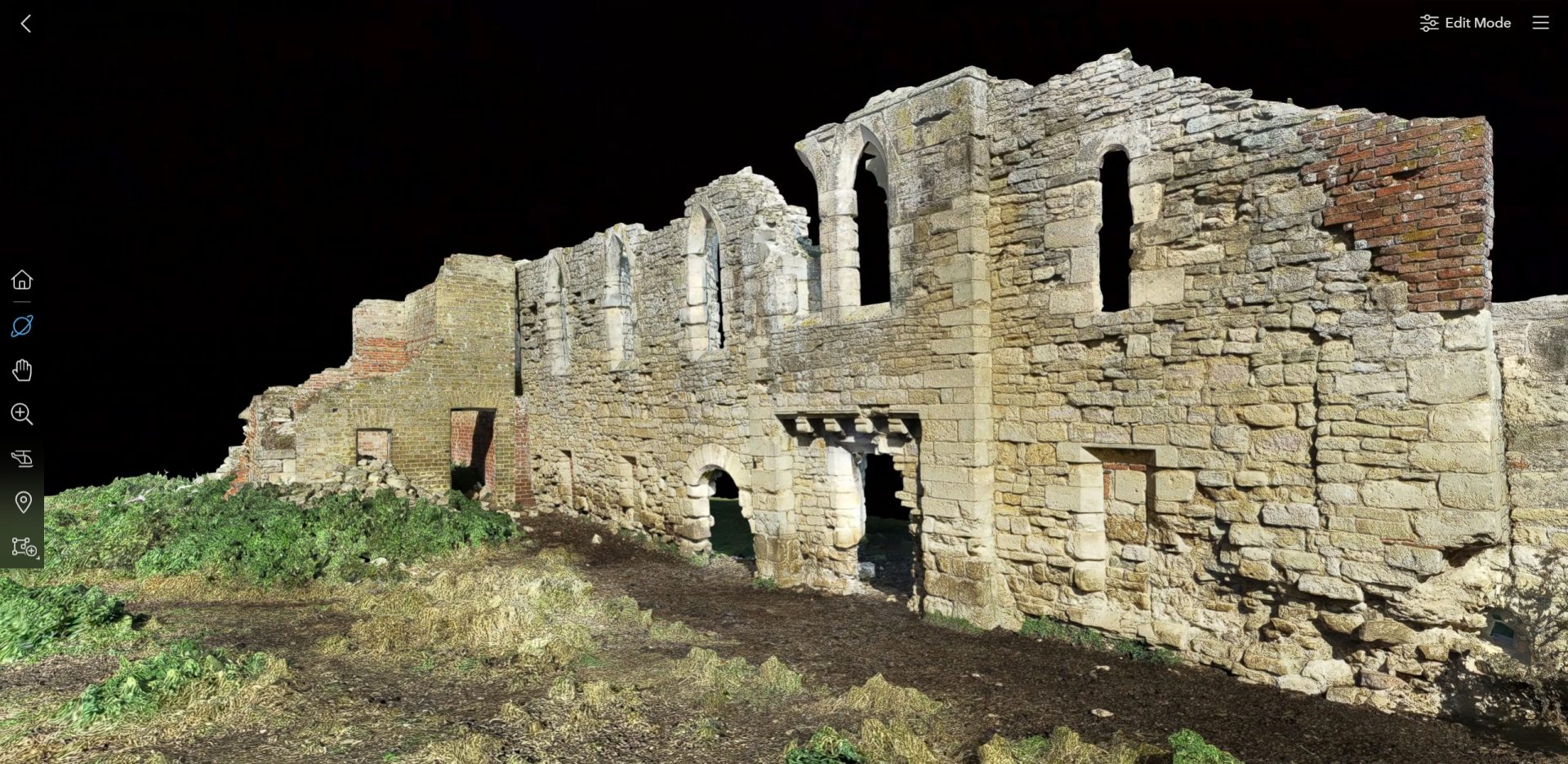
Heritage & Forensics: Access and analyze cultural/historical sites in browser.
Media & Entertainment: Showcase high-fidelity 3D assets to remote stakeholders.
Education & E‑commerce: Interactive 3D product viewing anywhere.
DIFFERENTIATORS
Device-agnostic, no-app viewer
Granular measurement + markup tools
Custom branding + embed support
Scale-on-demand pricing based on asset complexity
Security-first architecture with cloud and on‑prem options
TYPICAL BUYER PERSONAS
Drone & Mapping Specialists looking to deliver easy-to-review outputs
Construction & Engineering PMs needing site transparency and accountability
Photogrammetry/scan service firms wanting to upsell interactive deliverables
Heritage/archaeology stakeholders requiring remote inspection capabilities


