Energy & Renewables
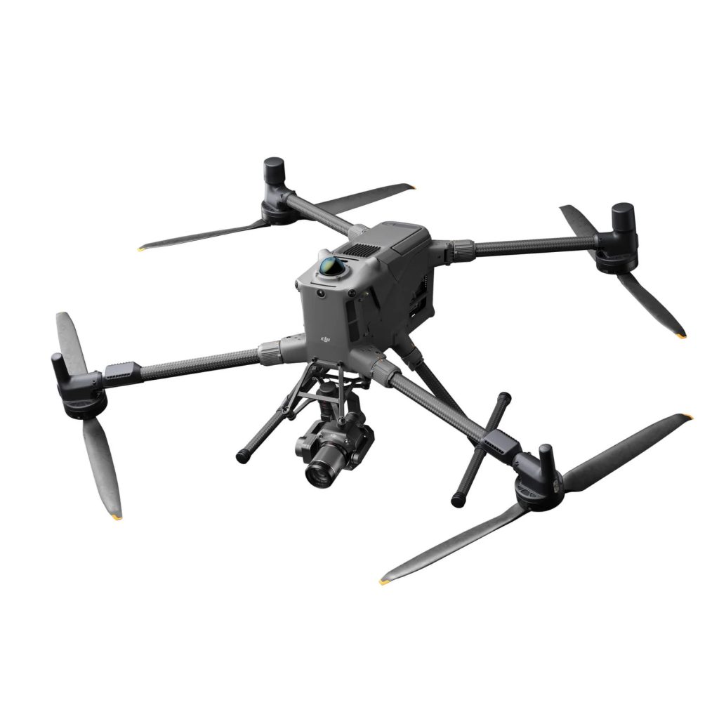
Inspection drones combine their aerial capabilities with high-resolution cameras, precise asset modelling, thermal sensors, and powerful zoom features to significantly improve inspection efficiency and safety.
- Enhanced Efficiency
- Improved Safety
- Cost Savings

Get your FREE guide
Inspection drones combine their aerial capabilities with high-resolution cameras.
Inspections Made Faster, Safer, and Cheaper

Enhanced Efficiency
Conduct more inspections with fewer personnel, cutting labour costs and eliminating the need for hazardous rope access. Drones perform inspections over 50 times faster than traditional methods for solar farms. For wind turbines, drones can monitor performance and detect damage without shutting down the turbines. Similarly, nuclear plants can maintain higher output levels during drone inspections, rather than powering down to below 20% for human access.

Cost Savings
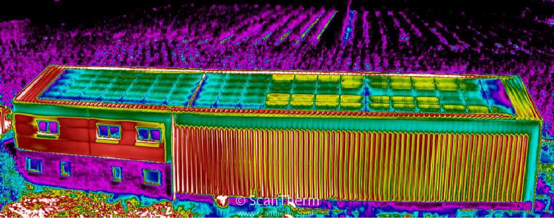
Drones reduce operational expenses by cutting labour and equipment costs while extending asset life spans through proactive maintenance and monitoring. Thermal imaging identifies issues like broken solar panel circuits or heat loss cracks before service interruptions occur. Additionally, keeping turbines spinning and maintaining higher output levels in nuclear plants during inspections minimise loss of production costs.

Improved Safety
Reach and inspect areas that are difficult, dangerous, or impossible for humans to access. This includes tall wind turbines, confined spaces, and high-radiation environments. By using drones, inspectors can avoid the risks associated with climbing, radiation, or working at height.

Data Insights
Drones can stream data in real-time with precise coordinates, enabling immediate analysis and decision-making, especially critical in urgent situations. This capability allows for quick assessments and rapid response. Additionally, drones can process footage into detailed 2D and 3D models, allowing remote experts to participate in the inspection process without needing to be physically present. This also facilitates year-over-year comparisons of assets, enhancing record-keeping and long-term maintenance planning.
Cutting Edge Technology
3D Modelling
Create detailed 3D models from drone flights and analyse your asset from your computer. Pan, rotate, and zoom to explore the model comprehensively.

Shareable Reports
Tag points of interest, add notes and descriptions, and classify them by criticality from your computer. Measure the size of cracks and flaws using measurement tools on drone software for precise calculations.

Share Formatted Reports
Export your analysis and points of interest into a PDF or Word document. Easily share these reports within your organisation or with clients, ensuring everyone has access to detailed, formatted data.

Traditional Methods
Traditional energy inspections are time-consuming, costly, and risky, involving manual labour and hazardous conditions, often leading to incomplete results and operational downtime. Drones transform this process by reducing costs, enhancing safety, providing accurate data, and minimising downtime by allowing continuous operation during inspections
Wind Turbine Inspections
Drones significantly reduce inspection time per wind turbine to 15-30 minutes, cutting man-hours and turbine downtime for maintenance checks by over 75%. Traditional methods require technicians to physically climb into each of the three blades, but they can only inspect up to 28 inside, leaving over half of the internal structure unchecked. Drones can inspect the entire blade, both internally and externally, ensuring a more thorough and efficient assessment in a fraction of the time.


Solar Panel Inspections
Drones cover ground 86% faster than inspections conducted on foot. Equipped with thermal imaging, they can quickly identify malfunctioning panels and areas of heat loss, improving maintenance efficiency and reducing energy production losses. This rapid, comprehensive inspection capability enhances the overall performance and reliability of solar installations.
Nuclear Plant Inspections
Using drones in nuclear plants can avoid up to 10% of the annual radiation dose for personnel, significantly enhancing safety. Traditional inspection methods require reducing the plant's output to 20% to make the inspection feasible for humans, leading to substantial operational inefficiencies. Drones allow for continuous operation at higher output levels while performing thorough inspections, maintaining productivity, and ensuring safety.

FAQs
Drones can capture high-resolution images, videos, thermal data, LiDAR scans, and topographical data, providing detailed and accurate information for planning, monitoring, and inspections.
Drones perform tasks that would otherwise require workers to enter hazardous areas, reducing the risk of accidents and injuries. They eliminate the need for manual inspections at heights or in dangerous environments.
Drones reduce labour costs, minimise the need for expensive equipment like scaffolding and cranes, and shorten survey and inspection times. This leads to significant savings in operational expenses and project budgets.
Drones equipped with advanced sensors like LiDAR and high-resolution cameras provide highly accurate measurements, essential for detailed surveys, volume calculations, and structural assessments.
Yes, drones can capture real-time images and data, allowing project managers to monitor progress, identify delays, assess work quality, and make informed decisions to keep projects on schedule.
Software such as DJI Terra, Pix4D, and similar platforms are used to process drone data. These tools generate orthomosaics, 3D models, and volumetric calculations, and facilitate data analysis and reporting.
Drones create accurate site surveys and maps using photogrammetry and LiDAR, generating detailed topographical maps and Digital Elevation Models (DEMs). This data aids in the design and layout of construction projects.
Drones capture aerial images of stockpiles, and software like DJI Terra processes this data to generate precise volumetric measurements. The drag-and-click interface allows for easy area selection and calculation.
Yes, drone data and reports can be exported into formats like PDF and Word documents, making it easy to share with project stakeholders, clients, and team members for effective communication and collaboration.
Drones provide faster, more accurate, and safer data collection. They reduce the need for extensive manpower and equipment, minimise disruptions to ongoing work, and offer detailed, real-time insights that enhance project planning and execution.
Book your FREE online consultation
Experience the unique advantage of our 360° drone solutions exclusively at Coptrz. With a network of over 20 partnerships with top-tier drone technology manufacturers, we're uniquely positioned to provide a tailored solution that you won't find elsewhere.
Impartial Expertise for
Commercial Drone Integration
End-to-end Drone Solutions
Complete drone solutions, including hardware, software, pilot training, repairs and support.
Impartial Advice
Industry experts work closely with you to find the best solution for your organisation.
UK's Widest Drone Selection
We're not limited to one brand, we offer the UK's widest range of world-renowned suppliers.


