Free guide · 2026 edition
Turn two weeks of surveying into two days
While your team is still walking the site with a total station, your competitors are flying it, processing it and pricing the job. This guide shows exactly how UK construction and survey teams cut site survey time by up to 80%: the kit, the costs, the compliance and the numbers behind it.
- Trusted by Kier, Jacobs, RSK, EDF, Veolia, Texo and RPS
- Most teams see payback within one to three projects
- CAA-approved training provider, rated 4.9 from 1,000+ reviews

Get your free guide
34 pages. No cost, no credit card.
Downloads in about 30 seconds.
Working with the UK’s largest contractors and consultancies







611 reviews
426 reviews

professionals trained and equipped

How quickly can we see ROI?
What is manual surveying costing you a year?
Three numbers you already know. Move the sliders and see what the old way is worth.
Indicative only. Based on the 80% time reduction reported by teams in the guide, with a minimum of one day in the air plus processing.
you’d get back
Before and after
See the transformation
Real results from construction professionals who made the switch. The work doesn’t get rushed, it gets replaced.
On foot
In the air
Deliver projects eight days faster
Turn weeks of fieldwork into days of precision mapping, and hand the time back to the programme.
Reduce costly rework with ±2cm precision
Achieve centimetre-level accuracy in hard-to-reach areas, instead of ±30cm from traditional methods.
Eliminate high-risk site access
Zero boots on the ground in dangerous areas, while capturing better data than a walked survey.
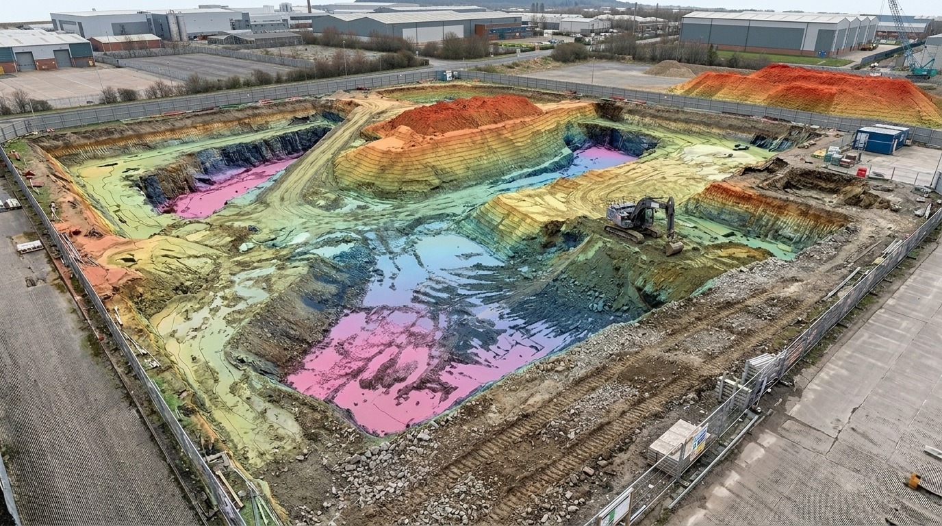
The deliverable
What lands in your inbox
Not a photo. A measurable, survey-grade model of the whole site.
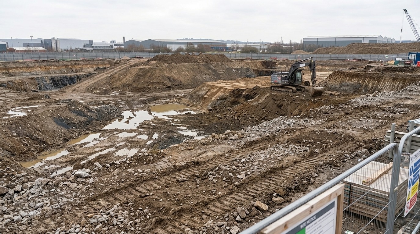 Site photo
Survey output
Site photo
Survey output
Illustrative example showing typical drone survey data
Who it’s for
Perfect for…
Site managers
Protecting the programme
Land surveyors
Accuracy and deliverables
Civil engineers
Design-stage survey data
Project planners
Sequencing and progress capture
Questions
Questions? We’ve got answers.
The five things people ask before they download. The guide goes into each properly.
“It won’t be accurate enough for setting out.”
On its own, no. With RTK and ground control checked against known points, you’re at ±2cm, which is tighter than most topographic surveys are contractually required to hit. The guide covers where drone data is and isn’t the right tool.
“Do I need a drone licence to get started?”
There’s no single “drone licence” in the UK. You’ll need an Operator ID, a Flyer ID and, in most commercial cases, an A2 CofC or an RPC-L1. Most teams qualify one or two people and keep it in-house, and it’s days rather than months.
“What if I don’t have a big budget for drones?”
The guide covers everything from entry-level setups to full professional systems, with recommendations at each level. Most companies see positive ROI within one to three projects, whichever end of the range they start at.
“Our client won’t accept drone data.”
They almost certainly already do. Output comes as DWG, LandXML, point cloud or orthomosaic, the same formats your CAD and design teams work in now.
“Will this work on small sites under two acres?”
Yes. Some of the largest time savings come from small, awkward sites, because that’s where traditional survey work is slowest. Tight spaces and difficult terrain are the argument for it, not against.
How it works
Getting started is easy
Download the free guide
Get insights and equipment recommendations tailored to your industry.
Speak to a drone expert
Book a 15-minute call to discuss your project. No obligation.
Deploy drones with confidence
Training, hardware and software all in one place.
In their words
What teams say after the switch
£750,000We’ve been working with Coptrz for a number of years. The team initially helped us onboard drone technology, where we saved over £750,000 in our first year. Since then, our experience with Coptrz has been excellent.
Duncan Turner
“Coptrz gave us absolute expert guidance on both hardware and the training when we were onboarding drone technology. We’ve had seven pilots trained up, and it was an absolutely fantastic service.
Nick Canham
“I’ve been working with Coptrz for a few years now and have always found them to offer a professional and thorough service.
Emily B.
Credentials
Regulated, audited and accountable
Anyone can sell you a drone. Training and compliance are where it matters who you buy from.
CAA Recognised Assessment Entity
Authorised by the Civil Aviation Authority to deliver accredited drone training and examinations.

Ofqual regulated training
Government-regulated qualifications, not in-house certificates.
SORA authorised
Approved to carry out Specific Operations Risk Assessments for complex operations.

TQUK recognised centre
An officially recognised centre for Training Qualifications UK.

ISO 9001 certified
Independently audited quality management systems.

ISO 14001 certified
Environmental management to the international standard.

Cyber Essentials Plus
Government-backed certification covering how your data is handled.

ELCAS registered
Approved to provide funded training for Armed Forces personnel.

FCA registered
Authorised and regulated for consumer finance, so kit can be spread over time.

The Equality Register member
Committed to equality, diversity and inclusive practice.

Inside the guide
Everything you need before you commit a penny
Written for teams weighing up whether drone surveying stacks up on their sites, not for people who already fly.
How drones cut surveying time by up to 80%
Where the hours actually go, and which ones disappear.
Real examples of drone success on UK sites
Programme savings and rework avoided, with the figures.
Equipment recommendations by budget
What to buy at each level, and what you can safely skip.
CAA compliance advice for 2026
What you legally need before your first commercial flight.
How to choose the right training path
A2 CofC or RPC-L1, and which your operations require.
A full ROI calculation
The long version of the sliders further up this page.
Is it really free? What’s the catch?
Will I get hounded by sales?
Do we need a licence before we can start?
Free download
Get your competitive edge before your rivals do
While your competitors are still walking sites, you could be delivering surveys 80% faster. Download the guide and start your transformation today.
- 30-second download, straight to your inbox
- 34 pages of kit, cost and compliance detail
- ROI typically visible within the first project