

Asset Integrity & Inspection
Inspection drones combine their aerial advantage with high-resolution cameras, accurate asset modelling, thermal sensors, and powerful zoom capabilities to enhance inspection efficiency and safety.
- Enhanced Efficiency
- Improved Safety
- Cost Savings Up To 90%
Get your FREE guide
Inspection drones combine their aerial advantage with high-resolution cameras.
Inspections Made Faster,
Safer, and Cheaper

Enhanced Efficiency
Conduct more inspections with fewer personnel, reducing labour costs and the time required to erect scaffolding or complete risk assessments for hazardous rope access. Drones can often inspect assets without necessitating a complete shutdown; for instance, wind turbines can continue spinning during inspections.

Cost Savings
Drones reduce operational expenses by cutting labour and costly equipment costs while extending the lifespan of valuable assets through proactive maintenance and monitoring. With thermal, spot potential problems, such as broken solar panels circuits or cracks causing heat loss, before these issues interrupt service.

Improved Safety
Using drones mitigates the risk of falls, unsafe or unknown conditions, high voltage power lines, and other dangerous situations. They can access hazardous or hard-to-reach areas, while the human worker operates the drone from a safe distance.

Data Collection
Capture high-quality aerial data to generate accurate 2D and 3D models, building information models, aerial maps, land surveys, and more. Data such as thermal imaging and LiDAR detects heat variations, leaks, insulation defects, electrical problems, and provides precise spatial eliminating the need for manual measurements.
Cutting Edge Technology
3D Modelling
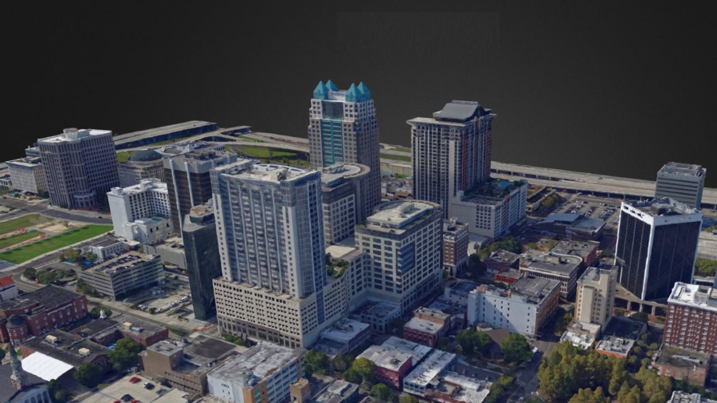
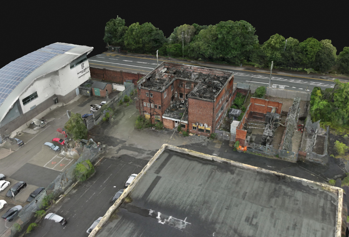
Create detailed 3D models from drone flights and analyse your asset from your computer. Pan, rotate, and zoom to explore the model comprehensively.

Analyse and Annotate
Tag points of interest, add notes and descriptions, and classify them by criticality via your computer. Acquire dimensions using measurement tools for precise volume and mass, and dimension calculations.
Share Formatted Reports
Export your analysis and points of interest into a PDF or Word document. Easily share these reports within your organisation or with clients, ensuring everyone has access to detailed, formatted data.
Infrastructure Inspection
Using drones equipped with high-resolution cameras and thermal sensors can inspect infrastructure such as bridges, buildings, and pipelines. These inspections identify structural issues, heat loss, and other anomalies, enabling timely maintenance and repairs. Additionally, drones can create digital twins of assets, allowing for detailed inspections in the office. These digital twins can be shared across teams and compared year-over-year, enhancing long-term asset management.


Confined Space Inspections
Specialised drones are designed to navigate confined spaces like storage tanks, boilers, and pipelines. These drones provide detailed visual data, eliminating the need for manual inspections in dangerous or inaccessible areas. They can navigate dark and dusty environments that contain dangerous gases or chemicals, and even nuclear facilities with high radiation levels.
Power Line and Wind Turbine Inspections
Drones identify faults, corrosion, and wear to maintain the reliability and efficiency of power lines and wind turbines. LiDAR point clouds and 3D maps measure distances between vegetation and power lines, enabling predictive maintenance. Wind turbine inspections with drones are up to 7x faster and eliminate the need for climbing and rope access, enhancing safety and efficiency.


Oil and Gas Industry
Inspect rigs, flare stacks, and pipelines, providing real-time data on asset integrity to prevent leaks and ensure safety compliance. Deploying drones from a safe area eliminates direct contact with toxic chemicals, reducing risks to workers. Benefits include enhanced leak detection, reduced maintenance costs, improved emergency response, and more accurate data collection.
Building and Roof Inspections
Drones are a safe and efficient method to inspect building facades and roofs. High-resolution imagery and thermal scanning detect issues like water ingress, insulation defects, and structural damage. A drone can be launched in under 55 seconds to quickly check a roof, compared to the hours or even days needed to set up scaffolding.

FAQs
Drones can perform various types of inspections, including infrastructure inspections (bridges, buildings, pipelines), power line and wind turbine inspections, confined space inspections (tanks, vessels, sewers), and building and roof inspections.
Drones improve safety by eliminating the need for human entry into hazardous or hard-to-reach areas. This reduces the risk of falls, exposure to toxic chemicals, high voltage power lines, and other dangerous situations.
Drones can capture high-resolution visual imagery, thermal imaging for detecting heat variations, LiDAR data for precise topographical mapping, and multispectral and hyperspectral imaging for environmental analysis.
Drones enhance efficiency by performing inspections faster than traditional methods, reducing downtime, and providing real-time data. They can quickly cover large areas and generate detailed reports, saving time and resources.
Yes, specialised drones are designed to navigate confined spaces such as tanks, vessels, and sewers. They provide detailed visual data without the need for human entry, improving safety and efficiency.
Using drones reduces operational expenses by cutting labour costs and the need for expensive equipment like scaffolding or helicopters. Drones also help in extending the lifespan of assets through proactive maintenance.
The data collected by drones is highly accurate, especially when using advanced sensors like LiDAR and thermal imaging. This accuracy is crucial for detailed inspections, mapping, and analysis.
Yes, drones are highly effective for inspecting wind turbines. They can inspect both the inside and outside of turbines, identifying faults, corrosion, and wear without the need for climbing ladders or using rope access.
Various software platforms are used to analyse drone data, including DJI Terra, Inspector 4.0, Pix4DInspect, Trendspek, and other industry-specific tools. These platforms help process data, create 3D models, and generate detailed reports.
Inspection reports can be generated using the data captured by drones and analysed through specialised software. These reports can be exported into formats like PDF or Word documents and easily shared within an organisation or with clients.
Book your FREE online consultation
Experience the unique advantage of our 360° drone solutions exclusively at Coptrz. With a network of over 20 partnerships with top-tier drone technology manufacturers, we're uniquely positioned to provide a tailored solution that you won't find elsewhere.
