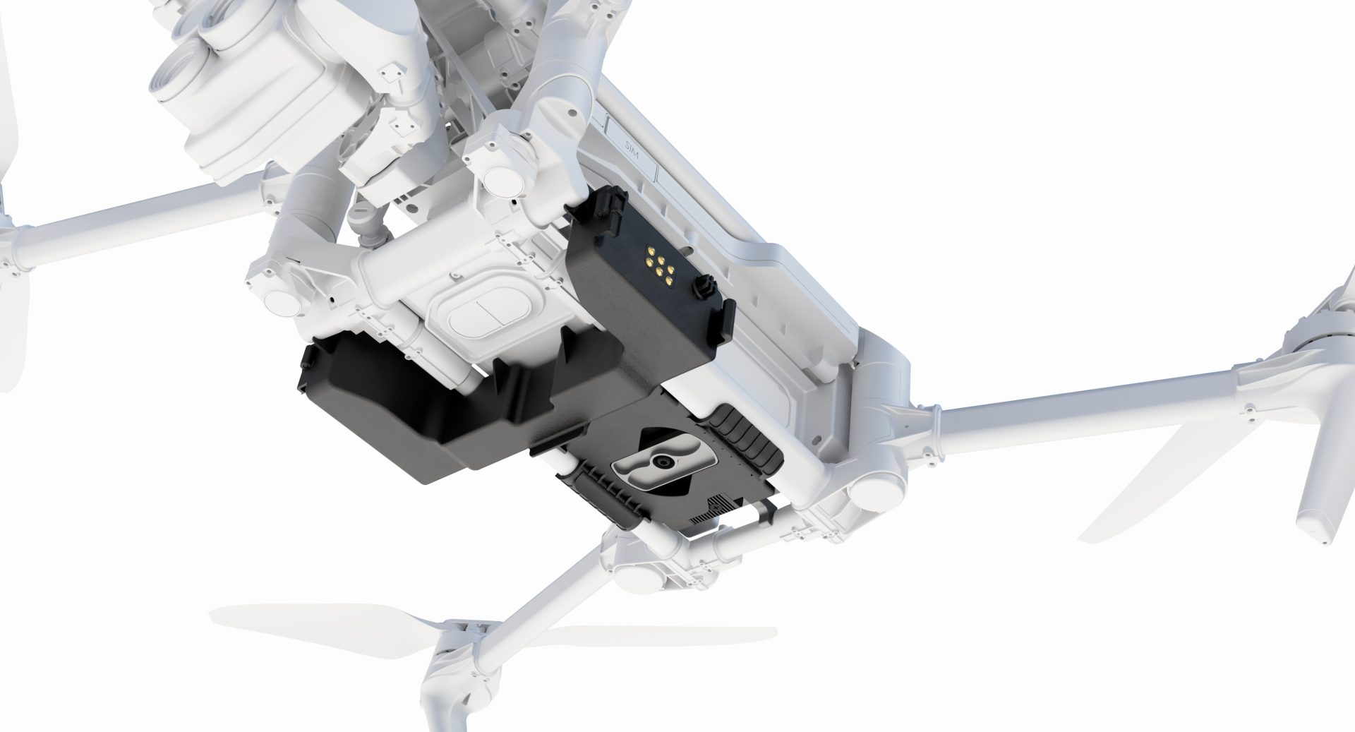
Flyability Elios 3 Surveying Payload
Advanced SLAM Algorithm
Compact and Robust Design
High-Resolution LiDAR Sensor
Revolutionising Surveying in Inaccessible Areas
Safely create centimetre-accurate scans of hard-to-reach areas with the Elios 3 Surveying Payload. This innovative payload transforms the Elios 3 into a mobile scanner, providing high-resolution 3D data capture in challenging environments.

High-Resolution LiDAR Sensor
The Elios 3 features the Ouster OS0-128 Rev 7 LiDAR sensor, providing high-resolution scans with centimetre precision. This sensor is essential for creating accurate 3D maps and digital twins of complex environments.

Advanced SLAM Algorithm
Powered by the world-leading FARO Connect SLAM algorithm, the Elios 3 ensures high accuracy and precise data capture in various conditions. The algorithm enhances mapping capabilities in cylindrical and symmetrical environments.

Compact and Robust Design
Designed to navigate through openings as small as 50x50cm, the Elios 3 can operate in the most complex environments. Its fixed cage protects the hardware, while its advanced flight controller maintains stability after collisions.


Efficient Data Collection
The Elios 3 Surveying Payload maximises efficiency by reducing the time required for data collection. It can cover a 300-metre tunnel in a single flight, making it significantly faster than traditional methods.

Real-Time Mapping
Real-Time Mapping capabilities allow for immediate field verification, improving efficiency and decision-making during survey operations.

Stunning Point Clouds
Capture rich, detailed point clouds of complex indoor environments, enabling precise mapping and analysis. The Elios 3 ensures comprehensive visual representations for various industrial applications.

Scanning Beyond Safe Access
The Elios 3's small form factor and robust design enable it to navigate through hazardous areas, capturing high-resolution scans where other technologies cannot reach.

Environmental Durability
The Elios 3 Surveying Payload is built to withstand harsh conditions, ensuring reliable performance in various environments. Its durable design ensures consistent operation across diverse scenarios.
Buy Flyability Elios 3 Surveying Payload
FAQs
The Elios 3 is designed for use in hazardous, confined, and complex environments, such as mines, sewers, and industrial plants.
The LiDAR sensor provides centimetre-accurate scans, essential for creating precise 3D maps and digital twins.
The Elios 3 can navigate through openings as small as 50x50cm.
Industries such as mining, oil & gas, power generation, infrastructure inspection, and disaster response benefit from the Elios 3.
The FARO Connect SLAM algorithm ensures high accuracy and precise data capture, even in cylindrical and symmetrical environments.
The exact flight duration may vary, but the Elios 3 is optimised for efficient data collection during each flight.
The Elios 3 features a fixed cage and an advanced flight controller that maintains stability and protects the hardware after collisions.
Yes, the Elios 3 offers real-time mapping capabilities, allowing for immediate field verification and improved decision-making.