Mapping
-

AgEagle MicaSense RedEdge-P Dual
£13,453.63 Excl. VATExperience enhanced satellite data comparison with the RedEdge-P dual sensor, featuring two cameras and 10 bands.
This high-resolution multispectral and RGB composite drone sensor excels in plant classification, weed identification, environmental research, and water body vegetation analysis. It's a comprehensive dual solution, combining the proven RedEdge-P with the innovative RedEdge-P blue camera.
-

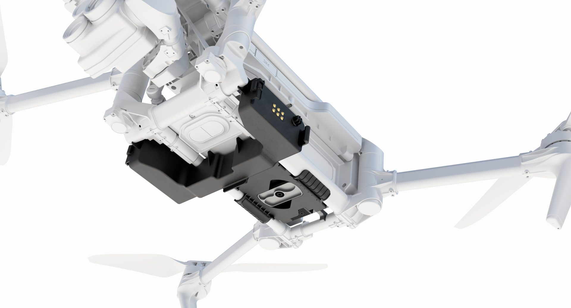
DJI Mavic 3 Multispectral Agriculture Package
£7,321.00 Excl. VATThe DJI Mavic 3 Multispectral Agriculture package provides you with all the tools needed to upscale your farming and land management practices. Including, but not limited to, the DJI Mini 4 training drone, 2x GVC licenses, and Pix4Dfields, you'll be well equipped to get your operations off the ground and elevating to new heights.
-

DJI Modify
Price range: £225.00 through £3,109.00 Excl. VATDJI Terra is a software solution specialising in 3D model reconstruction, with photogrammetry at its heart. It facilitates precise and swift 2D and 3D reconstruction using visible light data, as well as data processing via DJI LiDAR technology. Seamlessly compatible with DJI Enterprise drones and their payloads, DJI Terra integrates to form a comprehensive application system. This system serves a variety of sectors, including land surveying, mapping, power transmission, emergency response, construction, transport, and agriculture.
-

DJI Terra
£917.50 Excl. VATDJI Terra is a software solution specialising in 3D model reconstruction, with photogrammetry at its heart. It facilitates precise and swift 2D and 3D reconstruction using visible light data, as well as data processing via DJI LiDAR technology. Seamlessly compatible with DJI Enterprise drones and their payloads, DJI Terra integrates to form a comprehensive application system. This system serves a variety of sectors, including land surveying, mapping, power transmission, emergency response, construction, transport, and agriculture.
-
Flyability Asset Management Software
Building on previous asset maps captured with Elios 3, the Asset Management extension automatically merges newly acquired data with existing results in real time, offering a holistic view of your asset data in a single frame of reference
-

Pix4Dcloud
Price range: £0.00 through £2,646.02 Excl. VATElevate your project management with Pix4Dcloud, a powerful online platform that transforms aerial imagery into custom maps and 3D models for in-depth analysis. Ideal for professionals in construction, agriculture, real estate, and more, Pix4Dcloud offers a suite of tools for tracking progress, measuring distances, and analysing changes over time.
-
Pix4Dfields
Price range: £0.00 through £3,097.35 Excl. VATPix4DFields stands out as a transformative software, harnessing the power of technology and agronomic expertise.
-
Pix4Dmatic
Price range: £0.00 through £5,831.86 Excl. VATTransform your large-scale mapping operations with Pix4Dmatic, the next-generation photogrammetry software designed for efficiency and accuracy. Built to handle the vast data sets generated by modern aerial imagery, Pix4Dmatic ensures that professionals can leverage the full potential of their hardware, turning high-resolution images into precise, georeferenced 2D maps and 3D models.
-
Pix4Dreact
Price range: £0.00 through £699.12 Excl. VAT -
Pix4Dsurvey
Price range: £0.00 through £3,973.45 Excl. VATUnlock the full potential of your surveying and mapping projects with Pix4Dsurvey. Designed to bridge the gap between drone photogrammetry and traditional surveying, this powerful software transforms your point cloud data into actionable insights and detailed digital maps.
-
Trendspek
Trendspek is a revolutionary 3D software, transforming digital inspections and asset management with unparalleled precision and interactive reporting. Trendspek connects asset owners, operators and engineers, through a simple to use online platform. Form opinions, make decisions and reach outcomes faster by collaborating on a single source of truth.
- Plan induction training
- Locate and identify defects and hazards
- Track defects and build maintenance plans
- Grant access to contractors and tenderers to accurately plan their scope of works
- Design shutdown plans including logistics and site access mapping
-
Ultimate Pix4DMapper Bundle
Price range: £0.00 through £5,831.86 Excl. VATTransform your large-scale mapping operations with Pix4Dmatic, the next-generation photogrammetry software designed for efficiency and accuracy. Built to handle the vast data sets generated by modern aerial imagery, Pix4Dmatic ensures that professionals can leverage the full potential of their hardware, turning high-resolution images into precise, georeferenced 2D maps and 3D models.