Why You Should Take The Commercial UAV Surveying Course
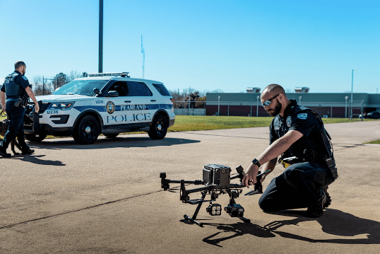
The drone industry is a growing business. According to a recent RICS study, the list of approved commercial operators using drones in the UK jumped from 359 to 5,000 between 2014 – 2019. With this growth, various businesses have seen innovations, especially within the surveying industry.
Surveying refers to the examination and recording of an area’s features to create a detailed description, map, or plan of it. Using drones to map spaces in an aerial survey can help improve the accuracy of this data when compared to ground-based or satellite methods. As James Pick, UAV Strategist at Coptrz, highlighted in one of Coptrz’ exclusive webinar’s:
“The more traditional survey businesses understand the importance of collecting highly accurate data. But when transferring it into a photogrammetric or data collected via drone there is a knowledge gap in the industry.”
That’s why it’s time to upgrade your surveying techniques and move into the twenty-first century with drone mapping technology.
To help fill this knowledge gap Coptrz has created the Commercial UAV Surveying course.
In this article, we’re going to look at:
- What are UAV surveys and drone mapping?
- What software is best for drone surveys?
- How accurate are drone surveys?
- How can the Commercial UAV Surveying course help?
- What are the benefits of the course?
In the process, we’ll hear from the course creator James Dunthorne who curated the Commercial UAV Surveying course.
If you have any further questions about the program, feel free to contact us Contact Us to talk to a member of our expert team.
What is drone mapping?
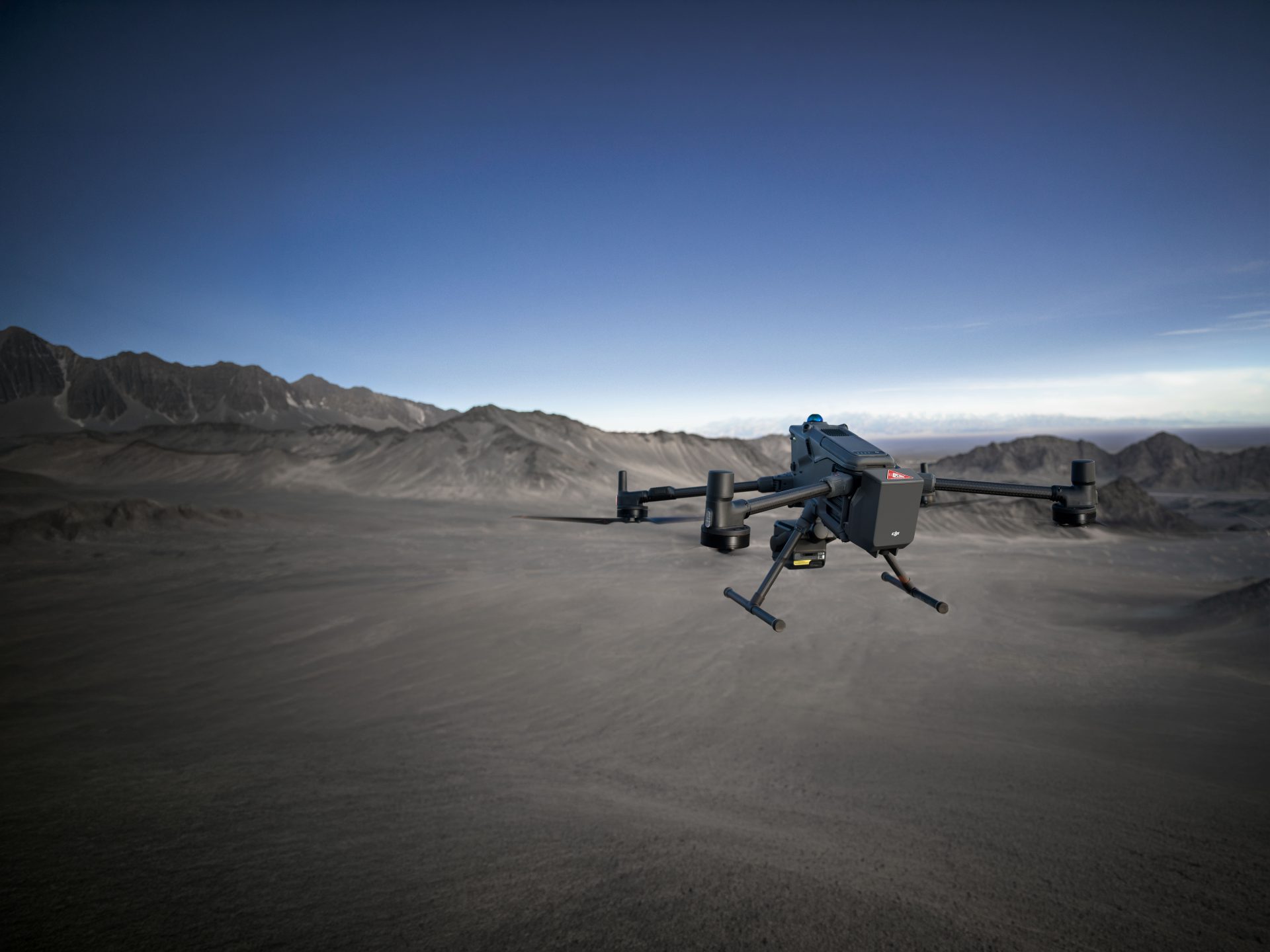
Drone mapping refers to a mapping technique using photogrammetry, the science of taking measurements from photographs. The drones are unmanned aerial vehicles or UAVs which use multispectral or RGB cameras, LIDAR payloads or downward-facing sensors to create a map, 3D model or set of measurement data.
There are lots of benefits to using drones over traditional surveying methods. Drones are up to five times faster than land-based methods, easily transported/deployed and well adapted for use on terrain that would be otherwise difficult to survey by foot.

What software is best for drone surveys?
Transforming your drone’s data into an understandable map or data set requires software. There is plenty of photogrammetry-dedicated software on the market, but two of the most popular include:
- Pix4D MapperPix4D Mapper creates 3D point clouds, digital surface models, and geo-referenced orthomosaics. It can also process volume calculations and display contour lines.
- Global Mapper is a spatial data management and mapping tool and is excellent for LiDAR enabled drones.
However, the needs of your business determine the software you’ll need.
James Pick highlights:
“Different software does different and better things compared to other software, especially for when we’re looking at different sensors and particular drones for certain applications. I think that looking towards the future in terms of drone use, I can see businesses not having one drone for one job but different drones and a whole range of software to process that data.”
If you have any queries on the best kind of software for your drone mapping or business needs, don’t hesitate to get in touch with our team today.
How accurate are drone surveys?
The more data points, the better your accuracy in mapping. With a drone, surveyors can capture more topographic data and produce more accurate volume measurements. Crucially, these measurements are more precise than ground-based methods. Using drone surveys provides a ‘very high accuracy, right the way down to 5mm’.

How can the Commercial UAV Surveying course help?
Learning and research around drones use continues to grow as fast as the industry itself, with a recent report revealing £78 million in research grants for drone-related projects over the last six years. With all this new knowledge, Coptrz has launched a new course on Commercial UAV Surveying to bring expertise to your screens. Course creator, James Dunthorne draws on his experience of integrating drone technology in a large number of companies. He says:
“Over the last 6 years, I’ve been optimising the photogrammetry process and trying to achieve the highest accuracies. Having built this knowledge, I wanted to share it with the industry and help other people to do the same.”
The course covers 12 modules over ten hours comprising of short videos, practical survey demonstrations, and interactive content. The course begins with an introduction to drone surveying and moves through the digital camera components you’ll need to know about, as well as drone mapping and photogrammetry. Once you know how to control a survey, the course covers how to capture, process and extract survey-grade data, and achieve accuracy through quality assurance and implementation. With the other modules included, this creates a one-stop-shop for your commercial UAV surveying needs.
Talking about the course Coptrz Co-founder, Steve Coulson, said:
“We recognised organisations and drone service providers needed a training course that bridged the gap between acquiring the hardware and leveraging the technology to its full potential.”
What are the benefits of the course?
Whether you’re a beginner in the drone industry or an experienced professional looking to integrate drones into your business, this drone training course has something for you. Ideal for people working in a survey, geotechnical or civil engineering organisation, the course ensures you have the essential knowledge and capability to understand photogrammetric theories and capture high-quality data.
The online format is ideal for working around your busy schedule too. The online platform means it’s available 24/7 on multiple devices and revisits it any time. “The great thing about these courses being online is that you can do it at your own pace”, says James Dunthorne. “Over a space of two or three weeks, you could get it done in your lunch period.”
To book onto the Survey Course, click Commercial Uav Surveying Course.
If you’re interested in the idea of drone mapping and UAV surveys to optimise your business, reach out to our expert advisers at Coptrz today. We offer a wide range of drone courses from beginners training to specialised programmes like this one, covering a broad range of industries. You can contact us Contact Us to get started or learn more about our training academy Becomeadronepilot.
Download Our FREE RPC-L1 Guide
Understand everything you need to know about moving towards commercial drone operations with our RPC-L1 guide.
- Understand what RPC-L1 is and who it is for
- Learn how the CAA transition impacts operators and training routes
- Get a clear breakdown of requirements, costs and next steps


Related Posts

What is an IP Rating? A Guide to Understanding Drone IP Ratings
Drones have become an integral part of our technological landscape, from recreational flying to commercial applications. But what happens when the weather is bad? Can you fly your drone in the rain or wind? The answer lies in understanding the IP rating of your drone What Exactly is an IP Rating?: IP, which stands for […]
6 Ways Drones Surveys Can Help Lower Insurance Premiums & Boost Profits – A Guide for Insurers
Insurance is risky business. From fraud to first response at times of trouble, insurance investigations can be expensive and lengthy processes for both the provider and the claimant. We investigate how the drones are a game-changer for insurance surveys and how the latest automated drone technologies are a win-win for insurance companies looking to boost […]

Answering Your Questions on the DJI Zenmuse P1
The DJI Zenmuse P1 is DJI’s first entry into the photogrammetry market. Integrating a full-frame sensor with interchangeable fixed-focus lenses on a 3-axis gimbal, this payload takes efficiency and accuracy to a whole new level. But just how good is this payload? In this blog, we’ll be answering your questions on the DJI Zenmuse P1. […]