How drones are the social distancing solution for construction and surveying
The coronavirus pandemic has changed life as we know it, affecting everything from the weekly visit to the shops to how we work as a nation. One of the best methods to fight the virus is through the use of social distancing, reducing the amount of contact everyone has with each other which dramatically reduces the chance of infection. But with the news last week that construction and manufacturing industries can go back to work, many employers are looking into ways to enforce social distancing while still completing their projects.
Drones offer the perfect solution, allowing employees the chance to continue working while still following social distancing guidelines. This is particularly true for those in the construction and surveying industries who can use drones to map, survey and inspect sites. This blog post will dive into the different types of drones and software packages that can be used in construction and surveying, the uses of said drones and how they can help ensure your building sites are following social distancing guidelines in order to help suppress the pandemic.
In this blog you will learn about;
- How drones are used in construction
- Types of drones and software
- The Wingtra PPK
- Lidar
- Pix4d
- Global Mapper
- Enforcing Social Distancing
- Eliminating Human Contact
If you would like to discuss your drone solutions in further detail, just get in touch HERE.

How are drones used in construction?
Drones are already being used in this field, offering some of the best and most accurate technology when it comes to monitoring construction sites. They can be used in everything from keeping an eye on contractors, ensuring they are following health and safety regulations, to providing clients with an aerial view of the project. Multiple drones can also be used simultaneously to deliver a live stream of a site, which can then be viewed anywhere in the world, giving clients the peace of mind that their project is in the right hands. This can help construction crews stay on schedule while also providing visual evidence of any big milestones, something that clients would be happy to provide to investors and major stakeholders.
Drones can also offer several benefits to contractors, helping them identify any major issues that the project may come across, showing the site in the context of the local area. The technology also allows them to highlight access routes, manage site traffic, and highlight any design impracticalities. Alongside this, drones also offer contractors the chance to follow the social distancing guidelines, but before we get into that, let’s take a look at the different drones and software packages available to those in the construction industry.
Types of drones and software
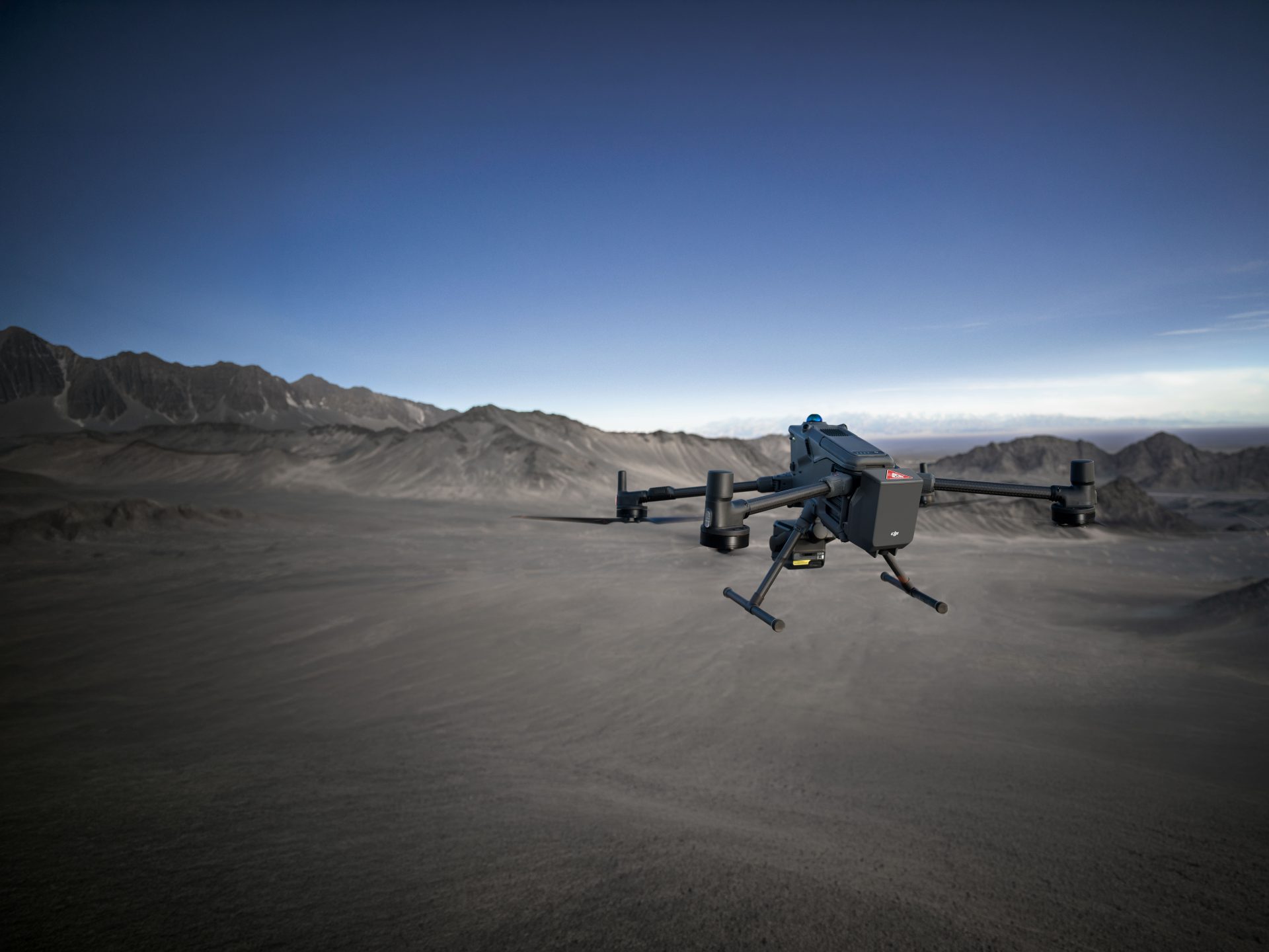
The wide scope of the construction industry means there are several types of drones that can be utilised for a variety of different purposes. These drones can assist in everything from mapping and surveying to site security. Drones are a fantastic way of performing long-distance operations with minimal human contact, something that has become critically important in the last few months with the development of the coronavirus.
Your choice of drone, camera and software can really have a huge impact on the type and quality of data collected, meaning it needs to be a carefully considered decision. So what drones are available?

Wingtra PPK Fixed-Wing VTOL
One of the fastest, most aerial competent drones on the market at the moment, the Wingtra PPK Fixed-Wing VTOL is a great piece of technology used by specialists and industry professionals to capture aerial images for Surveying and GIS, Construction, Agriculture, Mining and Environmental Monitoring application. The Wingtra is great for surveying mid-to-large scale sites due to the endurance provided by its fixed-wing structure. This makes it ideal for use in construction, allowing a drone operator to survey a large project without physically traversing the terrain, greatly reducing the chance of human contact and virus transmission. Thanks to the high-resolution cameras that the Wingtra boasts, the drone is capable of taking unparalleled, high-quality aerial photographs resulting in accurate surveys.
LiDAR ScanLook Revolution
Some of the most popular drones used in the construction industry are made by LiDAR. One of the best drones from this industry titan is the LiDAR ScanLook Revolution. This drone is a great piece of technology in terms of both accuracy and price. It’s affordable, easy to use and perfect for performing topographical and archaeological surveys. In terms of social distancing benefits, this drone is a fantastic entry-level choice for those lacking experience in drone operation but need an easy to use drone that won’t break the bank, while still being capable of performing land surveys and reducing human contact among employees.
Your choice of mapping software is just as important as the drone you choose. However, software can really differ in both complexity and cost, so it can be a difficult decision to make, especially considering how fast drone mapping software has been developing over the past few years. Let’s have a look at some of the best drone mapping software that will be ideal for enforcing social distancing guidelines.

Pix4D
If you are looking for one of the best, most comprehensive software packages in the industry, then look no further then Pix4D. As with most pieces of software, Pix4D possesses functionality for RGB and thermal and multi-spectral imaging. However, what makes Pix4D stand out from the crowd is the fact that it has industry-specific drone mapping software. This covers Civil Engineering, Agriculture, Engineering, Mining, Public Safety, Education and Construction.
Each option has been tailored to cover the challenges that can arise from drone mapping in these individual industries. In terms of construction, this includes cut and fill calculations, excavation comparisons and topographic surveys. The only downside for this software is that the wealth of features can be overwhelming for those who do not possess drone mapping experience. However, if you do have some experience in the field, but are looking to expand your drone mapping software capabilities to adapt to the difficulties presented by the social distancing guidelines, then COPTRZ offers Pix4D 4D Training Courses that can help get you to grips with the program.
DroneDeploy
If you are new to drone operation, then one of the best drone mapping software packages for beginners is DroneDeploy. DroneDeploy offers both open-source options for Android and iOS as well as Enterprise options for the more experienced drone surveying business. However, this particular software can only be used in conjunction with DJI drones.
For those simply looking for the best drone mapping software package for surveying, then there is really only one choice; Global Mapper. This exceptional tool offers support for almost every spatial data format, alongside access to a variety of spatial databases. Some of the surveying features the software offers include: cut and fill optimisation, volume measurements, contour generation and line of sight modelling, alongside an optional LiDAR module. If you are looking into expanding your business to include drone operation thanks to social distancing, then this is a great piece of software.

Social distancing and drones in construction and surveying
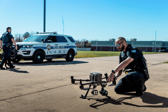
Drones are already used for security and safety purposes on construction sites. For instance, large-scale demolition sites use drones to scan the surrounding area for any hazards or people at risk of injury. These demolition sites use drones to track any rogue dust clouds which could cause harm to people in the local area and to the environment in general, while also assessing the site for any vulnerabilities or potential problems that may arise throughout the demolition process.
In terms of security, drones are used on construction sites to monitor for any intruders or potential security risks, helping security staff to act quickly and professionally, while also acting as a deterrent, making potential trespassers think again before breaking into the site. Many different contractors already utilise drones in many different ways in the construction industry, meaning it would not require much for even further usage in terms of social distancing. So now we’ve talked about the types of drones and software that can be used in surveying and construction, let’s have a look at some of the possible uses in terms of social distancing.
Eliminating human contact
First of all, drones are an ideal way of performing land surveys and traversing construction sites across a large area. But what social distancing benefits does this offer? A drone eliminates any human contact a surveyor may experience, as it allows them to stay in one place as they pilot the equipment, rather than walking across an entire site. This is particularly useful when deployed across busy complex capital plan sites such as runways, roadworks or other infrastructure.
Drones can also be used by site managers, letting them check on the progress of sites that may be difficult to traverse, especially when trying to adhere to social distancing guidelines as these sites may be busy with site operatives. One application of this can be found on a road expansion project which can cover huge areas. Normally if a project manager wanted to check on the progress being made on the other side of the site, they would have to travel a considerable distance, potentially interacting with several people. A drone allows them to check on the progress of the site while still following social distancing guidelines.

Eliminating the need for subcontractors and scaffolding
Another social distancing benefit of drones in construction can be found in mapping tall buildings. In normal circumstances, a surveyor hoping to perform a roof survey on a tall building such as a church would require the use of specialist scaffolding and ropes, which would need subcontractors. Using a drone completely eliminates the need for these subcontractors and scaffolding, allowing the surveyor to map the building without causing any potential damage, but also not having to interact with people, allowing them to follow social distancing guidelines. Utilising the services of a drone also means that a surveyor can identify any access issues with a roof space, aiding in the buildability of the design or renovation. By surveying a roof space with a drone, a surveyor can easily assess the site in a much quicker manner then they would normally be able to do.
Enforcing social distancing measures
A further social distancing benefit of drones is that they can be used to ensure contractors are following social distancing practices. Large scale construction projects often include numerous internal and external operatives, meaning it can be extremely difficult to enforce social distancing. A drone can help site managers enforce these guidelines, visiting different on-site locations to check that their operatives are two metres apart, while also monitoring any deliveries and checking that delivery staff are also following the governmental guidelines, creating some sort of barrier between on-site employees and off-site staff.
Drones have many existing uses in the construction industry, especially when it comes to surveying. However, they also offer a chance for contractors and surveyors to follow the government social distancing guidelines, something especially important in order to help to control the pandemic and reduce the pressure being put on the NHS and other emergency services. For more information on how drones can revolutionise your construction or surveying business, contact Coptrz today and we will be happy to help you find a complete drone solution.
Download Our FREE RPC-L1 Guide
Understand everything you need to know about moving towards commercial drone operations with our RPC-L1 guide.
- Understand what RPC-L1 is and who it is for
- Learn how the CAA transition impacts operators and training routes
- Get a clear breakdown of requirements, costs and next steps


Related Posts

Wind Turbine Inspections – Martek Marine
We’re revolutionising the way visual wind turbine inspections are carried out using specialised UAS drone technology. Gone are the days of risking staff safety or using inefficient inspection techniques that don’t deliver complete blade coverage and data We’re committed to delivering minimum blade downtime to maximise your production. It’s all been made possible by the […]

Drones in Civil Engineering
Drones (unmanned aerial vehicles, UAVs) have become indispensable tools in civil engineering, offering aerial access and data collection for many tasks. They are widely used to capture high-resolution imagery and sensor data, enabling precise 3D models, orthomosaic maps, and inspections that inform design, construction, and maintenance. For example, surveying drones equipped with high-res cameras and […]

Coptrz Academy Launches with the Mission of Improving Drone Training Standards around the World
22nd November 2021 — A radical new drone training platform has launched with the mission of improving Enterprise Drone Training to a Higher Education standard. The drone industry is predicted to be the fastest growing global industry across multiple sectors over the next 10 years with 70,000 drone operators needed within the UK alone by 2030. […]