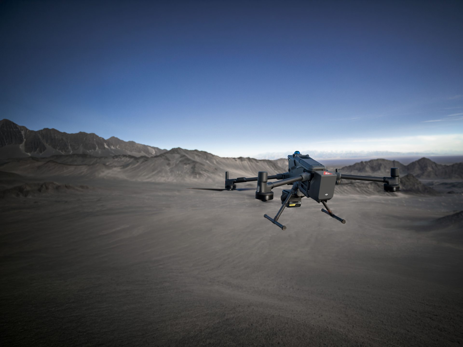
A Guide to On The Man Drones
From special forces to infantry, artillery, command and engineer teams – on the man drones can be used by a wide-range of people to support their operations. In this guide, we look at what on the man drones are and how then can be used in the interests of public safety.

Sam Denniff, UAV Strategist for Public Safety and Military at Coptrz
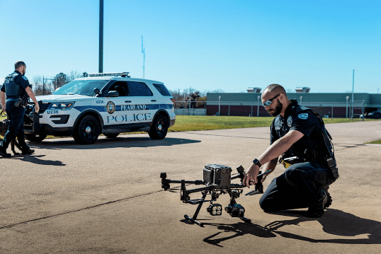
Coptrz’s UAV Strategist at Coptrz for Public Safety and Military, Sam Denniff, explains: “Drones allow for emergency services to get a perspective that is usually only given by the use of a helicopter. This means that an ‘eye in the sky’ can be used far more frequently and to react much quicker to unfolding events.”
If you’re interested in how on the man drones can aid your organisations, why not download our FREE Ebook?
What are On The Man drones?
On the man drones are military grade aircrafts without a pilot. They are controlled from the ground and are used for a wide range of activities including targeting, surveillance, mapping and distraction – in the interests of public safety.
They are small, lightweight and portable aircrafts that do not require an extensive supporting infrastructure in which to get the data from. They are functional and immediate to fit the time-conscious needs of this type of use. By adopting drone technology, emergency and military responders can benefit from improved efficiency, heightened security and increased safety.
What are the main uses for On The Man drones?
When used within a defence situation, the possibilities of using drones for public safety are extensive. Here we list few of the most common uses for one the man drones in this type of environment:
Drones for recce (reconnaissance)
In the interests of public safety, on the man drones can be used to scout out unknown environments that could be too dangerous for humans to venture. The drones will gather data and reconnaissance information about the area, bringing it back to be analysed and used for tactical operations.
The drone’s capability allows it to not only build a geographically accurate map, but also a semantic one. The intelligent onboard computer recognises roads, cars, buildings and other objects and identifies them on the map. When the drone’s mission is completed, it can provide clickable images, which can be downloaded and evaluated.
Drones for mapping and surveying
When it comes to mapping and surveying, drones are quick, safe and accurate for deployment in a first-eyes-on-the-ground scenario. They can cover a wide area range within a limited amount of time, providing data that can be processed within minutes.
When it comes to repeatability, which is often needed in the military, they are fast and efficient. Teams can make regular surveys, hourly, daily or weekly to make comparisons and re-address the situation on a real-time basis.
Leading photogrammetry software such as Pix4D Mapper can be used easily to collect survey-grade data and create 4D models with basic training and very little technological ability.

Drones for military command operations
Depending on the mission, on the man drones may be tasked with supplying tactical information about the immediate area during a military command operation. Essentially this allows teams on the ground to make better and faster decisions, which could be vital when it comes to facing enemy forces.
The sensor equipment, the areas flown over, the communication links and control of the airspace in which they are operating will all vary depending on the operation. On the man drones can be used for real-time planning, information dissemination, commander’s attack view and ultimately for making precise and well-informed decisions.
Drones for distraction
Distraction payloads are very lightweight aircrafts, which aid as additional tools to help during military operations. Set with a timer by an operator, these payloads emit loud sounds up to 169 decibels, with low flash and low fragmentation, acting as a distraction technique as teams enter a specific room or building.
As well as aiding as distraction tool, this type of on the man drone can also act as an attraction tool – to gain attention on the ground when needed.
The Typhon DS-100 is designed for military or police use for tactical operations. It integrates seamlessly with the Sky Hero Loki 2 or the Parrot ANAFI USA. Typhon is primarily designed for military, professional public security and offender management markets. Applications include covert operations, counter terrorism, law enforcement, close protection, aviation and maritime.
You can see the Typhon DS-100 in action here:
Drones for search & rescue
On the man drones are ideal for use by the emergency services as a search and rescue tool. Police, firefighters and volunteer rescue teams can use these unmanned aircrafts to search for missing persons or victims of crime in need of rescue. They can also be used, instead of dangerous helicopter missions, as an eye from the sky to locate a person lost on a mountain, or at sea, for example.
In the search for missing persons, infrared (IR) thermal imaging cameras can detect human body heat. This capability greatly increases the ability to find people or objects at night that may be hidden, as well as during daytime operations too.
Drones for accidents & disasters
On the man drones can also provide real-time visual information when a disaster or incident threatens the lives of those around it. During such incidents, emergency responders need such real-time information to be able to make better decisions faster so that lives can potentially be saved.
Natural and man-made disasters such as fires, floods and chemical spills often make conditions too difficult for relief workers to provide immediate assistance. Therefore, drones can provide awareness over a vast area of dangerous terrain in quick time, reducing the size of the rescue team needed to respond.
Such drones can be used to map disaster areas, providing greater advantages in both cost and response times when compared to traditional methods. They can be deployed quickly, generating high-resolution and 3D mapping, identifying hotspot areas that have sustained the most damage. The data can be uploaded in real time to coordinate relief efforts
What are best On The Man drones for public safety?
Parrot ANAFI USA
The Parrot ANAFI USA is a military-grade drone designed for use by first responders and defence teams. It is encryption ready, with complete data protection in case of loss or theft. Data is only shared if consent is given and is stored on secure European servers.
The Parrot ANAFI USA is ultra-portable and rugged in its design. It can operate effectively even in extremely rough, dusty, windy and wet conditions. It is also the quietest drone in its class and will not attract unwanted attention. It weighs only 500g and can be operational in only 55 seconds.
This aircraft is also useful for longer missions – with 3 x 32-minute flight time smart batteries to assure safe return to home location.
As well as the aircraft, the package includes a controller, batteries, USB charger and accessories – all inside a tough carry case with removable security sticker.
KEY FEATURES & SPECIFICATIONS
- 32X Optical Zoom & FLIR Boson® 320 long-wave infrared (LWIR) thermal camera
- 4K HDR Video & Stills in visible spectrum, 1280x720p thermal spectrum
- IP53 Qualified for water and dust resistance
- Flies in winds up to 14.7 m/s, 53kph, 32.9mph
- Hand Launch, and Hand Landing for impracticable ground
- 4 km / 2.5 mi maximum transmission range
- Flight time of 32 minutes
- Unfolds, powers & connects securely to controller in <55 seconds
- Compatible with PIX4D Software

Sky Hero Loki MK2
The Sky Hero Loki 2 is an operational aircraft providing emergency services and military teams with the immediate capabilities to detect, reduce and clear threats.
It has extreme performance in most light conditions and allows users to track and anticipate target movements, enabling reliable and rapid situational awareness for precise decision making.
Both the video signals and flight commands are securely encrypted, ensuring crucial maximum security with every use.
KEY FEATURES & SPECIFICATIONS
- Precise position holding without GPS network
- Automatic altitude and speed control functions
- AES256 encryption implemented in the telemetry and control command signals
- Night vision 0.00008lux, EO/IR
- Analogue video and audio signal scrambled via FPGA
- No lag nor frozen images
- Integrated connector for additional payloads, sensors and actuators
- Listen before talking on audio-video frequencies
- Automatic pairing (RC – Drone)
- Front and central IR LED systems adapting to all environments with variable power (0-100%)
- Hand-launch take-off and assisted landing
- Turtle mode allowing the drone to flip over automatically should it find itself on its back
- Complete telemetry data, performance
- Indicators for sensors, estimated remaining flight time on display
- Main structure made of highly resistant polycarbonate
- Optimal flight modes for both indoor (GPS denied environment) or outdoor (GPS activated) use
You can see Sam Denniff speak through the features of the Sky Hero Loki 2 for military operations in this recorded webinar here:
The Loki Mk2 is only available to Police and Military, so pricing and technical specifications are completely confidential. If you’d like more information on the Loki Mk2 then please contact us so that we can verify you.
On The Man Drone Solutions
If you would like to find out more about on the man drones, contact us today to see how we can help source a drone solution for your business.
Download Our FREE RPC-L1 Guide
Understand everything you need to know about moving towards commercial drone operations with our RPC-L1 guide.
- Understand what RPC-L1 is and who it is for
- Learn how the CAA transition impacts operators and training routes
- Get a clear breakdown of requirements, costs and next steps


Related Posts

DJI launch Phantom 4 for Agricultural Sector
The P4 Multispectral is a fully integrated multispectral imaging drone designed for precision agriculture and environmental management. Combining data from six separate sensors to measure the health of crops, from individual plants to entire fields, as well as weeds, insects and a variety of soil conditions, the P4 Multispectral sets a new standard for easy-to-use […]

How to maintain a safe environment whilst flying your drone
When flying your drone, you are the sole person responsible for ensuring that it’s flown in a safe manner. This does not just include the safety of the drone itself, but also considering the safety of yourself, other people in the area and the environment too. Whether you are flying for surveys, filming or just […]

Choosing a Drone for Commercial Applications
Drones are one of the most rapidly advancing technologies which are currently disrupting industries across the world. There are hundreds of drone manufacturers vying for business across the leisure and commercial market, with household names such as Parrot and Go-Pro now getting in on the act. But how do you go about choosing a drone […]