Getting a drone surveying solution off the ground can be great for business
The Adoption of Drones for Surveying
As the adoption of drones and UAV technology continues to blossom across all corners of the globe, there is still a certain hesitation among businesses of all sizes to embrace the potential and take those first steps to a brighter future. Certainly, when it comes to areas such as aerial surveying and inspections, there’s never been a better or easier time to get yourself airborne and learn to appreciate the many benefits that an aerial solution can bring. Businesses looking to scale operations can also explore our drone surveying services for tailored commercial surveying support.
It does seem that there’s still some apprehension towards the technology, or perhaps more a lack of understanding or confusion, given how many options a quick web search might throw up. It could also be argued that there’s still an element of ‘wait and see’ about drone use, with companies looking to see nailed-on positive results or proof of return on investment (ROI) before taking the plunge themselves.

However, the proof is definitely out there and in the world of surveying, we’re seeing more and more case studies showcasing vastly increased efficiency from using a drone solution over traditional methods. Project times are now counted in days rather than weeks, the amount and quality of data is increased, and smaller crews are required – although we should note that drones don’t need to replace people, they simply give those already employed a better tool to do the job (so those people not out in the field can be back in the office working through the results!).
The end result is huge savings across the board, with increased health and safety due to the reduction in risk of sending humans into potentially dangerous areas – not to mention sending a drone to inspect the top of a wind turbine being a whole lot quicker. There’s also the potential added saving of not having to shut down the turbine while the crew gets to work or maybe having to assemble scaffolding or some other viewing platform to get a closer look at your target.
The Aerial Revolution
Of course, aerial surveying isn’t a new thing that only drones can do, but they’re a whole lot cheaper and more flexible, portable and adaptable than the likes of a helicopter or doing flybys in a plane. You could start out with an off-the-shelf £1,000 drone and maybe a little smart software, or spend tens of thousands on the latest top-of-line kit but, whether you’re planning quick inspections or large-scale analysis, an aerial surveying solution should more than pay for itself after your first few flights.
“We’re seeing more and more case studies showcasing vastly increased efficiency from using a drone solution over traditional methods.”
Land surveying is one of the main areas, where 3D mapping and orthomosaics can be used to deliver an overview of a location quickly and easily. Construction is another growth area, along with other worksites including quarries and mines, with site management and development a welcome home for drone use.

With simple GPS technology and flight plans you can repeat flights to the millimetre and deliver a comparative day-by-day progression of the site, perhaps combining this with volumetrics to constantly monitor on-site aggregate or other supplies. Similarly aerial surveying could be used to track coastal erosions over time, and we’ve also seen organisations taking to the skies to track plastic pollution – which in turn will identify hotspots where clean-ups or preventative measures can be addressed.
“You might also want to consider having variable payloads and sensors or possibly even a dual-camera system”
We’re seeing the likes of English Heritage using drones to improve their surveying needs, not only to more quickly and efficiently inspect and monitor historic lands and buildings across the UK, but also using LIDAR and other technologies to uncover traces of long-lost structures or gardens that have been buried by time. Likewise, town planners can use UAV technology to both plan new developments and track their progress over time – and with a little 3D mapping they’ve also got a great way to showcase those plans or the ongoing work to local residents.

The short of it all is that drones provide a quicker and more detailed solution to most of the older methods in place. Not that the technology is necessarily replacing those methods, but UAVs certainly provide a compelling option to work alongside them, offering the capacity to capture masses of data on a single flight (especially if you don’t want a more subjective or selective human element at play). Even if you don’t need it at the time, you can use a single flight to gather all manner of variable data – all of which might have considerable value to a client further down the line.
What do I need to get started?
As with all commercial applications you either need a Permission for Commercial Operations (PfCO) or hire a pilot who has one. Here at Coptrz we offer everything you need to qualify, with our course also offering the chance to earn our academically-registered OFQUAL Level 4 qualification (more HERE with our ‘Pay as You Learn’ option HERE), and there’s plenty more you can do beyond this with more specialised training – whether enhancing your aerial expertise, learning to use vital software or unlocking the secrets to maximising your data analysis for optimum, client-pleasing, results every time.
Of course, any pilot also needs something to fly and this is where your specific requirements can come into play as there are many multirotor and fixed wing solutions on offer. A multirotor is typically more manoeuvrable and great for tighter flying areas, with the likes of DJI’s M200 Series (notably the likes of the DJI M210 V2) proving popular for professional surveys and inspection work. Certainly DJI knew the market it was targeting when bundling together an impressive combination of high-quality hardware and software.

Fixed-wings require more planned flight paths but their aerial efficiency and longer flight times makes them great for large-scale operations. One great model is the WingtraOne which we covered in more detail in a previous blog entry, with a vertical take-off and landing solution that negates one of the major flaws in standard fixed wing craft that require larger landing zones due to the angle of descent (as well as taking minimal damage if landing on rough ground).
What other options should I consider?
With these models and many more besides, you might also want to consider having variable payloads and sensors or possibly even a dual-camera system so you can capture double the data on a single flight! We recently announced a partnership with Phase One Industrial to offer its iXM Series of high-productivity metric camera solutions which were designed for aerial inspections and surveying, with many a proven success story (more on those later).
You might also want to consider a thermal imaging camera, such as FLIR Duo Pro R or DJI’s FLIR-based Zenmuse XT2 (which both combine an RGB and thermal camera), or a multispectral solution such as the MicaSense RedEdge-MX which is great for agricultural environments in helping to plan watering, fertilisation and other factors to greatly enhance crop yields.
“Whether you’re planning quick inspections or large-scale analysis, an aerial surveying solution should more than pay for itself after your first few flights.”
It’s worth considering your own potential use cases to determine what set-up might work for you. A common aspect of aerial surveying is for general topographical analysis where a good RGB camera could be fine, as it would be for most photogrammetry scenarios, but a LIDAR-equipped camera that can see through cloud cover, a treeline or other vegetation could be a real asset (we covered a great example with a lot more detail in this recent blog entry).
As with the aforementioned land surveys and site management situations, you might want to look at software such as Pix4D or Propeller to help with converting that data into orthophotos or 3D models and more. Essentially you need to cater for your workflow from planning and data capture, through post-processing and analysis into ultimately sharing your results with a client. For some that might be a quick and easy solution, while others might benefit from a little extra help at each stage!

While some models with real-time kinetic (RTK) systems might boast of no longer needing ground control points (GCPs), they’re always worth having in place. Essentially large mats running off a small power source (often solar), these add extra GPS locators to your survey, and so having just a few of them in place at key points around a regularly surveyed site will offer that extra degree of accuracy in knowing exactly where everything is – which can be crucial if you’re relying on exact measurements for calculating distances or volume etc.
There are certainly plenty of options beyond that £1,000 off-the-shelf Phantom 4 or Mavic 2 Pro, and so you’re free to tailor your solution to suit your own requirements or budget – and we’d be happy to talk such matters through with each and every one of you!
“Even if you don’t need it at the time, you can use a single flight to gather all manner of variable data”
Case Study 1: Draganfly
We did say that some people are looking for proven case studies before taking the plunge into aerial surveying themselves, so we’ve got a couple for you. This first example comes from Canadian company Draganfly Innovations, which teamed up with the nearby University of Saskatchewan Plant Sciences team. The department was conducting extensive research into agricultural phenotyping and genomics for crop breeding, and required precision imagery to boost their findings.
Draganfly initially used its own X4-P system to improve upon the slow and laborious on-foot surveys, swapping between an RGB and multispectral camera from one flight to the next. However, it soon upgraded to a DJI M600 Pro which was capable of carrying a larger payload – taking on board both a 100MP Phase One iXU-1000 RGB camera and a MicaSense RedEdge camera, and so doubling the data gathered each flight and halving the number of flights required.

With the improved cameras, the team found it was getting 10 times more coverage from a single 15-minute flight at a comparable resolution, and as much as 20 times greater efficiency in terms of productivity and results. Needless to say, the research team is now working with a lot more data in a much shorted turnaround time and hopefully ensuring the locals are now reaping the rewards of greatly improved crop yields as result.
Case Study 2: CopterSystems
Elsewhere, out in Germany, CopterSystems, a specialist in high-end UAV solutions, was so impressed by the Phase One camera that it purpose-built a UAV solution to host them: the CS-P.O.C.. Built with safety in mind, this hexacopter has multiple redundancy features and is designed for smooth flights to enable precise overlapping of images for orthophotos, using either the 100MP Phase One iXU-1000 or its 50MP sibling, the iXU-150.
Using the latter, the company was tasked with surveying a sand mine in the south of the country roughly 400 by 500 metres in size. Operating with a ground sample distance of 0.75cm and 13 GCPs, the team captured some 444 images with an average of 52,689key points in every single image (using Pix4D). This in turn gave them a median of 37,682 matches per calibrated image which ensured a perfect transition into an orthophoto, with a further digital terrain model (DTM) and point-cloud also created, to wrap up a near-perfect example of aerial surveying for photogrammetry.
Not only was the client impressed with the quality of the results, as well as the speed with which the project could move from planning to conclusion, the use of the drone also meant the company could capture parts of the mine that were considered too unstable for humans. This meant that not only did the team deliver a faster and more accurate survey than had been done previously, but also gave a more comprehensive study of previously untouched areas of the mine to boot.

Interested in using Drones for Surveying?
Get in touch with Coptrz if you are interested in our drone surveying services for your business. We can create packages including all the hardware, software and training required to suit your application and budget requirements.
info@coptrz.com
Download Our FREE RPC-L1 Guide
Understand everything you need to know about moving towards commercial drone operations with our RPC-L1 guide.
- Understand what RPC-L1 is and who it is for
- Learn how the CAA transition impacts operators and training routes
- Get a clear breakdown of requirements, costs and next steps


Related Posts
It’s a bird! It’s a plane! It’s a UFO?
When you think about it, UFO sightings used to be all the rage before the invention of drones and mobile phones. Now, with everyone carrying a camera in their pocket those stories have all but disappeared. And it’s with that thought in mind that we look at not only this great mystery, but others that […]

Overview of drone capabilities and their potential risks
As drone technology becomes ever more capable and easier to use, the number of drones flying globally is set to triple over the next three years. Data from the Federal Aviation Authority (FAA) suggests that the number of hobby drones operating will increase from 1.10 million to between 2.75 and 4.47 million. The number of […]
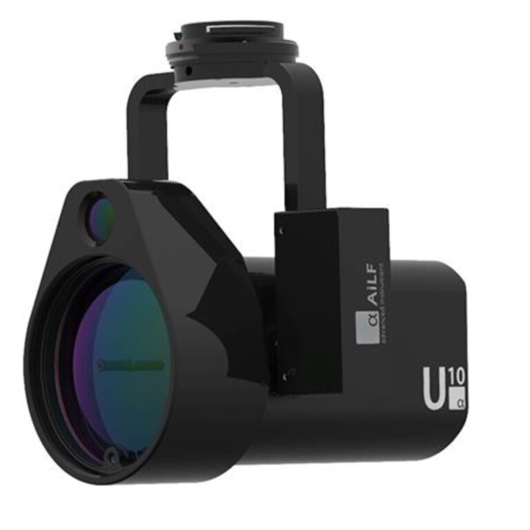
DJI Launch Two New Payloads for the M200 Series
COPTRZ are excited to announce the availability of two new partner payloads, this news comes live from DJI at the Airworks conference in LA. The new payloads are the U10 UAV Based Laser Methane Leakage Detector and the Wingsland Z15 Gimbal Spotlight. U10 UAV Based Laser Methane Leakage Detector The U10 is a light-weight, high-sensitivity […]