

Drones for Good: Drone Data And Climate Change
The impact of global warming on a broad variety of communities has been well-documented, highlighted and forecast. However, there are specific parts of the world where predictions to mitigate the risks of global warming are made more challenging by changing temperatures, difficult terrain and environmental complexities. One of these areas is Alaska. Alaska faces many challenges as a result of its remote location, disruptive weather patterns and severe environment. One of the biggest challenges facing those living and working in Alaska is logistics and access. The flow of people, goods and services is often disrupted by seasonal weather patterns and flooding, leaving many people cut off from vital goods and services. These gaps in services can have serious consequences, and can even result in fatalities. It is clear there is an essential need for technology to step in to address these problems.
Drones in Alaska
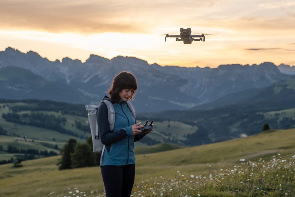
Drones offer solutions to the distinct problems in Alaska in many ways. Drones have been used to assist Alaskan communities with logistics, as they are not as susceptible to the changes in weather as marine or road transportation. Drones can not only provide essential services, but reduce the risk of loss of human life as a result of accidents. In addition to using drones to solve logistics problems, research teams are now using drone technology to predict and prevent the disasters that cause such disruption. Climate scientists and research teams monitor the changes in glaciers in addition to permafrost and avalanche in an attempt to predict the impact of global warming on Alaskan communities. In this article, we look at one of the key operations taking place in Alaska today and how the WingtraOne is providing unrivalled assistance to one research team working in the area.
A professor of research from the Climate Adaptation Science Centre at the University of Alaska Fairbank, Gabriel Wolken, is now using drone data to predict and visualise the activity of a glacial lake outside Juneau, Alaska. Wolken is also the manager of the Climate and Cryosphere Hazards Program for the State of Alaska, and his team of researchers are working to determine how the seasonal flux of the glacier will affect the vital infrastructure of communities nearby.
The research group began working on the project in 2015, and since then have faced significant challenges, including data accuracy, mapping a large area and working in difficult terrain. The team began their research using a variety of aerial survey methods, but in 2019 the professor heard about the Wingtra. What Wolken realised at that point, is that the WingtraOne would give the team the possibility of more frequent data capture, gathering data of a much higher quality.
He said:
”The Wingtra provided an interesting option for us for many of our research objectives. It’s VTOL allowed us to operate from the glacier and from one of the rock ledges. Since it’s also a fixed-wing, we could fly higher, longer, and with a payload that gave us the outputs we needed to achieve.”
Research teams that are part of climate science projects use the outputs from digital elevation models and orthophoto produced by WingtraOne data. This allows them to analyse any changes to the levels of ice that sit on top of Suicide Basin. Ice level changes indicate the water level status, and also how this water level interacts with the Mendenhall Glacier.
The Dangers of Large, Moving Glaciers to Local Communities

The Mendenhall Glacier, Suicide Glacier and the Suicide Basin
On the outskirts of Juneau, Alaska is the Mendenhall Glacier. The Mendenhall Glacier is a huge body of ice, which stretches to around 21 kilometres (13 miles) . The glacier was, at one time almost a century ago, attached to another glacier, known as Suicide Glacier. However, over the course of the preceding eighty years, Suicide Glacier has slowly retreated from Mendenhall Glacier. While the larger section of the glacier moved away, a piece of Suicide Glacier has seceded, left behind in a substantial basin. The issue for surrounding communities is that underneath this left behind fragment of ice, the ‘Suicide basin’ as it is referred to, fills with water. The interactive activity in the basin is secured by the Mendenhall Glacier, situated next to the basin. which holds it all in place. The interaction can cause disastrous floods for surrounding areas.
Wolken’s research team are targeting the area where the Mendenhall Glacier and Suicide Basin meet. They conduct lines of remote sensing in order to detect changes in the level of the lake.
Wolken said:
“The main issue is that it’s ice covered so we can’t really see the water as it fills up the basin on a seasonal basis,”
“The Wingtra covers a large area, efficiently and provides data that is high quality in terms of visualisation and location accuracy.”
Integral to the interaction and impact of all of this is how the Mendenhall Glacier acts as a dam to contain water in the basin. But, when the water level gets too high, it will flow over the glacier, or will push it up from below. Over time, there is an increasing amount of hydraulic pressure Unfortunately, this results in a disastrous event when the lake water drains. The whole body of water drains over the course of around 36 hours, which floods the community and infrastructure below.
How do drones help?

How can the research scientists prevent disaster?
The biggest threat to the communities around Mendenhall Glacier is Glacial lake outburst floods (GLOFs). Such floods began to happen in 2011, and they have caused great damage to both homes and infrastructure in the area surrounding Suicide basin ever since.
The area was first assessed in 2015, with Wolken a part of the team. However, in 2018 additional agencies became involved in the research and analysis. Both the International Arctic Research Centre and the US Geological Survey Field Office based in Juneau became involved along with numerous others. Wolken explained the concerns of the agencies, in particular that the flooding “threatens a bridge that is connected to the road system,”. The bridge in question is the only access the community’s residents living on the northernmost side have to essential facilities – including hospitals. if this bridge was impacted it would cause some very serious issues for a lot of people.”
Wolken and his time have utilised photogrammetry using helicopters, quadcopters and Light Detection and Ranging ( LIDAR) surveys using manned aircraft. However, helicopter surveys were expensive, costing around $3500 a flight. They could also only be carried out once per year. To really analyse and solve the problems for these communities, the study required surveys more frequently. The researchers needed to capture enough data to recognise the elevation change patterns, which would allow them to understand what patterns indicate that water is filling beneath the glacier which could lead to downstream flooding.
However, in a real game-changing moment, Wolken discovered the Wingtra during a fellowship in Davos. The Wingtra is well-suited to the broad coverage required by these basins, and drone technology could allow for more frequent and accurate data capture.
Wolken said:
“We also used a Phantom 4 to do some of the photogrammetry, but it required a lot of effort to survey the lake, with several battery changes just to cover the area,”
He described the challenges of landing a drone that is fixed-wing on a glacier, as the glacier itself is cut deeply by channels of meltwater and has a lot of rock debris. It would be almost impossible to avoid a collision. But, the Wingtra worked perfectly for this particular environment.
Using drones for mapping in Suicide Basin, Alaska
The biggest challenge to drone mapping in Alaska is covering such a vast expanse, while maintaining high-accuracy of data. Wolken along with his research flew to survey Suicide Basin with the Wingtra RX1R II and PPK bundle at the time of year when the water level generally peaks. In the initial test period, Wolken was delighted with the accuracy and resolution of the data the team managed to gather, particularly with the notoriously difficult terrain and the scope of the coverage. He said:
“Alaska is a big place,”
“There’s virtually nothing we address that we consider small here. So if it’s going to be a drone, we have to have something that can actually fly for a long time, fly high enough to be able to handle the complex terrain that we’re constantly dealing with and provide the resolution that’s required for the work that we’re doing.”
To complete a single mission with 3 cm / px GSD, covering 3 km2, it would take around 90 minutes from beginning to end. A digital terrain model and orthophoto was generated by stitching together the 1734 images captured. The team will now use these to track and analyse changes over several missions.

Safety and efficiency of drones in mapping dangerous terrain
One of the major advantages of drone use in such a mission is of course, efficiency. However, anyone who lives in the area or has attempted to collect data in this environment will be well aware of the dangers faced when using aircraft or collecting data manually in the basin. Wolken describes the ‘amazingly challenging terrain’ as being very complex to work in. The wind vectors make it dangerous for aircraft to be in the area. He said:
“So simply staying out of an aircraft is the greatest advance in safety that we could have in this setting—it’s really important.”
However, the Wingtra does more than just keep aircraft out of the sky. This model of drone actually takes the research to new levels as a result of a well-integrated multi-frequency PPK module. As a result of this module, the Wingtra features high levels of location ‘absolute accuracy’, but does not require the extensive ground control required with other drone models.
Wolken described how the Wingtra helped the team make excellent efficiency savings in their workflow. The research team were only required to collect a small number of checkpoints in order to validate the analysis.
Even getting this small number of Ground Control Points (GCPs) was challenging in such difficult terrain. Members of Wolken’s research team had to make their way down rock walls in order to access some of the areas they wished to put that ground control. So, the Wingtra greatly reduces the need to carry out extensive effort to collect data.
Drones For Good
Download Our FREE RPC-L1 Guide
Understand everything you need to know about moving towards commercial drone operations with our RPC-L1 guide.
- Understand what RPC-L1 is and who it is for
- Learn how the CAA transition impacts operators and training routes
- Get a clear breakdown of requirements, costs and next steps


Related Posts

Saying “I Do” To Drones: Drones For Wedding Photographers
Drones For Wedding Photographers How are online drone courses helping wedding photographers in the COVID-19 crisis? One of the industries that have financially suffered in the Covid-19 crisis has been the events and wedding sector. For many, particularly in the UK, the wedding market runs in earnest between May to September inclusive. By the time […]
Why RPC-L1 Alone Does Not Authorise a UK Drone Flight
Why RPC-L1 Alone Does Not Authorise a UK Drone Flight One of the most persistent mistakes in the UK drone market is treating pilot competence and legal operating permission as though they are the same thing. They are not. RPC-L1 proves a level of remote pilot competence. It does not, on its own, give an […]

Still Open For Business – Paul Luen Has A Message For You
Paul Luen has a message for you – Coptrz is still open for business and will continue to help you revolutionise your business with drones. In such crazy times I wanted to reach out to you as one of our most valued partners and send you a message of support to thank your continued investment […]


