DJI, a leader in civilian drone technology, is updating its Geospatial Environment Online (GEO) system to include UAS geographical zone data from national aviation authorities.
What is this for?
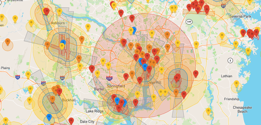
DJI first adopted the GEO system in 2013 to help drone operators avoid flying in controlled airspace or near sensitive sites. This update is part of DJI’s commitment to safety and regulatory compliance as European drone laws now require all drone makers to let users download and show geographical zone data for drones from the national aviation authorities of countries in the European Aviation Safety Agency (EASA). You must make sure that you have the most recent geographical data from these countries before they fly your drone or you risk non-compliance. This update aligns with regulations from the European Aviation Safety Authority (EASA) and the UK Civil Aviation Authority (CAA), offering drone pilots more operational freedom while ensuring safety.
First Rollout
The update is first rolling out in Belgium, Bulgaria, Cyprus, Denmark, Germany, Ireland, France, Lithuania, Switzerland, and the UK, with other EASA member states to follow. The update applies to most of DJI’s consumer, enterprise, and agricultural drones.
How do I update?
It’s a simple process, all you need to do is refresh your flight app to initiate the update.
Learn more
- EU Drone Regulations: EU Regulations
- Drone Operator Responsibilities: EASA FAQ
- EASA UAS Geographical Zones: EASA Geo-Zones
Download Our FREE RPC-L1 Guide
Understand everything you need to know about moving towards commercial drone operations with our RPC-L1 guide.
- Understand what RPC-L1 is and who it is for
- Learn how the CAA transition impacts operators and training routes
- Get a clear breakdown of requirements, costs and next steps


Related Posts
Preparing Your PfCO Operations Manual
As a qualified NQE, COPTRZ provides specialist training to enable drone pilots to obtain their permission for commercial operations (PfCO). The process of applying for your PfCO involves three key areas; a theory assessment, flight assessment and an operations manual submission to the Civil Aviation Authority (CAA). Submitting drone flight operations manual to the CAA is […]

Top Drones for Inspection in 2024
The drone inspection market is booming, driven by advancements in technology that are constantly creating new applications. And 2024 is shaping up to be another year of significant growth. Drone technology is becoming more accessible and affordable than ever, with a wider range of options available than ever before. To help you navigate this evolving […]
Coptrz make Financial Times 1000 fastest growing businesses 2022
Drone Specialist Soars as one of Europe’s Fastest Growing Companies Coptrz identified as ‘outstanding’ among millions of European enterprises Statista observed that Coptrz had ‘Strong record of fast, organic and sustainable growth’ Certified as of one of the ‘Best Places to Work The Leeds based drone solutions company ‘Coptrz’ has been ranked as one […]