With the rise in drone technology over the past few years has come the broadening of choice when it comes to aerial cameras. There are a huge variety of cameras now available to choose from, making picking the right model for the job a potentially complex process. Drone surveying is one such task which relies heavily on a quality camera. So what are the key features which you should be looking out for when it comes to buying a camera for drone surveys?
Ground Sample Distance
Ground sample distance, or GSD, refers to the spatial resolution of the camera, or the distance between two consecutive pixel centres measured on the ground. This can be seen as the ‘accuracy limit’ of your aerial surveying using the camera. The GSD of a certain camera model will be dependent on factors such as the size of the camera sensor, the lens’ focal length, the image capture’s altitude, camera resolution, and the aperture.
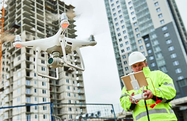
Which is the right camera to use for drone surveys?
Surveying lends itself to drone cameras with higher resolutions and larger sensors. This goes towards increasing the GSD and allows you to fly higher whilst still achieving the same quality of results. If there are forms of interference encountered nearer to the ground, this can be an important consideration.
A mechanical shutter can also be helpful to the objective of improving the accuracy of 3D models, in order to avoid distortion of imagery owing to its combating of the rolling shutter effect.

Which is the right camera to use for drone inspections?
When it comes to drone inspections, you should look for cameras which are among the highest resolution on the market. These typically come with a 35mm or equivalent focal length and bigger sensor. You will find that these features allow you to use a greater degree of image contrast. This is in order to produce better 3D models. You can also expect the ability to acquire more details on an inspected object.
A quick autofocus will be helpful for drone surveying. Automatically adjusting your region of focus according to the position of your drone in relation to the ground. This can help you avoid the issue of blurred images.
Articulation is also imperative – especially when filming from underneath a structure; for these kinds of projects, you might need a drone with a fully articulated camera.
At COPTRZ, our UAV Strategists have helped a number of companies to choose the right camera for their drone surveying needs. Amongst the most popular is the DJI Zenmuse range, including models such as the DJI Zenmuse X4S, DJI Zenmuse X5S and DJI Zenmuse X7.
These models have you covered for a wide variety of project types where high resolution is required for photogrammetry or inspection purposes. You might also find what you are looking for from the FLIR Duo Pro R and Parrot Sequoia selections.
Still unsure which is the best drone camera for you? Schedule your free drone strategy consultancy session with a COPTRZ UAV Strategist and receive expert advice on the right camera for your project.
Download Our FREE RPC-L1 Guide
Understand everything you need to know about moving towards commercial drone operations with our RPC-L1 guide.
- Understand what RPC-L1 is and who it is for
- Learn how the CAA transition impacts operators and training routes
- Get a clear breakdown of requirements, costs and next steps


Related Posts
Coptrz make Financial Times 1000 fastest growing businesses 2022
Drone Specialist Soars as one of Europe’s Fastest Growing Companies Coptrz identified as ‘outstanding’ among millions of European enterprises Statista observed that Coptrz had ‘Strong record of fast, organic and sustainable growth’ Certified as of one of the ‘Best Places to Work The Leeds based drone solutions company ‘Coptrz’ has been ranked as one […]
Drones for Inspection: Drone Inspect’s Alex Hall
Drones for Inspection Every day, workers around the globe perform inspections of hazardous inside spaces. Drones can perform surveys of challenging internal environments more safely and efficiently than a human inspector, now is the time to move towards drones for inspection. Internal inspections involve access to some of the most dangerous environments in industry. Internal […]

Mobile Mapping for Rail and Highways: Capturing More During Access Windows
In rail and highways survey, access is the constraint. Possessions are short, expensive to arrange, and non-negotiable in their end time. Highway lane closures carry traffic management costs that mount by the hour. The window for data capture is fixed — and when it closes, it closes regardless of how much of the site has […]














