5-10 minute read
Numerous surveying and construction companies across the UK have been integrating drones into their operations for some time now. However, for those of you who haven’t made the jump yet, this blog will give you an introduction into the best entry level drones for surveying, so you can take that next step ready for success.
Drones provide significant efficiency and safety enhancements over existing mapping methods which have led to surveyors quickly adopting the devices to create 3D point clouds.
A few years ago now DJI announced the new DJI Phantom 4 RTK drone (P4 RTK) and D-RTK 2 mobile station. The P4 RTK has been developed specifically for surveying and mapping applications and comes with a range of features making it the perfect entry-level drone for surveying and mapping.
Improved accuracy
The Phantom 4 RTK was redesigned from the ground up to achieve survey-grade absolute accuracy by reducing ground control points. The drone uses a state-of-the-art RTK module fitted directly on top of the frame to provide real-time positioning data.
RTK (Real-Time Kinematic) is a satellite navigation technique which is used to enhance the precision of data obtained from popular Global Navigation Satellite Systems (GNSS) including BeiDou, Galileo, GLONASS and Global Positioning System (GPS).
The Phantom 4 RTK requires minimal GCPs to be placed for redundancy or as a check to confirm accuracy. This dramatically reduces setup time while improving image accuracy.
We now offer a range of competitively priced RTK licenses. Get a FREE 15-day RTK License to try out HERE.
Precision navigation
One of the biggest features of the Phantom 4 RTK is the introduction of the DJI D-RTK flight control system. This advanced computer vision system uses dynamic differential technology to provide highly accurate 3D positioning, supporting newer pilots during critical missions.
Real-time accurate data transmission with TimeSync
Collecting all this extra information requires a rethink of how the data is transmitted real time from the drone to the ground controller or mobile device. This led DJI to create TimeSync which continually aligns the flight controller, camera and RTK module during the flight to ensure accurate image data is collected.
In addition, TimeSync fixes the positioning data to the centre of the CMOS sensor which ensures each image contains the most accurate metadata. This optimises photogrammetry and helps give the Phantom 4 RTK its centimetre-level positioning data, which is crucial for creating accurate 3D point maps.

More precise imaging technology
The Phantom 4 RTK uses a mechanical shutter for both stills and video capture. The 1 inch, 20 megapixel CMOS sensing system in the Phantom 4 RTK can achieve a Ground Sample Distance (GSD) of 2.74cm at 100m altitude. This allows operators to fly at a higher altitude, reducing image counts and decreasing processing time.
Purpose-built flight planning application
The Phantom 4 RTK introduces two planning modes for operators to make the best use of the new technology. Photogrammetry and Waypoint Flight modes are available alongside traditional flight modes such as Sport mode. These new modes allow the pilot to plan flight paths directly on the flight controller or via the DJI Go App using waypoints. They also give the pilot access to flight parameters such as airspeed, altitude and overlap rate.
There are several benefits to this new system, but one of the most useful is that it allows the operator to create automated workflows, allowing flights to be repeated to collect the same data across different periods. This feature is specifically targeted at the surveying industry, who need to monitor site progress over a period of months.
A welcome addition to those new to drones in surveying is the flight planning application is the ability to carry out in-office flight planning by enabling direct loading of KML and KMZ files. That allows operators or surveyors to spend more productive time in the office and less time on-site.
Safer, smarter and more stable
The Phantom 4 RTK introduces a range of features aimed at creating a safer, smarter and more stable flying experience. The drone comes with DJI’s OcuSync video transmission system as standard. This creates a stable connection with strong interference resistance between the drone and remote controller using 2.4 GHz/5.8 GHz dual-frequency transmission.
OcuSync also allows 1080p video transmission feeds at a distance up to 7 km. This is an improvement on the Lightbridge 2 system fitted to the Phantom 4 Pro, which only allows for 720p video transmission over the same distance. When combined with the improved interference resistance of OcuSync, this makes the Phantom 4 RTK the smart choice for surveying large tracts of land in built-up areas.
Compatible with D-RTK 2 Mobile Station
Finally, the new drone is compatible with the DJI D-RTK 2 Mobile Station, which provides real-time differential data. When combined with the OcuSync transmission system, it creates a highly accurate mobile surveying solution capable of obtaining centimeter-level accurate data even in the most challenging conditions.
It’s clear to see from the impressive yet accessible feature set that the Phantom 4 RTK is the best entry-level drone for surveying businesses looking to transform their operations with drones.
Do you want to see how the Phantom 4 RTK compared to other leading drones in Surveying and Mapping? Download our Accuracy report from the Surveying Resource Centre today:
Download Our FREE RPC-L1 Guide
Understand everything you need to know about moving towards commercial drone operations with our RPC-L1 guide.
- Understand what RPC-L1 is and who it is for
- Learn how the CAA transition impacts operators and training routes
- Get a clear breakdown of requirements, costs and next steps


Related Posts
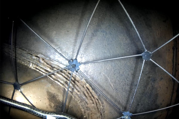
Flyability Elios: Inspection of a Pulp & Paper Mill Tank
Pulp, which is the raw material used in the manufacture of paper, is prepared by chemically or mechanically separating cellulose fibres from wood, fibre crops or waste paper. At an industrial scale, this process is performed in large tanks that need recurrent inspections. Customer Needs One of Europe’s leading manufacturer of pulp and paper possesses […]

A Closer Look at the Parrot Sequoia
Within the agricultural sector, the Parrot Sequoia has quickly become one of the most sought-after cameras currently available. However, it is important to note right away that it is not just a camera. It is so much more. Its incredibly advanced range of features makes organising and managing agricultural land incredibly efficient on the micro-plot […]

DJI Mini 3 Pro Drone Gets a Fresh Firmware Update 2024
DJI has just dropped a brand-new firmware update for their incredibly versatile Mini 3 Pro drone. If you’re a proud owner of this drone, it’s time to get excited! What’s New? The Mini 3 Pro aircraft firmware has been updated to version 01.00.0900. Alongside this, there are new firmware versions for the remote controllers: RC-N1 […]















