Aerial photogrammetry has so many applications, especially when it comes to survey practices. However, it has traditionally been limited to expensive manned aerial photogrammetry, however drones have changed that!
The affordability of aerial photogrammetry unmanned aerial vehicles (UAVs) have opened up the possibilities for many companies to use this technology to great advantage… but what makes a good drone for photogrammetry?
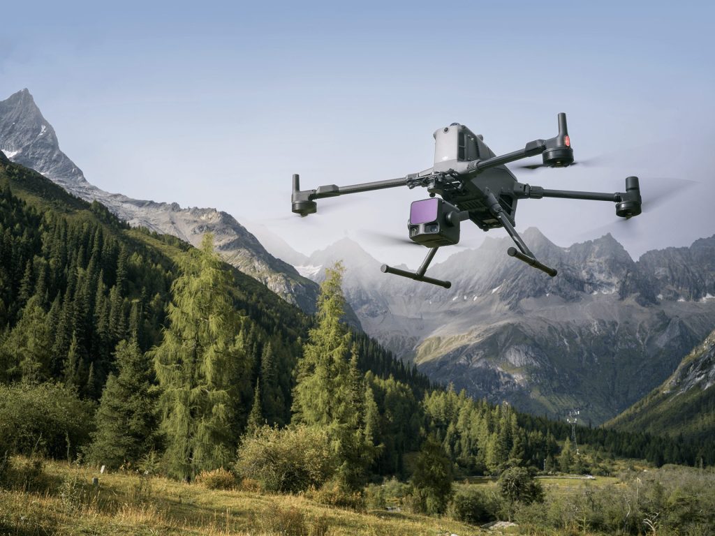
Multi-rotor or Fixed Wing?
The most fundamental choice to make is whether you require a multi-rotor or fixed wing drone design. Both have their merits and downfalls!
A multi-rotor is easier to fly, especially when it comes to take-off and landing, and provides a unique hover ability ideal for taking aerial images. Less pilot skill is needed, especially with GPS plotted flights, meaning photogrammetry surveys can be autonomous – ideal for a company new to using drones.

However, fixed-wing aerofoil designs are the dominators when it comes to surveying drones, and this is because the traditional design allows for far greater distances to be covered in one flight. While a multi-rotor can hover, large batteries are required for this and the payoff is a heavier battery and therefore reduced flight time. The glide possibilities of an aerofoil design of a fixed-wing means significant power savings, and a lighter drone overall.
Fixed wing drones do take more practice to fly: while autonomous and semi-autonomous flights are possible with GPS, it’s advised that a pilot is able to take full control. This sounds simple enough, and with advanced telemetry systems on-board is fairly true – but the pilot’s spatial awareness still needs to be good! A fixed-wing drone will ‘flip’ the controls when it turns to fly back towards you – so what was ‘forward’ on the control is now ‘backwards’ etc – meaning great skill is required to avoid the dreaded crash!

Photogrammetry Camera Types
You’ll need to consider exactly the type of photogrammetry mapping your drone will be used for: some types of map will require more than a traditional visible spectrum (red, green, blue or RGB) camera.
A visible spectrum camera will provide high definition images of the landscape, with great levels of detail, but may miss topographical features especially when vegetation is dense.
NDVI Cameras
Normalised Differentiation Vegetation Index (NVDI) cameras are able to provide very detailed images of vegetation – making them ideal for agriculture or environmental research. NVDI cameras operate by a ratio of near infra-red images minus red reflectivity, over NIR plus red reflectivity. The differentiation is what provides the levels monitored in images to deliver very detailed vegetation analysis.

Multispectrum
A multispectrum camera uses visible (red, green, and blue or RGB) spectrum AND near infra-red together, making them perfect for incredibly detailed photogrammetry images. The biggest downside, as you can imagine, is that more features make for a larger price tag.
Metric Cameras
The main benefit of the metric camera is that the interior orientation parameters (or calibration) are more reliable. Simply put, they are more robust and stable. Changes in pressure, temperature or vibrations from the UAV or other platform don’t affect the internal mechanisms of a metric camera in the same way that they would a standard camera. Standard, even commercial, cameras simply haven’t been engineered to withstand the challenges which arise in airborne surveys. For example, even if the lens moves slightly, your images will suffer.

GPS Camera Tagging
Whatever camera you choose to use on your photogrammetry UAV, it’s ideal to ensure you can include GPS tagging on each image. This helps software stitch images together seamlessly, and also means repeat flights can be made with the exact same locations for images when surveys are required over time to monitor landscape elements.
Drones are increasingly integrated with RTK modules to give further accuracy to the data/ images captured during your mission. RTK stands for Real-Time Kinematic and is a technique that uses carrier-based ranging and provides ranges (and therefore positions) that are orders of magnitude more precise than those available through code-based positioning.

Portability
And finally, think about how far you’re going to need to lug your drone! Often launched from middle-of-nowhere fields with little road access, it’s best to ensure your UAV can pack down into a reasonably sized case which you can carry with relative ease.
The weight of some photogrammetry UAVs can be off-putting, especially with larger multi-rotor drones, so it’s important to consider the carry case used is as light as possible while remaining rugged to withstand regular transportation. Luckily, fixed-wing drones as usually used for aerial photogrammetry tend to be lighter thanks to the efficient aerofoil design, so the more rugged cases can be used without adding too much additional weight.
Download Our FREE RPC-L1 Guide
Understand everything you need to know about moving towards commercial drone operations with our RPC-L1 guide.
- Understand what RPC-L1 is and who it is for
- Learn how the CAA transition impacts operators and training routes
- Get a clear breakdown of requirements, costs and next steps


Related Posts
DJI Zenmuse L3 vs L2: See Through Far and True
See through far and true.That’s the promise behind DJI’s latest LiDAR payload — the Zenmuse L3. As the successor to the proven DJI Zenmuse L2, this new generation builds on DJI’s reputation for precision mapping and effortless integration with enterprise workflows. Designed for surveying, construction, forestry, and infrastructure inspection, the L3 combines a next-generation laser […]

EU Drone Regulations Update: CE Marked Drones
As of January 1, 2024, drone operations in the open category within the EU will undergo significant changes. Drones must either have a C0 to C4 class identification label or be self-constructed for personal use. It’s crucial to note that drones assembled from ready-to-assemble kits don’t fall under the ‘privately built’ category. If you’ve acquired […]

5 THINGS TO CONSIDER WHEN SETTING UP YOUR THERMAL CAMERA
If you have invested or are thinking about investing in a thermal camera, you’ll want to get the most efficient results from its use. So, here are the top five things to bear in mind when setting up your camera. Resolution When setting up your thermal camera, you must ensure the IR resolution is suitable […]