

Insurance is risky business. From fraud to first response at times of trouble, insurance investigations can be expensive and lengthy processes for both the provider and the claimant. We investigate how the drones are a game-changer for insurance surveys and how the latest automated drone technologies are a win-win for insurance companies looking to boost profits and customers hoping to lower their premiums.
A recent study by PwC predicts that drone powered solutions could be worth $6.8 billion in the insurance industry alone, having highlighted the sector as one of eight which could be revolutionized by this growing disruptive technology. Scroll to find out how drones can improve safety, fight fraud and lower costs for everyone.
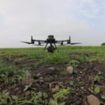
It’s a dirty job but someone’s got to do it. Or do they?
Many insurance inspections require loss adjusters to get their hands dirty and work in conditions that are not only difficult, but also dangerous. Even on smaller domestic claims, such as roof damage after high winds, assessors and surveyors have traditionally had to carry out visual inspections at risk to themselves.
The UK’s HSE statistics report that out of 144 workplace deaths in 2015-16, 34 (26%) were due to falling from height. Without further investigation, we cannot say if any of these fatalities could have been prevented by using drones, yet what it does tell us is that any job requiring the need to work at height is a dangerous occupation.
UAVs are an ideal solution to mitigate risk to workers in a variety of circumstances, outside of working at height. Railway and tunnel inspections can be notoriously dangerous due to environmental conditions and lack of visibility. Difficult to assess locations can be accessed easily, with real-time imagery relayed to the operator remotely, even if just to identify if the area is safe for personnel to enter.
By assigning even the most basic inspection tasks to drones, many work place incidents could be avoided.
First Response: Emergency Drone Surveys
Insurance assessments aren’t just needed when you crash your car or accidentally set your kitchen on fire cooking dinner; often insurance operatives are first on site in the event of a natural disaster or large scale incident. Insurance surveys often needed to assess not just the current conditions but also any immediate and future risks to people, businesses and structures.
Collapsed buildings, floods, landslides and other disasters all make for extremely hazardous conditions when it comes to collecting information. This is where drones come in. Within minutes of being on site, a drone can be deployed and relay real-time imagery to disaster response crews, with no risk to human life. When time is critical, no one wants to wait around for risk assessments to be carried out. Using a drone, the first responder can gather vital information in seconds as this video by Quiditch Aerial Filming shows of relief efforts after the Nepal earthquake.
When heavy rain caused flooding in Scotland at the beginning of 2016, Aviva commissioned a third party to survey the area using drones. The main task was not to assess claims made, but to find out which of their customers were most at risk of harm as many roads we rendered impassable by road vehicles. The collected imagery also helped rescue crews to identify the worst hit areas and focus relief efforts.
It is also an insurers responsibility to help local authorities to ensure business continuity after an event. Drones offer faster situational visibility than any other system associated with visual surveying, which can allow all stakeholders to access real-time information and speed up decision making processes.
Top Tip: Make sure you buy a drone that can fly in the rain and is not affected by small particles such as dust – Check out the DJI 210 RTX
Accurate Assessments in Real-Time:
One of the greatest benefits of drone technology is the ability to not only capture imagery from the air, remotely, but also to gain real-time situational awareness on the ground. Commercial UAVs allow for the collection of highly accurate data, even in areas which would normally be difficult or impossible to reach.
A drone can carry a payload of several kilos, meaning both visible spectrum and multi-spectrum cameras (such as near infra-red and thermal imaging) can be fitted. A UAV will often provide a 360 degree – or at least wide panoramic – view of a property or incident, allowing for fast assessment of the scope and cost of damage.
By using aerial imagery or video and applying a principle such as orthophotography, it is possible to calculate measurements which are astoundingly accurate meaning that valuations and risk assessments are based on facts, rather than assumptions.
Whether calculating small scale measurements such as fence boundaries and clearance heights, or assessing a whole geographical area for signs of damage, drone mapping allows for the creation of orthophotos, digital terrain models and 3D point clouds which can allow assessors to accurately evaluate conditions to accuracies of around 10mm, meaning that pre-or post claim, there is no room for doubt or negotiation.
Photogrammetry software makes it easy and quick to process and present the collected data in a meaningful and straightforward way, allowing claim settlements to be based on real-time information as close to the event as possible.
Top Tip: Invest in software which gives you the most bang for your buck. Check out Pix4D which can convert any image from any camera into an accurate map or model.
Fighting Fraud:
Between 2005 and 2014, the value of detected insurance fraud in the UK rose from just over £400 million to just under £1.4 billion. Whilst it’s impossible to say whether this huge increase was due to insurance fraud being on the increase, or insurers becoming more adept at uncovering fraud, British insurance providers now set aside a combined £200 million per year to fight fraudulent claims.
Insurance fraud affects both insurers and customers, as losses are often offset by increasing premiums, proving that this problem not only costs insurers when it comes to time and money spent investigating each case but also each one of us when our home, car or health insurance payments go up.
Unmanned aerial vehicles can be instrumental in detecting potential fraud, especially in situations where claim rates increase, such as after a storm or flood. When Storm Doris hit the UK in February this year, one insurance provider reported a 300% increase in claims. Although many of these claims may have been low value, the 24-hour storm was estimated to have cost insurers over £400 million. Any insurer utilising drone technology would have been able to quickly assess affected areas in a matter of minutes, with photographic or video records to allow for retrospective analysis which can then be used to provide clear evidence should a case go to court.
Drones aren’t just helpful when it comes to quickly identifying fraudsters; they are also invaluable when assessing honest claims where time is of the essence.
Top Tip: Make sure you know the privacy laws regarding using drones in residential areas
Risk to Reward
Insurance is big business yet the basis of all sustainable business models is the ‘risk to reward’ factor. Obviously, it suits most insurers to be risk-averse, however technology is now giving us the ability to assess risk in a more calculated and comprehensive way.
Access to more detailed data can provide insurers with the ability to calculate risk based on a bigger picture. Imagine you need to prepare a detailed insurance proposal for a historic building or new construction project. A risk assessment could potentially take months to prepare, with hundreds of man-hours spent carrying out surveys and inspections and constant collaboration with third-parties such as chartered surveyors, money lenders, local authorities and the land owners themselves.
UAVs allow rapid access to huge amounts of data. High resolution images and video can be collected in a matter of minutes, allowing for remote inspection and retrospective analysis of the entire site. From intricate architectural features under preservation orders to potential situational hazards which pose a risk to on-site personnel, drones allow access to a wider scope of information.
Once collected, drone imagery can be used to create detailed topographic maps and models to allow for enhanced analysis by all parties concerned. Charted Surveyors can carry out evaluations in minutes, lenders can calculate true worth and building owners can more easily understand how their insurance premium or claim value has been calculated.
Top Tip: Use drone data to collaborate with external stakeholders. It saves time, money and misunderstandings.
How many people love their insurance company?
Having to make an insurance claim causes dread in the pit of most people’s stomachs; it generally means something bad or even catastrophic has happened. Whether you’ve had a car accident or your home has been damaged following a storm, filling in the paperwork, waiting for a loss adjuster to take stock of the damage; it can all take months until a payment is received and you can get on with your life.
One of the greatest benefits of drones to loss adjusters and claims assessors is that they can dramatically shorten the time it takes to survey a site and process a claim. Instead of sending a team of people for safety reasons, insurers only need to send one drone and one operator who can collect all the necessary information in minutes. The collected data can even be sent to the office in real-time, leaving the operator free to move on to other jobs.
If a large number of claims are received from one geographical area it is possible to assess multiple claims at once, meaning that resources can be spread further and the time spent on each claim drops significantly.
It’s a win-win when insurers save time and money and client’s claims are assessed and paid quickly.
Top Tip: Tell your customers that you are employing drone technology to help lower their premiums. It’s great PR and shows that you want to help resolve their claim faster.
The Low Down:
Improved Health & Safety: Drones can often go where you can’t or don’t want to. Unstable roofs, dilapidated buildings, flooded streets. Send in a drone to do the dirty and dangerous work.
First Response: Drones can be dispatched quickly and cover more ground than any ground surveying team in the event of an emergency or disaster. Gather critical information instantly, when it counts the most.
Accurate Assessments: Drones can provide geographical information which is accurate down to 10mm. Invaluable when calculating the scale of damage in any scenario.
Fighting Fraud: People tend not to do something naughty when they know someone is looking! Drone imagery also allows for accurate before and after images to be evaluated for change.
Risk to Reward: Calculate risk on a larger scale. Drones can collect large amounts of previously untapped data across a wider area.
Customer Satisfaction: Share the benefits you reap from drone technology with your clients. Let them know that you are now processing claims faster than ever!
The bottom line….
Drones save time and money – multiple surveys can be conducted in one flight, imagery is available in real-time, surveys can be conducted with one operator, no safety set up is needed, no ladders, information can be shared instantly. Need we go on?
Download Our FREE RPC-L1 Guide
Understand everything you need to know about moving towards commercial drone operations with our RPC-L1 guide.
- Understand what RPC-L1 is and who it is for
- Learn how the CAA transition impacts operators and training routes
- Get a clear breakdown of requirements, costs and next steps


Related Posts
UK CAA Extends The Open Category
Following a consultation by the UK Civil Aviation Authority (CAA) and an official decision by the Department for Transport (DfT), the transition and legacy provisions for drones operating in the open category will be extended until 1 January 2026. Summary: The Transitional and Legacy provisions for UK drones in the Open category will now last […]

DJI Releases New Firmware Updates For TB50 and TB55 Batteries
Improved Firmware Addresses Early Return-To-Home or Automatic Landing of M200 Series Drones Without Compromising Measures Implemented To Maintain Flight Safety December 19, 2018 – DJI has released new firmware updates for users of TB50 and TB55 batteries which address the small number of reports of Matrice 200 Series drones experiencing early Return-to-Home (RTH) or […]
How are Drones Used In Surveying?
5-10 minute read The use of drones in the survey and construction sectors has come a long way and the capabilities of those very drones has seriously improved, with many organisations now adopting professional drone surveying services to streamline data capture and analysis. Your choice of sensors, surveying software and drone can have a huge […]


